
On the heels of a near-perfect weather weekend, the atmosphere continues to heat-up across the Front Range, just in time for the first full week of June. The theme for the week ahead will be sweltering heat intermingled with afternoon thunderstorms. Continue reading for our full outlook of the upcoming week, including which days could surpass the 90-degree mark.
That ridge!
The driver behind our recent stretch of warm and dry weather is a high-amplitude upper-level ridge that has set-up across the western United States, whose impact on Colorado began last Thursday. Its position today can be seen in the 500 mb map below.
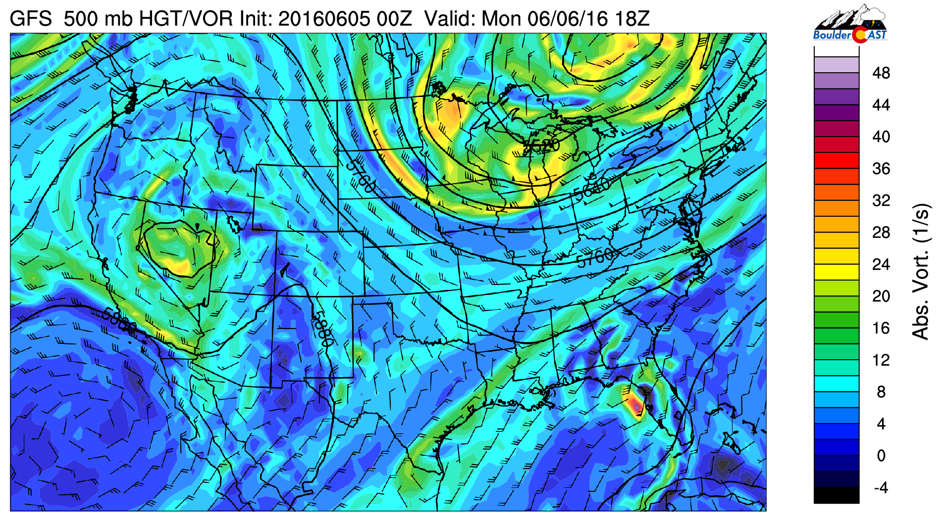
GFS 500 mb vorticity map for Monday. Notice the ridge pushing into Canada, and a weak-low in Nevada
There are two features of importance here that will be working in tandem to shape our weather this week.
- First and foremost, the intense ridge across the western half of the country. This will be our biggest weather influence for the week, pumping the heat northward making for a very warm stretch of days
- The small-scale upper-low that is under-cutting the ridge, the core of which is located over Nevada (seen above). This feature will provide a little extra instability and lift to fire off afternoon thunderstorms
This pattern in place is quite stagnant, and with that, not much will change throughout the course of the entire week. The threat of storms will stay in the forecast, as well as a further gradual warming each day.
Storm chances elevated to start week
For Monday through Wednesday, the upper-level disturbance will be trekking slowly eastward towards Colorado, arriving for the day Wednesday (shown below).

GFS 500 mb vorticity map valid Wednesday afternoon. The small piece of energy can be seen as a dip in the height lines (trough) over Colorado
A combination of high moisture and daytime heating will aid in the formation of afternoon storms across the Denver Metro area. Some low-level easterly flow Monday should help to further enhance storms near the Foothills. With 500 mb winds of just 10 to 15 knots and deep moisture availability, slow-moving scattered storms could cause localized heavy rain and minor flooding. The best chance of rain is Monday, with Tuesday not far behind. Expect scattered storms these days. Wednesday will be a little drier, but still stormy nonetheless.
Rainfall totals through Wednesday from the NAM model are shown below. Highest amounts are over the mountain locales.
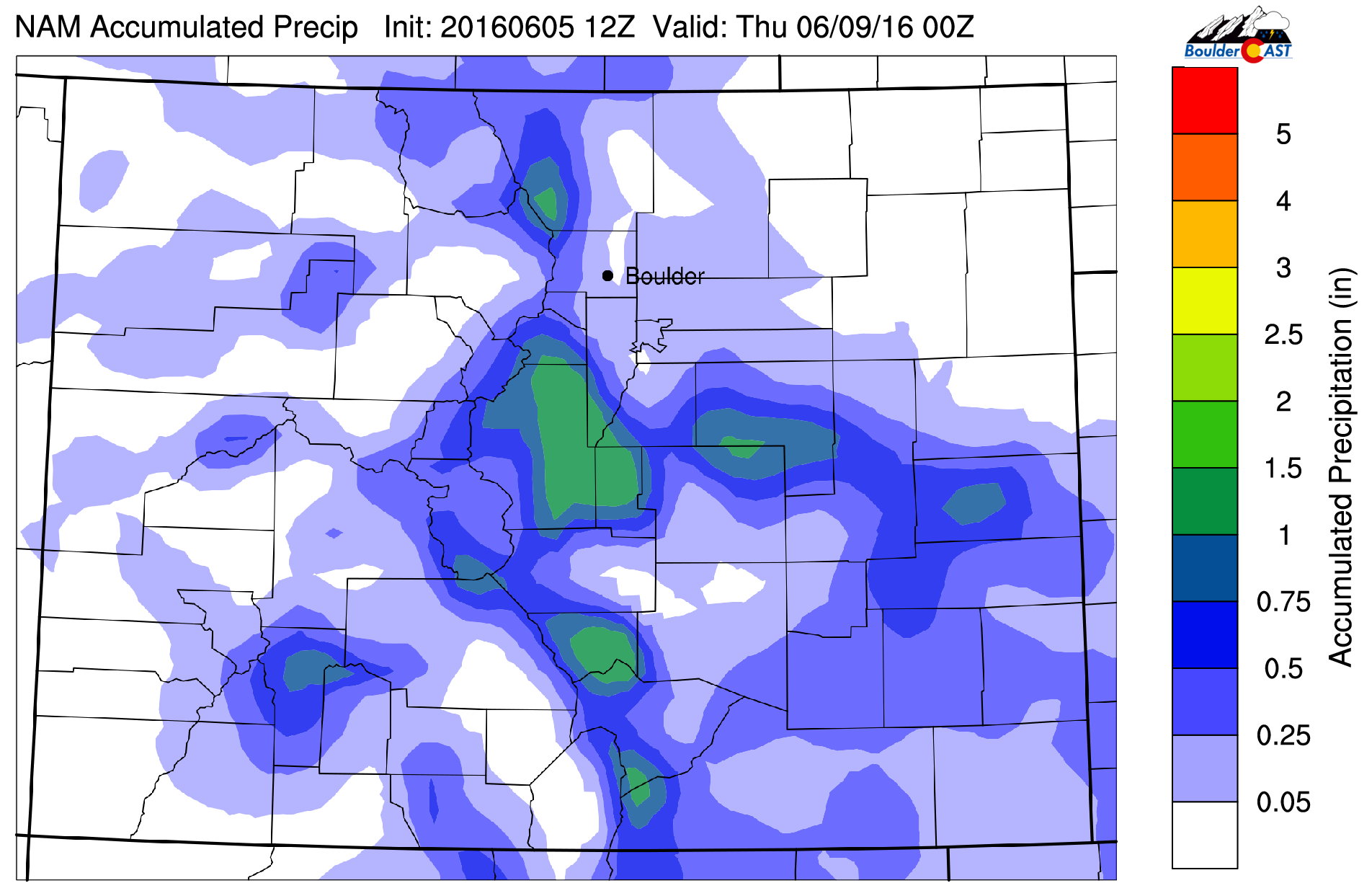
NAM total accumulated precipitation through Wednesday evening
High temperatures Monday and Tuesday will be in the low 80’s, with Wednesday a few degrees warmer.
Week ends toasty…
By Thursday and Friday, that upper-level system will be dying just east of Denver. Our focus then shifts to the western flank of the ridge, as an impressive trough comes ashore in the Pacific Northwest (seen below).
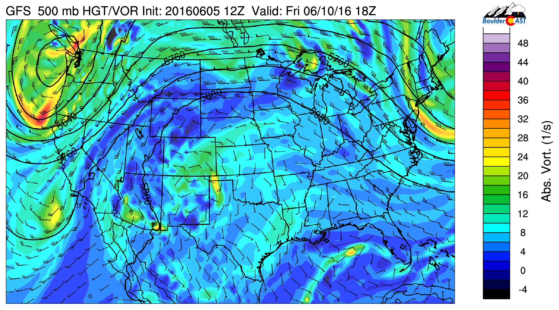
GFS 500 mb vorticity forecast map for Friday, showing the huge ridge dominating our weather, as well as a trough coming ashore in Washinton
This will help to create a conveyor belt to further enhance the warm air advection to Colorado, causing our temperatures to soar into the 90’s. The 800 mb temperature map for Thursday afternoon shows very warm air building across the region.
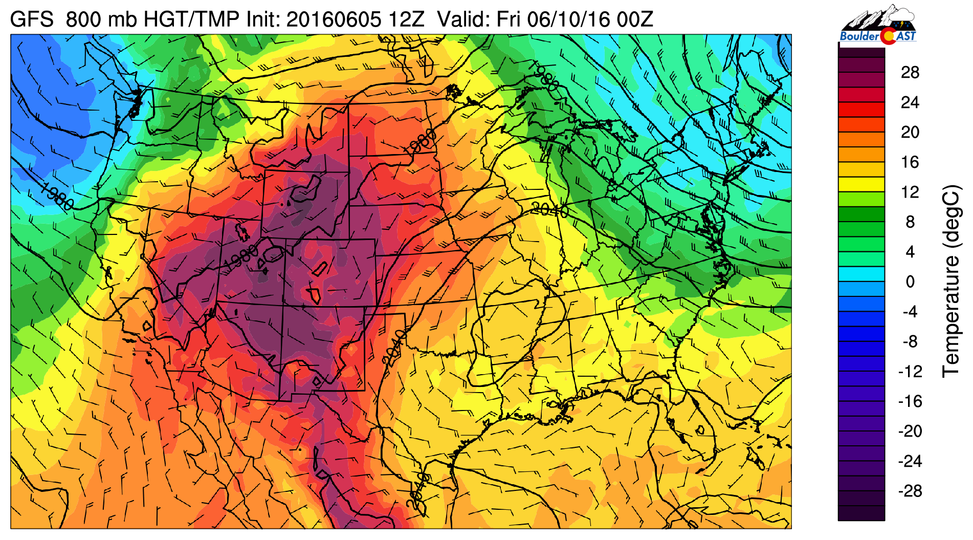
GFS 800 mb temperature map showing a very warm pool of air across the West
Based on early model projections, it looks as though Thursday will climb to near 90 degrees across the Plains, with potentially low 90’s on tap for Friday. Storms will be around, but diminished in coverage, only isolated and mostly across the terrain west and south of Denver. Several of the models show a ton of moisture for the week’s end, particularly in the upper-levels. This could mean that pesky cirrostratus clouds may knock our temperatures down a little. Regardless, Thursday and then Friday will be the warmest days to date in 2016.
In additional to localized heavy rain, the very warm temperatures and above normal snowpack may cause some flooding along creeks and streams heading out of the High County throughout the week.
The Forecast:
Monday: Sun early, then mostly cloudy. Widespread thunderstorms forming during the afternoon hours. Storms could produce small hail and localized heavy rain. Best chances will be over the Foothills. Highs near 80 degrees on the Plains, with upper 60’s in the Foothills.
Tuesday: Spotty morning fog, then partly to mostly cloudy with scattered afternoon thunderstorms. Highs in the low 80’s across the Plains, near 70 in the Foothills.
Wednesday: Increasing clouds with widely scattered afternoon thunderstorms, most numerous across the higher terrain. Highs in the mid 80’s for the Plains, with low 70’s in the Foothills.
Thursday: Mostly sunny skies becoming partly cloudy in the afternoon. A few isolated storms are possible but should be confined to the Mountains and Foothills. High temperatures sizzling to near 90 degrees on the Plains and upper 70’s in the Foothills.
Friday: Hot and partly cloudy with isolated afternoon thunderstorms. Highs in the low 90’s across the Plains, near 80 in the Foothills.
Extended: Model ensembles are showing temperatures remaining warm through the weekend with a continued chance for rain. It’s not clear if the 90’s will stick around for the weekend, but we should still be a above normal, at least (i.e. mid to upper 80’s).
High Country: Afternoon widespread to scattered storm activity for Monday through Wednesday. On Thursday and Friday, upper-level instability will remain in place for isolated storms. Friday looks to be the “driest” day as storms will only be isolated and mostly south of Interstate 70.


