
As we head into the first full-week of June, unsettled weather in the form of showers and storms returns to the forecast over the next few days. We’re also tracking the potential for our first 90-degree days of the year towards the end of the week. Continue reading for our comprehensive outlook of the week ahead.
Monday starts out warm with storm activity
Happy Monday! The current weather pattern for today and tonight is featured in the below image. High pressure is situated over New Mexico. To its north is clockwise flow (red arrow) rotating around the high, resulting in monsoon-like moisture streaming in from southern California. Warm air in the Desert Southwest moving in will push our high temperatures into the low to mid 80’s this afternoon.
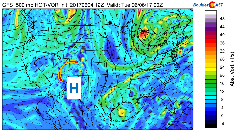
GFS 500 mb vorticity today/tonight
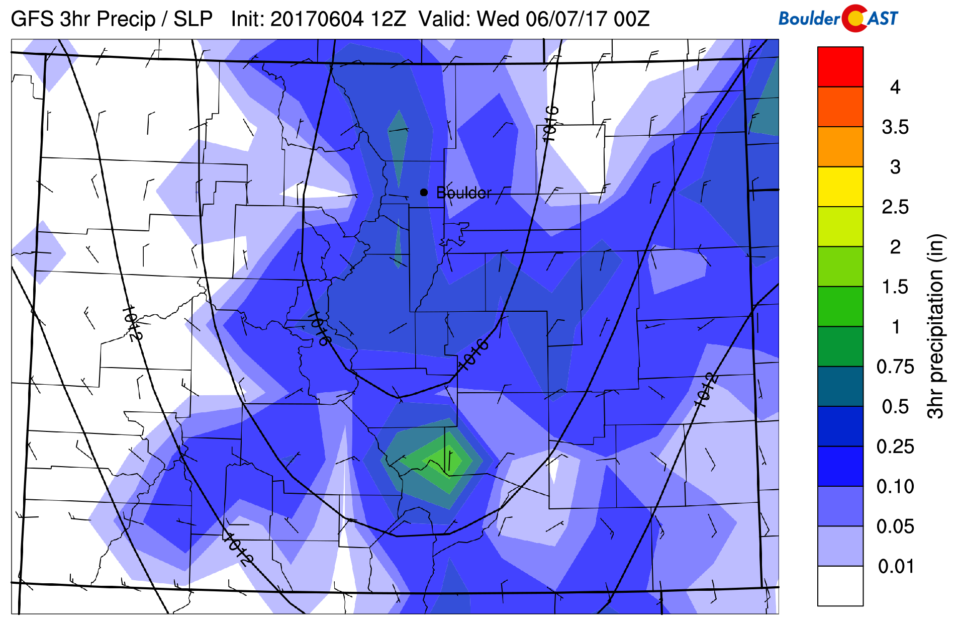
With moisture on the rise today, the threat of scattered showers and storms increases late this afternoon and evening. The GFS model is depicting widespread storms across the High Country and Foothills by early evening. These storms will likely make their way onto the Plains, though not all will maintain themselves due to large-scale subsidence. A few strong and possibly severe storms could form north and east of Denver, with the main threat being strong outflow winds up to 60 mph. Nevertheless, any storm activity should be ending by 10PM tonight for the Metro area.
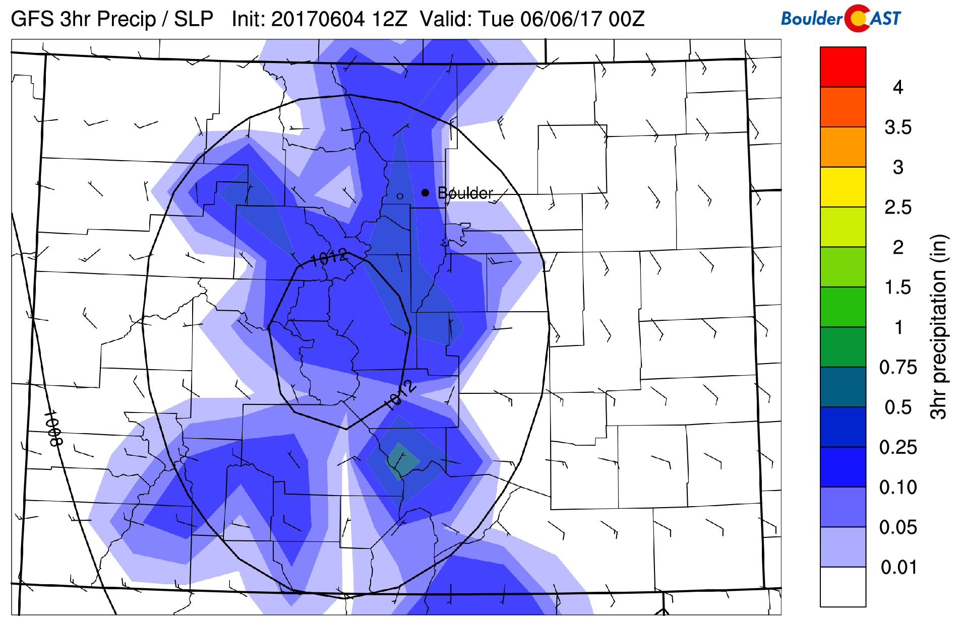
GFS precipitation tonight
Tue into Wed: A cold front with unsettled weather
On Tuesday, a weak cold front drops down from Wyoming in the very early morning hours. The figure below depicts the frontal position in blue. This front is tied to a weak low pressure system in central Canada. The passage of the front will give way to cooler temperatures, likely only lower 70’s for highs Tuesday.
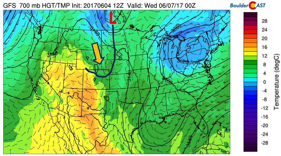
GFS 700 mb temperature and wind for Tuesday
Tuesday looks to be the WETTEST day of the week thanks to the tandem of low-level upslope and mid-level southwest monsoon-like flow.
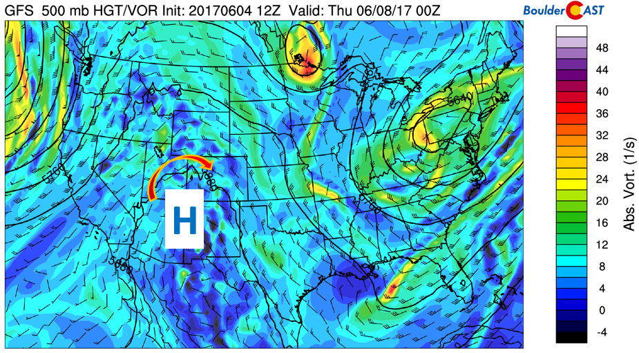
GFS 500 mb vorticity for Tuesday
Expect widespread showers and thunderstorms by mid to late afternoon. Storms will likely once again start out in the High Country and track east-southeastward onto the Plains. Locally heavy rainfall up to 1″ will be possible in the heavier storm cells. Storms will end around midnight or slightly after.
GFS precipitation for Tuesday
On Wednesday, the pattern remains quite similar to Tuesday, with the exception of weaker upslope flow. Highs should warm up into the mid 70’s in most areas, though still remain relatively cool compared to Monday. Storm activity will become more isolated to scattered in nature, with not all regions seeing wet weather. However, the High Country should remain quite unsettled.
90’s to end the week?
Thursday and Friday shows a pattern of heat building into the state of Colorado, one very eminent of the summer season finally taking hold! This is expected as June is typically a warm and quieter month for eastern Colorado. There is usually a lengthy lull in the action between the spring upslope storms of May and the ignition of the summer monsoon in early July.
The below image shows 700 mb temperatures approaching 16 degC Thursday and potentially 18 degC on Friday. Translating this to the surface, it would point to predicted highs near the middle 80’s Thursday and possibly low 90’s Friday! We are several days out, but the pattern looks quite favorable for the heat to build-in late this week. The one fly in the ointment that may hinder the warm weather will be clouds from the moisture-laden flow. On Thursday, the high pressure shifts further south near Mexico, pushing storm activity south and east of us, though an isolated storm Thursday can’t be ruled out. On Friday, large-scale downslope should likely stop any threat of storms both in the High Country and Plains.
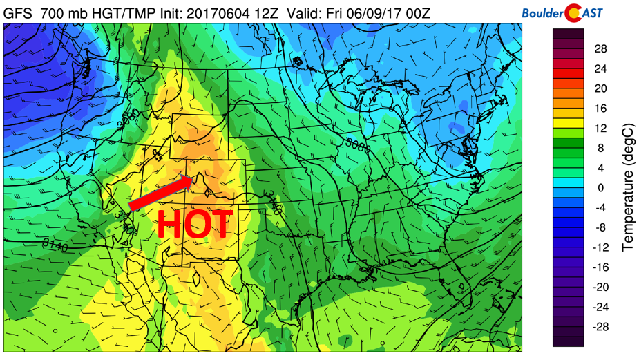
GFS 700 mb temperatures for Friday
As we head into the weekend, a large area of low pressure in the western United States makes its way onshore over California. It will impact Colorado late in the weekend. Initially, this will allow highs near 90 again on Saturday. By Sunday, though, storm chances increase and this will continue into early next week with the eventual approach of the system. If you’re headed out of the Denver Metro this weekend to go into the Mountains, expect windy weather on Saturday and a chance of storms Sunday.
Enjoy the week!
Forecast Specifics:
Monday: Sunny skies giving way to increasing clouds with scattered showers and thunderstorms developing by mid to late afternoon and tapering off by 10PM this evening. Stronger to borderline severe storms will be possible north and east of Denver, with damaging winds the main threat. Highs climb into the middle 80’s on the Plains with middle 70’s in the Foothills.
Tuesday: Cooler, mostly sunny early, then increasing clouds by afternoon. Widespread showers and storms developing in the late afternoon and continuing into the early morning hours. Highs will be in the lower 70’s for the Plains and lower 60’s in the Foothills. Storms that form have the potential to produce heavy rainfall up to 1″.
Wednesday: Partly cloudy skies becoming mostly cloudy with isolated to scattered thunderstorms in the late afternoon/evening. Highs in the mid 70’s on the Plains and low 60’s in the Foothills.
Thursday: Partly cloudy skies with an isolated chance of thunderstorms…most of us to stay dry. Highs in the middle 80’s on the Plains and lower 70’s for the Foothills.
Friday: Full sunshine, dry, and hot. Highs will possibly reach the low 90’s on the Plains with upper 70’s in the Foothills.
High Country: The threat of thunderstorm activity will be in the forecast for Monday, Tuesday, Wednesday, and part of Thursday. The most unsettled days look to be Monday through Wednesday with moisture-laden southwest flow overrunning the Mountains. If you are out hiking this week, start early in the morning to avoid being caught in the storms. Thursday will see isolated storms and Friday will be mostly dry with large-scale subsidence.
Don’t be selfish…share our forecast with your friends!
Mon
Tue
Wed
Thu
Fri


Temperature
83
71
75
85
90


Precip Chc (Plains)
40%
60%
30%
10%
0%


