
While our forecast for the week ahead contains the chance of rain each and every day, we do believe that many locations won’t see a drop of rain at all this week. The roller-coaster ride of temperatures is the bigger story here.
Ridging to start the week
Our weather early in the week will be influenced mainly by a weak ridge moving across the Rockies. The 500 mb map below shows the ridge on Monday afternoon centered across Utah.
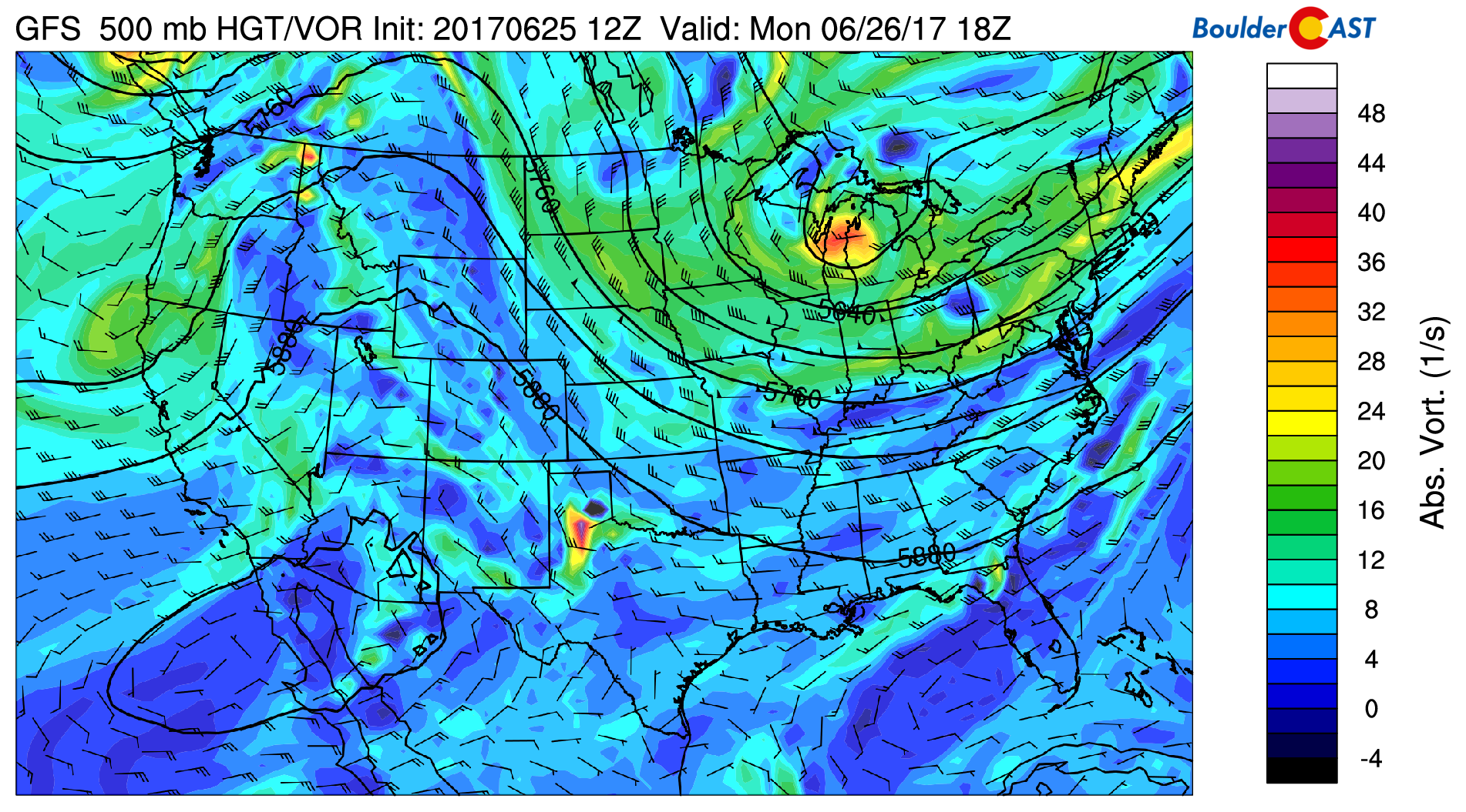
GFS 500 mb vorticity map for Monday afternoon showing a ridge centered across Utah
Large scale subsidence from the ridge and dry air will lead to a nice day Monday. Highs will be in the low to middle 80’s with a few afternoon clouds.
By Tuesday morning, the ridge axis will move eastward across Colorado (blue dashed line below). This will bring the warmest air of the week by Tuesday afternoon. Expect highs in the low to middle 90’s. However, a mere hours after the ridge axis passes over Denver, a weak shortwave will be pushing across Colorado (red dashed line below). It looks as though this trough’s timing could overlap nicely with daytime heating, bringing increased chances of storms to the Front Range Tuesday afternoon and evening.
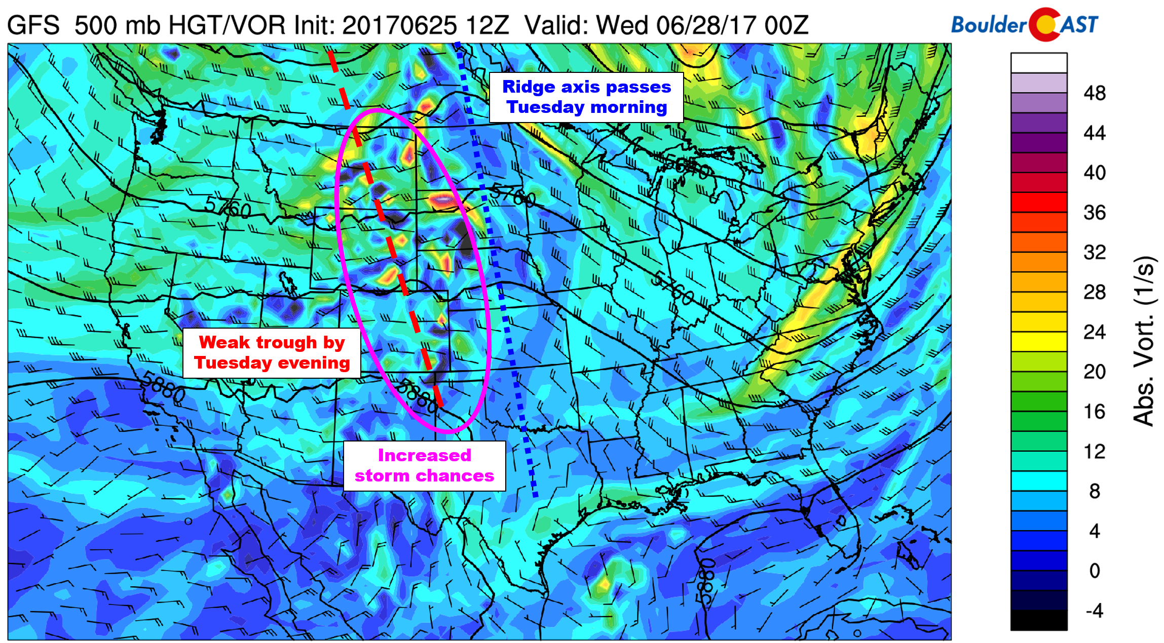
GFS 500 mb vorticity map for Tuesday evening. With a weak trough passing across Colorado, rain chances will be slightly elevated
Moisture is still very much limited, so storm coverage will likely remain isolated to widely scattered. Further north and east of Denver, towards Fort Morgan and Sterling, isolated severe storms are possible. At this time, the Front Range looks to be in the clear.
West-northwest flow lingers
On the backside of that weak system, westerly flow slowly turns northwesterly and lingers across the state into the weekend (red arrows below). At the same time, an active pattern will be in place across the northern tier of the country (systems circled in purple below).
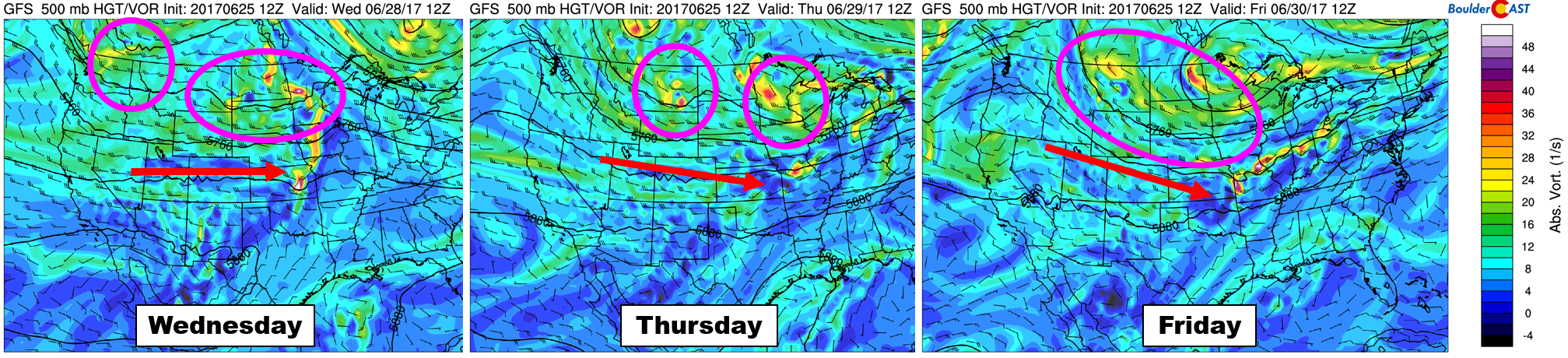
GFS 500 mb vorticity maps for Wednesday, Thursday, and Friday showing the mid-level winds turning northwesterly. This will open the door for weak cold fronts
While these systems won’t have much impact on Colorado, the northwest flow should allow for associated weak cold fronts to reach the Plains Thursday into Friday (and beyond). Outside of this weak upslope, there is nothing else to facilitate precipitation late-week. As such, we expect rain chances to be fairly slim. However, we should see a cool-down with highs likely falling into the 75 to 85-degree range Thursday and Friday.
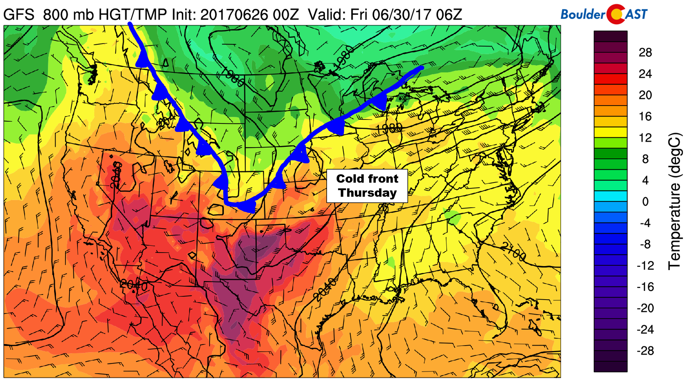
GFS 800 mb temperature and wind forecast for Thursday, showing cooler air already in place across northeast Colorado
While still not for uncertain, the GFS ensemble keeps the cooler air in place through the upcoming weekend with one or two reinforcing shots of cool air for our region. It looks right now that the upcoming weekend could be another nice reprieve from the heat!
Enjoy!
Forecast Specifics:
Monday: Sunshine early with a patchy afternoon clouds. Isolated afternoon/evening storms will be possible south of Denver. Expect highs in the mid 80’s across the Plains, with low 70’s in the Foothills.
Tuesday: Mostly sunny skies with isolated afternoon thunderstorms, mainly east of the Denver. Some of the storms towards the Nebraska border could turn severe. Expect highs in the low 90’s on the Plains, with low 80’s in the Foothills.
Wednesday: Sunny skies to give way to afternoon cloud cover. An isolated storm or two is possible on the Plains and Foothills, otherwise dry. Highs in the upper 80’s across the Plains and upper 70’s in the Foothills.
Thursday: Morning sun followed by building clouds through the afternoon. While most areas will be dry, isolated storms are possible, especially east of Denver. Highs in the low 80’s across the Plains with low 70’s in the Foothills.
Friday: A mix of clouds and sunshine and cooler temperatures lingering. Isolated storms can be ruled out this day either. Highs in the upper 70’s on the Plains and mid 60’s in the Foothills.
High Country: Overall a great week to head to the Mountains as conditions will largely remain tranquil. Expect isolated storms Monday and Tuesday, with even lower chances of storms Wednesday through Friday. It’s hard to pinpoint where the focal points for any storms may be from mid-week onwards. However, many areas will be dry with the wettest places only under the gun for isolated showers and storms.
Mon
Tue
Wed
Thu
Fri


Temperature
84
93
88
82
78


Precip Chc (Plains)
0%
20%(pm)
10%(pm)
10%(pm)
10%(pm)


.


