
Our weather this week will be all about the heat, at least through Thursday. A strong cold front sags in late-week to cool us off, but not before we are ruled by a ridge of high pressure. A few storms are possible but most of our week will remain dry. Read on for the full details.
Persistence Monday
Today’s 500 mb vorticity map is shown below. A ridge exists over much of the southwestern United States, spelling out dry and warm weather again today. Not much has changed in the atmosphere from yesterday, so we will likely see highs in the low to middle 80’s once again.
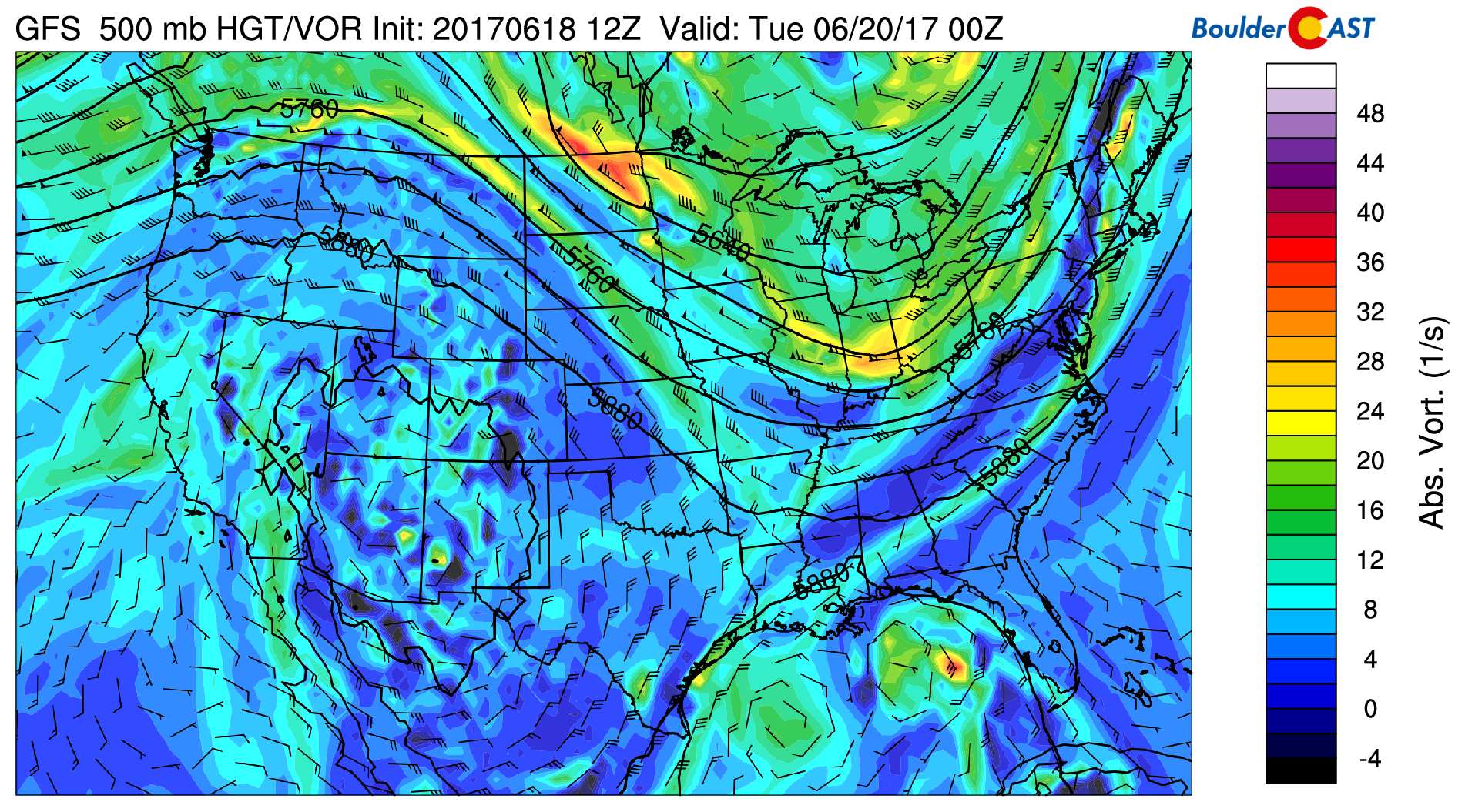
GFS 500 mb absolute vorticity for today
Calm weather and heat prevail
Come Tuesday, the ridge of high pressure will sag ever so slightly southward into New Mexico and Arizona. With that, impulses of energy will have the potential to move from west to east across Colorado, leading to the chances of isolated afternoon storms over the High Country and Plains. With general downslope flow over much of the state, however, these pieces of energy will mainly produce clouds for the most part, with little if any rain. The GFS (below) depicts isolated activity Tuesday evening.
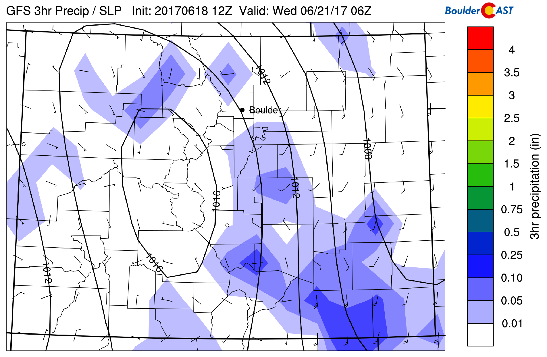
GFS precipitation for Tuesday evening
Both Tuesday and Wednesday look much warmer, with general warming from southwest-westerly flow, pushing highs back into the lower 90’s. It’s possible, we could get into the middle 90’s, though cloud cover from the shortwave energy may hinder that from happening.
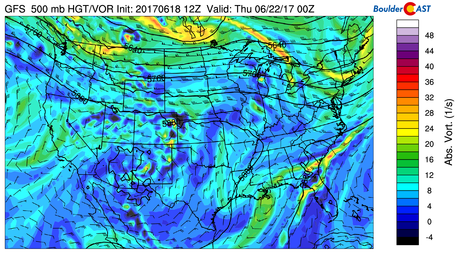
GFS 500 mb absolute vorticity for Wednesday
Much of the same pattern will exist for Thursday as well. It appears the best chance of isolated storm activity, at least through the middle of the week, will exist Wednesday and Thursday, with increasing moisture from the northwest. The threat though will be marginal at best. A weak push of “cooler” air arriving Thursday afternoon should drop temperatures back a few degrees into the upper 80’s.
Potent cold front Thursday night/Friday
Late Thursday night or early Friday morning, forecast models are hinting at a rather strong cold front pushing in from the north.
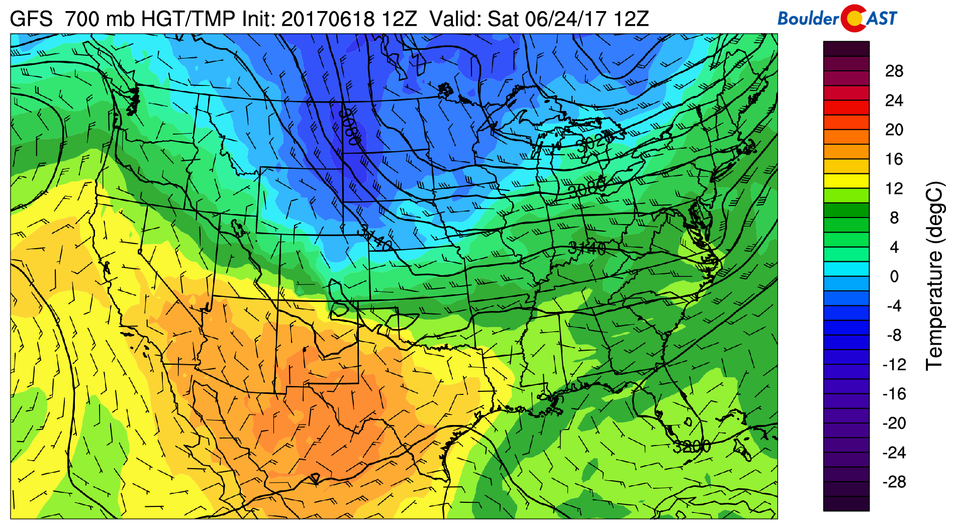
GFS 700 mb temperature and wind for Saturday
By Friday morning, northeasterly upslope flow is present in much of the global forecast guidance, with a 15 to 25 degree cool-down for Friday and Saturday. In fact, the GFS (above) is hinting at 700 mb temperatures over us dipping to below freezing (10,000 feet up)! This is quite impressive for late June, which would spell out high temperatures in the 70’s (and potentially 60’s!) for the first part of the weekend. We’ll even need to watch for some snow in the Mountains above 12,500 feet.
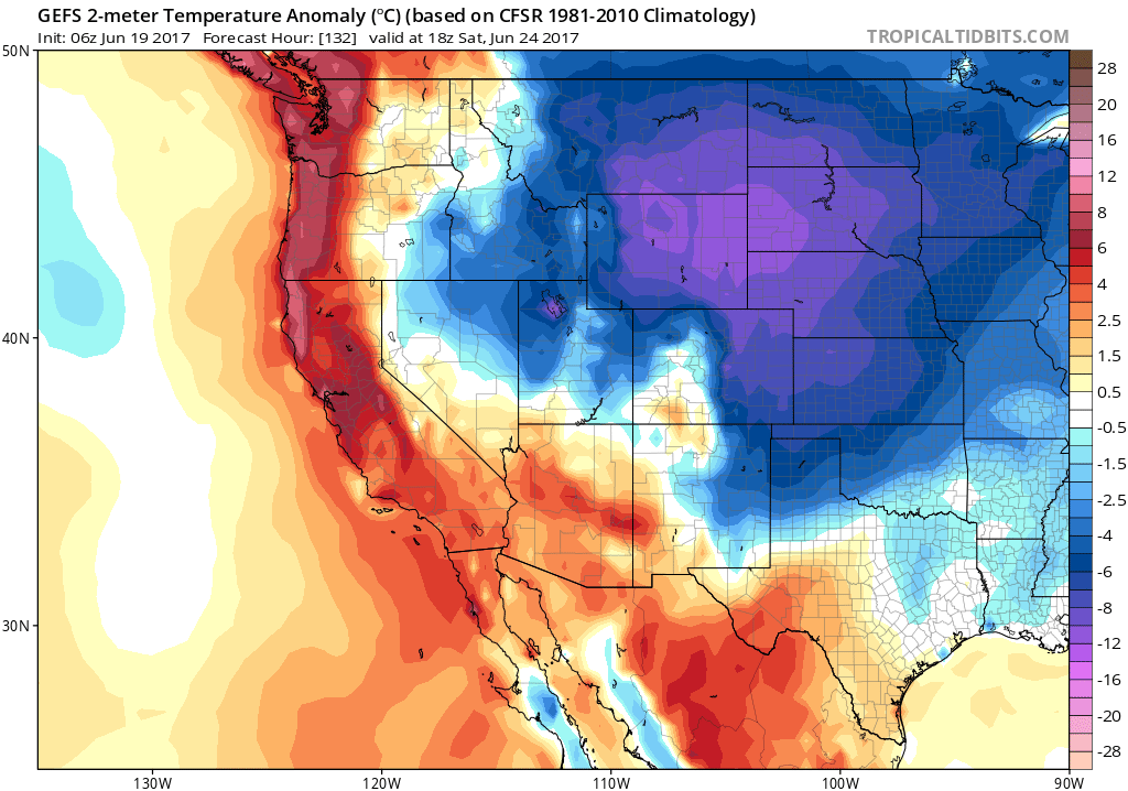
GFS ensemble surface temperature anomaly for Saturday. Chilly across eastern Colorado!
With the frontal passage and upslope, the threat of some unsettled weather rises. As expected, the GFS hints at more widespread rain activity Friday across the Plains. This far out, however, it’s too uncertain to say. It will all hinge on the exact position and strength of the front. Either way, looks cooler to end the week!
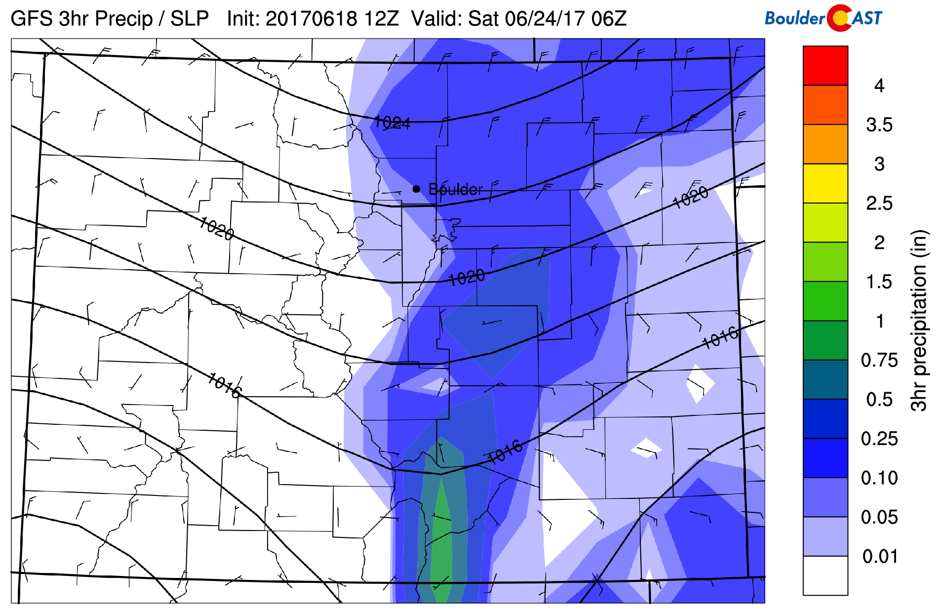
GFS precipitation for Friday night
Forecast Specifics:
Monday: Sunny skies and mild. Expect highs in the mid 80’s across the Plains, with lower 70’s in the Foothills.
Tuesday: Mostly sunny skies, giving way to afternoon increasing clouds. A few isolated storms are possible in the evening and overnight hours. Expect highs in the middle 90’s on the Plains, with upper 70’s in the Foothills.
Wednesday: Sunny skies to give way to afternoon cloud cover. An isolated storm or two is possible on the Plains and Foothills. Highs in the lower 90’s across the Plains and upper 70’s in the Foothills.
Thursday: A mix of clouds and sunshine with isolated storms possible over the region. Highs in the upper 80’s across the Plains and upper 70’s in the Foothills.
Friday: Increasing cloud cover and cooler with the threat of unsettled weather in the evening. Highs in the mid 70’s on the Plains and mid 60’s in the Foothills.
High Country: Weather will be relatively tranquil across the High Country Monday and Tuesday thanks to large-scale high pressure. Storm activity becomes isolated Wednesday and Thursday. On Friday, scattered storms are possible thanks to a sagging cold front. With the cooler air moving in, snow levels fall towards 12,000 feet Friday. This could facilitate a light dusting of snow on the higher peaks that see storm activity.
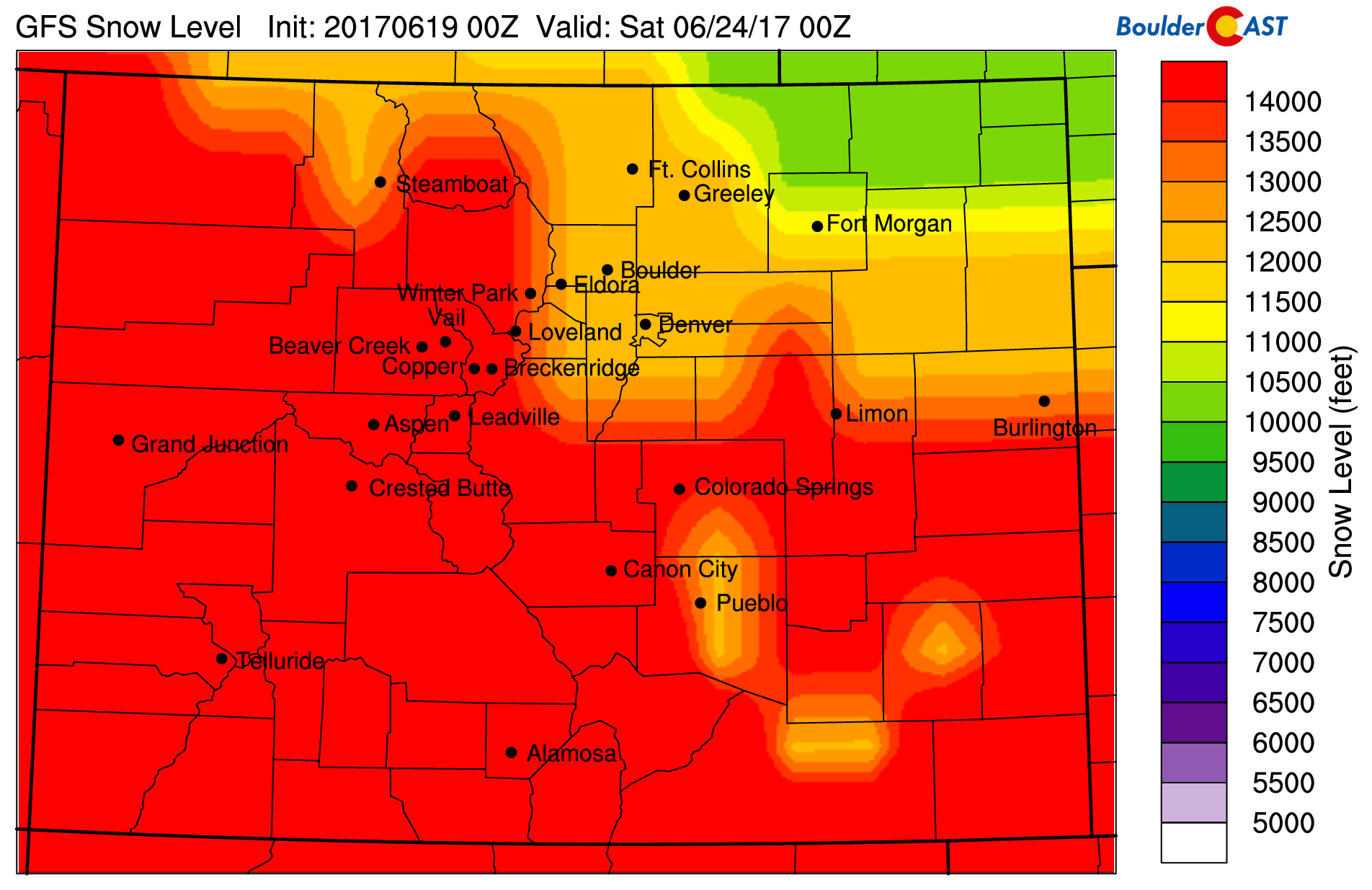
GFS-derived snow level for Friday evening
Mon
Tue
Wed
Thu
Fri


Temperature
83
94
92
89
75


Precip Chc (Plains)
0%
10%(pm)
10%
20%
20%


.


