The week ahead begins warm before the arrival of a southern-track winter storm by mid-week. Unfortunately, the path of the upper-low is not very favorable for Colorado. We’ll see some snow, but not much. Temperatures will then rebound to end the week on a mild note.
Warm southwest flow!
The 500 mb vorticity map below is for Monday. A ridge axis will be passing over Colorado today with warm west-southwest flow across the state of Colorado. Today’s high temperature will be in the upper 40’s to middle 50’s under generally cloudy skies. This ridge will continue eastward on Tuesday and eject the Arctic air that has been plaguing the eastern half of the country for weeks now.
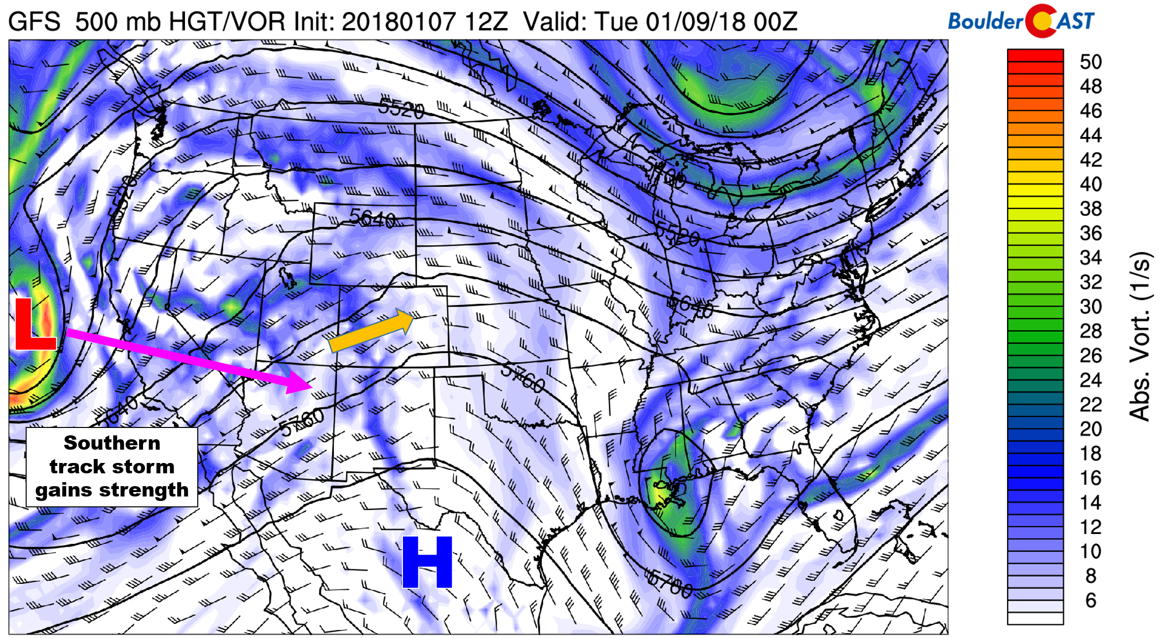
GFS 500 mb vorticity map for Monday evening. Southwest flow and downslope warm us up. A storm system is visible off the coast of California.
In the forecast map above, you will also notice this week’s main weather player off the coast of California. This storm will continue to track east and impact Colorado Wednesday and Wednesday night. More on this storm in the next section….
Tuesday will in all certainty be the warmest day of the week. Plentiful sunshine, downslope warming, and warm air advection from the Desert Southwest will push temperatures into the mid to upper 60’s across the Denver Metro area. The 800 mb temperature map below shows the wedge of warmth tonguing into eastern Colorado Tuesday afternoon.
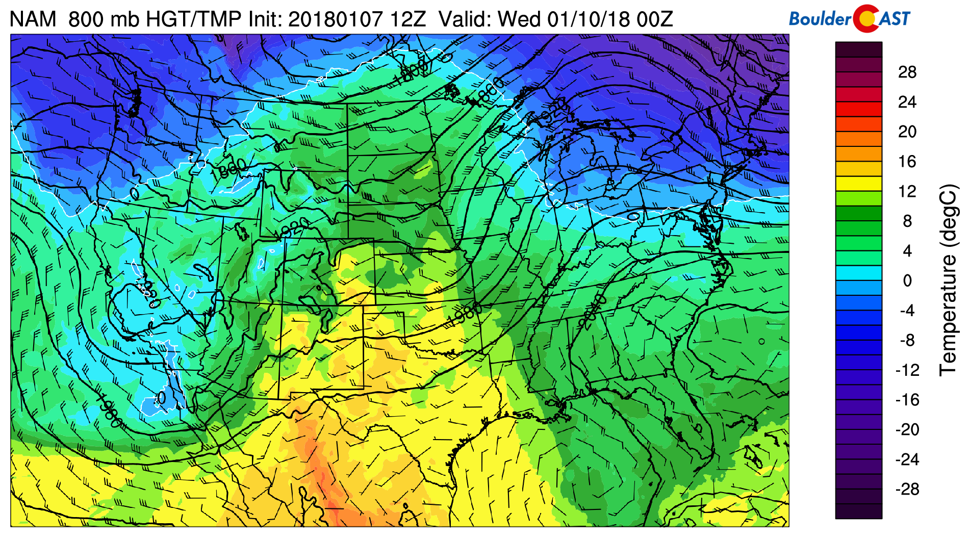
NAM 800 mb temperature map for Tuesday afternoon. Warm air pushes into eastern Colorado.
We were initially concerned about record-warmth on Tuesday, but alas, most Front Range locations pushed into the middle 70’s on January 9, 1934. We’re not likely to get that toasty tomorrow. So warm, but not record warm, for Tuesday.
Disappointing mid-week rain/snow
It’s been quite some time since we’ve had a southern track storm system like this one. The major benefit of this track will be deep moisture, with the drawback being less cold air overall. Considering that it still early January, the latter is not too concerning for us.
The animation below shows GFS model normalized moisture anomaly for Monday through Thursday morning. Deep moisture is being drawn northward into Arizona, New Mexico, and Colorado as the system approaches.
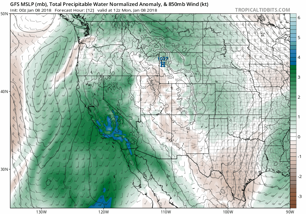
GFS precipitable water anomaly animation for Monday through Thursday morning. Lots of moisture available to the mid-week system.
The issue is that most model guidance continues to show the center of the upper-low tracking across central New Mexico on Wednesday. This track has been rather consistent in the models for a few days now, and unfortunately, doesn’t bode well for much snow across our region. This set-up generally favors southeast Colorado in terms of the deepest moisture and the best dynamics for lift.
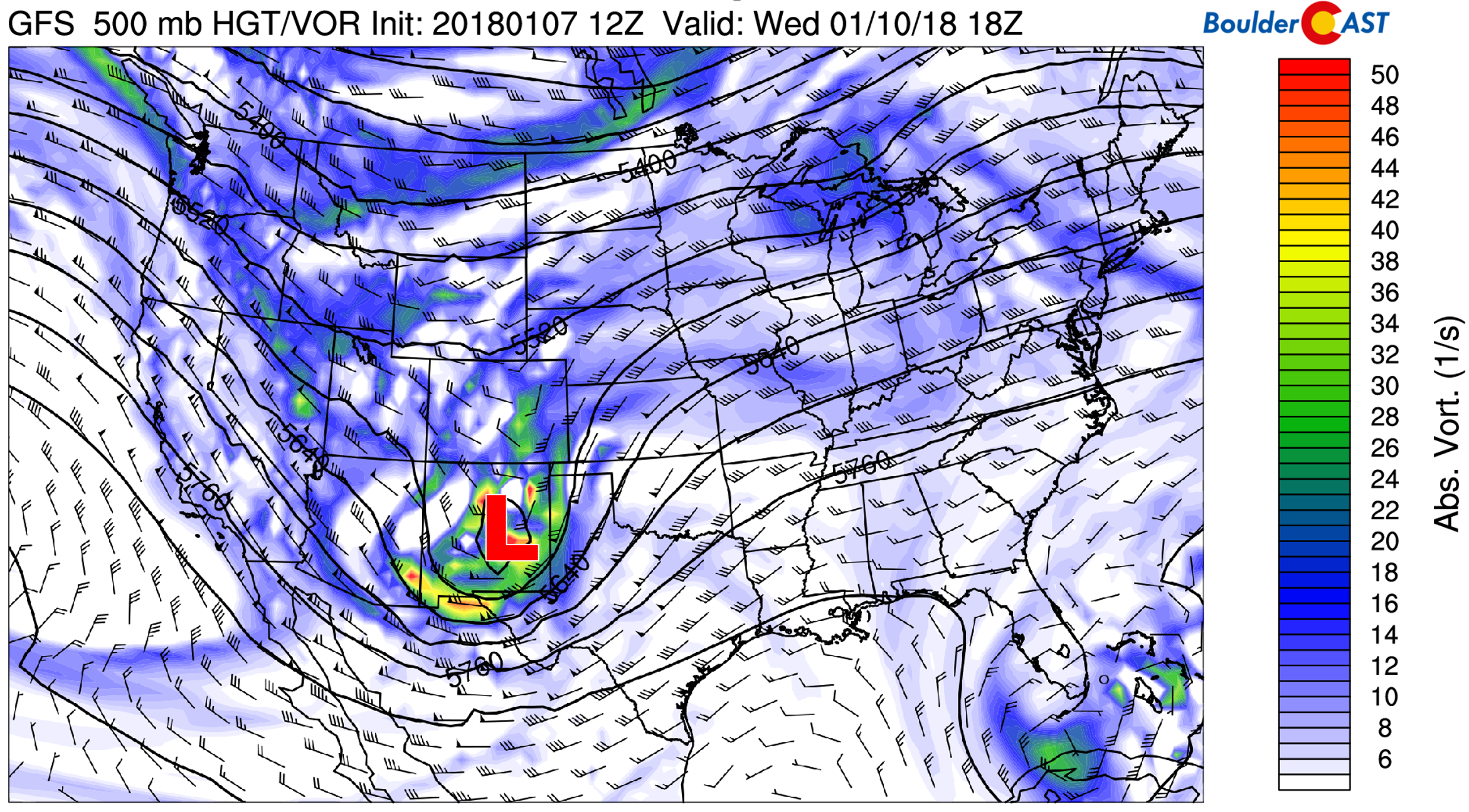
GFS 500 mb vorticity map for Wednesday afternoon showing the position of the upper-low across central New Mexico. Too far south…
The surface low is projected to form across southeast Colorado, putting the Front Range in a downslope regime rather quickly.
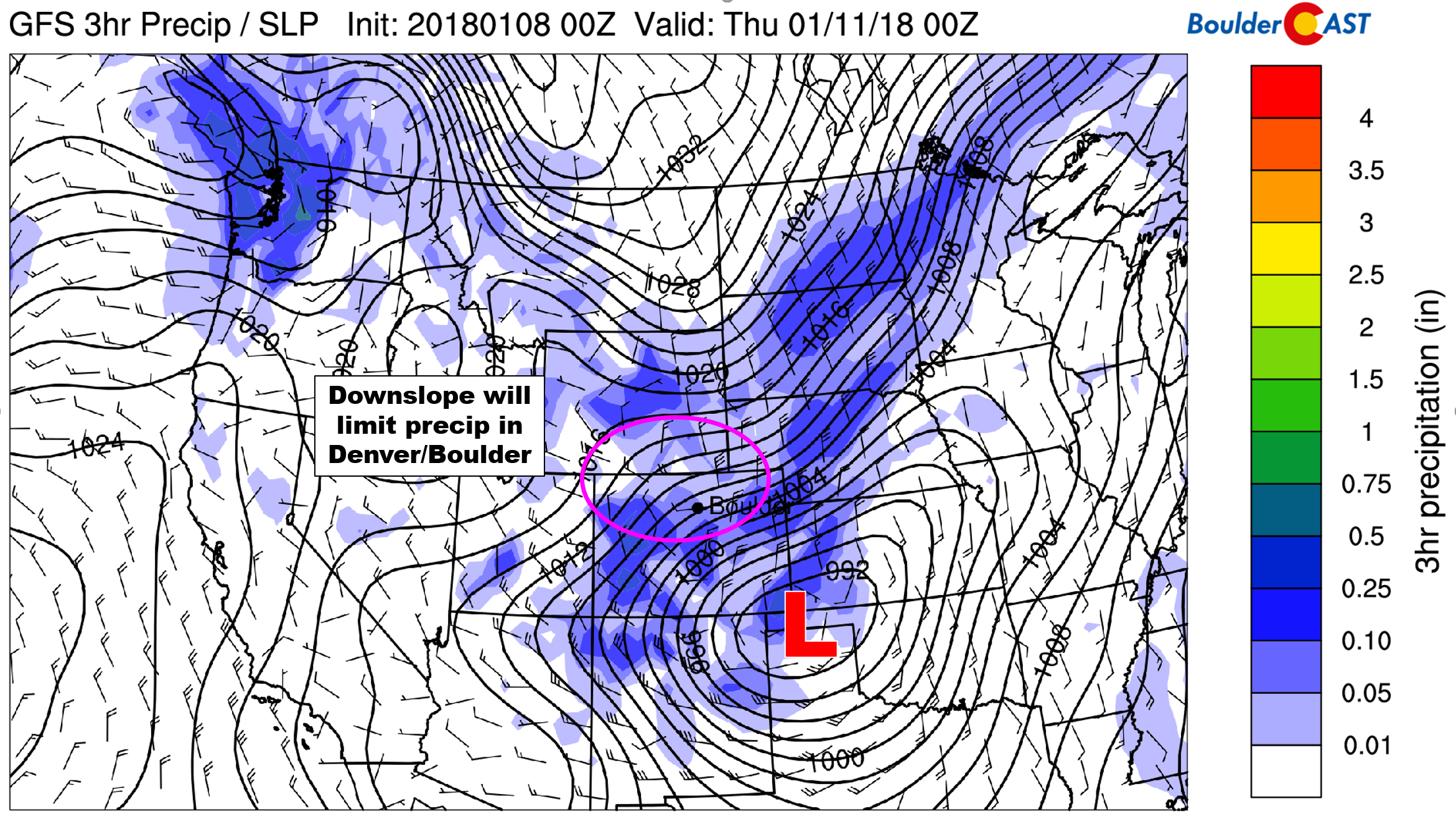
GFS precipitation and pressure for Wednesday evening. The position of the surface low across the Oklahoma Panhandle is too far south. Downslope winds limit precipitation for the Front Range.
Nonetheless, the system will swing a cold front across the region from the north Wednesday afternoon, with upslope developing and temperatures quickly falling into the 30’s by early evening. We’re fairly confident in saying that everyone should see some precipitation, likely a few raindrops changing to all snowflakes. Accumulation is still uncertain, but less than 1″ seems to be the way things are trending right now. The GFS (snowier) and ECMWF models remain at odds on this one. You may see a forecast update from us in the next day or two.
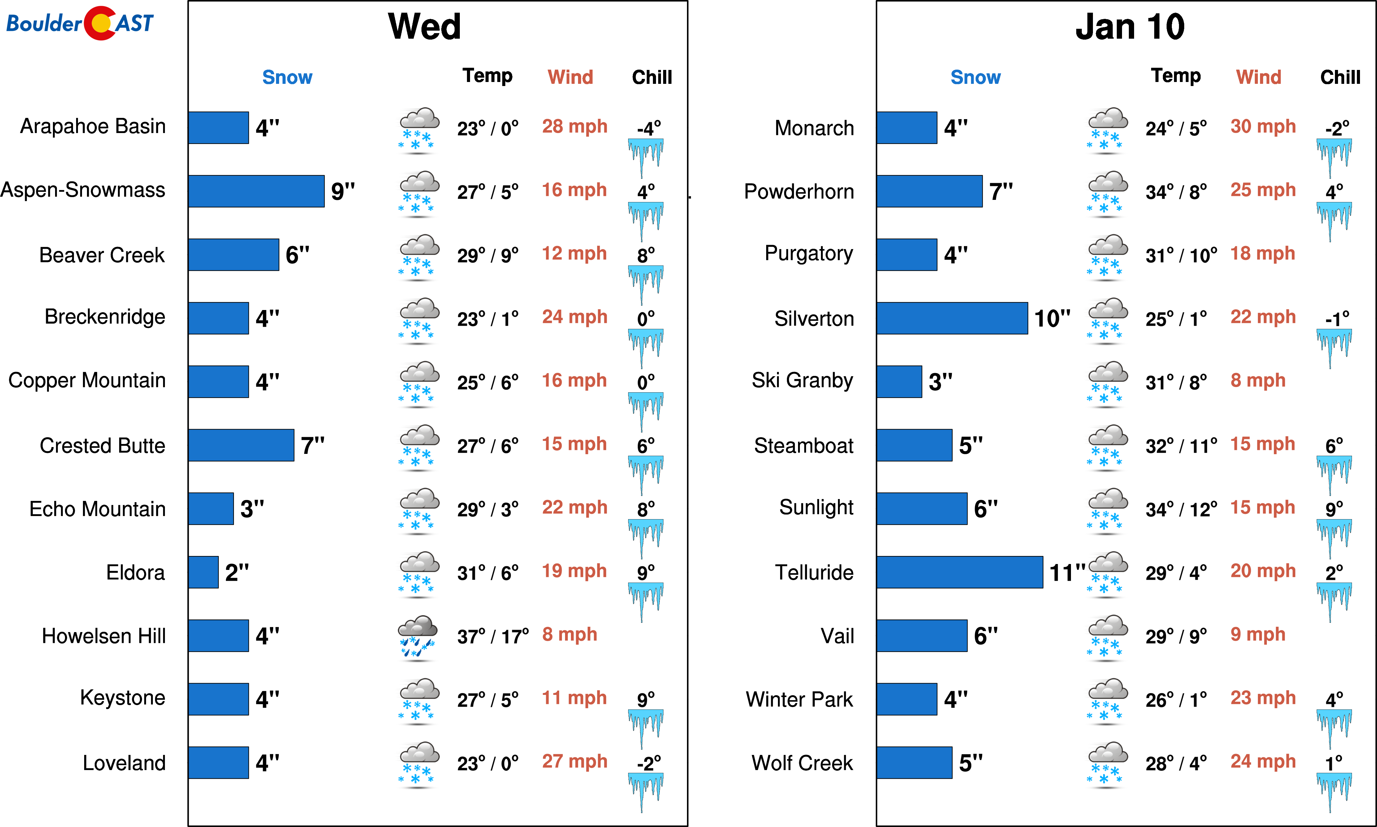
One bright spot: the ski resorts should do fairly good from this storm, especially those favored by southwest flow (Aspen/Telluride/Crested Butte). There is a lot of moisture hanging around the state through Wednesday night and temperatures will be balmy by January standards. Thursday is the best “POW” day this week, but Wednesday may be decent too with snow actually falling during the day. Generally, we’re looking at 4 to 10″ for most resorts.
Quiet heading into the weekend
The progressive upper-low heads eastward with drying and clearing taking over across Colorado by Thursday morning. Look for sunshine with temperatures remaining cool in the lower 40’s.
On Friday, a weak northwesterly system may move across the state. It’s too fine of a detail to trust in the models five days out. But we did want to mention it. If it does materialize, we could see a few snowflakes Friday evening. Temperatures Friday will rebound to near 50 degrees with partly cloudy skies.
GFS 500 mb vorticity map for Friday. Generally northwest flow is expected with the potential for isolated rain/snow showers Friday evening as a weak disturbance moves through northern Colorado.
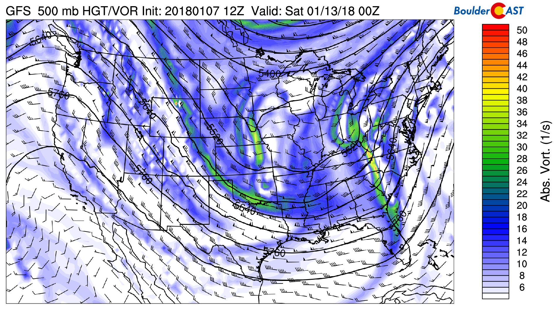
We also see good indication of a high-amplitude ridge redeveloping across the Pacific Northwest into Alaska this weekend. While Colorado will likely remain cool through the weekend, generally quiet weather is expected heading into next week.
Forecast Specifics:
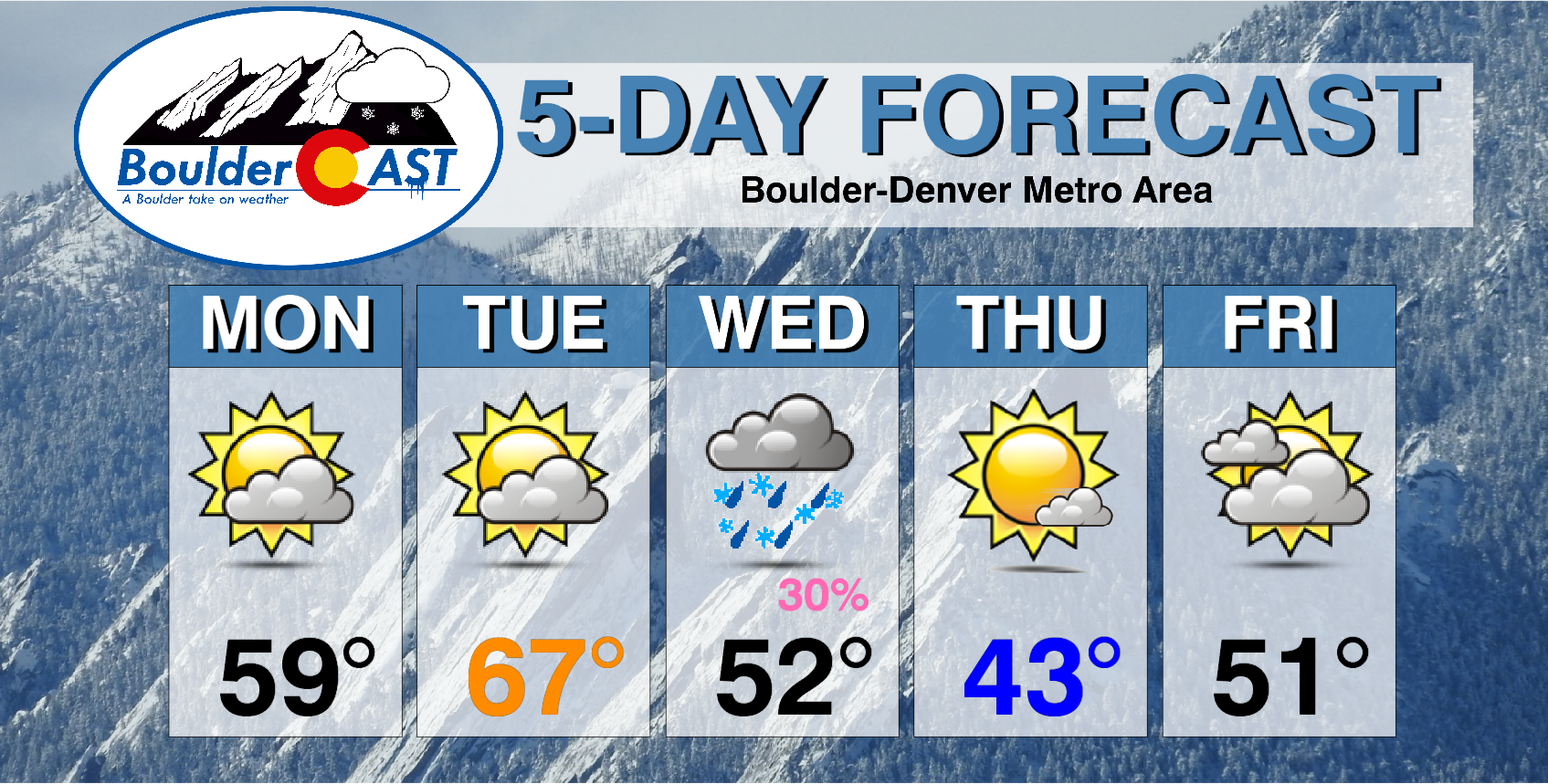
Monday: Morning sunshine with thick mid-level clouds increasing by late morning. Highs will be in the mid 50’s for the Plains, with mid 40’s in the Foothills.
Tuesday: Mostly sunny and unseasonably warm. Highs in the mid to upper 60’s for the Plains with mid 50’s in the Foothills.
Wednesday: Overcast skies and mild before a cold front passes in the afternoon. Post front, temperatures will fall into the 30’s with light rain changing to light snow by evening. High temperatures are expected to be in the 50’s for the Plains with 40’s in the Foothills (morning hours). Accumulations will be light, generally less than 1″.
Thursday: Mostly sunny and cooler. Highs in the lower 40’s across the Plains, upper 20’s in the Foothills.
Friday: Partly to mostly cloudy. There may be a few snow showers across the region during the evening hours. Expect highs in the low 50’s for the Plains, and in the low 40’s for the Foothills.
Extended: A large ridge rebuilds across the Pacific Northwest this weekend. Northwest flow will set-up across Colorado with a cool airmass lingering through the weekend with highs in the 30’s and 40’s. Our weather looks to remain quiet through the first half of NEXT week.
High Country: Moist southwest flow will produce isolated snow showers in the Mountains of mainly southwestern Colorado Monday and Tuesday. As the mid-week system arrives, snow will increase across most of the Mountains Wednesday morning and continue into early Thursday morning. 4 to 8″ are expected statewide for areas above 10,000 feet west of the Divide. Find the latest forecast for all your favorite Colorado ski resorts on our PowderCAST page.
DISCLAIMER: This weekly outlook forecast was created Monday morning and covers the entire upcoming week. Accuracy will decrease as the week progresses as this post is NOT updated. To receive daily updated forecasts, subscribe to BoulderCAST Premium.

.
Share!


