
From everyone at BoulderCAST, we wish you all a Happy New Year! This week, the main weather story will be a warming trend as high pressure settles in across the Southwest. The Arctic air, which has entrenched much of the CONUS the past week, will be pushing off to our east, allowing for an early January thaw. Read on for more details.
Tuesday starts the warm-up
Below shows the mid-level atmospheric pattern today, with an area of low pressure across western Kansas that is embedded over the Arctic air airmass in the Midwest. Behind this system, in Colorado, we have a weak ridge of high pressure with northerly winds.
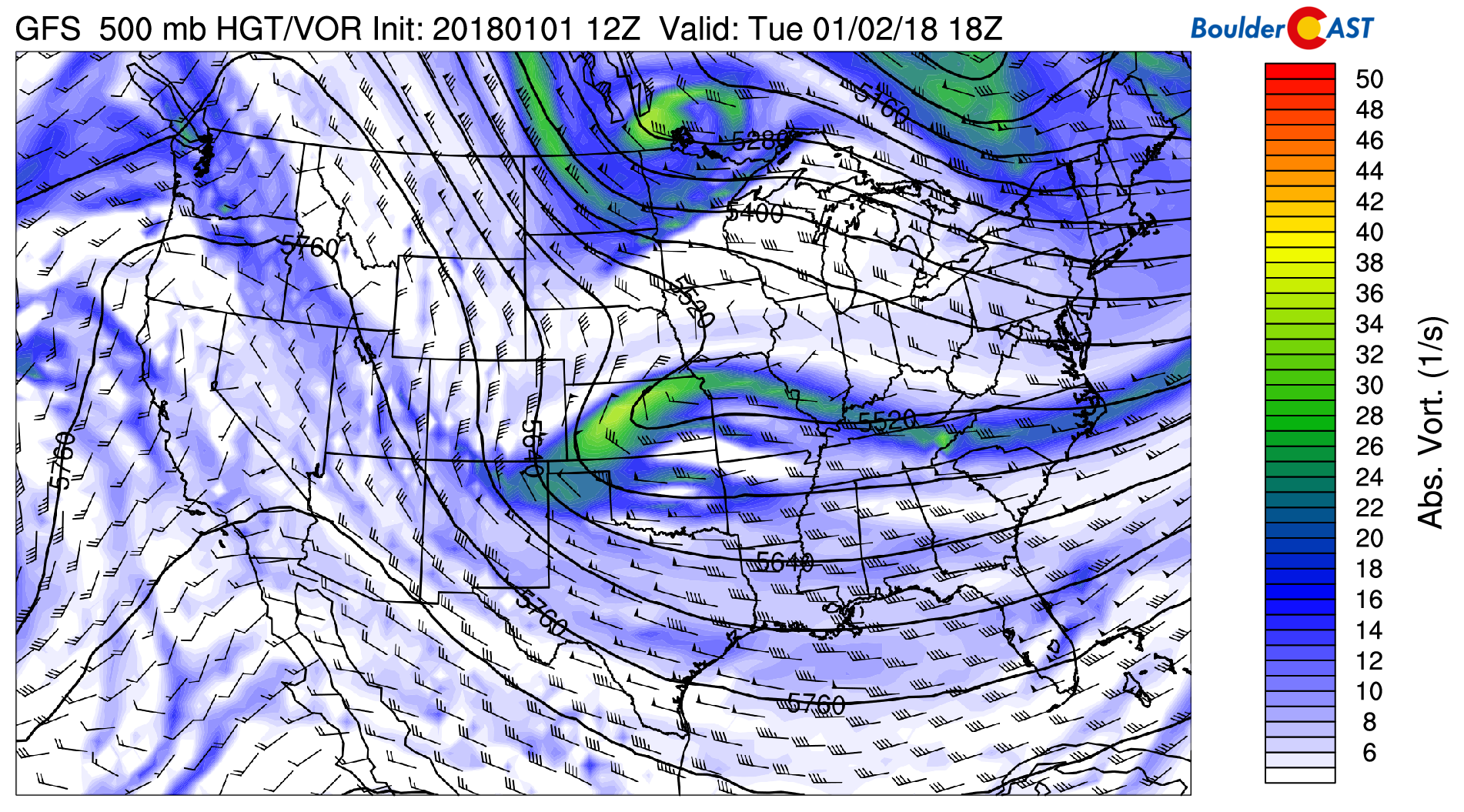
GFS 500 mb absolute vorticity for this afternoon
The pattern change noted above will translate into northwest downslope flow at the surface, aiding in warming across Denver Metro area. Below shows that the freezing line at ~ 5000 feet (Boulder’s elevation) evacuates out of the region, helping temperatures to reach the lower 40’s today under sunny skies.
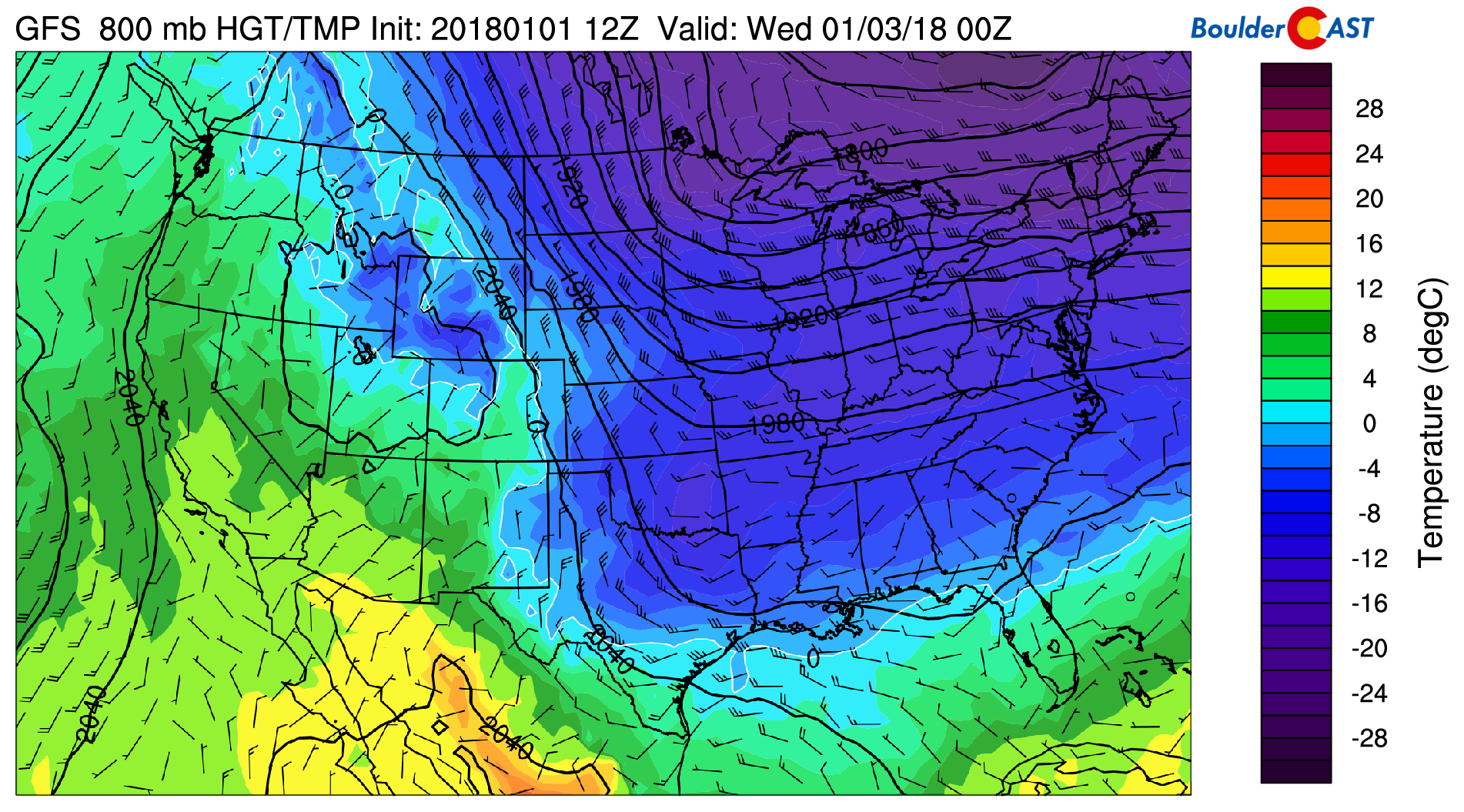
GFS near-surface temperatures (~ 5000 feet) for this evening
High pressure dominates through Friday
Beyond today, much of the weather can be summed up in one image (see below). High pressure across Nevada and Arizona will propagate eastward Wednesday, Thursday, and into Friday, pushing the Arctic air to be confined to the Ohio Valley, Great Lakes, and northeastern US. That, in turn, should help temperatures rise each successive day this week. By Friday, we could see highs in the middle 50’s, a welcome change! Though we will generally be under northwest flow the rest of the week, the airmass is bone-dry, so we don’t expect any snow in the Mountains. Sorry skiers.
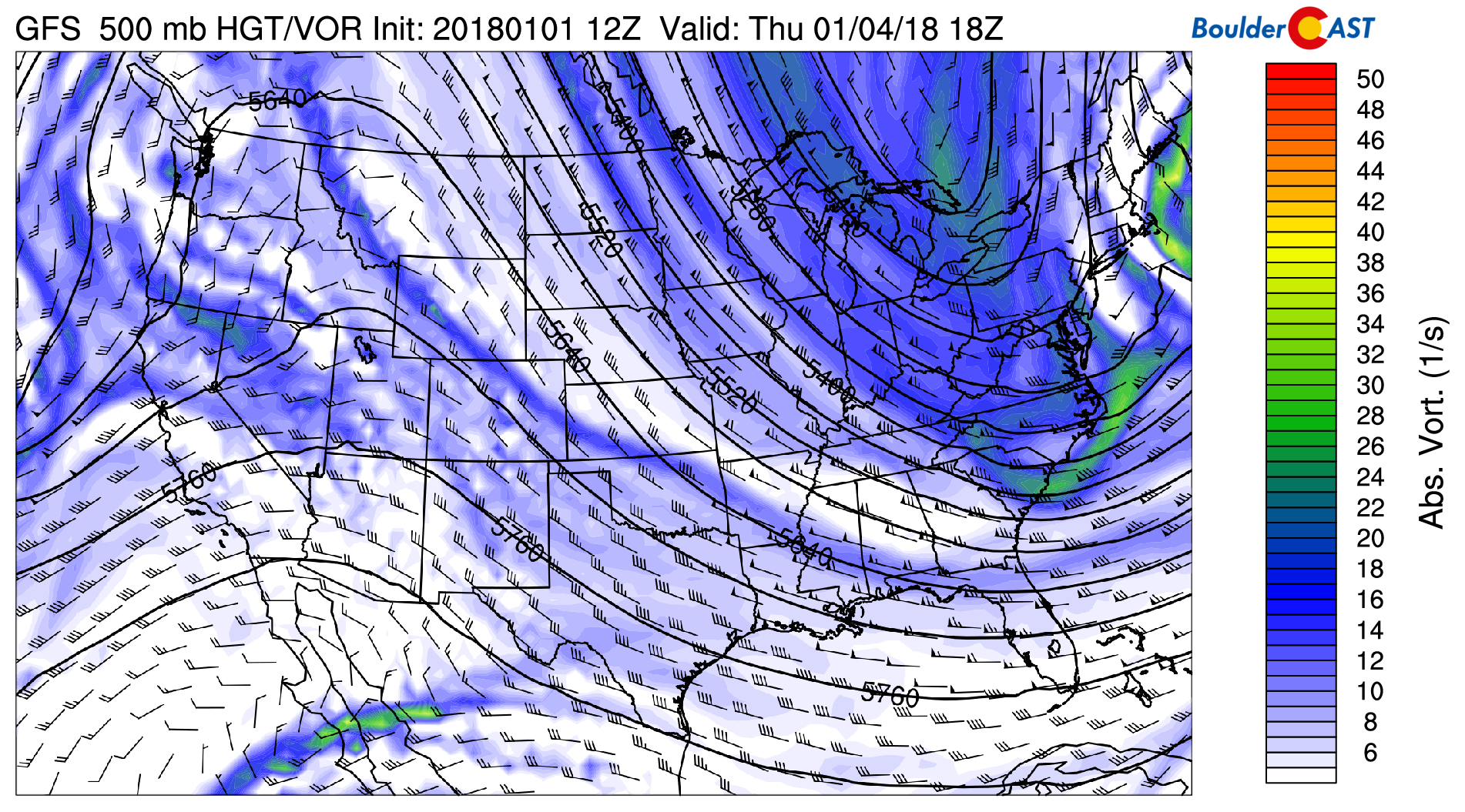
GFS 500 mb absolute vorticity for Thursday
In the extended outlook, there are some indications of a more active pattern trying to redevelop this weekend. Though, at best, it’s looking like mostly a High Country snow chance at this point late Saturday into Sunday.
Enjoy the first week of 2018!
Forecast Specifics:
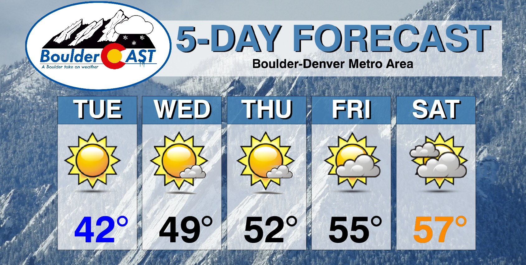
Tuesday: Sunny and warmer. Highs in the lower 40’s for the Plains with lower 30’s in the Foothills.
Wednesday: Lots of sunshine and warmer still. Highs in the upper 40’s for the Plains and in the upper 30’s in the Foothills.
Thursday: Mostly sunny with some high clouds from time to time in the afternoon. Highs in the lower 50’s across the Plains, low 40’s in the Foothills.
Friday: Partly to mostly cloudy and dry. Expect highs in the low to middle 50’s for the Plains, and in the 40’s for the Foothills.
Saturday: Mostly cloudy and warm with highs in the middle 50’s across the Plains with low 40’s in the Foothills.
High Country: Not much to speak of in terms of new snowfall for the ski resorts. This week’s weather pattern will keep things rather dry once again. Our next shot of snow will not come at the earliest until the weekend. Right now Saturday evening into Sunday looks best for snow in the Mountains. Find the latest forecast for all your favorite Colorado ski resorts on our PowderCAST page.
DISCLAIMER: This weekly outlook forecast is was created Tuesday morning and covers the entire upcoming work-week. Accuracy will decrease as the week progresses as this post is NOT updated. To receive daily updated forecasts, subscribe to BoulderCAST Premium.

.
This time last year was cold and snowy! Read our weekly outlook from one year ago!
Share!
.


