
The weather pattern this week will be somewhat active for Colorado, but the overall impact on the Plains will be minimal. However, the skiers will be pleased for the return of more mountain snow. Despite the quiet and warm times of late, our two snowiest months are still in front of us, so don’t let your guard down yet! Read on for our outlook of the upcoming weather-week in Denver.
Early week is troughy
Monday and Tuesday will sport the most interesting weather this week as a broad and disorganized trough passes through Colorado. The 500 mb vorticity map below for Monday afternoon shows the first wave across Idaho, with southwesterly flow over the entire region. This wave will move across Colorado Monday night.
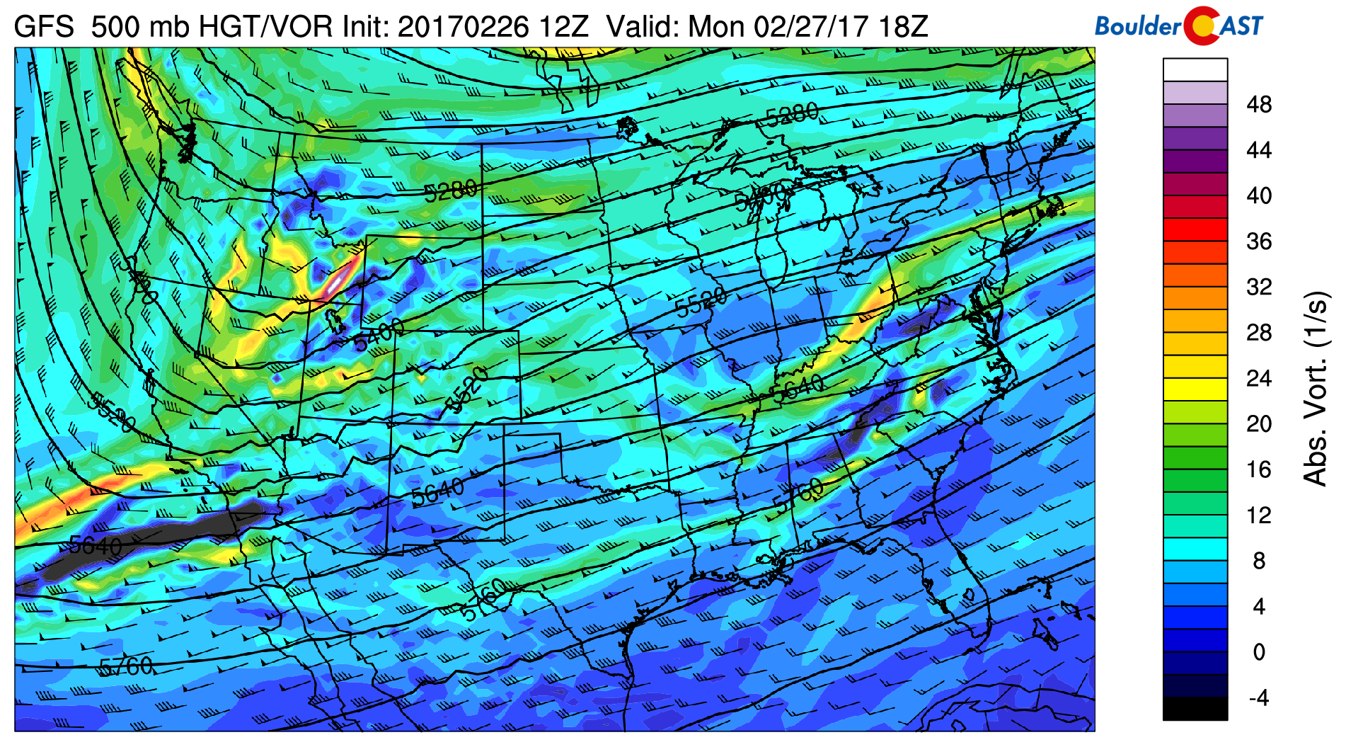
GFS 500 mb vorticity map for Monday afternoon, showing the first trough of interest over Idaho, and a second one just northwest of Seattle.
The trough will be quick moving, and while heavy mountain snow will be possible in western Colorado, it will only serve to bring a cold front to our region Monday night and isolated chances of a rain/snow mix overnight. Highs will be near 50 on Monday with southwesterly winds gusting up to 30 mph during the late afternoon and evening.
On Tuesday, a secondary wave will be moving through which looks slightly more impressive (see below).
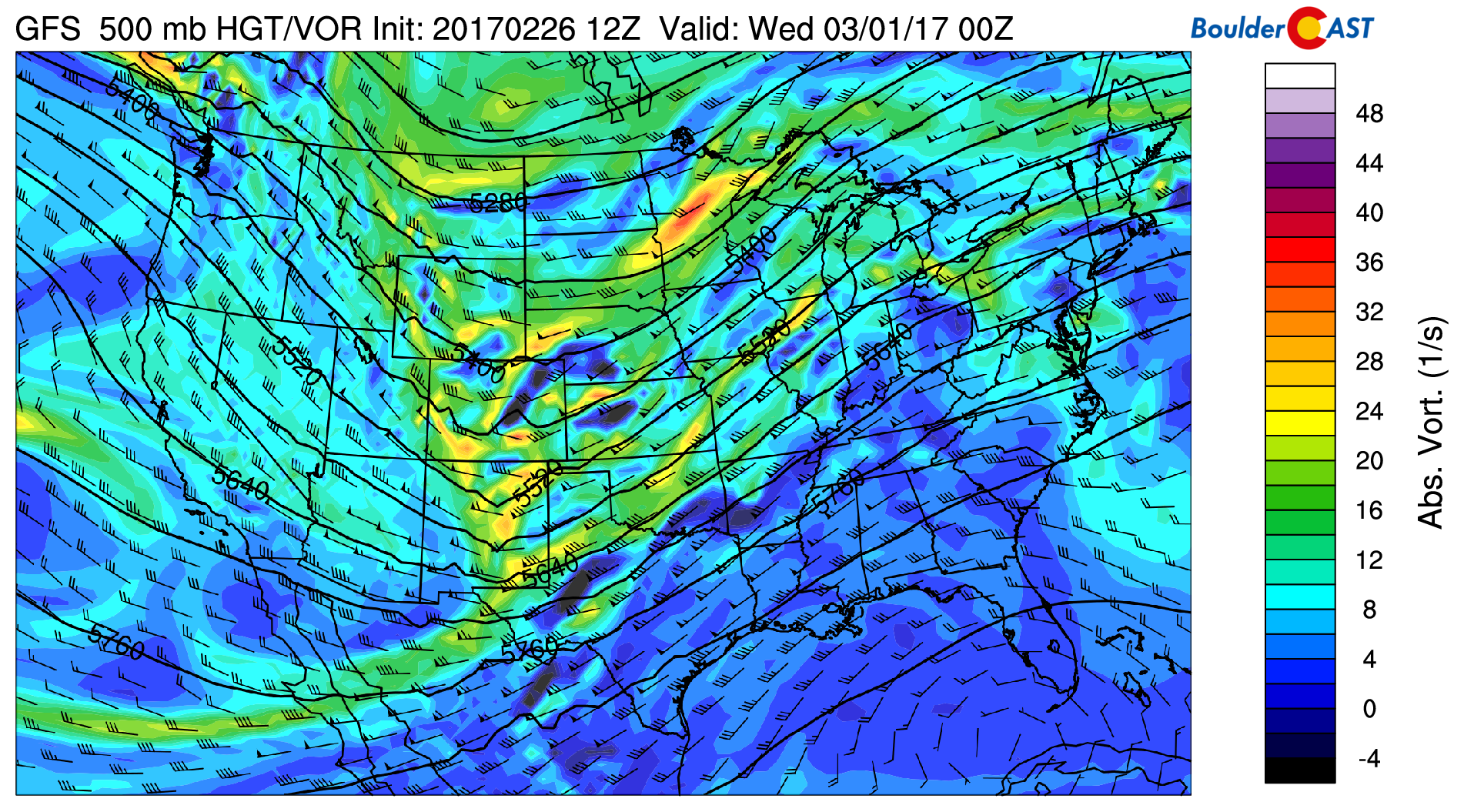
GFS 500 mb vorticity map for Tuesday evening, showing the second trough of interest moving across Colorado
Large-scale lift associated with the second wave and weak upslope behind the front will combine to bring our region’s best chance of precipitation for the week on Tuesday. While the most probable area for snow Tuesday appears to be south of Denver, most of the Metro Area should see snow at some point Tuesday afternoon and evening. Temperatures will be in the 30’s, so melting will be an issue. Therefore, we’re thinking less than 1″ for this event for Boulder and Denver. South of Denver and in the Foothills, a couple of inches are possible.
Skiers rejoice! The mountains will pick up good snow through Wednesday, with 5-10″ north of Interstate 70 and 6-14″ to the south. The snowfall forecast map below from the GFS model through Wednesday shows the heavy mountain snow, as well as the region south of Denver we are watching for light accumulations.
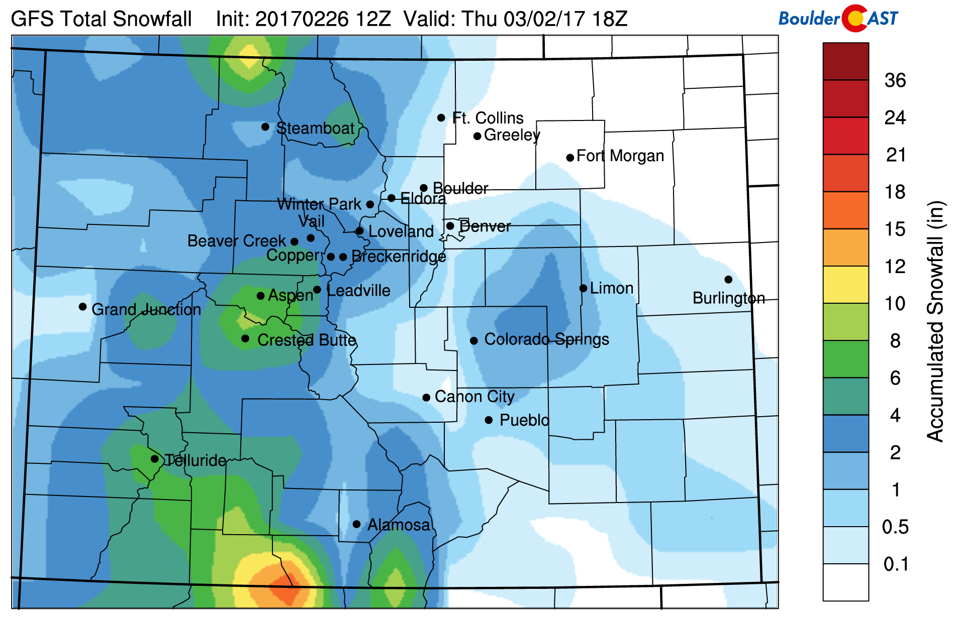
GFS total accumulation snowfall forecast through Wednesday.
Northwest flow ever-after
By Wednesday, our weather will be taking a quiet turn as northwest flow sets in across Colorado and persists right into the weekend.
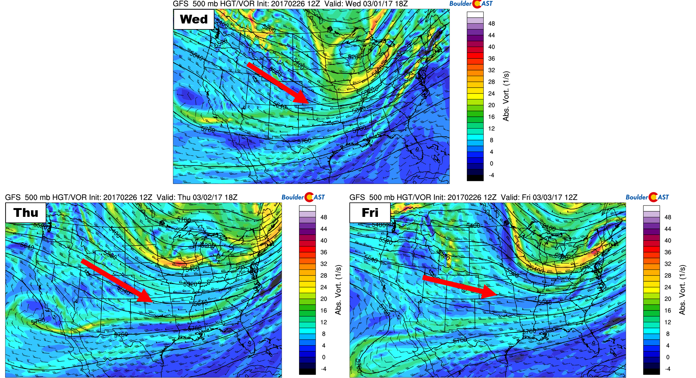
500 mb vorticity forecast maps from the GFS for Wednesday, Thursday, and Friday. The red arrow indicates the direction of the flow over Colorado each day.
The direction of the flow will gradually shift more westerly by Friday. With this, temperatures will slowly be warming up, from the 40’s into the 50’s, and potentially the 60’s by Saturday. Conditions will be dry and sunny statewide during this time, except maybe a few snow showers in areas favored by northwest flow (around Steamboat) on Wednesday.
A wave-feature is present in the models with the jet overhead late Tuesday night into early Wednesday. Depending on how this evolves, areas in and near the Foothills could see a brief wind event. The cross-barrier component of the flow (i.e. the westerly component) is decreased due to the winds being out of the northwest, so we’re not expecting a severe wind storm. Best timing for this looks to be from midnight to 8AM Wednesday. Gusts could exceed 50 mph, which could be enough for High Wind Warning criteria.
Have a solid week!
Forecast Specifics:
Monday: Partly sunny. Isolated rain/snow showers in the Foothills during the second half of the day. Little to no accumulation expected. Breezy during the late afternoon and evening with gusts up to 30 mph. High temperatures near 50 on the Plains and in the upper 30’s in the Foothills.
Tuesday: Mostly cloudy and cold with scattered afternoon and evening snow showers, especially south of Denver. Less than 1″ of accumulation expected. Winds in and near the Foothills could gust in excess of 50 mph Tuesday night. Highs in the mid to upper 30’s on the Plains, and in upper 20’s in the Foothills.
Wednesday: Sunny and dry with highs in the low 40’s on the Plains and in the low 30’s in the Foothills. Winds in and near the Foothills could gust in excess of 50 mph Wednesday morning.
Thursday: Mostly sunny with highs in the mid 40’s on the Plains and in the mid 30’s in the Foothills.
Friday: Partly cloudy and warmer with highs in the upper 50’s across the Plains. The Foothills will see temperatures in the mid 40’s.
High Country: Snow showers will increase in the Mountains during the day Monday and persist into late Tuesday night. Accumulations will be heavier in southern Colorado, but most places will fall in the 5-12″ range. Drier conditions and sunshine take over Wednesday through Friday.
Extended: The upcoming weekend looks to be dry and mild as an upper-level ridge will be in place. Expect temperatures between 55 to 65 with a mix of clouds and sun both Saturday and Sunday. There are hints of light snow in the Mountains, but chances are low and any that does fall will be very light.
Mon
Tue
Wed
Thu
Fri


Temperature
52
37
41
45
58


Precip Chc (Plains)
10%(pm)
30%
0%
0%
0%


