
The month of November wrapped up as the second warmest on record in Boulder. During the month, we had ten 70+ degree days, but only one with a high temperature below 40 degrees. The remarkable warmth of late will NOT continue for the week ahead, unfortunately. Continue reading as we detail the forecast for the next seven days.
Monday’s swing and a miss!
We’ve been discussing today’s big cool-down for many days now. The reason for the drastic change in weather is a strong trough moving across the the northern Rockies. It sure is nice to have a reminder we are indeed in December, and it shouldn’t be in the 60’s or 70’s day after day!
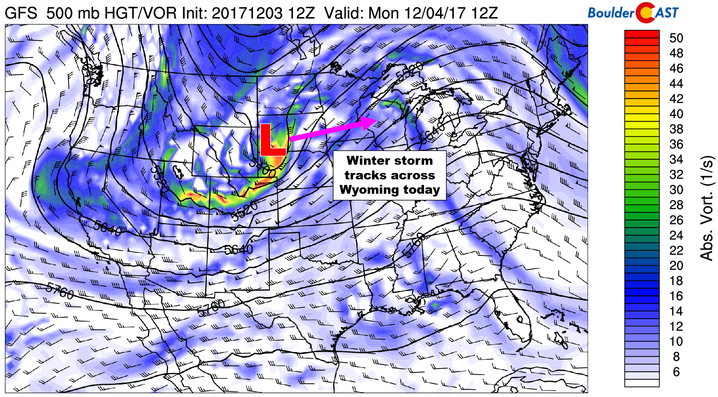
GFS 500 mb vorticity map for Monday morning. Most of the energy from today’s system remains north of Colorado
Initially it looked as though this trough may bring a larger impact and more snowfall to Colorado. However, the track has shifted northward and will remain across Wyoming.
A surface low formed across eastern Wyoming overnight. This position is very unfavorable for precipitation/snowfall in northeast Colorado. The 700 mb temperature and wind map for this morning shows nothing but downslope in the Denver Metro area (see northwest flow below). However, the front has already passed and we’ll see a cold and blustery day with a high in the low 40’s. Winds this morning could gust to 45 mph. Winds then decrease this afternoon as the trough pulls eastward into Kansas, but it still will be breezy.
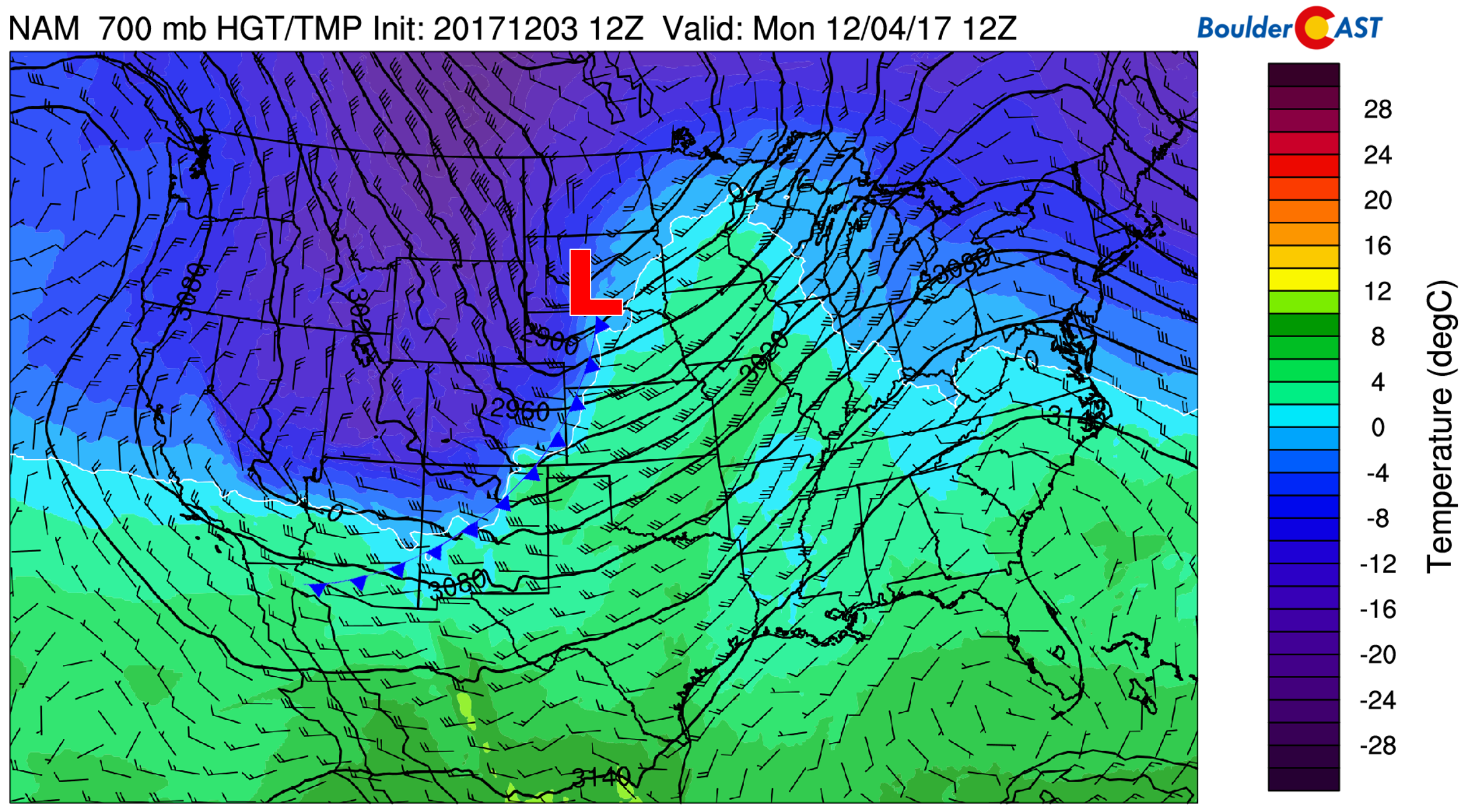
GFS 700 mb temperature and wind map for Monday morning. The front has already passed and the low pressure is pulling into the northern Great Plains.
While northwest flow is DOWNSLOPE on the Plains, this direction is UPSLOPE for the western slopes of the Mountains. Light snow accumulations will be possible for the higher elevations, generally 1 to 4″. As of Monday morning, most of this is done already, but a few isolated snow showers will linger through this afternoon for northwest-facing slopes.
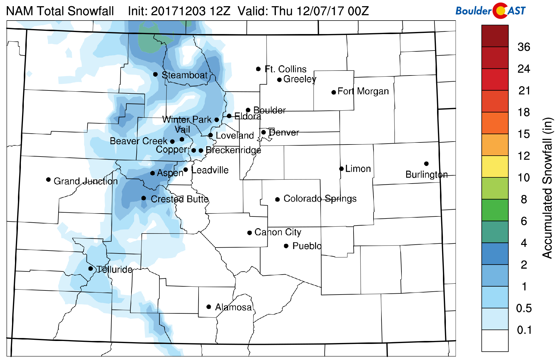
NAM model-derived snowfall accumulation for Monday across the Mountains.
Quiet but cool….
It will be business as usual throughout the rest of the week as cool but dry conditions last into the weekend. A highly amplified ridge is projected to develop across the Pacific Northwest and into Alaska, with troughing continuing across the eastern United States. Between the two, northwest flow will linger across Colorado.
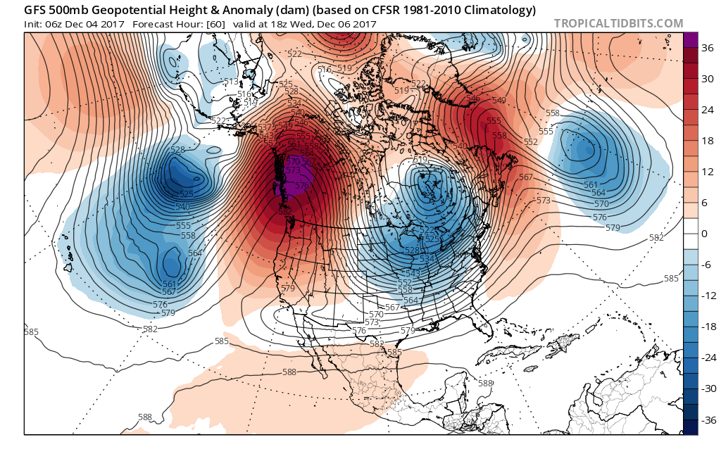
GFS 500 mb height anomaly forecast for Wednesday. A large ridge is expected across the PNW and Alasaka, with continued trough into the Great Lakes.
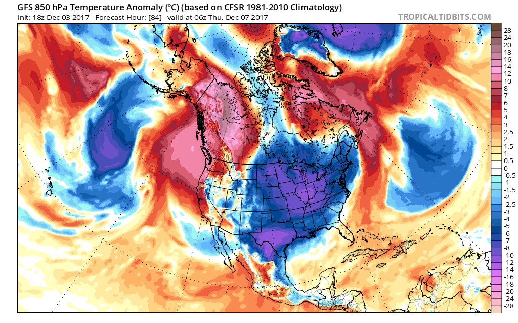
Winter’s grasp will soon take hold over the eastern two-thirds of the country (see below). However, we will remain on the fringe of this Canadian airmass, with temperatures near normal through the rest of the week.
The prevailing storm track will favor quick-moving clipper-type systems into the Great Lakes, with Colorado remaining on the pleasant side, albeit chilly. A dome of high pressure will hold strong across the region, with sunny skies and temperatures generally in the 40’s to lower 50’s this week. Models are hinting at a weak reinforcing shot of cooler air on Thursday, bringing what will be our best chance of precipitation for the week. It’s still unclear if this system will materialize enough to bring any precipitation east of the Divide, but for now, expect a cloudy and cool day Thursday, with a slight chance of a few snow showers or flurries.
Friday will be partly sunny with temperatures moderating several degrees. Middle 40’s to lower 50’s is what we are thinking right now.
Looking longer-term, all signs are pointing towards warm and dry across Colorado. We may be waiting to closer to Christmas before winter once again rears its ugly head!
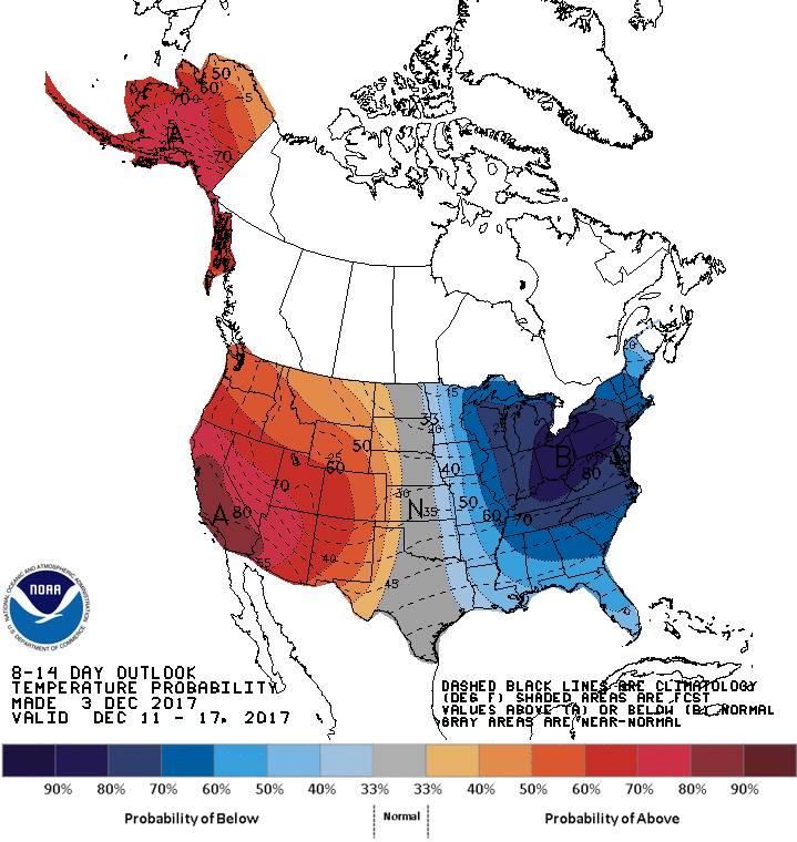
8 to 14 day outlook (December 11 – 17, 2017) for temperature across the United States | Climate Prediction Center
Forecast Specifics:
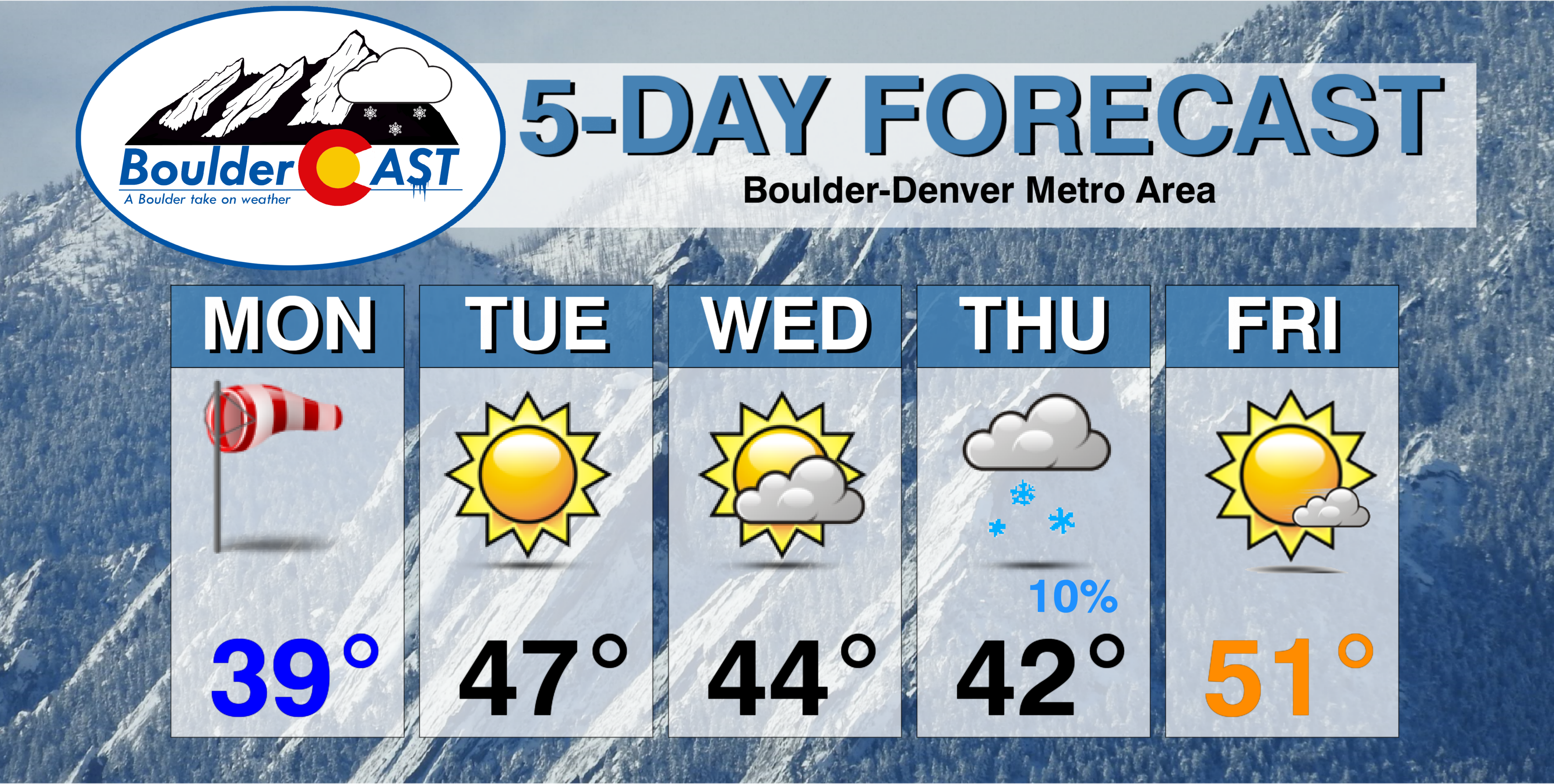
Monday: Partly cloudy, windy and much cooler. Winds during the morning could gust to 45 mph. Temperatures barely rising into the lower 40’s across the Plains, with 30’s in the Foothills.
Tuesday: Sunny and seasonal. Highs in the mid 40’s for the Plains, with mid 30’s in the Foothills.
Wednesday: Partly cloudy and dry. Highs will remain in the lower 40’s across the Plains, and in the lower 30’s in the Foothills.
Thursday: Mostly cloudy with isolated snow showers or flurries during the day. Temperatures in the low 40’s on the Plains and low 30’s in the Foothills.
Friday: Partly to mostly sunny and possibly breezy. Highs in the lower 50’s over the Plains and lower 40’s in the Foothills.
Weekend: Tranquil weather is expected both Saturday and Sunday for the entire state of Colorado. Expect abundant sunshine Saturday, with more clouds on Sunday as a weak (and dry) system moves across the state. Look for highs to be above average both days, probably in the 50’s to lower 60’s for the Plains.
High Country: We’re tracking light snow accumulations of 1-3″ for the Mountains Monday morning. Otherwise, dry and quiet weather is expected through most of the week and the weekend. Thursday and Friday will be blustery under north winds, with another chance of light snow accumulations (probably 1-2″ on Thursday). Find the latest forecast for all your favorite Colorado ski resorts on our PowderCAST page.
DISCLAIMER: This weekly outlook forecast is was created Monday morning and covers the entire upcoming work-week. Accuracy will decrease as the week progresses as this post is NOT updated. To receive daily updated forecasts, subscribe to BoulderCAST Premium.

Help us reach more people before winter! Share this forecast with your friends:


