
We hope you had a safe and festive holiday weekend! Please excuse the brevity of this week’s forecast. Overall, we’re not expecting much in the way of interesting or impactful weather this week anyways. Dry and warm conditions will prevail through Friday, with snow potentially arriving for the weekend and into early next week. Read on for our short and sweet outlook covering the upcoming week.
Wind was our gift
Despite the lack of snow on Christmas for most of us, the Front Range never disappoints as powerful downslope winds developed Sunday afternoon. A strong pressure gradient and elevated stability just above mountain level were to blame for yesterday’s windstorm. Here were some of the peak gusts from around the region:
NCAR Mesa Lab (Boulder): 90 mph
Broomfield Airport: 82 mph
NREL (South of Boulder): 72 mph
Longmont Airport: 69 mph
Berthoud Pass: 60 mph
NCAR Foothills Lab (Boulder): 56 mph
BoulderCAST Station: 55 mph
Boulder Airport: 54 mph
A boring weather week lies ahead
The dominant pattern for the week will be dry northwest flow across Colorado. This is visible in the 500 mb vorticity maps for Monday through Thursday below…
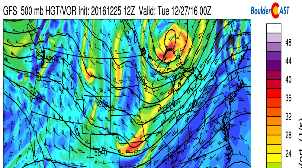
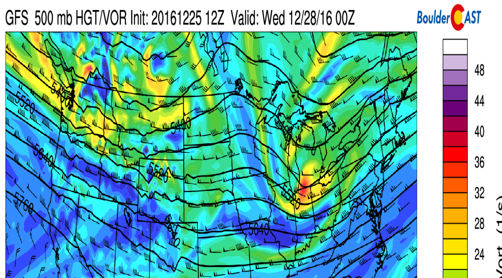
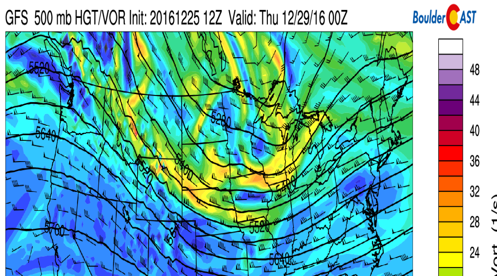
Under this flow pattern, we’ll see plenty of sunshine throughout the week and no chance of precipitation, with temperatures in the 40’s and 50’s. This is above normal for late December as our average high is in the low 40’s.
The only thing worth mentioning is a weak system that will skirt Wyoming and extreme northern Colorado Wednesday. This will bring an inch or two of snow the northernmost Mountains of the state.
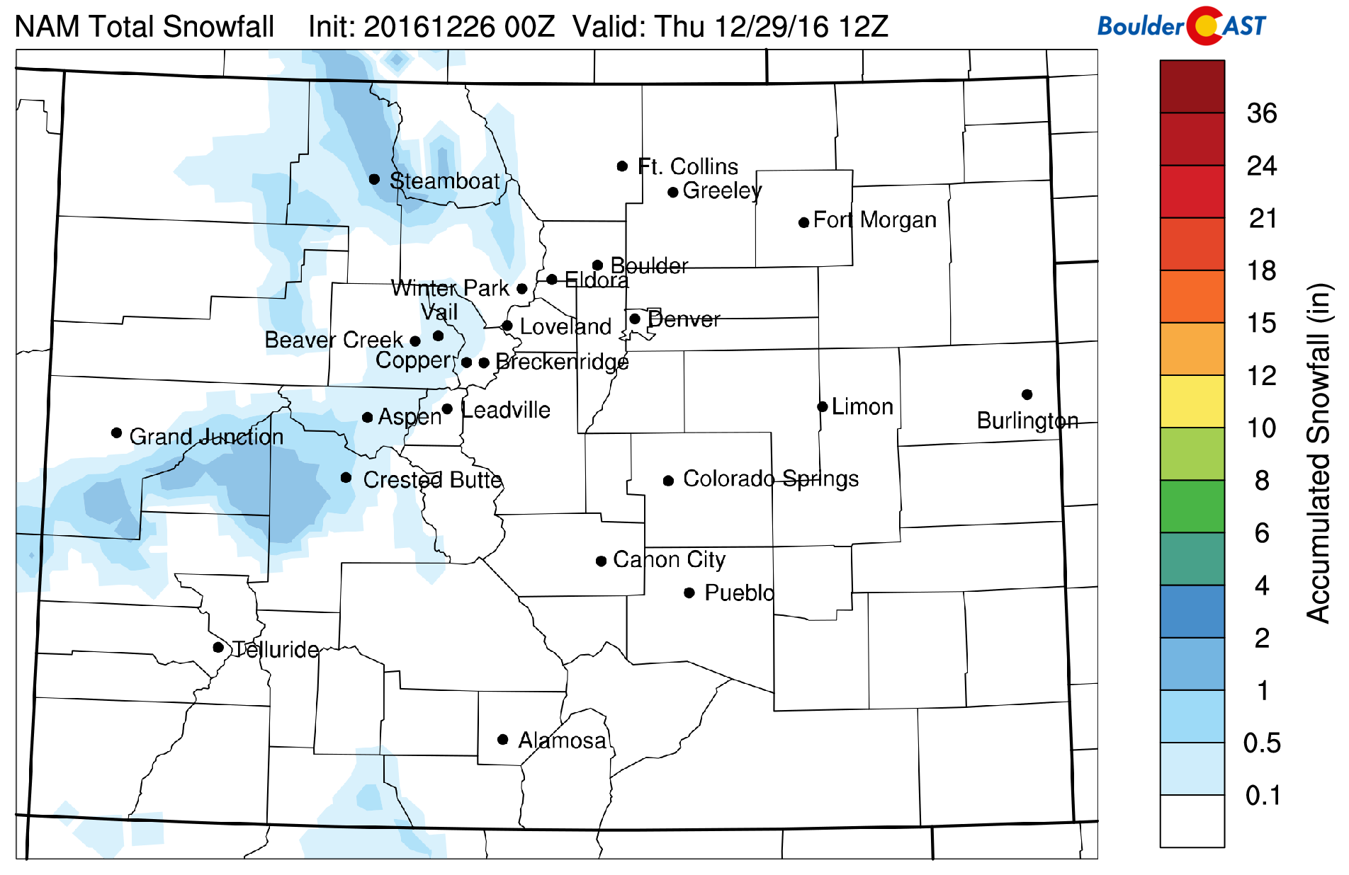
NAM snowfall forecast for the mid-week Mountain snow event
On the Plains, a weak Pacific cold front should swing through late Wednesday, knocking temps down into the low 40’s for Thursday.
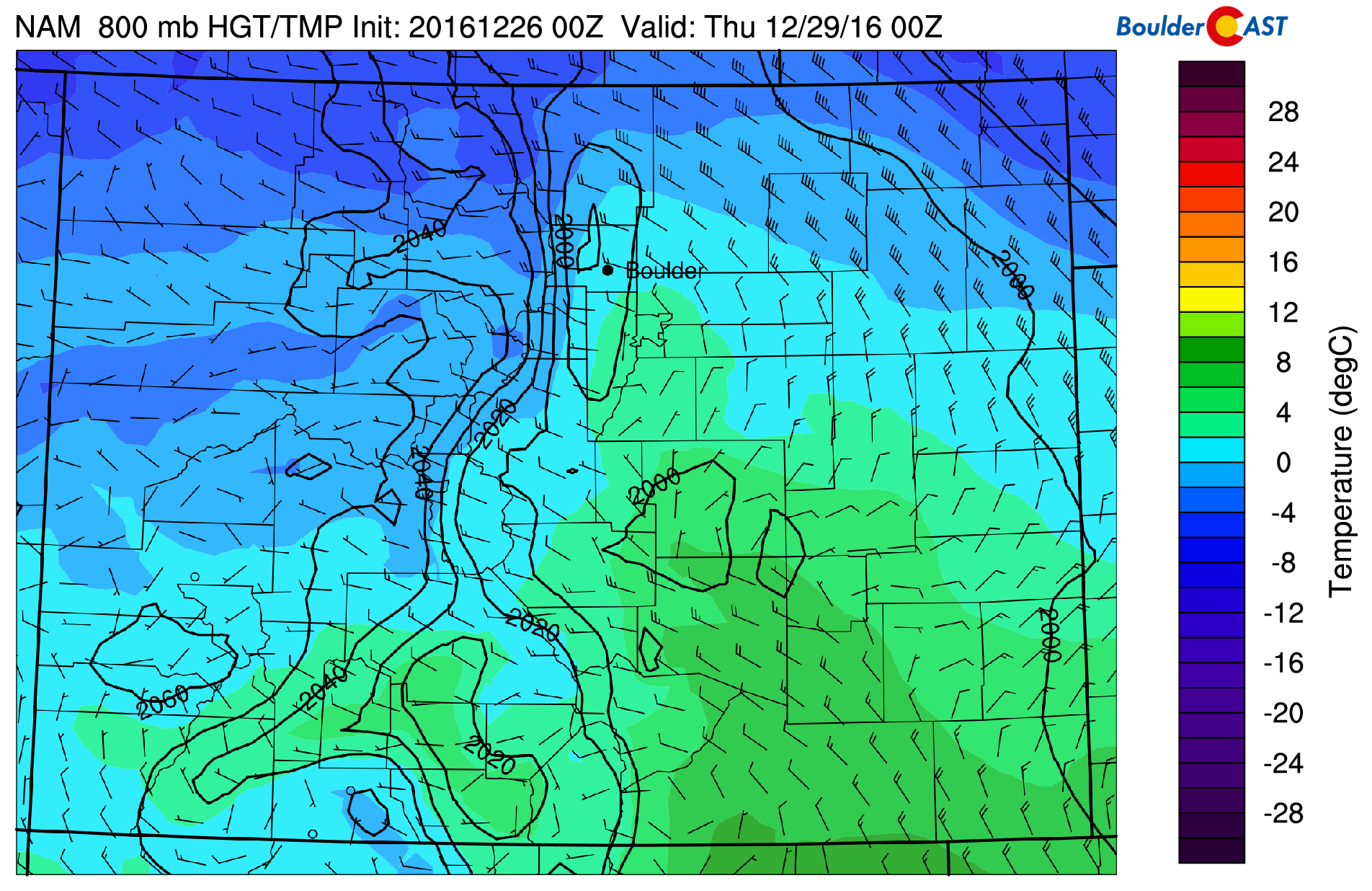
NAM 800 mb temperature and wind forecast map for Wednesday evening. A weak cold front is moving into Colorado from the northwest
New Year’s Snow?
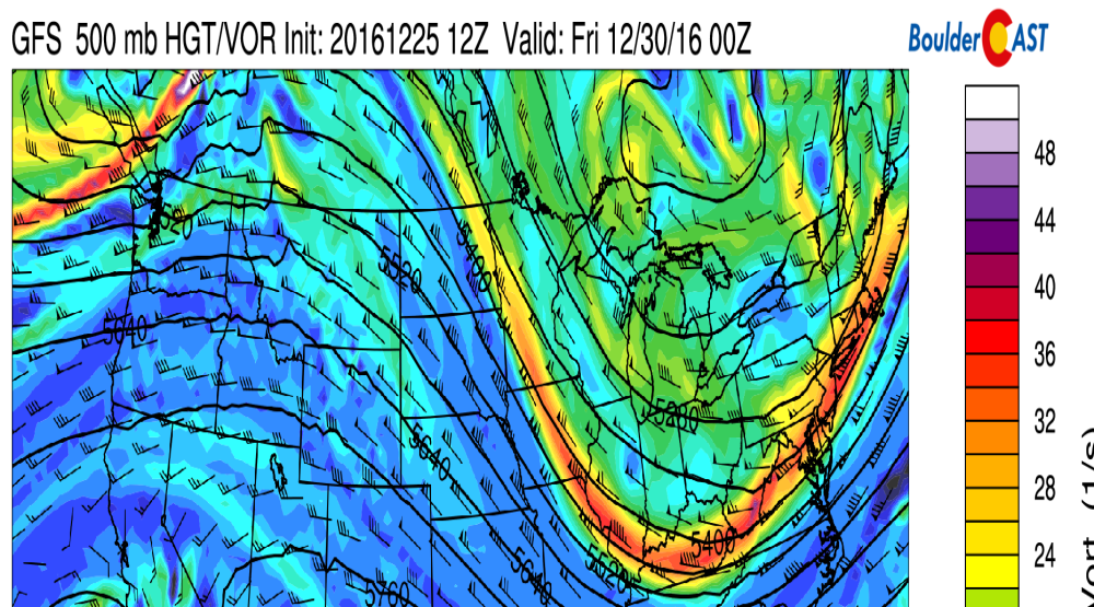
Just in time for the upcoming holiday weekend, we’re watching a trough in the time-frame of Saturday or Sunday. Six days out, model spread is quite high. At the least, we should expect snow to return to the Mountains, with a slight chance of snow showers on the Plains for New Year’s Eve or Day. Cooler air will most likely filter in as well. After temperatures Friday in the 50’s or low 60’s, 40’s will be on tap for the weekend.
Forecast Specifics:
Monday: Sunny and seasonal. Expect temperatures in the low 40’s on the Plains with low 30’s in the Foothills.
Tuesday: Warmer and generally sunny with a few late-day clouds. Highs in the low 50’s for the Plains with near 40 in the Foothills.
Wednesday: Lots of sunshine and breezy. Highs in the 50’s for the Plains and in the 40’s in the Foothills.
Thursday: Full sunshine, but cooler. Highs in the low to mid 40’s across the Plains, low 30’s in the Foothills.
Friday: Sunny skies and warmer ahead of the weekend system, with increasing clouds later in the day. Expect highs somewhere in the 50’s for the Plains, and in the 40’s for the Foothills.
High Country: Not a great week for skiing as snow will cease across Colorado’s higher elevations. The northern mountains could pick up an inch or two as a weak system skirts northern Colorado Wednesday. Otherwise, sunny skies will be widespread across the High Country. Snow will likely return Saturday and Sunday as our next system arrives.
Extended: A system is set to approach Colorado this weekend. We’re watching for the potential for the chance of light snow New Year’s Eve or Day, as well as another disturbance for early next week. One thing the ensemble models are indicating is frigid air sliding south next week into the country, including Colorado. We could see an extended period of cold weather.
Mon
Tue
Wed
Thu
Fri


Temperature
42
50
51
43
55


Precip Chc (Plains)
0%
0%
0%
0%
0%


.


