The week ahead looks rather tranquil with high pressure primarily in control. A few weak cold fronts will push across the state to create swings in temperatures between the 50’s and 60’s. The extended outlook shows a possibly more active pattern going for next week. Read on for more details.
The mild pattern continues
The current atmospheric state is depicted below. High pressure is situated over western Nevada. A cut-off system is located south of Baja California, with a clipper system over Iowa bringing down another surge of cold air across the Midwest and Great Lakes. Colorado is positioned uniquely between these weather systems, spelling out calm and mild conditions for us.
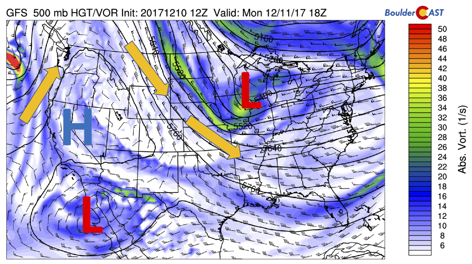
GFS 500 mb absolute vorticity this afternoon
The jet stream lies just to our east – keeping the cold air across the Midwest (see below). We should expect mostly sunshine with temperatures near 60 degrees.
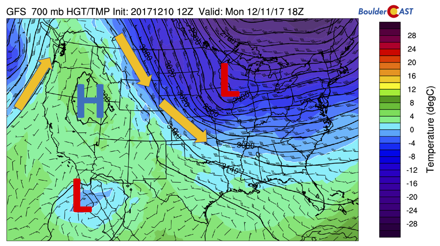
GFS 700 mb temperature and wind on this Monday
On Tuesday, the aforementioned low pressure system across Iowa makes its way into western New York state. In return, high pressure over Nevada will push the cold air further east and create a weak downslope warming scenario to nudge temperatures up a few degrees for Tuesday.
GFS 700 mb temperature and wind for Tuesday
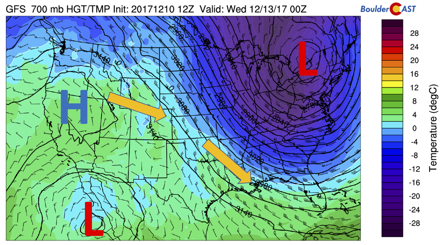
Cold front Wednesday cools the area into 50’s Thursday
During the day on Wednesday, clouds will likely increase as a cold front makes its way southward from Montana and Wyoming. The airmass will start out mild, although cold air advection will commence in the afternoon. That will likely lead to temperatures only somewhat cooler in the mid to upper 50’s. The cold front pushes through in the early evening, with colder air by Thursday morning. Areas in and near the Foothills could see a few isolated snow showers Wednesday night, too. Little to no accumulation is expected at this time.
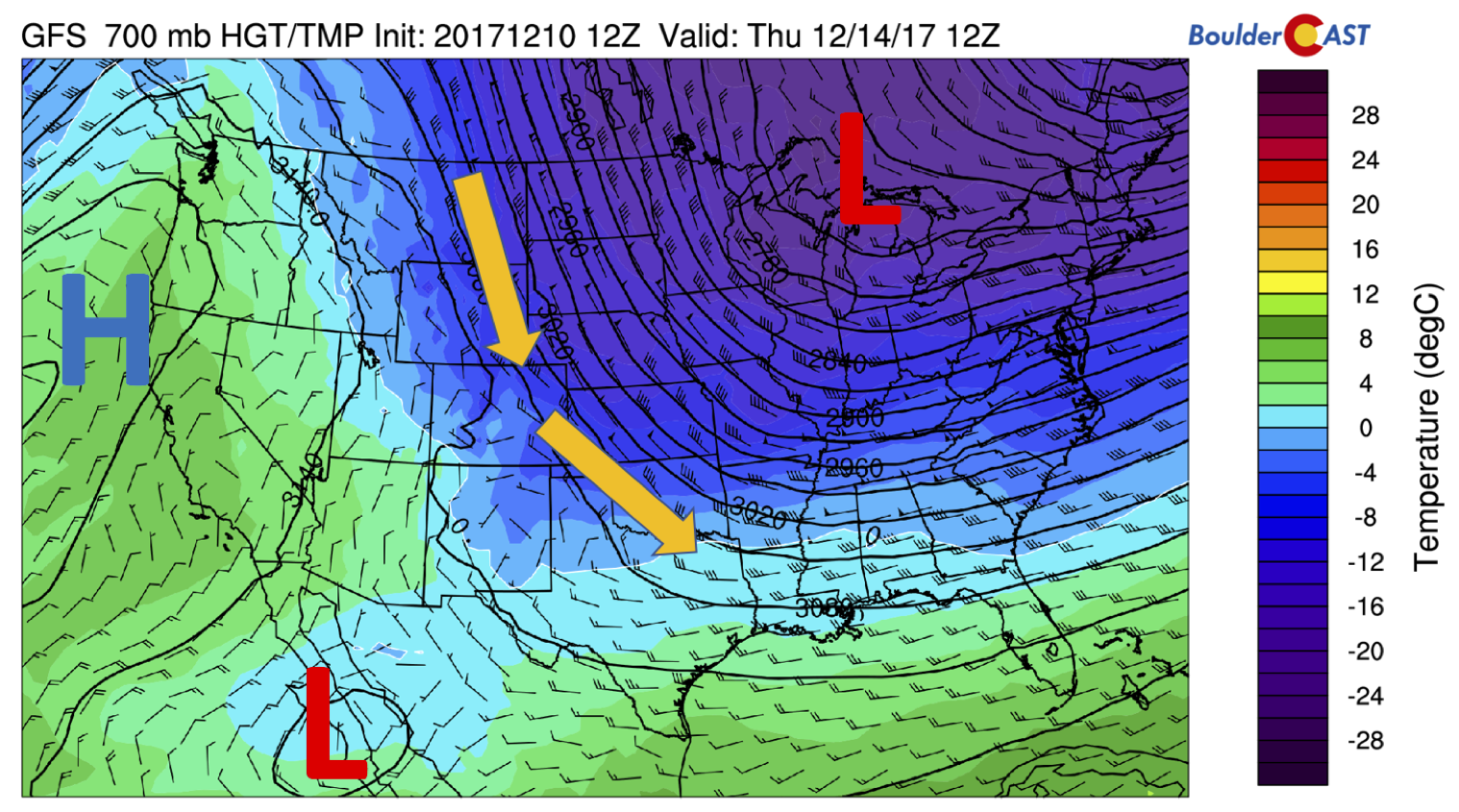
GFS 700 mb temperature and wind for Thursday morning
Temperatures will drop some 10 degrees or so in the upper 40’s to lower 50’s for Thursday. Certainly by no means cold, but cooler nonetheless.
Mild air returns Friday
The week ends once again on the warm side. Below shows the 700 mb temperature map for Friday afternoon. Downslope flow will exist across the Plains. The airmass warms a sizable amount, so it’s likely temperatures will rise into the middle 60’s, maybe even upper 60’s depending on the exact pattern.
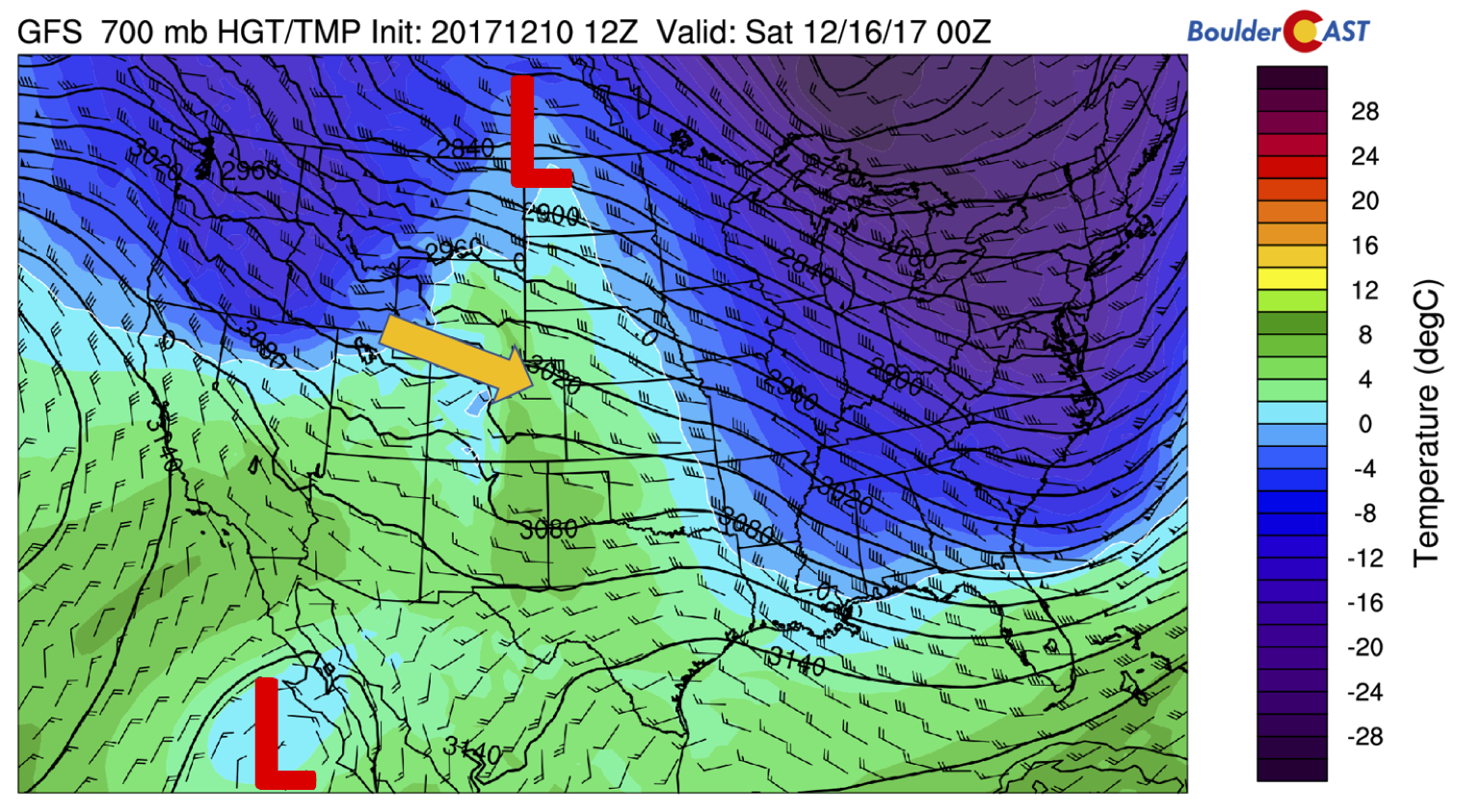
GFS 700 mb temperature and wind on Friday

GFS forecast for total precipitation through Saturday
Extended looks potentially more active
Going into the weekend, models are showing another weak cold front for Saturday with temperatures likely returning to the 50’s. There are some hints of snow for the High Country with the front, but amounts look generally light at this juncture. Next week, primarily Tuesday and Wednesday, many of the global forecast models (ECMWF, GFS, and CMC) are consistent in showing a low pressure system digging across the western United States, potentially impacting Colorado with snowfall. Current trends show this may impact the entire region, but of course we are too far out to make any accurate predictions. We will continue to monitor this through the week and be sure to update you if needed. In the meantime, THINK SNOW….we sure do need it!
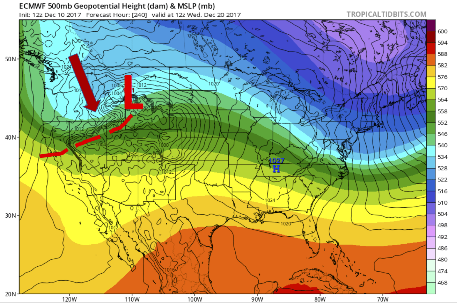
ECMWF geopotential height and sea-level pressure for Wednesday, December 20th
Forecast Specifics:
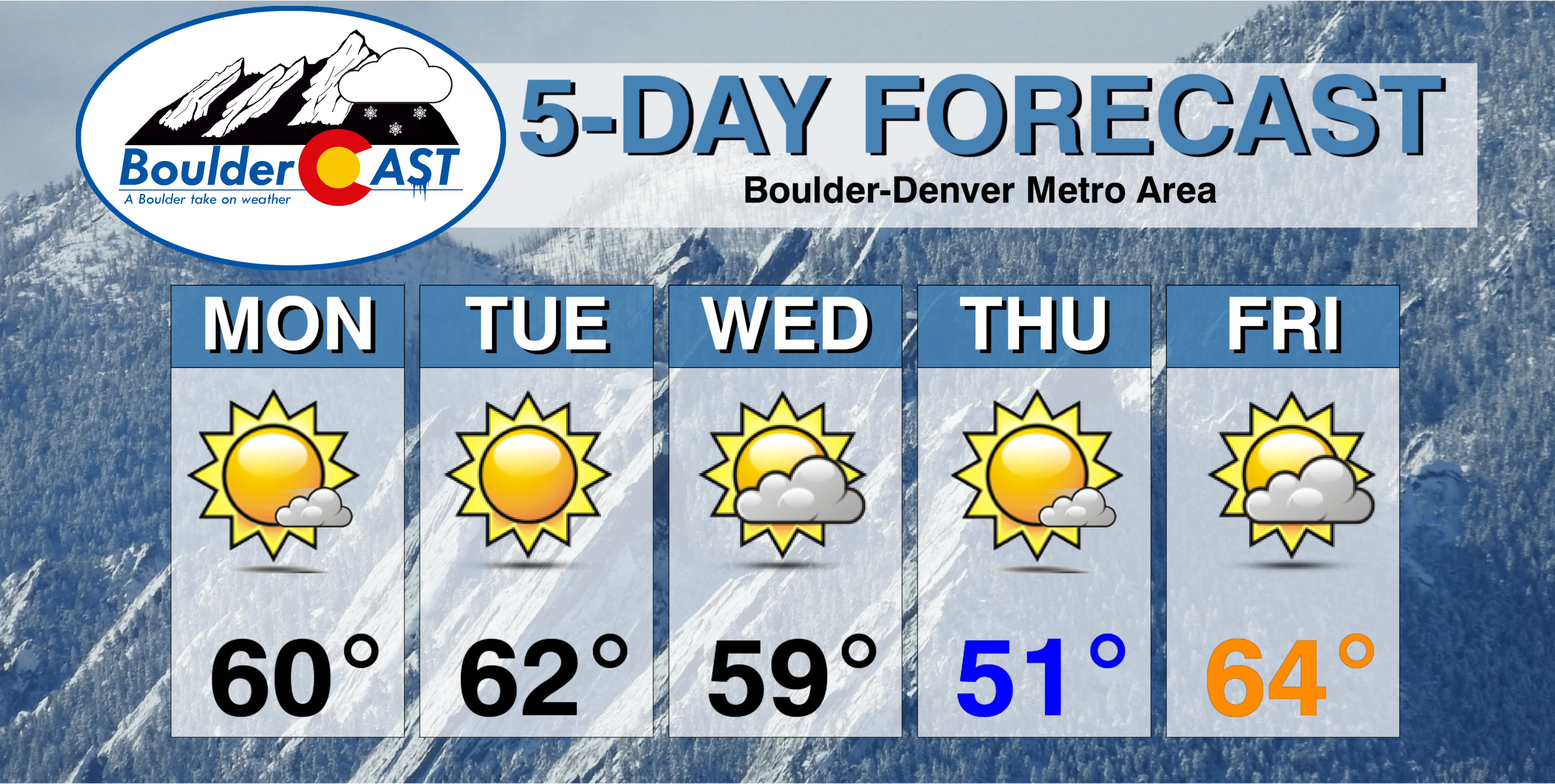
Monday: Mostly sunny and mild. Temperatures near 60 across the Plains, with low 50’s in the Foothills.
Tuesday: Sunny and warm. Highs in the low to middle 60’s for the Plains, with low 50’s in the Foothills. West winds at 10-15 mph.
Wednesday: Increasing clouds and cooler with a cold frontal passage during the afternoon or evening. A few areas in and near the Foothills could see isolated snow showers overnight with no accumulation. Highs in the upper 50’s across the Plains, and in the upper 40’s in the Foothills.
Thursday: Isolated pre-dawn snow showers. Then partly to mostly sunny and cooler. Temperatures near 50 degrees on the Plains and upper 30’s in the Foothills.
Friday: A mix of clouds and sun, warmer and possibly gusty with west winds 10 to 20 mph. Highs in the middle 60’s over the Plains and lower 50’s in the Foothills.
Weekend: The weather pattern will likely remain quiet through the upcoming weekend. The only thing to speak of is a cold front that will return temperatures to the 40’s or 50’s for highs Saturday and Sunday. Models are currently showing dry conditions prevailing across the Metro area, but this could change with a slight shift in how this front arrives to Colorado.
High Country: Expect dry conditions throughout the week across the higher elevations. Although this is bad news for skiers, there are hints of a weak system Saturday evening that could possibly bring 1-4″ depending on the exact storm track. A more potent system is possible next week so stay tuned. Find the latest forecast for all your favorite Colorado ski resorts on our PowderCAST page.
DISCLAIMER: This weekly outlook forecast was created Monday morning and covers the entire upcoming work-week. Accuracy will decrease as the week progresses as this post is NOT updated. To receive daily updated forecasts, subscribe to BoulderCAST Premium.

Share this forecast with your friends:


You must be logged in to post a comment.