This week starts off clear, calm, and unseasonably warm for the shortest days of the year. The exciting news is there is a potential snow storm in the works for Thursday! It’s no perfect storm, but we’ll take what we can get at this point. Models are indicating temperatures could stay cold enough until Christmas to maintain snow cover, especially in the shade, with a second shot for snow and much cooler temperatures over the weekend in case you’ve been dreaming of a white Christmas.
Thursday’s potential snow certainly won’t make up for our missing moisture and Denver’s 65 snow-free days, but we broke the streak with 2.1″ of snow in Boulder and less in Denver last Thursday. Boulder’s streak was much shorter. A quick scroll through my snow photos reveals a fantastic storm on October 9 that hit Denver as well, but another on Halloween that was pretty localized, and again on November 7.

Warm to start the week
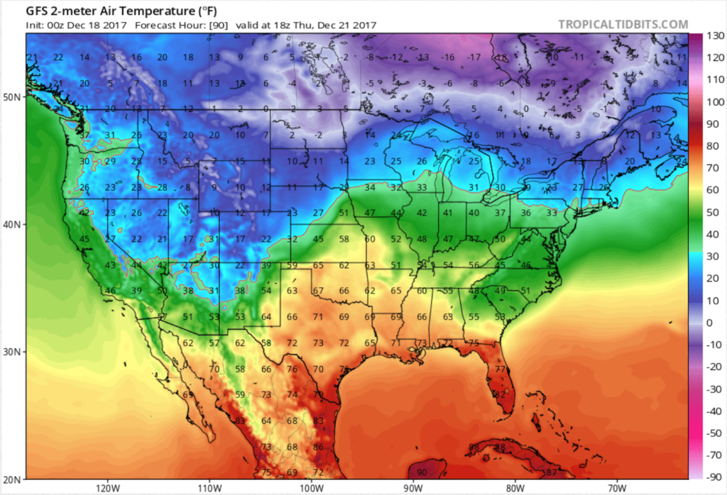
Temperatures will reach the mid- to upper- 50’s Monday through Wednesday as polar air remains well north of us. Wednesday, winds swing to a southerly component, causing some warm air advection to get us near 60 degrees before the big change Wednesday evening.
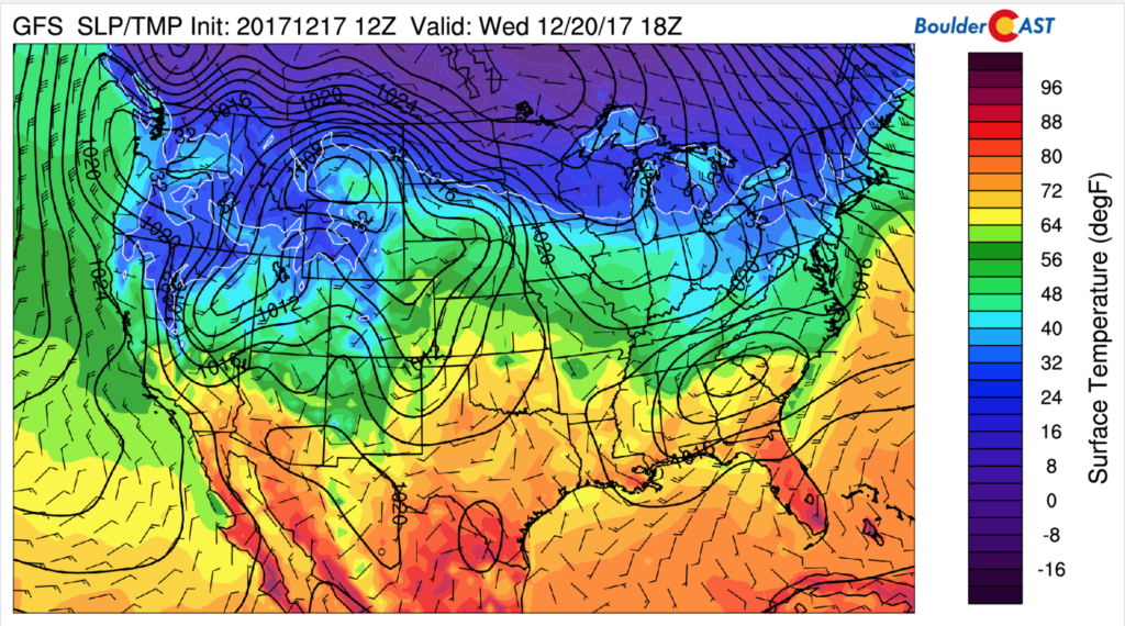
Surface temperature forecast valid noon Wednesday.
Snow Storm Potential for Thursday, the Winter Solstice
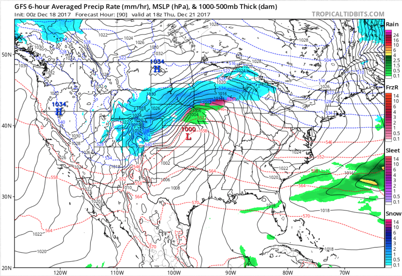
Winter is coming! After a warm afternoon Wednesday, temperatures just keep dropping as a trough and associated cold front approaches us. The trough and corresponding surface low could hit our sweet spot for upslope winds. I will warn that we’ve seen a few of these systems in the forecast the last two weeks and they have all missed us to the north or south, but Thursday’s storm has been a continuous feature in the GFS model as well as the ECMWF, and now the NAM, which increases my confidence that this one will come to fruition. Stay tuned.
The trough will roll in from the Pacific Northwest.
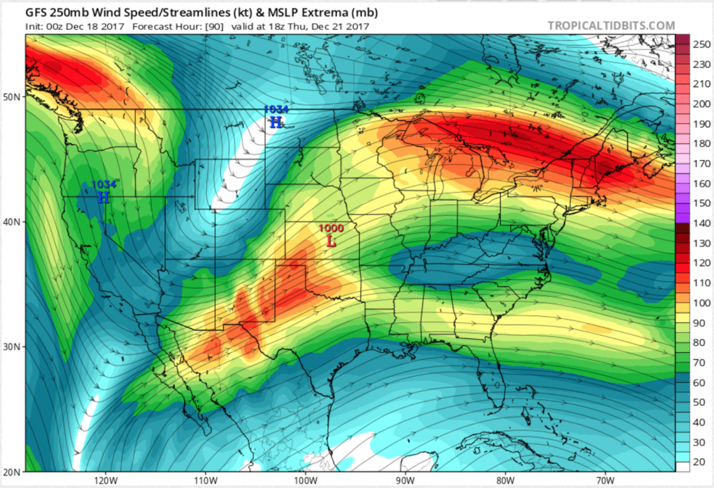
Jet stream winds, forecast valid noon on Thursday
The latest run (0Z Monday) has the vorticity max just a bit further north than where I’d like it to land. It also shows the system a bit weaker than it had been in previous runs. This vorticity maximum will allow for some lift as the system passes through, enhancing upward vertical motion.

500mb vorticity valid noon on Thursday
Temperatures at the surface will have dropped Wednesday night to much cooler temperatures all day on Thursday, allowing for all precipitation to fall as snow.
Surface temperature forecast valid noon Thursday
Finally, the elongated low pressure system over Kansas and the Texas and Oklahoma panhandles will wrap the winds around nicely for some northeasterly flow on the Front Range, leading to a brief period of upslope winds, upward vertical motion, and snow. A few inches are possible, but this storm is still too far off to put a number on it.
The winter solstice is Thursday morning, December 21st. This means our time with daylight will get longer and longer until June. This date is also a day of celebration for many cultures, so dancing, eating, and having a warm fire in your fireplace are highly recommended while it snows!
Cold push and another chance for snow this weekend
Uncertainty greatly increases in the forecast as the weekend approaches. A huge ridge builds over the Alaskan region, the size of which we don’t see very often. Model runs are wavering on the shape of this jet pattern since it is still too far out, so we’ll have to keep an eye on it as the forecast continues to evolve. This ridge allows for strong northerly winds to advect extremely cool Arctic air into much of the U.S. This could create a second push of cold air with another chance for snow and keeping us chilly for Christmas. Should this pattern in the models become a reality, temperatures won’t get out of the teens Saturday, Christmas Eve, nor Christmas Day! Lows could reach negative single digits.
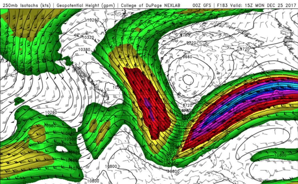
Jet stream winds valid Christmas morning pulling air out of the Arctic into Colorado
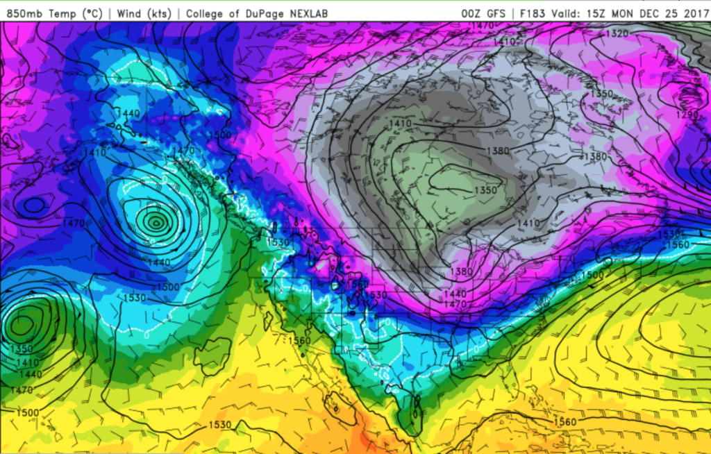
850mb temperature forecast for 9am Christmas Day indicates a cold Continental U.S.!
We’ve had such a mild November and December thus far, be sure your homes and cars and gardens are winterized and ready to go! If you are leaving town, be sure to keep the heat set to at least 50 degrees. If you have water pipes on uninsulated outer walls (isn’t Boulder construction great?), you might let your faucet drip while you are away. Insulating curtains and blinds can do wonders for keeping you warm indoors, and of course bring in those pets! Let’s not forget about our friends who live outside. Perhaps giving to the local homeless shelters would go a long way during such a cold snap corresponding with the holiday.
This week in Colorado Weather history
Two of Denver’s top ten snowstorms have taken place this week in weather history! In 1982, Denver got 24″ of the fluffy stuff on Christmas eve! You may more likely remember the blizzard of December 20-21, 2006 that dropped 1 to 4 feet of snow across the Front Range. This storm closed the airport for 45 hours and stranded people like me as 2,000 flights were canceled. (I eventually got out and arrived in Wisconsin during the early morning hours of Christmas eve.) Winds gusted to 60mph and drifts reached 12 feet high. Snow stayed on the ground for several weeks with additional snowfalls, making for one of the longest streaks of snow cover in the area, and some of the deepest snow-pot-holes on the side streets!
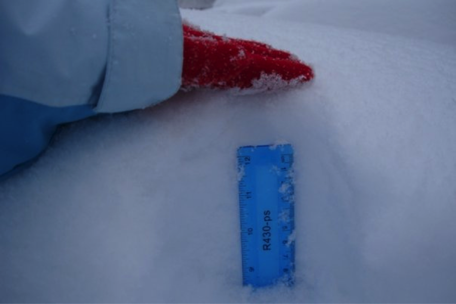
I’m going to need a longer ruler! December 20/21, 2006.
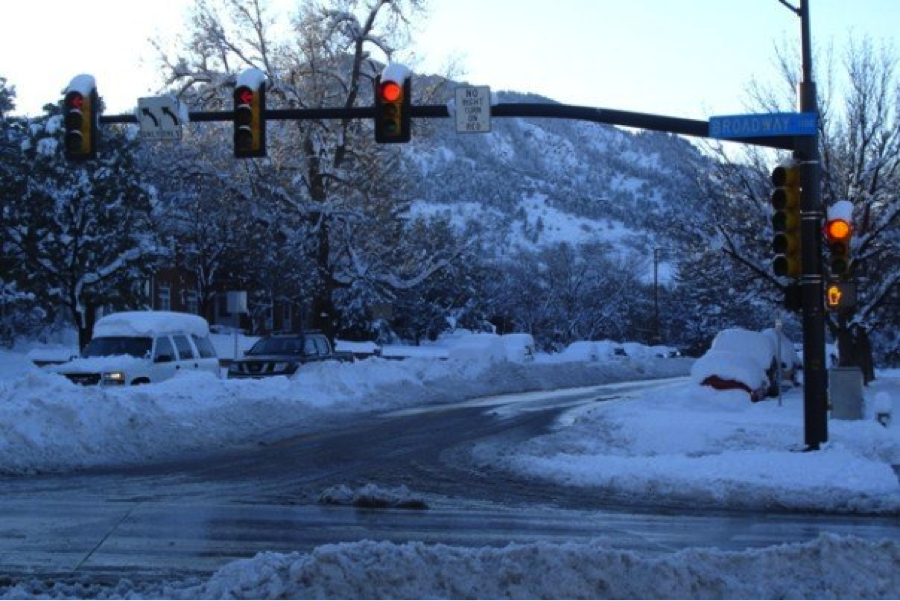
University and Broadway just after the December 21, 2006 snow storm with a snow median.
Personalized Forecasts
A few of my students will be giving personalized weather forecasts Wednesday evening live on Channel 7 from 4:00-6:30 on the Denver7 Holiday Weather Hotline. Give them a call, especially if you need a travel forecast before the snow starts: 303-777-7492.
DISCLAIMER: This weekly outlook forecast was created Sunday evening and covers the entire upcoming week. Accuracy will decrease as the week progresses as this post is NOT updated. To receive daily updated forecasts, subscribe to BoulderCAST Premium.

Share this forecast with your friends:
Keah Schuenemann
Keah is a Professor of Meteorology at Metropolitan State University of Denver where she teaches introduction to weather, climate change, dynamic meteorology, and advanced synoptic meteorology to undergraduates. https://www.msudenver.edu/earth-atmospheric-sciences/meteorology/
Follow Me:


