
Following four days of unseasonably cool temperatures, this week begins warm as moderately-moist southwest flow dominates the region. By mid-week, moisture associated with two tropical cyclones spreads into Colorado alongside a cold front from the north. With this, we’ll see storm chances increase and temperatures fall once again. Read on for our complete weekly outlook.
It has been cold, but where was the rain?
Despite a somewhat favorable weather set-up for precipitation at the end of last week (i.e. a cold front clashing with monsoon moisture), many areas across the Front Range struggled to pick up much of anything. The 7-day precipitation total through Sunday morning for the region is shown below.
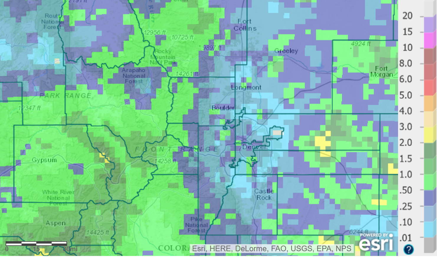
Observed 7-day total accumulated precipitation (radar estimated), ending Sunday morning
Most locales saw less than a quarter inch, but the higher Foothills and a few isolated lower-elevation spots exceeded 0.50″. At our station in North Boulder, we only measured 0.06″. Demonstrating the spotty nature of the more intense storms, just three miles east in Gunbarrel, BoulderCAST meteorologist Andy Kren recorded rain in excess of a half inch and even dime-sized hail.
The meager rain did little to mitigate the widespread dry conditions we’re currently experiencing. The cold, though, was very apparent. While highs soared into the mid-90’s Wednesday last week…just 24 hours later, temperatures for Thursday afternoon were brisk in the upper 60’s. A light rain/snow mix was even able to make it down as low as Berthoud Pass Thursday night (~11,400 feet elevation). Our temperatures remained below normal through Sunday, but weren’t record-breaking. The potential was there to set record cold maximum temperatures across the Plains Friday, but the distinct lack of precipitation allowed for too much warming.
Overall, disappointment resounds. The chilly fall-like temperatures were a welcomed relief from the summer heat, but we didn’t capitalize on an excellent setup for rainfall. Alas, while the atmosphere isn’t nearly as favorable this week, we still could see that beneficial rainfall in spots as storm chances will exist each day.
Starting the week warm with changes by Wednesday
Colorado begins the week on the western fringe of a weak upper-level ridge, centered over Kansas. In addition, a stalled cut-off low and associated trough continue to spin across the Pacific Northwest (seen below). This system will be our main weather player for the week.
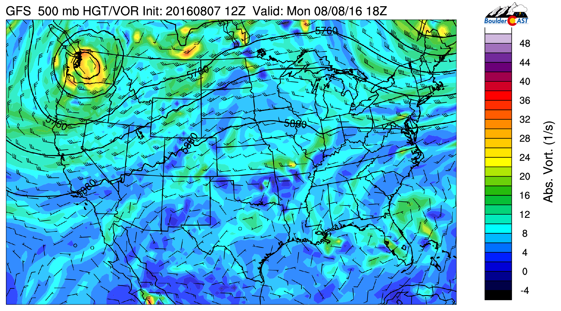
GFS 500 mb vorticity map for Monday afternoon, showing the weather set-up to begin the week
Ahead of this system’s arrival, we’ll begin the week under southwesterly flow aloft. This will not only help to keep our temperatures warm, but will also provide a steady stream on moisture to the region. Whereas the 500 mb flow on Monday (above) is west-southwesterly, by Wednesday (below), we see the shift to almost due southerly flow into Colorado.
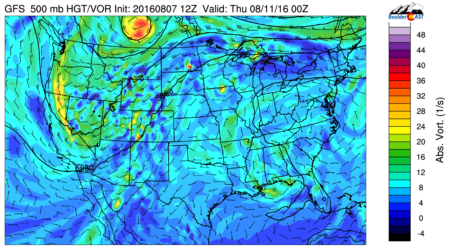
GFS 500 mb vorticity map for Wednesday evening, showing southerly flow across Colorado and the approaching trough to our west
This shift and associated bump in moisture are visible nicely below in the forecast moisture anomaly loop for the entire upcoming week from the GFS ensemble model. Take note of a few aspects of this animation:
- Moisture is elevated to start the week, but definitely variable across eastern Colorado
- Near the Baja Peninsula in Mexico, you will notice a large pulse of moisture moving northward and eventually across Colorado late Wednesday or Thursday. This large moisture plume is associated with Tropical Storm Javier, which itself formed from the remants of Tropical Storm Earl that made landfall in Belize last week
- At the end of the loop, drying ensues across our region as northwest flow takes over
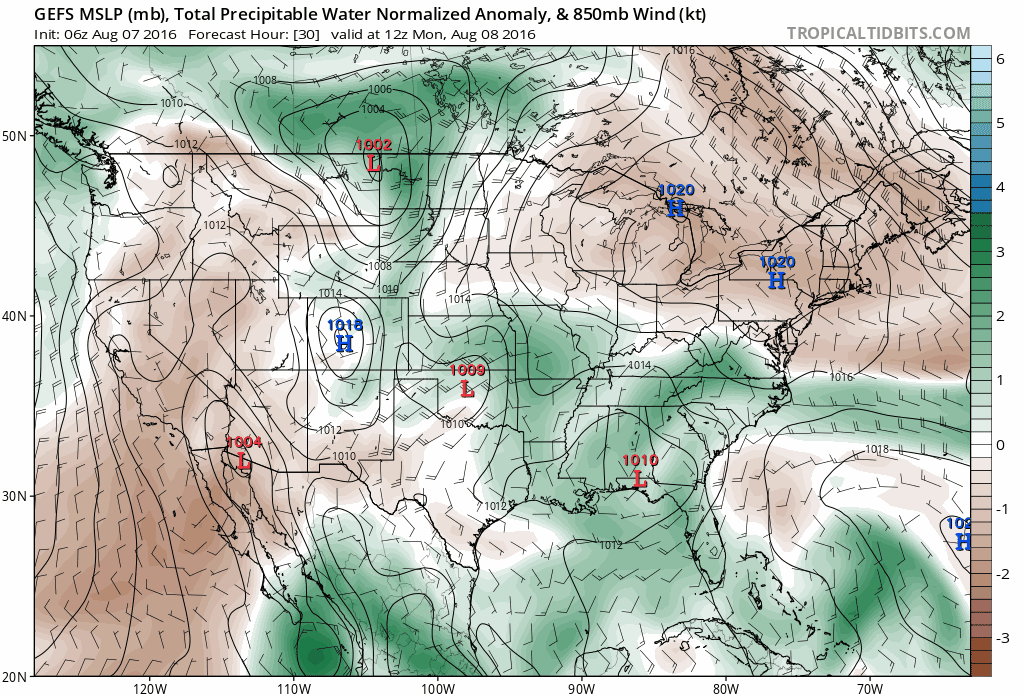
GFS ensemble forecast moisture anomaly animated loop for the upcoming week
On Monday and Tuesday, and actually for most of the day Wednesday, we’ll see warm conditions with spotty chances of late-day storms. Monday will be in the upper 80’s, with Tuesday seeing further warming into the low to mid 90’s.
Depending on the timing of that aforementioned moisture plume arriving to the Front Range, which as of now is set for late-day Wednesday, we may see a significant jump in storm coverage Wednesday evening into the nighttime hours. This should definitely be the case for southern Colorado, where daytime heating and elevated moisture overlap nicely. However, for northern Colorado, the plume may arrive just a little too late. Right now we think high temperatures Wednesday will be upper 80’s, with storm chances increasing towards sunset.

Javier is forecast to become a hurricane and make landfall in western Mexico by mid-week. Strong southerly winds on the eastern side of the storm will advect moisture into Colorado
Cooler for the week’s end
The 700 mb temperature map below for Monday shows that Colorado will be smack in the middle of the warmest air in the country. However, looming to the northwest in Washington is a very cold pocket associated with the upper-low. That cooler air will be spreading into our region behind a cold front for Thursday and Friday!
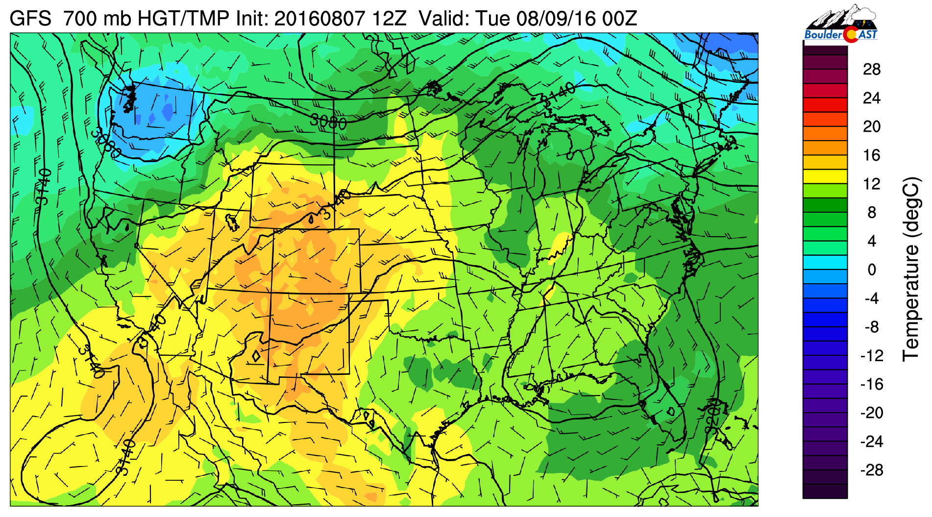
GFS 700 mb temperature map for Monday, showing very warm air across the Southwest and Colorado
The cool-down for Thursday is shown in the 700 mb temperature map below. The timing of the front looks to be after sunset Wednesday evening. Some storms could develop as the front passes, even in the overnight hours into Thursday.
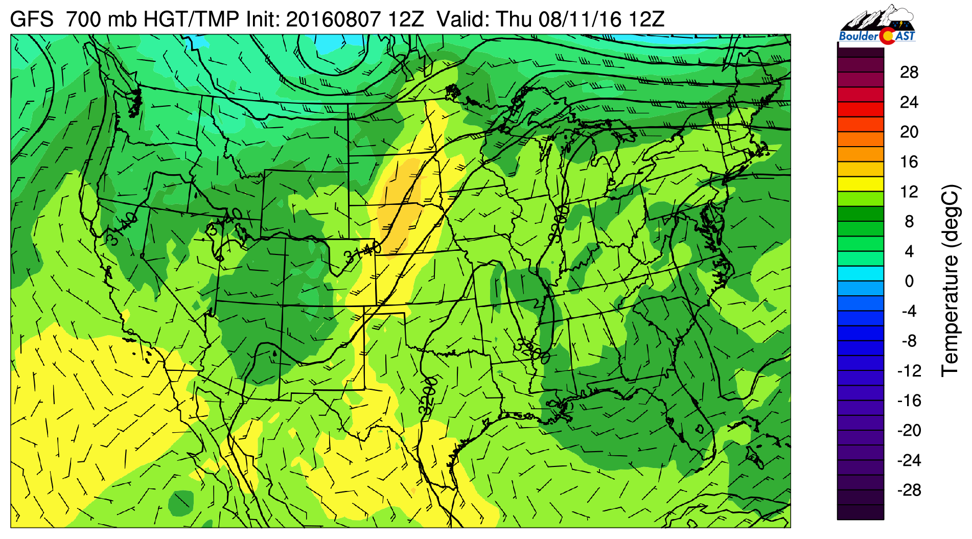
GFS 700 mb temperature map for Thursday showing the cooler air spreading into the region behind the cold front
While not quite as cold as the airmass we just experienced, both Thursday and Friday should only reach near 80 degrees for afternoon highs. Storm chances will be slightly elevated Thursday with that slog of moisture in place. However, by Friday, northwest flow sets up to bring drier air into the region (see below), greatly reducing the probability of rain.
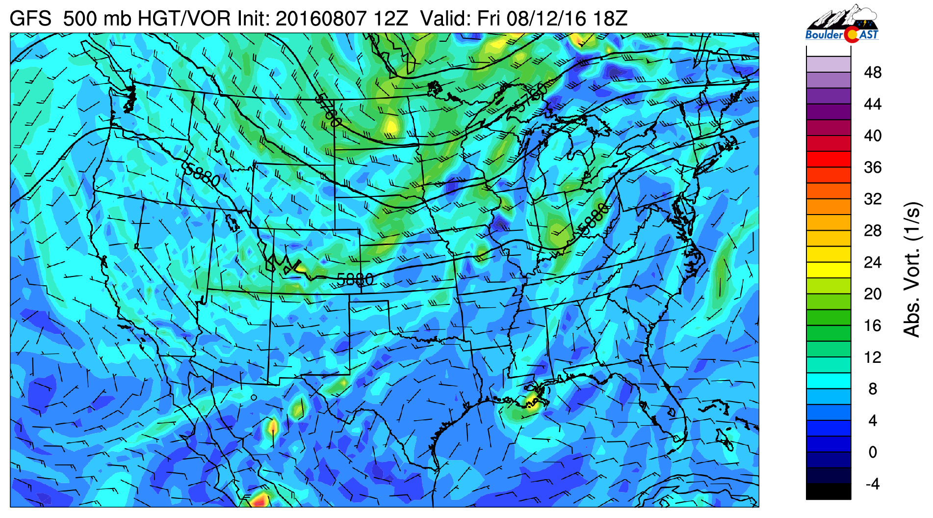
GFS 500 mb vorticity map for Friday, showing northwest flow in place
We also see that by week’s end, the trough axis has pushed east of Colorado with a ridge already beginning to build across the Pacific Northwest. This ridge will likely propogate eastward and bring warmer and more stable conditions to our region for the upcoming weekend.
Have a great week, everyone!
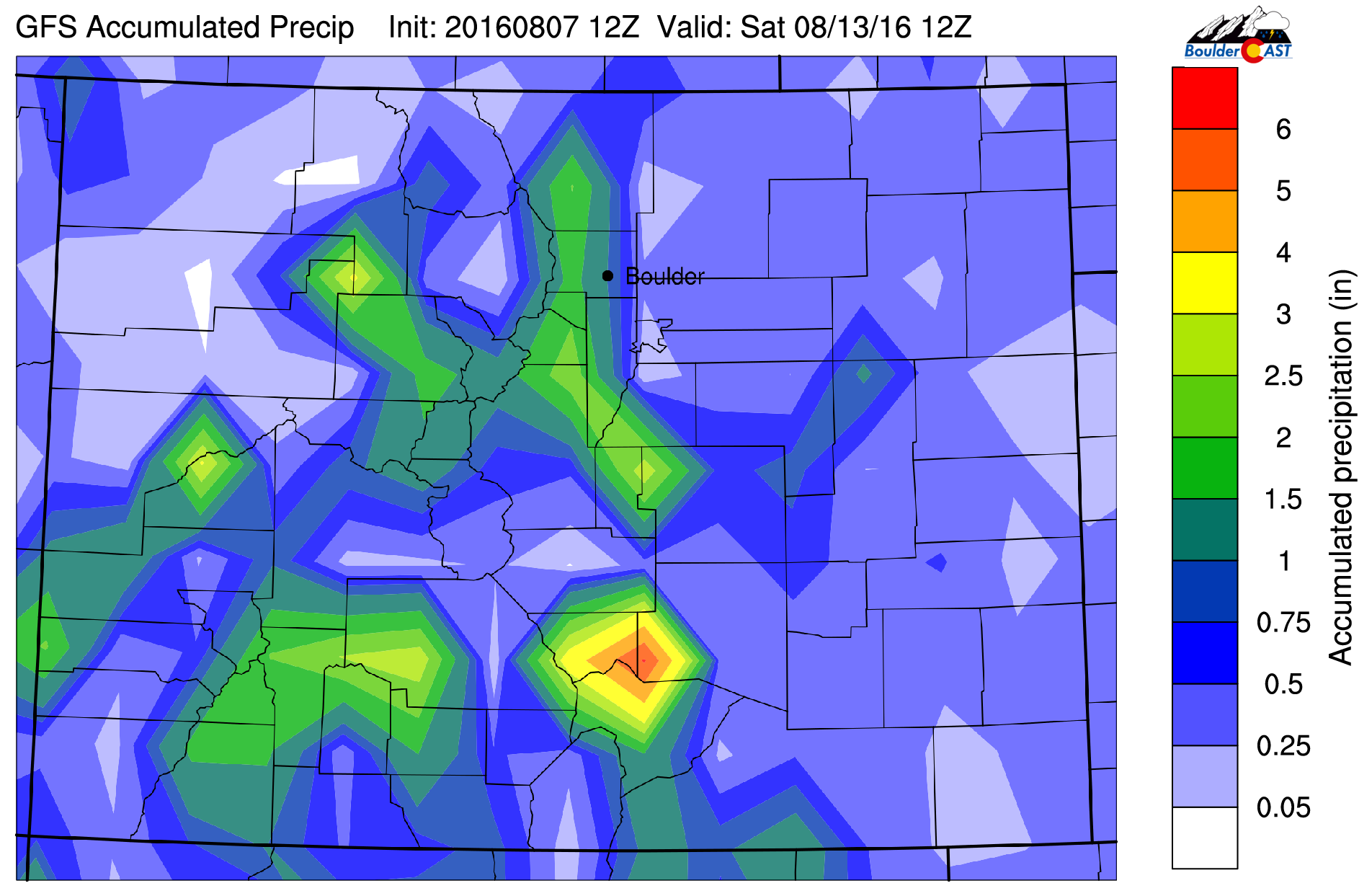
The GFS total accumulated precipitation map for Colorado through Friday shows a decent chance of rain throughout the week
Forecast Specifics:
Monday: Partly cloudy skies with widely scattered storms in the afternoon and evening, primarily across the higher elevations. Highs in the upper 80’s over the Plains and mid 70’s in the Foothills.
Tuesday: Sunny skies giving way to partly sunny conditions with isolated afternoon/evening storms for everyone. High temperatures in the mid 90’s for the Plains with low 80’s in the Foothills.
Wednesday: Partly sunny skies, then increasing clouds with isolated to scattered afternoon/evening storms, particularly south of Interstate 70. Highs near 90 on the Plains and mid 70’s in the Foothills. A late day cold front could develop some storms overnight into Thursday morning.
Thursday: Cooler with partly to mostly cloudy skies. Isolated afternoon showers and a few storms. Highs in the low 80’s on the Plains and near 70 in the Foothills.
Friday: Sunny skies with just a slight chance of an afternoon thundershower across the higher elevations. Highs near 80 degrees across the Plains and upper 60’s in the Foothills.
High Country: Storm chances will exist over the Mountains throughout the entire week. The highest threat will be Tuesday through Thursday, but both Monday and Friday will have at least isolated storm coverage across the higher elevations.
Extended: The upcoming weekend continues the drying trend with just an isolated storm or two for the Mountains/Foothills on Saturday, and dry conditions everywhere on Sunday. It looks like an excellent weekend for outdoor adventures. Highs across the Plains will be in the 80’s both days.
Mon
Tue
Wed
Thu
Fri


Temperature
88
93
89
82
79


Precip Chc (Plains)
10%
20%
30%
30%
10%


