After a wet end to the previous week, the weekend started out cool and concluded warm with highs approaching 90 degrees over the Plains on Sunday. This week will begin with above normal temperatures, but a cold front moving in along with subtropical moisture will increase our threat of rain and storms through the middle of the week. Once again our weekly discussion is riddled with mentions of rain, but as always, the extent and intensity for any given location remains to be seen. Read on for the full week-ahead forecast.
To highlight the focus for the week, below shows a satellite animation of water vapor in the mid-levels of the atmosphere from Sunday afternoon.
Two things are worth noting. The first is an area of circulation over Arizona with subtropical moisture streaming north and east of it. This system will push northeast into Colorado Tuesday. Second, a deep trough over the Pacific Northwest and British Columbia. This trough will push a cold front into northeast Colorado Tuesday into Wednesday. These two systems will be the major players over the next several days, ushering in cooler and wetter weather by mid week.
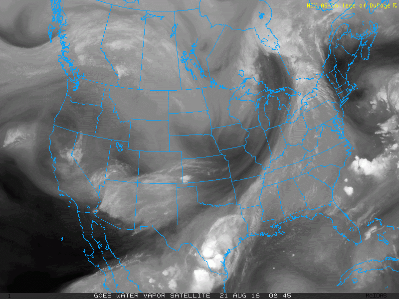
Water vapor satellite animation as of this past Sunday afternoon, indicating a trough of low pressure over Arizona and a trough over the Pacific Northwest. Both of these systems will interact Tuesday over Colorado. Animation courtesy of College of DuPage Weather
Warm beginnings
Monday is the warmest day of the week. Enjoy it! Sunday we experienced highs at the 90-degree mark over the Plains. Today will be a few degrees warmer with a very similar air mass in place. Our forecast calls for 92 degrees for Boulder and metro Denver. Below shows the mid-level pattern for today. Circled in red are the two circulations noted in the above satellite loop, with a black arrow denoting the movement of the Arizona subtropical Low.
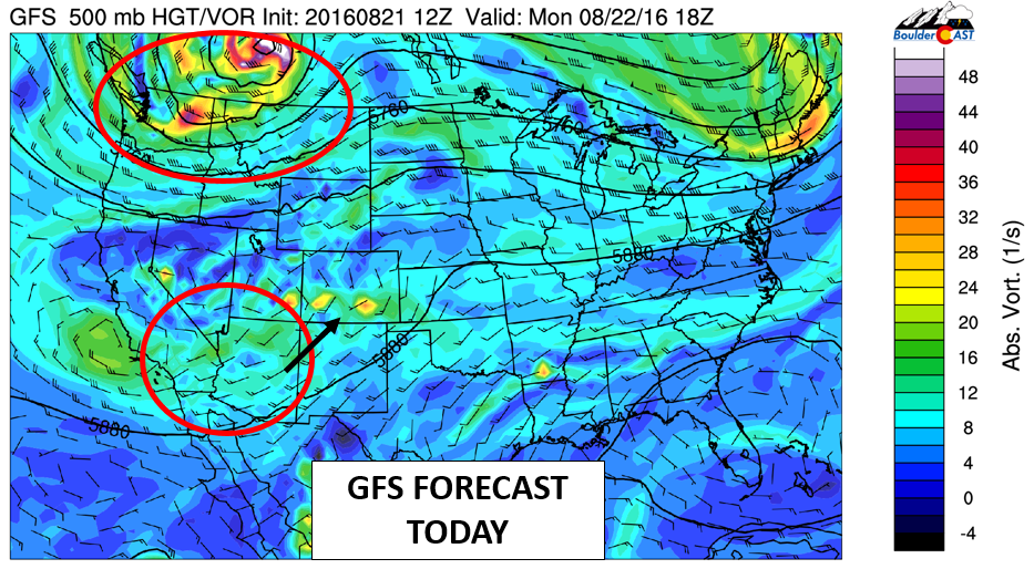
GFS 500 vorticity for Monday afternoon, showing the two areas of circulation mentioned previously
The monsoon low pressure system over Arizona will move northeast with embedded waves of energy developing thunderstorm activity over the High Country this afternoon and evening. Most of these storms will not move onto the Plains, which is due to a downslope pattern over much of eastern Colorado, providing stable conditions. This forecast is shown below in the NAM model output for precipitation this afternoon.

NAM near surface temperature (left) and precipitation for this evening (right)
A “transitional” Tuesday
Below shows the mid-level pattern for Tuesday. The Arizona low pressure system moves further northeast into Colorado. At the same time, the trough over the Pacific Northwest moves into central Canada and Montana. The northern trough will lower heights to usher in a cold front late Tuesday, while the subtropical low will help in thunderstorm development over the High Country and Plains. We expect cooler weather Tuesday in advance of the cold front, but highs will still reach the lower 80’s.
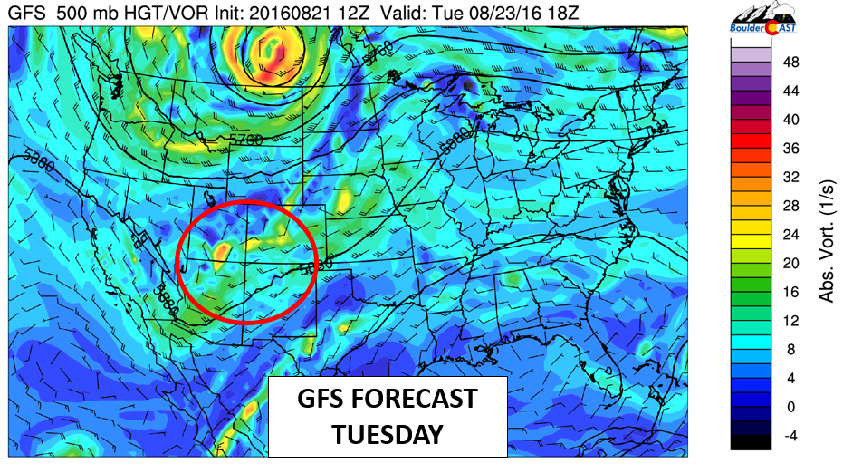
GFS 500 mb vorticity and mid-level pattern for Tuesday
The various forecast models for Tuesday are quite different in terms of precipitation coverage (see below). Nevertheless, we think Tuesday will be the best day for storms to reach the Plains. The reason is four-fold.
- Low and mid-level moisture increases
- Surface instability increases
- Weak surface downslope in advance of cold front
- Upper-level forcing from low pressure system
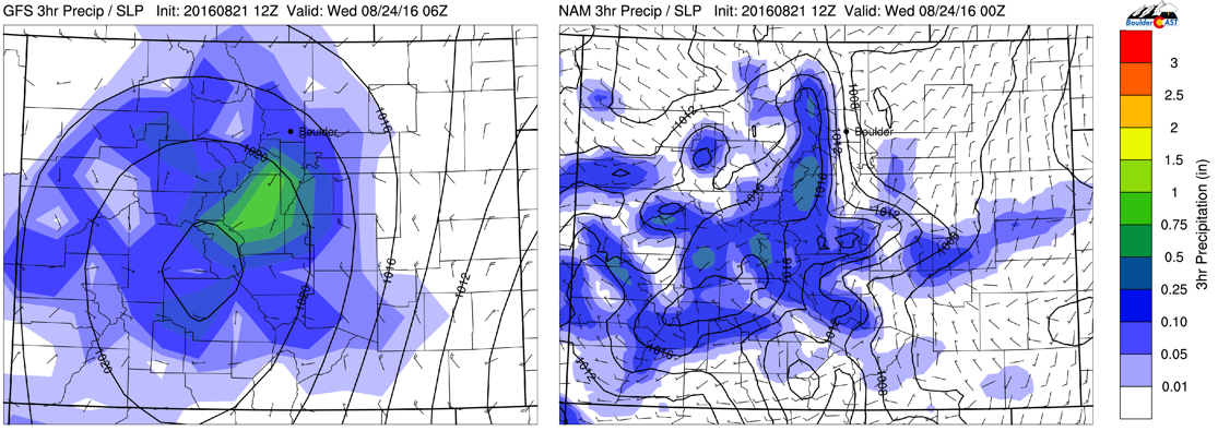
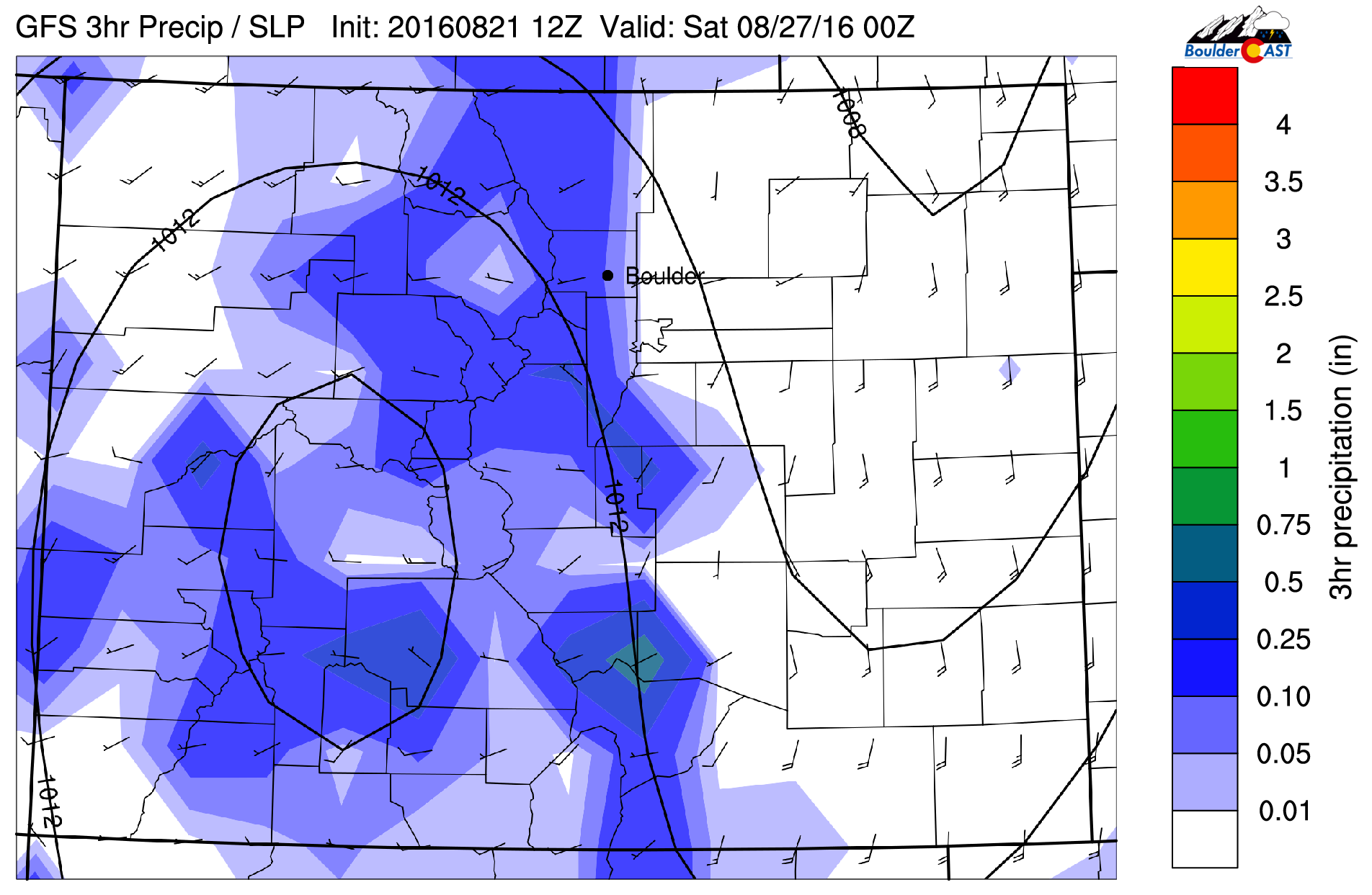
GFS (left) and NAM (right) 3-hr precipitation for Tuesday afternoon/evening
A chilly Wednesday
Wednesday will be similar to last Friday where temperatures felt like autumn. The aforementioned cold front pushes through (evident below) with east-southeasterly flow over the Plains. Near surface temperatures are some 14 degrees cooler than Monday! As a result, we’re expecting a great August Wednesday in the lower 70’s on the Plains with some upper 50’s in the Foothills. Overnight lows will be chilly on the Plains, dropping once again into the mid 40’s.
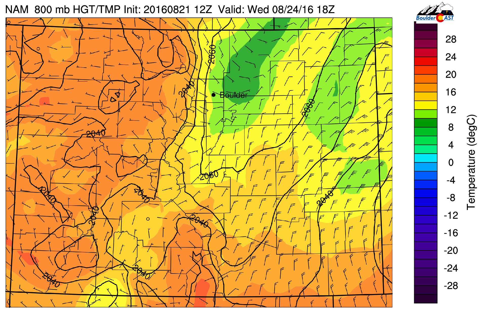
NAM forecast of near-surface temperature and wind Wednesday afternoon
As for storms on Wednesday, the High Country will continue to see the threat of activity. The chances over the Plains are less certain. However, with mid and low-level upslope flow and weak instability, isolated storms will likely develop over portions of the Plains, primarily in the late afternoon/early evening hours.
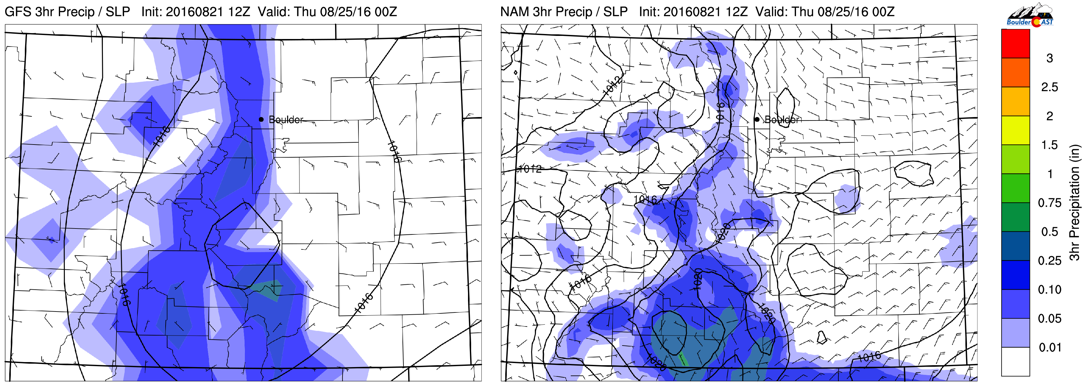
GFS (left) and NAM (left) 3-hr precipitation for Wednesday
Thursday and Friday “fall like” to seasonal
By Thursday and Friday, the low pressure system that moved in from Arizona will drift to our east. The trough in the upper-Midwest will also weaken. However, a secondary trough (circled in red below) will dig over California and Nevada. On Thursday, this will aid in a return to southerly flow over the Plains, with temperatures rising back to the mid to upper 70’s… a great day weather-wise! On Friday, this trough will advect in moisture from the southwest, continuing the threat of storms over the High Country and warming temperatures to near 80 on the Plains to end our week.
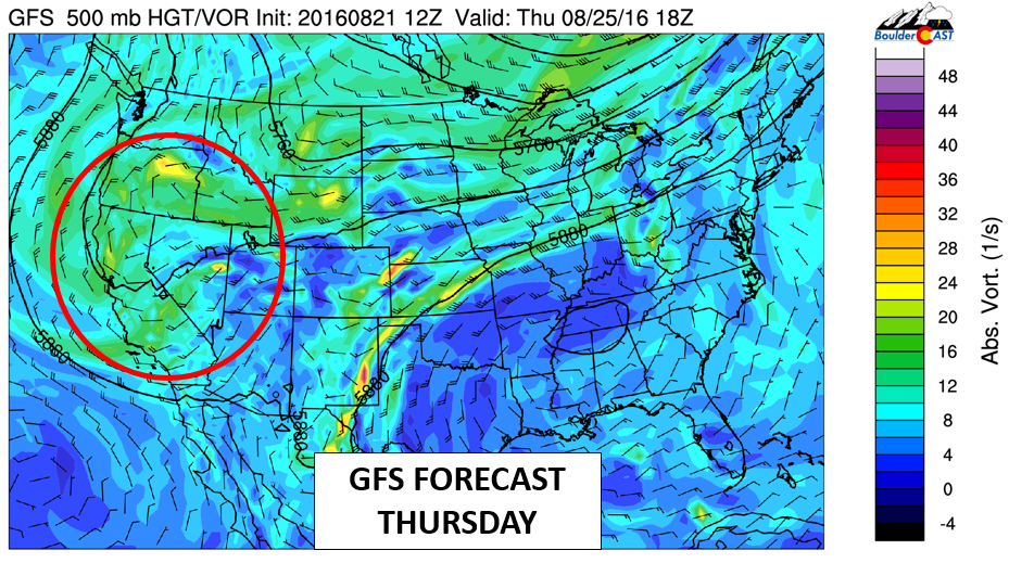
GFS mid-level flow pattern for Thursday
The below GFS precipitation forecast sums up the late week forecast in one sentence: storms continue over the High Country, but remain isolated to somewhat scattered over the Plains. The storms over the Plains will be less certain to end the week with large-scale downslope flow at the surface returning, a feature that tends to prohibit eastward storm movement. We certainly can’t rule out that “isolated” storm, especially with southwest monsoon-type flow.
GFS 3-hr precipitation for Friday
Forecast Specifics:
Monday: Lots of sunshine with increasing high clouds in the late afternoon/evening. A few isolated storms are possible over the Plains. Storms mostly confined to the Foothills. Highs in lower 90’s over the Plains and lower 80’s in the Foothills.
Tuesday: Sunny skies giving way to mostly cloudy skies by mid-afternoon with showers and thunderstorms over the High Country moving onto the Plains in the early evening. Storm activity may remain until midnight. Highs in the lower 80’s on the Plains and low 70’s in the Foothills.
Wednesday: Sunshine in the morning, then partly sunny with isolated to scattered storm activity in the afternoon/early evening. Highs will be cooler in the low 70’s on the Plains and upper 60’s in the Foothills.
Thursday: Partly cloudy skies with isolated storms possible in the early evening. Highs in the upper 70’s on the Plains and upper 60’s over the Foothills.
Friday: Partly cloudy with isolated storms in the afternoon/early evening with lower 80’s across the Plains and lower 70’s in the Foothills.
High Country: Thunderstorm activity will be the norm throughout the week over the mountains. We’ll even need to watch for very light snow accumulations above 12,000 feet on Wednesday as the colder air settles in. As a result, if you are hiking those 14ers, start early to avoid the lightning/whiteout conditions!
Extended: The extended range forecast models are hinting at a warming trend again with temperatures potentially back into the 90’s over the weekend and early next week. The chance of isolated storms will stay in the forecast but we don’t see any days that would be wash-outs!
Mon
Tue
Wed
Thu
Fri


Temperature (Plains)
92
83
72
75
79


Precip Chc (Plains)
10%
40%
20%
10%
20%


