
We hope you had a wonderful weekend. Whether you were skiing up in the mountains or biking/hiking in the Foothills, the weather was perfect for all outdoor activities! The warming trend continues today, but takes a slight reprieve by midweek with a cold front ushering in mountain snow. The warmth rebounds to end the week with lots of sunshine. Overall a great week to kick of the month of April! Continue reading for our full outlook.
The warmth continues
The week begins sunny and warm, with temperatures reaching the lower 70’s across the Plains and low 60’s in the Foothills — The GFS 500 mb vorticity plot at left shows the ridge well in place over Utah and Colorado. The figure on the right shows the 700 mb temperature from the NAM model. These temperatures are fairly pleasant around 4 deg C, supporting the spring weather we will experience today!
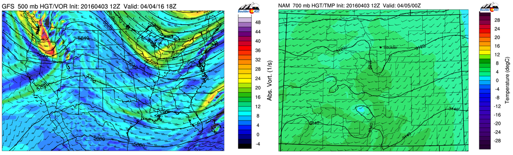
GFS 500 mb vorticity on Monday (left) and NAM 700 temp for Monday afternoon (right)
Tuesday is windy with mountain snow
On Tuesday, a fast-moving shortwave digging from Montana into the upper Midwest will bring a cold front through Colorado. The front will first hit northwestern parts of the state in the morning to afternoon hours to bring mountain snow, then passing through the Plains in the mid to late afternoon with gusty northwest winds and chillier air filtering in Tuesday night into Wednesday morning.
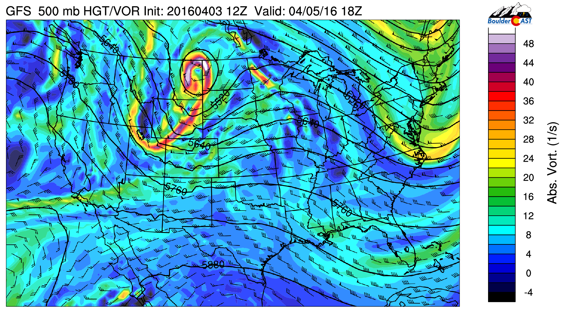
GFS 500 mb absolute vorticity for Tuesday
The front will be passing from northwest to southeast over the Plains; this passage is a downslope flow so little if any precipitation will exist with the front. We wouldn’t be surprised if a brief rain shower will develop in the mid-afternoon under increasing clouds, but these showers will be spotty. Before the frontal passage, expect highs in the lower 60’s over the Plains, falling to the lower 50’s by late afternoon with the cold front.
In the late evening, 700 mb temperatures drop to below freezing (left figure) and northwest winds increase to 50 mph at 10,000 feet. Models are hinting at a Chinook wind signature with the tight height gradient seen in the below maps. These winds look to mix down to the low levels in the Foothills and Boulder, with wind gusts up to 45 mph late Tuesday night and early Wednesday morning. These gusty winds and chilly air will make it feel colder than it actually is so keep that jacket handy if you are going out Tuesday night and for your work day Wednesday.
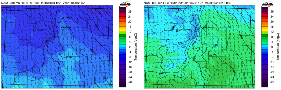
NAM temperature and wind for the 700 mb (left) and 800 mb (right) levels Tuesday night
In the mountains, the northwest flow will favor upslope conditions, in places like Steamboat, Winter Park, Vail, Beaver Creek, Copper, and Aspen. Snow will start in the afternoon on Tuesday and continue through Wednesday with northwest flow continuing (see bottom left figure of high moisture content over the High Country seen in the NAM model). A few light snow showers may persist into early Thursday but the main snow accumulations will take place Tuesday night through Wednesday afternoon.
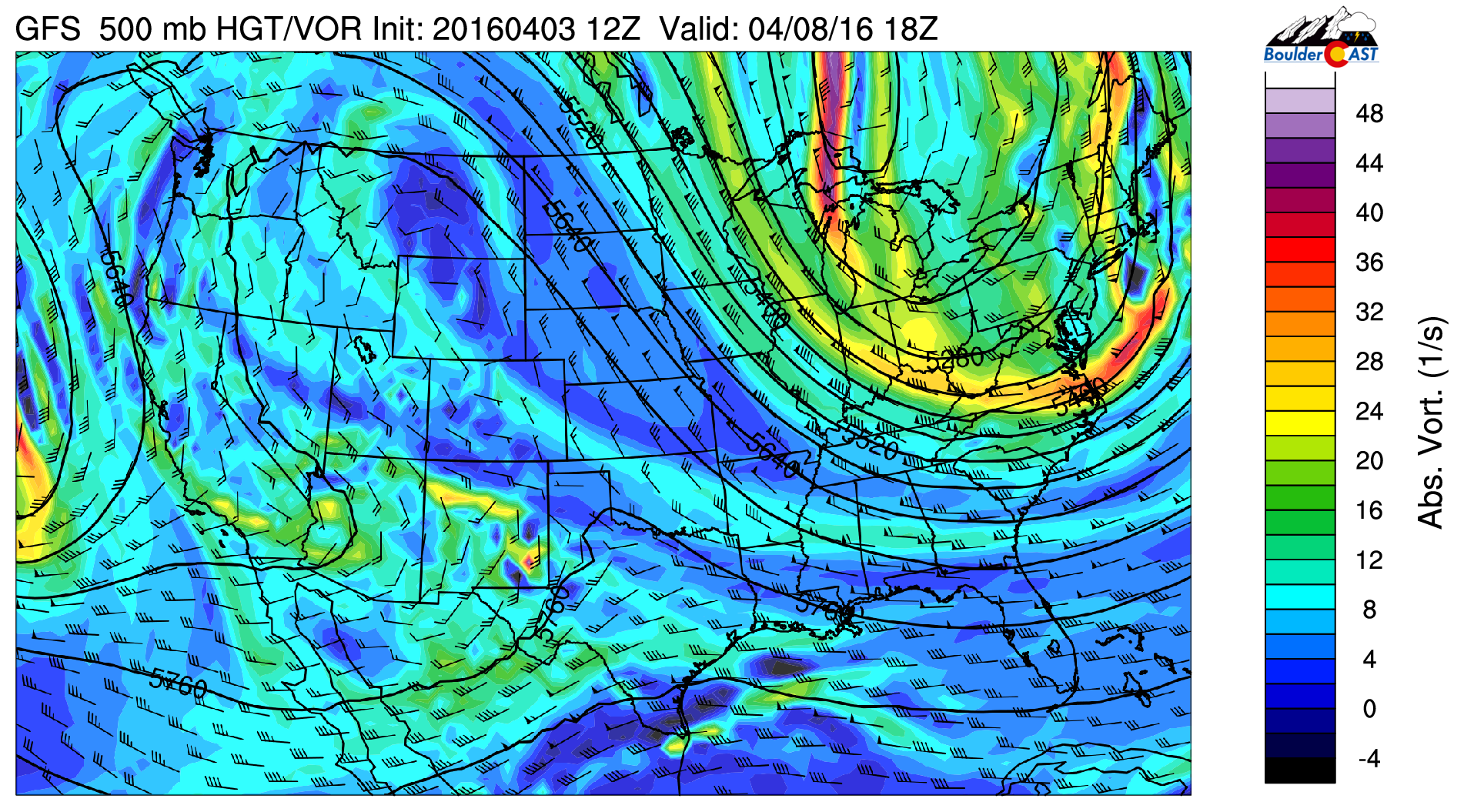
The GFS (bottom right) is hinting at a broad swath of 2-5 inches of snow over these ski resorts. These amounts seem quite reasonable given the synoptic pattern. If you are trying to decide on the best day to ski this week, we recommend Thursday as there will be fresh snow and sunny skies. Wednesday will be good as well but snowy and windy.
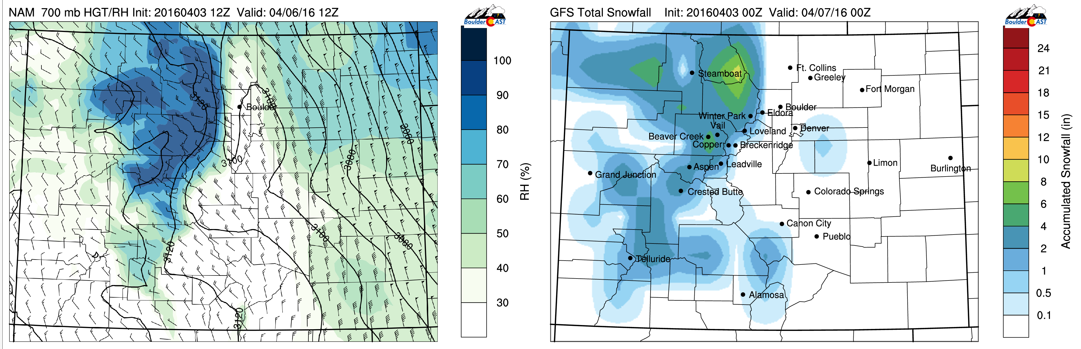
NAM 700 mb relative humidity Wednesday (left) and snow accumulation by Thursday from the GFS
Ending with tranquility
Wednesday will be rather tranquil with mostly sunny skies. Northwest flow is present in the upper-levels, however the chilly air will start to move off to our east in Kansas. As a result, temperatures will be back in the lower 60’s for much of the Plains. Mountain snow will continue as mentioned previously.

GFS 500 mb absolute vorticity for Wednesday
Thursday and Friday are again calm but temperatures rebound back to where they were on Monday with possibly middle 70’s on Friday. As seen below, the upper-level ridge is well entrenched on Friday afternoon. Some of the models are hinting at a very weak backdoor cold front Thursday. This, however, will not influence Boulder County as highs reach the upper 60’s Thursday. Enjoy the end of the week.
GFS 500 mb absolute vorticity for Friday
Longer term trend…
What does next weekend look like? There are some hints in the forecast models that the pattern may become slightly more active. The GFS (below) is pointing to a more active southern storm track with systems moving onshore into southern California. These could eventually influence Colorado Sunday and Monday. The ECMWF model, however, does not appear as strong as the GFS. Nevertheless, we think the pattern will turn more favorable for mountain snow over the weekend and early next week.
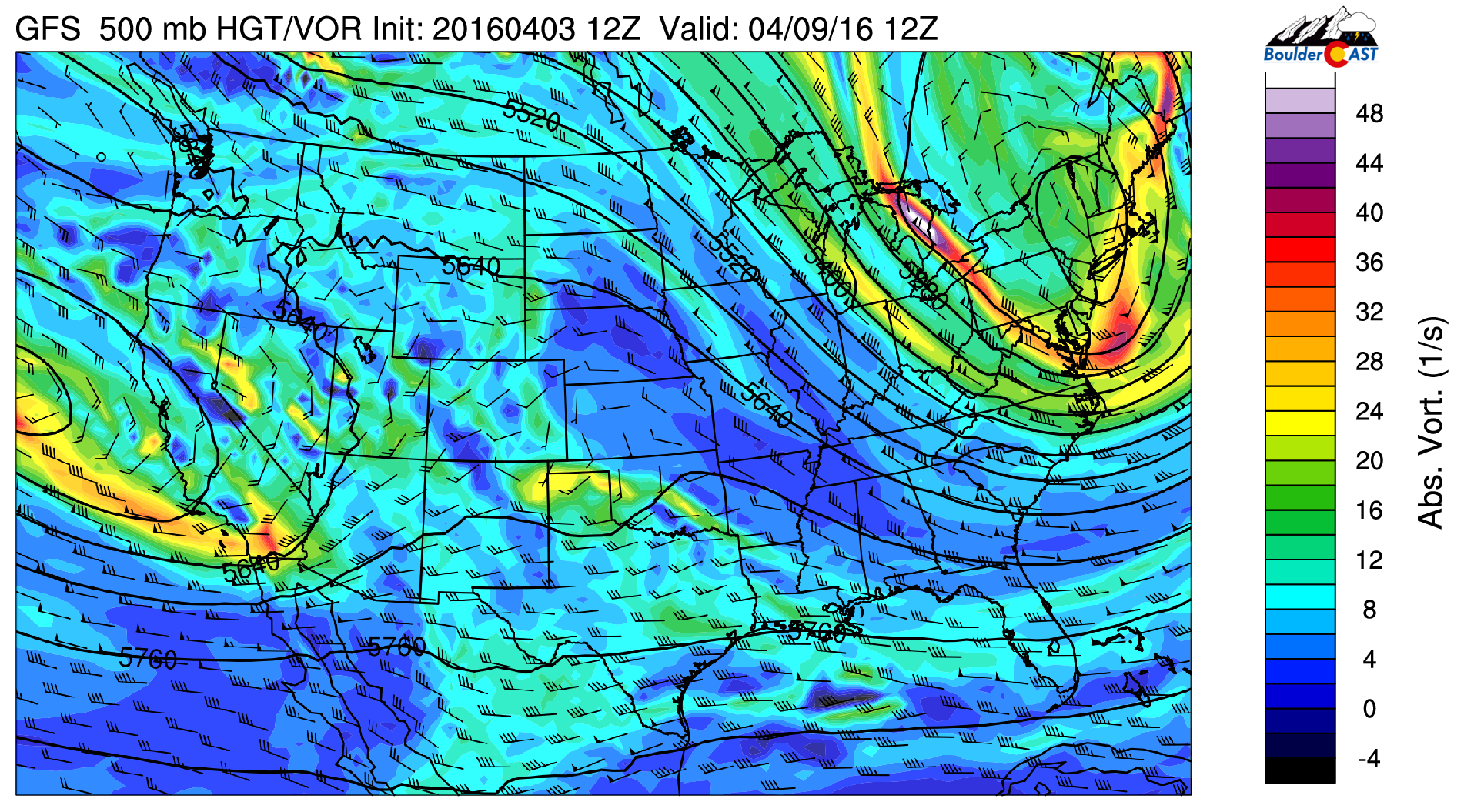
GFS 500 mb absolute vorticity for Sunday
As we mentioned in our outlook for April yesterday, this active pattern should eventually propagate that precipitation down to the Plains by the middle of the month.
The Forecast:
Monday: Mostly sunny and just spectacular, highs in the lower 70’s over the Plains and lower 60’s in the Foothills.
Tuesday: Sunny early, followed by increasing afternoon clouds with a brief passing shower possible (otherwise dry). Highs topping out in the lower 60’s across the Plains and lower 50’s in the Foothills. Temperatures will drop rather quickly from the 60’s to the 50’s by late afternoon over the Plains. Gusty northwest winds up to 45 mph Tuesday night are possible as well.
Wednesday: Gusty winds in the morning, then mostly sunny and pleasant in the afternoon with highs in the lower 60’s on the Plains and lower 50’s in the Foothills.
Thursday: Sunny skies and warmer with highs in the upper 60’s over the Plains and upper 50’s in the Foothills.
Friday: Sunny. Our warmest day of the week with lower to middle 70’s possible on the Plains and lower 60’s in the Foothills.
High Country: Dry and windy over the high country on Monday. Snow develops Tuesday afternoon and continues through Wednesday with 2-5″ of snow accumulation possible, with some locally higher amounts. A few lingering show showers early Thursday, but overall dry and sunny to end the week Thursday afternoon and Friday. A return to snow is possible as early as Sunday with the potential for more powder days ahead.


