
After an historic snow storm produced 18″ in Boulder and up to 45″ in the nearby Foothills over the weekend, our attention turns to the week ahead. Highlights include a cold and dreary first few days, with a warming trend and gorgeous weather by week’s end. In fact, highs look to return back to the 70’s by Friday. Read on for our full forecast for the upcoming week.
Beginning cold and snowy
See our recap of the historic snow storm in the prior post. Totals ranged from 10-20″ in Boulder proper, and as much as 50″ in the Foothills. There is certainly a lot snow on the ground and more is on the way for the High Country today through Wednesday. For today, that pesky low pressure system is still rotating over our state, now present over northwestern Colorado. Another wave of energy tied with this upper-low will track from southwest to northeast this evening and overnight connected with the counterclockwise rotation, keeping the region socked in with clouds with upslope flow.
Expect highs in the lower 40’s over the Plains but middle 30’s in the Foothills under significant snowpack. In addition, this wave of energy will produce more snowfall in the High Country and Foothills and some over the Plains. We would not be surprised if portions of the area see ~1″ of additional snow. Some rain may mix in and isolated thunder is possible too for the lower elevations.
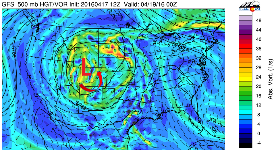
GFS 500 mb vorticity for Monday evening, showing the linger low pressure still over our state
Tonight, the models are showing a light amount of precipitation for the Plains, including Boulder (shown below). This map also indicates the total accumulation through Wednesday for the state, with up to 1″ of liquid equivalent for the High Country right along I-70. This is tied to a northwesterly upslope flow from the rotating upper-low. Expect periods of snow in the mountains through midweek, with another foot to foot and a half possible. Remember, Loveland, Winter Park, and A-Basin are still open for skiing! The system finally pushes out Wednesday with sunshine slowly returning.
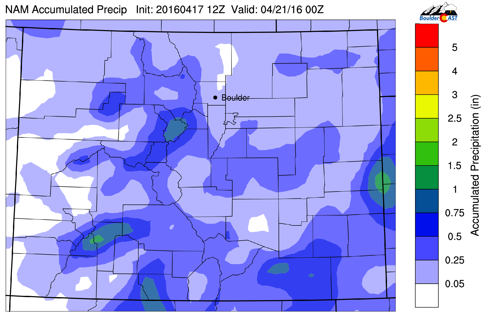
NAM model precipitation accumulation through Wednesday
Tuesday is cloudy, but sunshine takes over Wednesday
On Tuesday, the storm system will still be present over Colorado but it will have shifted eastward by a tad. Northwest flow will continue in the High Country. This, in union with afternoon instability and cold temperatures aloft, will lead to snow showers there. Meanwhile, the Plains will see only partial sunshine and a slight chance of afternoon rain/snow showers. Most areas to remain dry with weak downslope flow. Expect highs to warm to the upper 40’s on the Plains.
For Wednesday, sunshine returns as the upper-low finally exits the Colorado domain and pushes eastward into the Midwest. This will spell out a nice rebound in high temperatures to the middle 50’s on the Plains. The High Country will also see clearing skies slowly work in as the afternoon wears on.
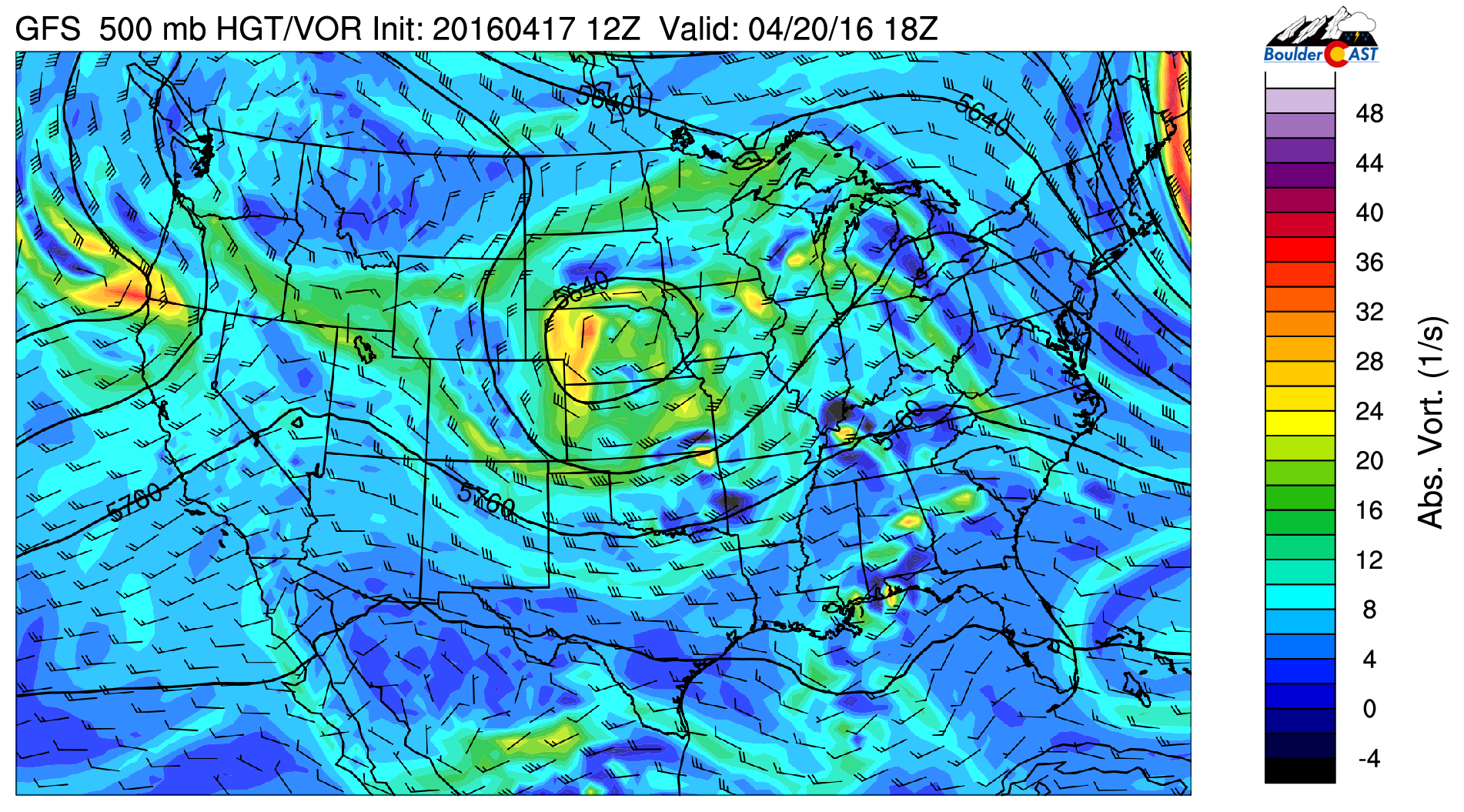
GFS 500 mb vorticity for Wednesday
The week ends magnificently!
An upper-level ridge builds in from the west on Thursday and fully entrenches itself by Friday. In addition to sunshine, southwest flow under the ridge will produce warm air advection from the desert southwest. Forecasted temperatures at 700 mb are around 5 deg Celsius by Friday afternoon, fully-supportive of low to middle 70’s for the Plains! What a great way to end the week!
However, we are watching another potential system for the weekend, in the red circled region below. Right now, this trough of energy looks to mainly impact the High Country with rain/snow showers. But the pattern looks to stay active into next week. Another shot at snow in April is certainly not out of the question! Stay tuned!
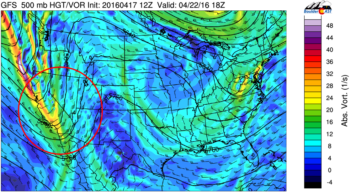
GFS 500 mb vorticity for Friday. showing a ridge for Friday, with our next potential system looming to the west
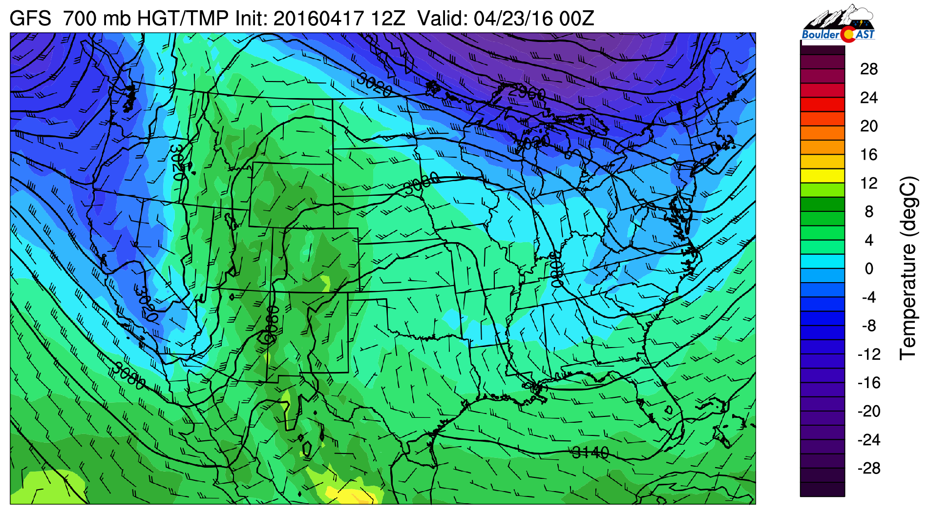
GFS 700 mb temperatures for Friday, showing the warm southwest flow into Colorado
The Forecast:
Monday: Overcast skies and cold. Temperatures in the lower 40’s on the Plains and middle 30’s in the Foothills. Rain/snow showers developing early evening, tapering off after midnight. An additional accumulation of snow of ~ 1″ is possible on the Plains, with 1-4″ in the Foothills.
Tuesday: Mostly cloudy skies, maybe a few peeks of sunshine. Highs in the upper 40’s on the Plains and upper 30’s in the Foothills. Isolated afternoon rain/snow showers in the Foothills and Plains. Light snow accumulations are possible in the Foothills in the late afternoon/early evening.
Wednesday: Mostly cloudy in the morning, followed by afternoon sunshine. Highs into the middle 50’s across the Plains and middle 40’s in the Foothills.
Thursday: Mostly sunny skies and beautiful with temperatures in the lower 60’s on the Plains and lower 50’s in the Foothills.
Friday: Sunny and warm with middle 70’s on the Plains and lower 60’s in the Foothills.
High Country: Periods of snow showers will persist in the mountains Monday and Tuesday, tapering off Wednesday afternoon with sunshine taking over. An additional 1-2 feet of snow is possible on top of what fell this past weekend, mostly near and south of I-70. Thursday and Friday are dry, though a more active pattern returns late Friday and the upcoming weekend with a mix of rain and snow showers Friday night into Saturday.
Header photo credit: Zack Pyle


