
Contrary to the active pattern of late, not much is on the table for the week ahead. The recent storm track that has been pummeling Colorado with storm after storm of late has receded northward for the time being. Continue reading as we discuss the implications of this pattern shift, including the outlook for the ski resorts over the next seven days.
We’ll keep this week’s outlook rather brief, mostly because there really isn’t much to discuss.
Shown below is the 500 mb vorticity map for this afternoon. Not much is happening across Colorado….just relatively weak westerly flow as a small-scale flattened ridge is in place. In eastern Nebraska, you can see the system that brought the big cool down and gusty winds yesterday to eastern Colorado (but no precipitation).
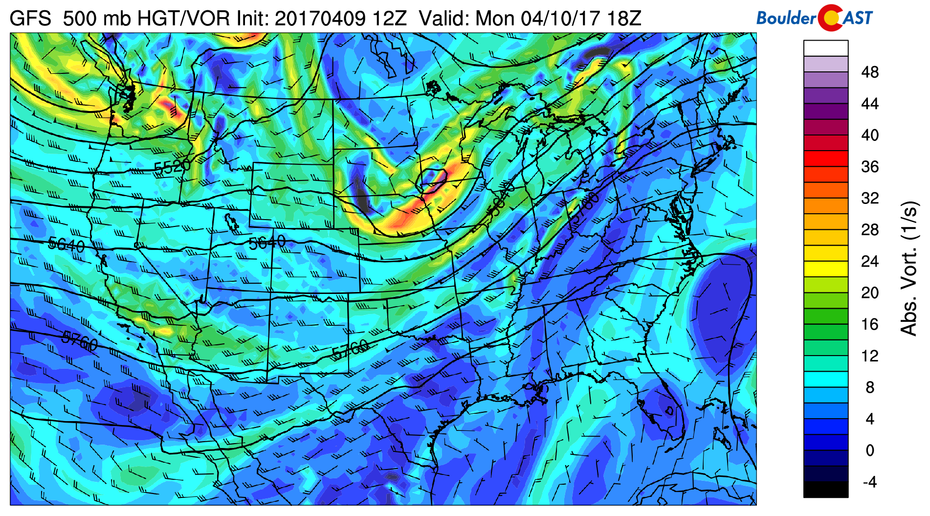
GFS 500 mb vorticity map for Monday afternoon
The precipitable water anomaly map below shows that very dry air accompanies this flow today. And in fact, that moisture pool seen off the coast of California won’t arrive for us until Wednesday.
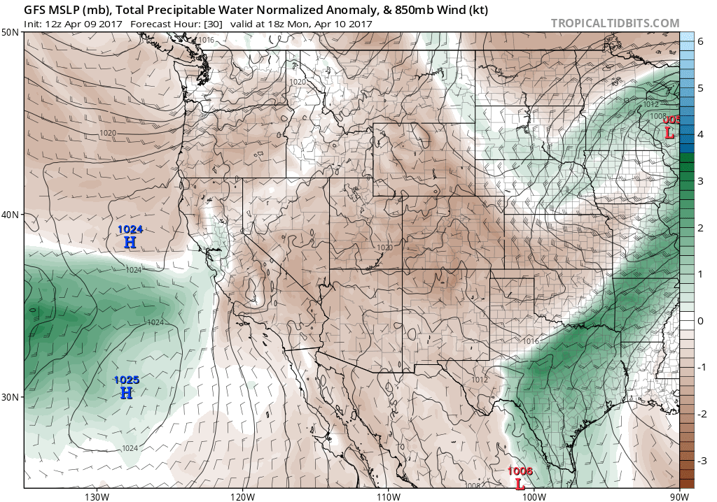
GFS forecast for sea-level pressure and moisture anomaly for Monday afternoon. Brown is below normal moisture.
Under this moisture-lacking zonal (westerly) flow, Monday and Tuesday will have abundant sunshine, dry, and mild conditions. Monday’s high will be near 60, with Tuesday warming further into the mid to upper 60’s.
The 500 mb map for Tuesday (below) depicts ridging across Colorado, but a weak quick-moving system is coming ashore in California (this is associated with that moisture mentioned above). This trough will rapidly pass by the Denver area early Wednesday, with little to no impact outside of increased clouds Wednesday morning. Temperatures Wednesday should still be able to reach towards 70 degrees with plentiful afternoon sunshine.
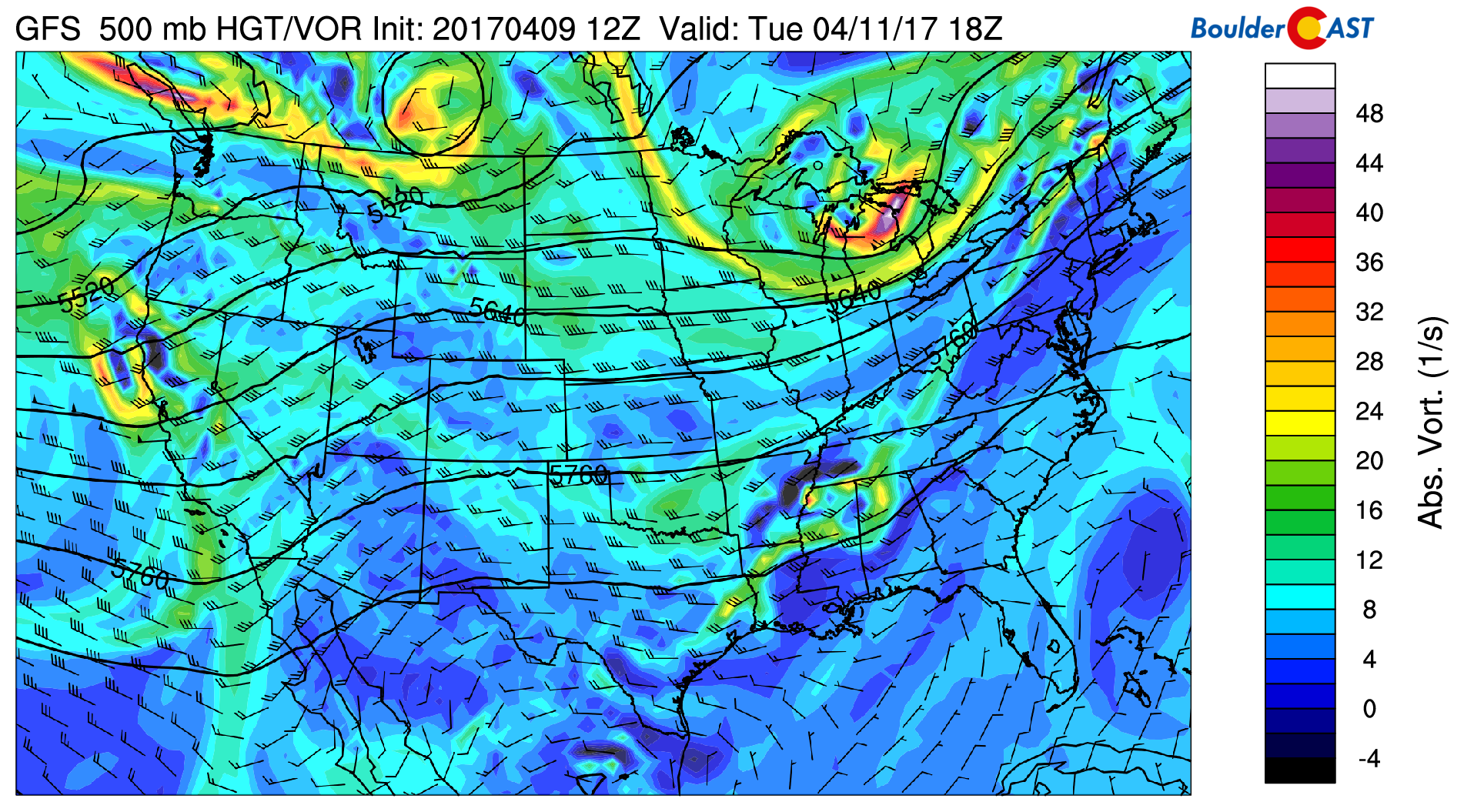
GFS 500 mb vorticity map for Tuesday afternoon.
By Thursday and Friday, a higher-amplitude ridge forms and produces southwesterly flow across Colorado (see below). A large trough is progged to come ashore in the Pacific Northwest as well.
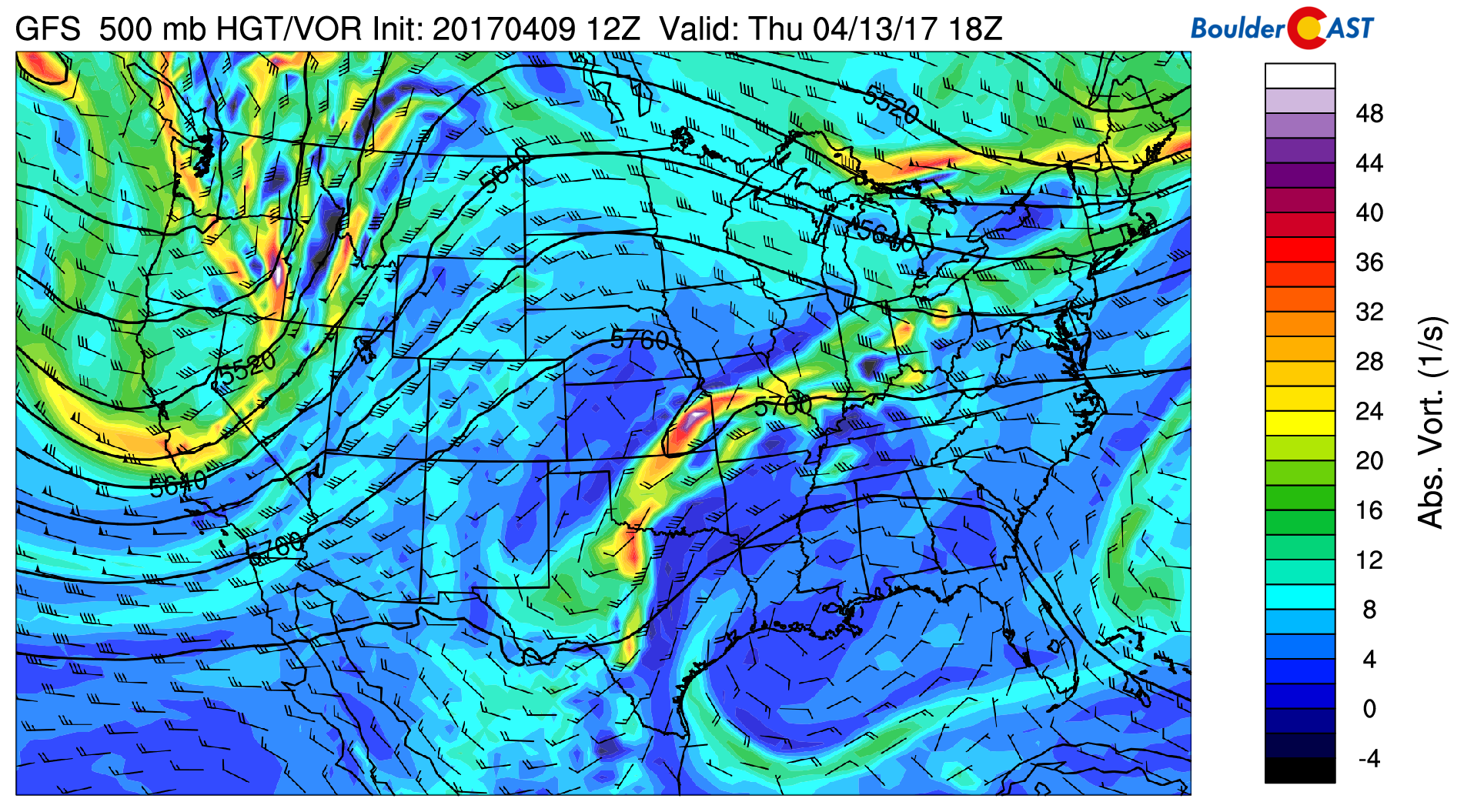
GFS 500 mb vorticity map for Thursday afternoon.
At this time, model guidance suggests this trough will weaken and remain north of Colorado to end the week. This will open the door for strong warming….likely into the mid 70’s both Thursday and Friday for our region.
The GFS forecast total accumulated precipitation map through Saturday sums up the week ahead nicely…
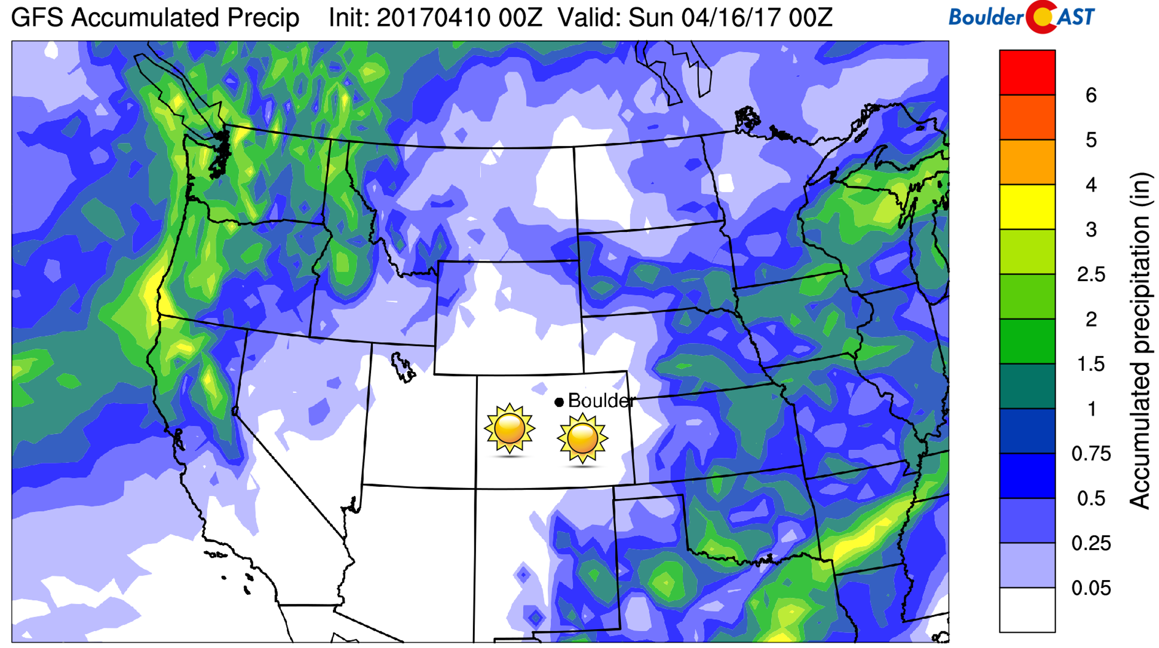
GFS total accumulated precipitation forecast through Saturday. A dry Colorado is the story this week.
Finally, if you haven’t done so already, you have until Tuesday, April 11th at 11:59 PM to submit your entry to our latest contest…How Much More Snow Will Boulder See This Winter Season? –> ENTER NOW!
Forecast Specifics:
Monday: Sunny and seasonal with a high in the low 60’s for the Plains and in the low 50’s in the Foothills.
Tuesday: Mostly sunny with increasing clouds in the afternoon. Temperatures will moderate into the mid 60’s across the Plains and into the mid 50’s in the Foothills.
Wednesday: Morning clouds, then sunny with highs near 70 degrees for the Plains and upper 50’s in the Foothills.
Thursday: Warming up and hardly a cloud in the sky. Look for highs in the mid 70’s across the Plains, with mid 60’s in the Foothills.
Friday: Mostly sunny and beautiful with temperatures again in the middle 70’s on the Plains and mid 60’s in the Foothills.
High Country / Ski Resorts: Unfortunately…dry, warm, and quiet conditions will dominate across the Mountains this week as well. We’re not seeing any chance of snow for the ski areas. Wind speeds will be relaxed too, particularly Monday, Tuesday, and Thursday.
Extended: We’re really receding back into a quiet weather pattern for this week and possibly next. With the ridge in place, most of the action will be deflected north of Colorado into Wyoming and Montana. However, models do show the potential for a weak storm early next week. Nothing to get excited about yet, though.
Mon
Tue
Wed
Thu
Fri


Temperature
60
67
68
76
74


Precip Chc (Plains)
0%
0%
0%
0%
0%


