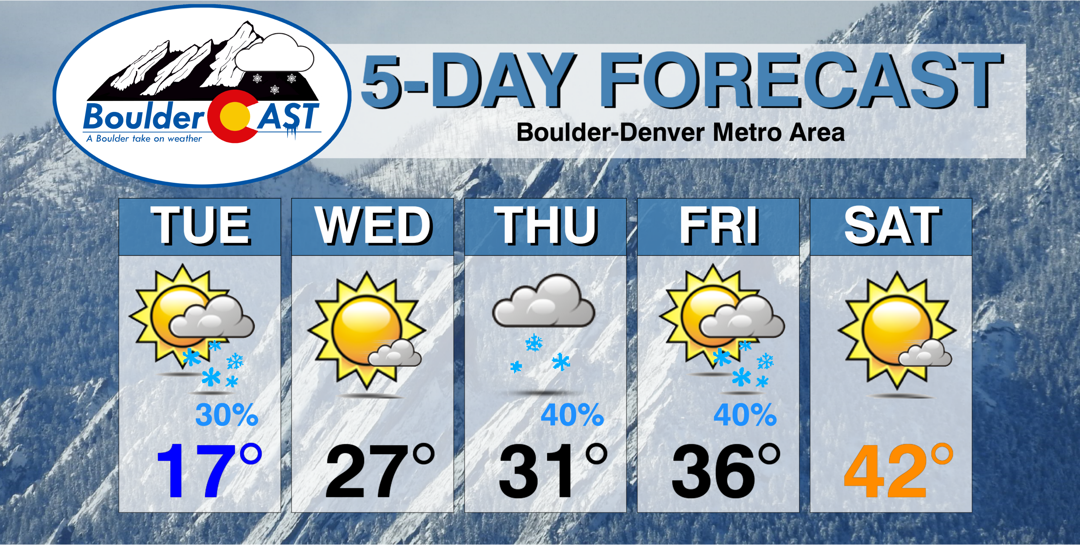
In the wake of last night’s snow, we start out the shortened work week on the nippy side with an Arctic airmass entrenched across the Front Range. Temperatures may not get above freezing until Friday. We are also watching three (yes three!) more chances for snow this week, especially on Friday, with the approach of another potent trough.
Beginning with the snow and cold air yesterday, persistent and broad troughing will remain in place across the western United States for the foreseeable future. This will keep our temperatures cool and the pattern active through the upcoming week. With drought creeping back into the state, this is great news for the Mountains and lower elevations which desperately need snow right now.
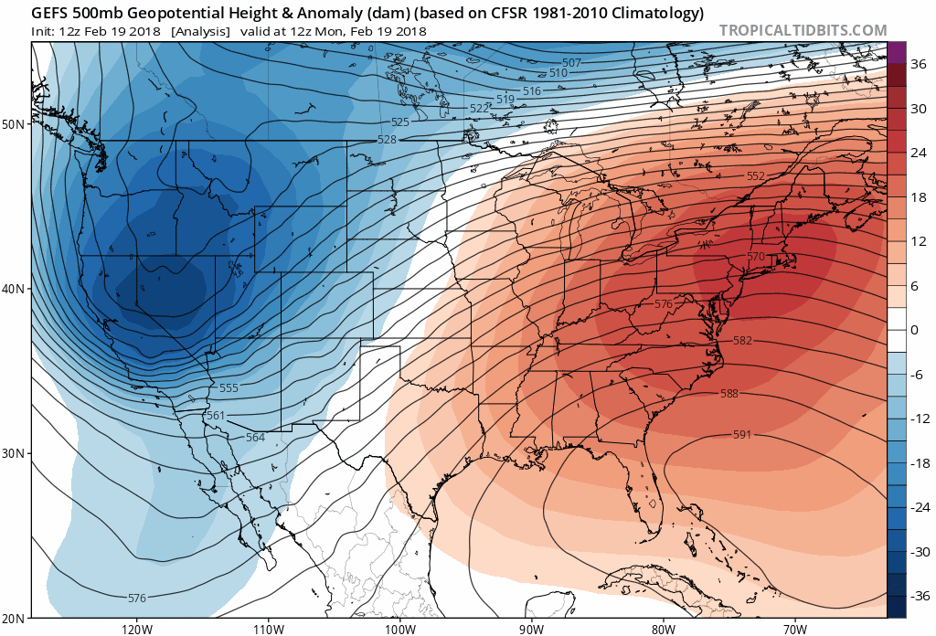
GFS 500 mb height anomaly forecast for the next ten days. Troughing is progged to remain across the western United States, with a dominant ridge over the Northeast.

A cold Tuesday with a few light snow showers
With fresh snow and generally mostly cloudy skies, we should only top in the middle teens this afternoon, more than 30 degrees below average for this time of year. Tonight, skies should clear with many locations dipping below zero under the fresh snow.
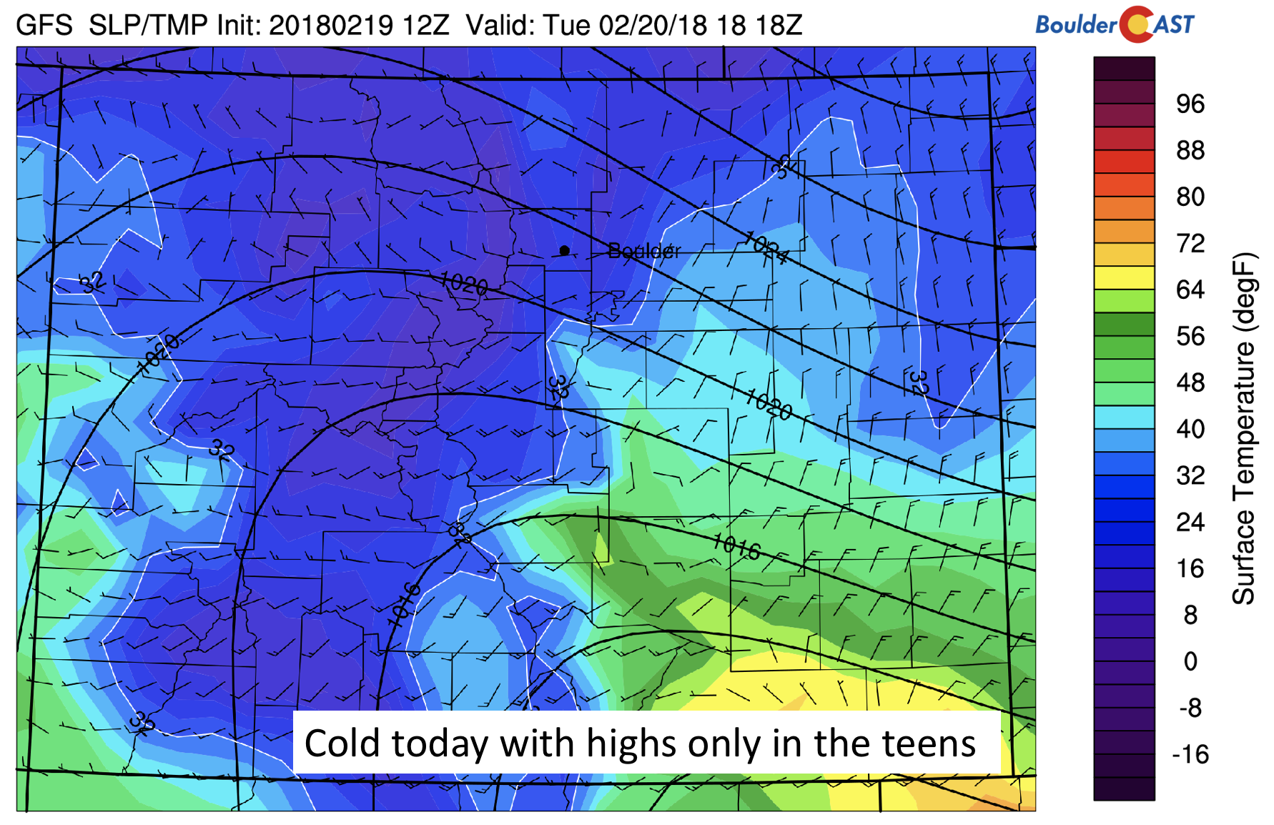
GFS surface temperature map across Colorado today
We are watching the potential for some resurgence of light snow later this afternoon to early evening. Aloft, we are still under the influence of the same mid-level trough that brought snow yesterday. This wave will not move out until early tomorrow. The trough, combined with weak instability in the mid-levels, may lead to the development of some light snow showers over the High Country, moving eastward onto the Plains later in the day.
Below shows a time-height plot of this in terms of wind, temperature, and humidity. The first wave on the image shows the lift with Monday’s snow storm (left yellow circle). A second “bump” in the humidity field is evident this evening, accompanied by southwest winds aloft. If this materializes, we could see only a light accumulation, potentially another trace to 1/2″ by evening.

GFS time-height plot of humidity, wind, and temperature for the week
The GFS hints of the light snow in the forecast map below. The most likely area to see a few flakes would be in the Foothills, or from Boulder southward through Denver.
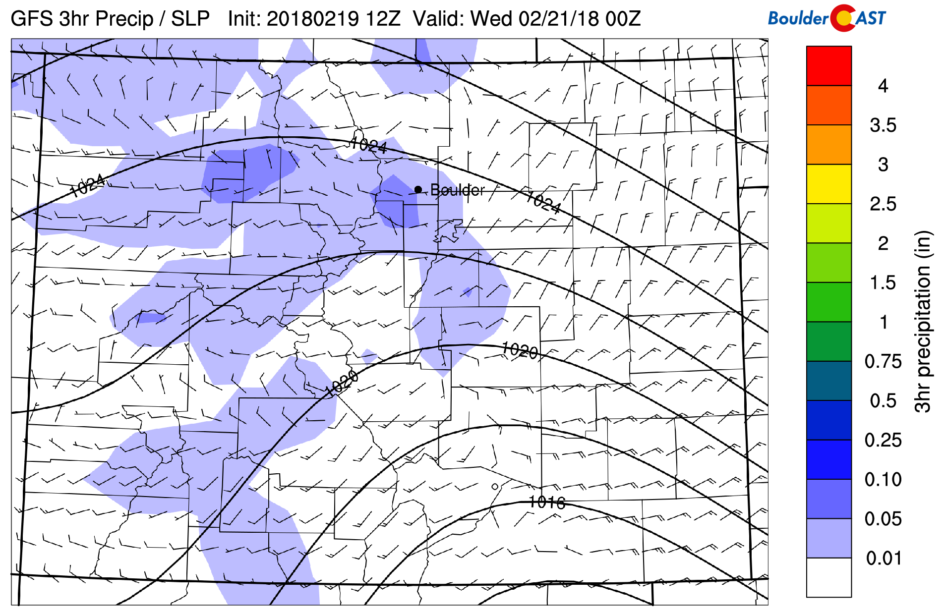
GFS 3-hr precipitation in early evening
Wednesday and Thursday more tranquil, but snow showers possible
The below forecast map shows the 250 mb jet stream pattern during the afternoon on Wednesday. Overall, the strong jet which brought us snow Monday will have moved off into the upper Midwest. However, a weak jet streak will still remain in place across northern Colorado. While there is a lack of forcing, moisture, and lift, the location of this jet makes us a little concerned that it could produce a few light snow showers in the evening, given its similar position as what occurred on Monday. Nevertheless, we are not expecting much in the way of accumulation. Highs should warm slightly into the 20’s on Wednesday with sunshine expected.
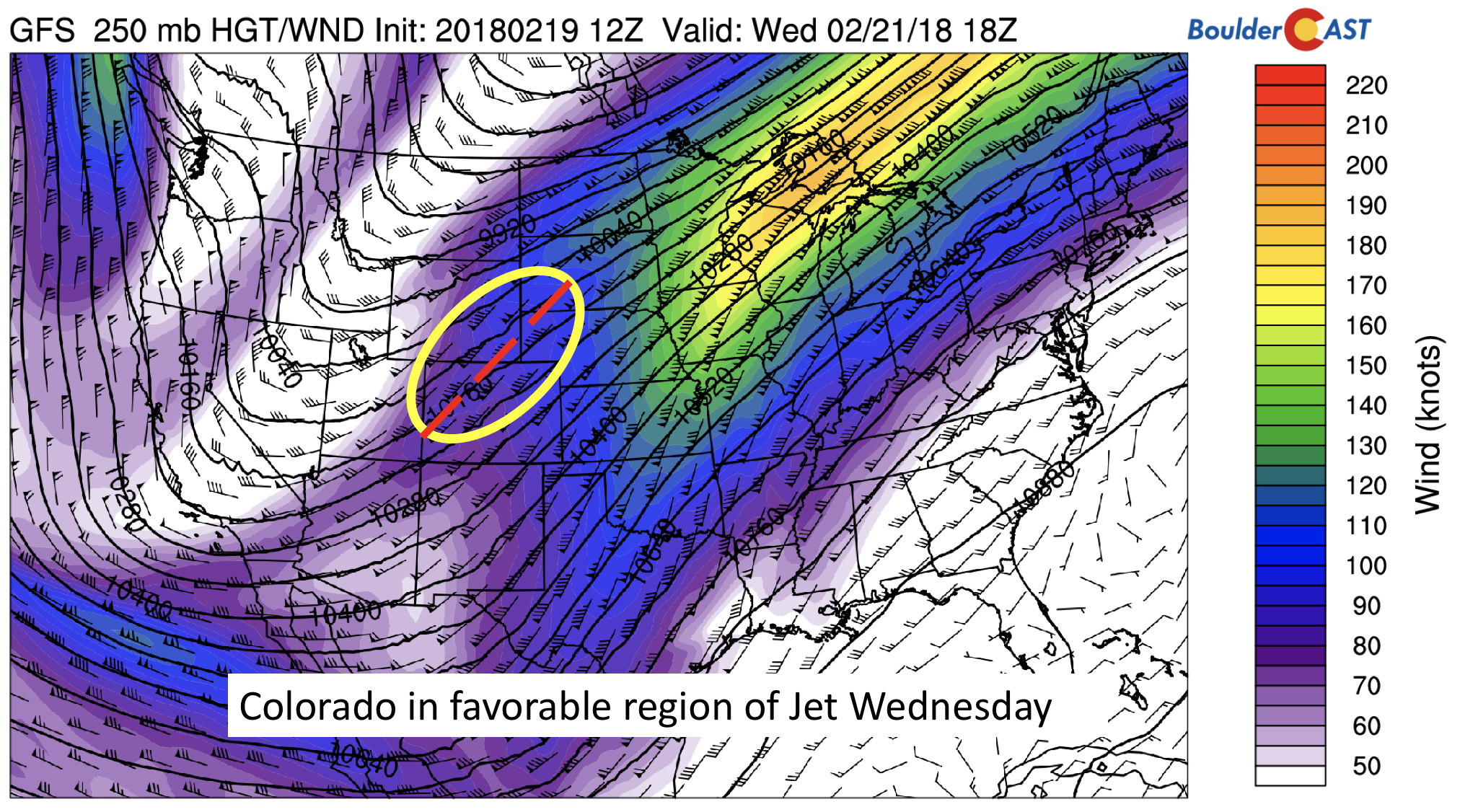
GFS 250 mb upper-level jet stream Wednesday
The more favored location for snowfall will come in the High Country both Wednesday and Thursday, with several resorts in southwest Colorado looking at more than 5″ of snow. Be sure to check out PowderCAST for our complete forecast, updated twice a day! A great week to catch some fresh powder on the slopes.
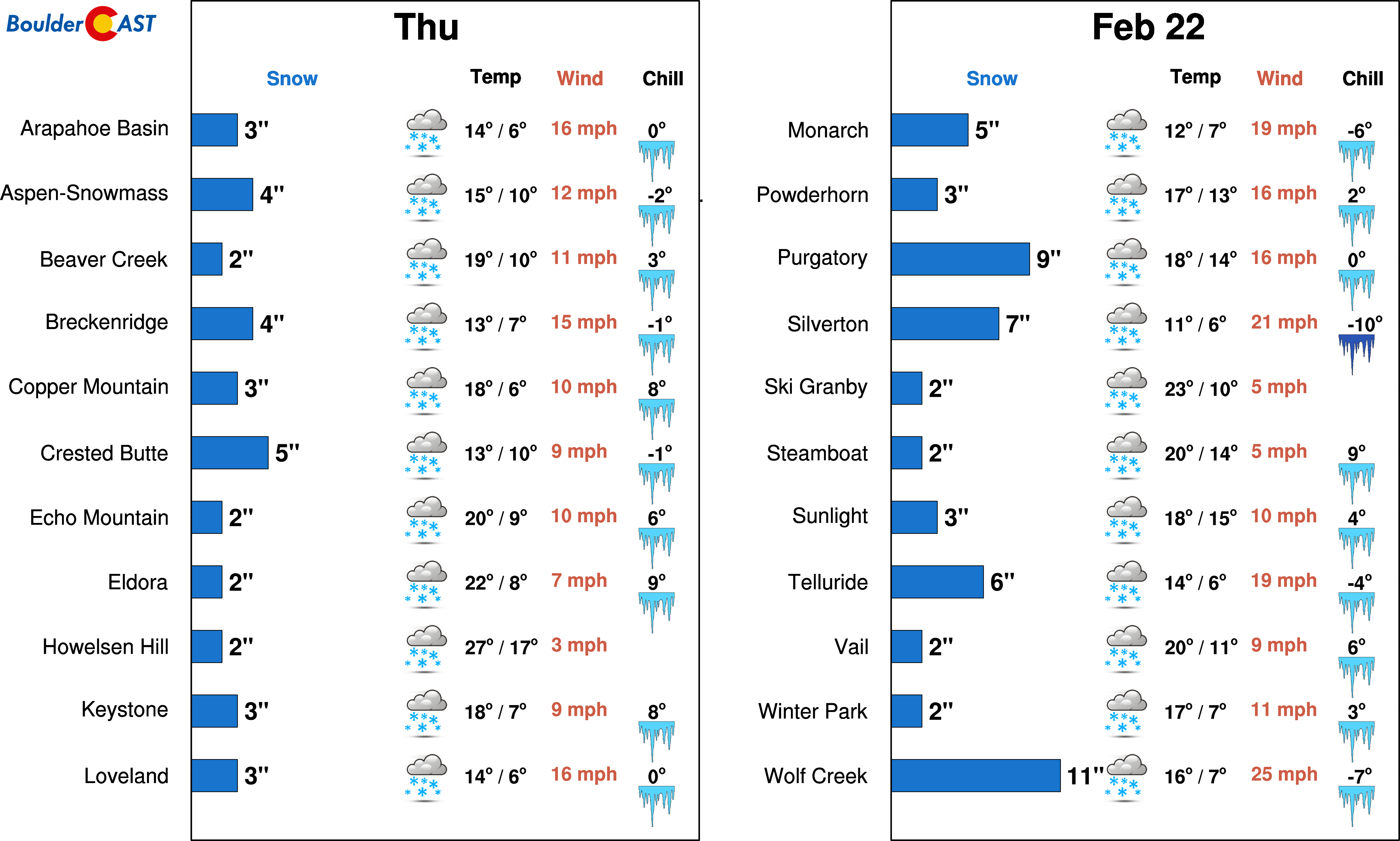
PowderCAST forecast on Thursday
On Thursday, another trough of low pressure will develop out to our west across California. The image below shows a trough axis situated from Wyoming, south into Utah, and into Arizona. Across Colorado, the trough axis will put us in a favorable region of lift, bringing the chance of snow yet again, maybe even some heavier bands from the jet. However, uncertainty remains, so as of now we will simply say the chance of snow showers is about 30 to 50%. A mix of clouds and sunshine will help temperatures reach near the freezing mark.
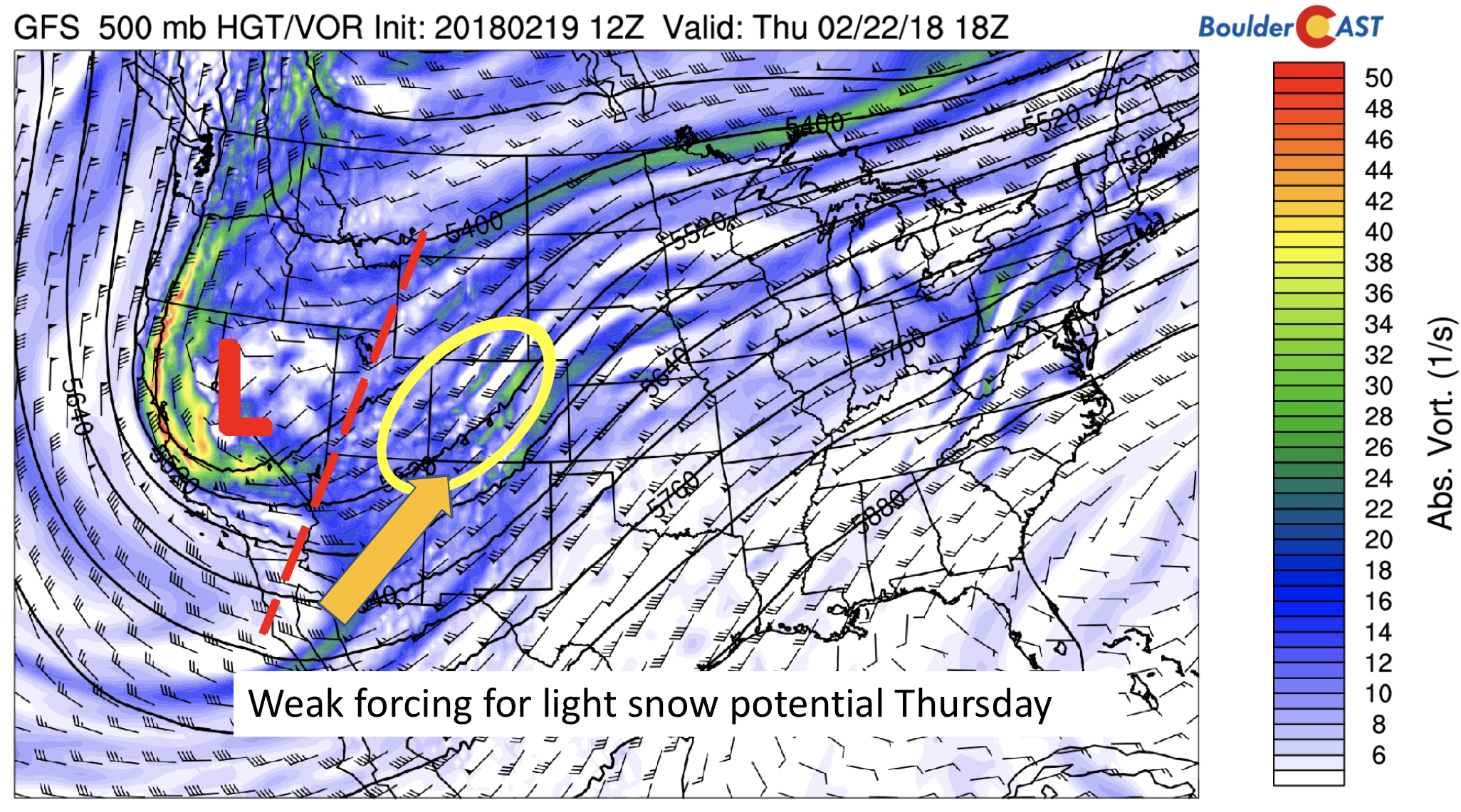
GFS 500 mb absolute vorticity on Thursday
Week ends with a decent snow chance
We’re looking at a good threat of snow Friday night into Saturday. However, the forecast will ultimately depend on the exact position of the mid-level trough. The current forecast (below) hints at a position across northern Arizona, a favorable storm track for snowfall across southeastern Colorado and maybe as far north as Denver/Boulder. At this time, this system definitely has the potential to produce several inches of snow for our region, but we are not going to make any predictions yet. We will continue to update you as the week progresses. All in all, Friday should be in the lower to middle 30’s, with sunshine giving way to clouds and the threat of light snow later in the day.
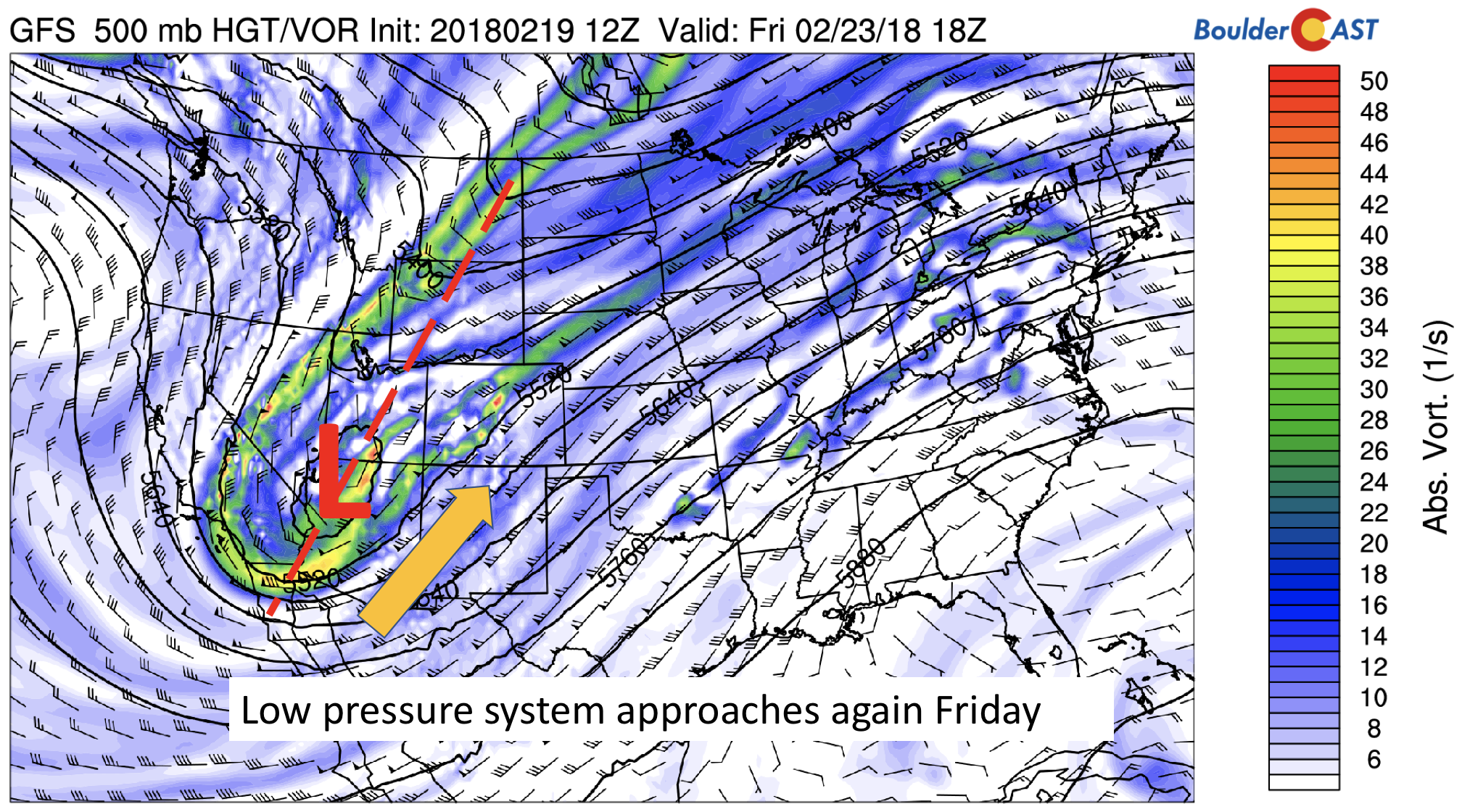
GFS 500 mb absolute vorticity for Friday
Enjoy the cold week ahead…things may not change much for next week either 🙂
Forecast Specifics:
Tuesday: Partly to mostly cloudy and cold with light snow showers in the late afternoon to early evening, with a trace of 1/2″ of additional accumulation possible. Highs in the middle teens for the Plains with low teens in the Foothills.
Wednesday: Mostly sunny and cold giving way to increasing clouds. Highs in the low to middle 20’s across the Plains, and middle teens in the Foothills.
Thursday: Partly sunny and warmer with light snow possible in the afternoon and evening. Accumulations should be less than 1″, if any. High temperatures in the lower 30’s across the Plains, with 20’s in the Foothills.
Friday: Sunshine giving way to cloudy skies with the threat of snowfall in the evening. Temperatures in the low to middle 30’s across the Plains. Expect highs in the middle 20’s in the Foothills.
High Country: After Monday’s snowfall in the High Country, a break in the action will be with us for today, although a few light snow showers cannot be ruled out today with 1″ or so of additional accumulation. Another wave of snowfall will develop Wednesday evening and during the day Thursday, with southwest Colorado favored. Amounts could be in the 6-12″ range for many resorts. Friday will also be a good threat for snow, with another system moving in – amounts could be near 6″ again for the Mountains statewide. Needless to say, a great week for powder! Find the latest forecast for all your favorite Colorado ski resorts on our PowderCAST page.
DISCLAIMER: This weekly outlook forecast was created Monday morning and covers the entire upcoming week. Accuracy will decrease as the week progresses as this post is NOT updated. To receive daily updated forecasts, subscribe to BoulderCAST Premium.

.
Share!


You must be logged in to post a comment.