
Our first widespread snowfall of 2020 is winding down, but the cold will linger for most of the week ahead. We’re also tracking our next potential chance of heavy snow resulting from the overhead jet stream in just a few days time. Read on for all the details.
A bitter cold Tuesday into Wednesday as snow ends
As expected, our storm system has weakened beyond the point of recognition. It’s no longer possible to locate a central circulation via satellite. Give it a try…. the GOES-East water vapor animation from Tuesday morning is shown below.
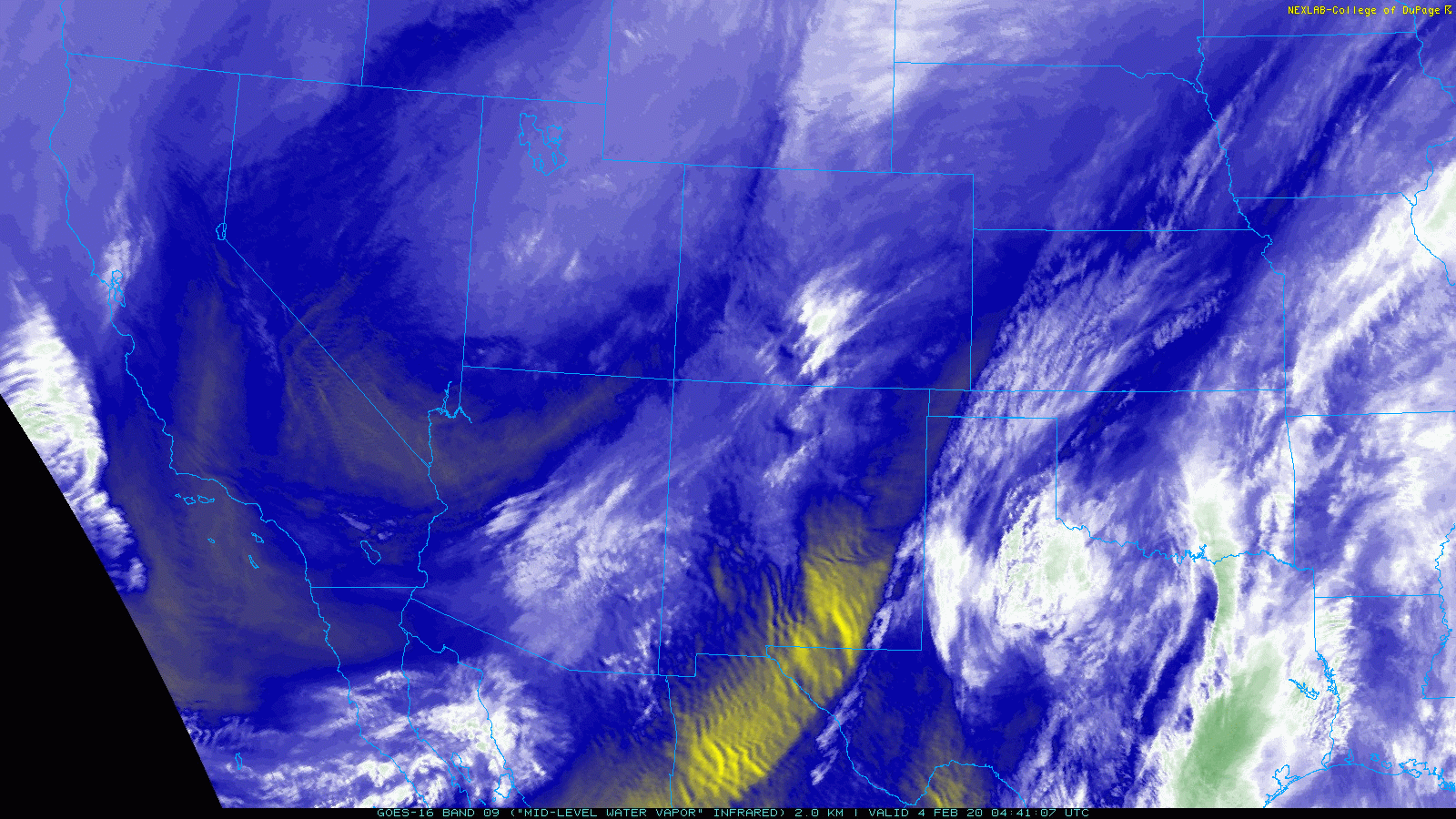
GOES-East water vapor satellite animation from Tuesday morning
Overnight the snowfall has decreased considerably in both coverage and intensity. However, light snow is still falling as of Tuesday morning in many spots. This will continue to be the case through the morning hours for most locations across the Denver Metro area. This snow may persist intermittently in and near the base of the Foothills well into the afternoon hours with some upslope still present and weak large-scale lift passing through. Generally less than 1″ of additional accumulation can be expected, though favored areas like Boulder could see up to 3″ additional. Here are rough storm totals as of 7:00 AM Tuesday:
- Boulder: 9-12″
- Golden: 8-10″
- JeffCo Foothills: 5-10″
- Loveland: 5-7″
- Superior/Louisville: 4-6″
- Westminster: 4-6″
- Broomfield: 4-6″
- Longmont: 4-5″
- Estes Park: 3-5″
- Denver: 2-4″
- Nederland: 2-4″

Persistent light snow continues to fall in Boulder Tuesday morning at 1/4″ to 1/2″ per hour
As the snow comes to an end, our focus shifts to the bitter cold temperatures which have overtaken the entire Intermountain West and even portions of Mexico.
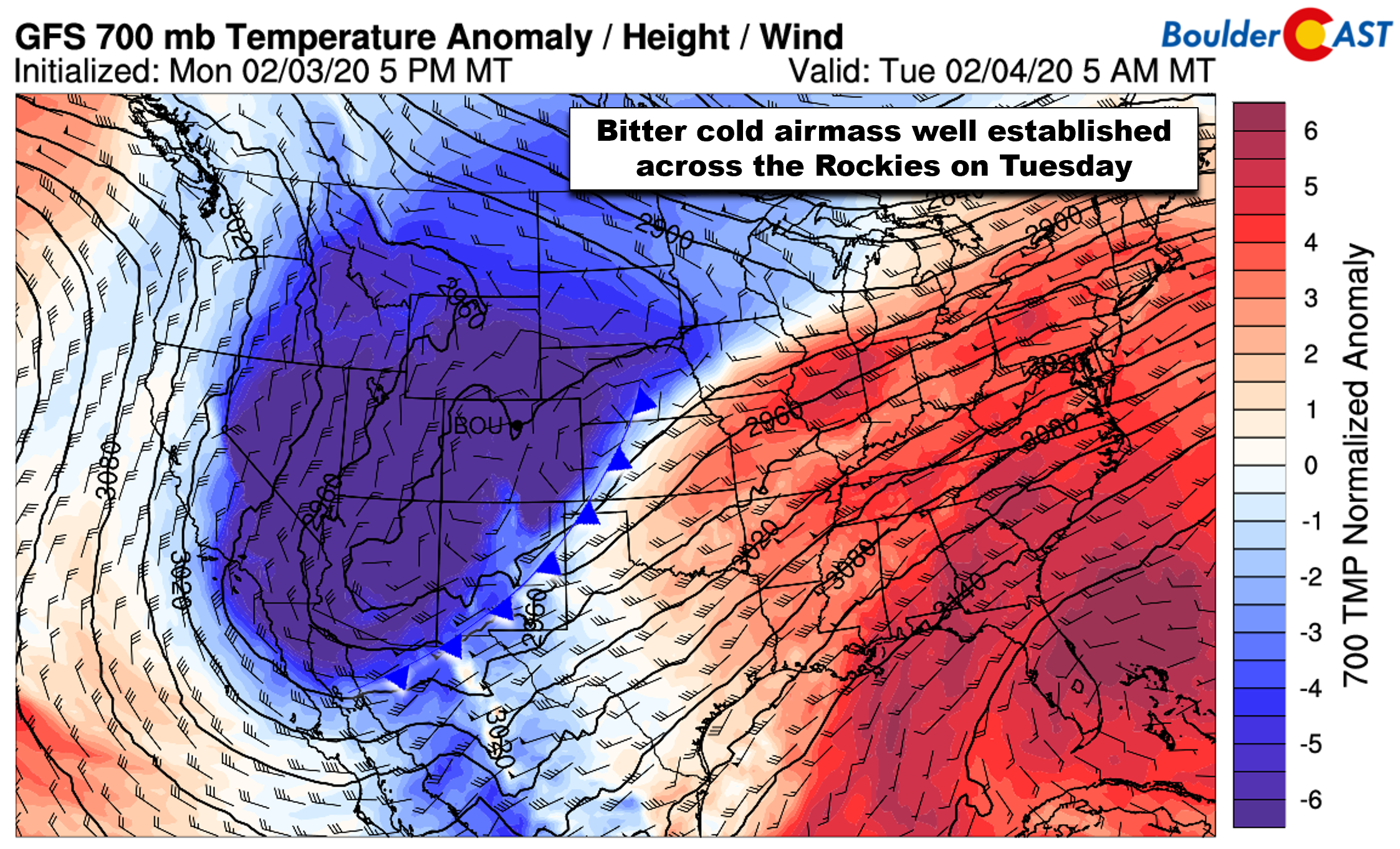
GFS 700mb temperature anomaly forecast for Tuesday morning showing the extent of the very cold airmass
With the clouds and snow, highs on Tuesday will remain in the teens for us…more than 30 degrees below normal. As skies clear Tuesday night into Wednesday morning, radiational cooling over fresh snow cover will allow overnight lows to drop close to zero or slightly below by sunrise Wednesday. Make sure to bundle up…This is definitely the coldest airmass we’ve seen since late November!
Some minor melting will occur Wednesday with highs returning to near 30 degrees and lots of sunshine.
Snow chances Thursday and Friday
We won’t be able to fully dig out from the current snow before our next potential wintry event arrives Thursday into Friday. We’re careful to say “wintry event” and not “winter storm” as our next tango with frozen precipitation will primarily exist outside of any major storm systems. In fact, high pressure will be over the area this time. However, late Wednesday night, the nose of a moderately strong and moist northwest jet will enter the picture for Colorado (see below). If the models are to be believed, this jet will remain nearly stationary for about two days in this configuration, inundating our state with a plume of Pacific moisture.

GFS 250 mb wind forecasts spanning Thursday evening into Friday showing a stalled jet over Colorado. The left exit region, favorable for banded snow, is highlighted in pink
Not only would this be extremely promising for heavy snow in the Mountains, eastern Wyoming and eastern Colorado would rest in the favorable left-exit region of the jet during this time as well (pink boxes above). This includes the Front Range. Pin-pointing jet-forced banded snow two to three days out is a difficult task to say the least. We know this set-up will produce some potentially slow-moving heavy snow bands oriented northwest to southeast, but we’ll have to wait and see where this jet ultimately ends up when it stalls out later this week. The latest model-derived snowfall forecast from the GFS shows the potential for large snow totals pushing out across northeast Colorado (see below). The GFS and Euro models currently target areas north of the Denver Metro area into southeast Wyoming with the heaviest snow. The GFS in particular doesn’t have the resolution needed to resolve the snow bands, so it’s really just smearing things. Regardless, we do expect the likelihood of 1-3 feet of snow in the Mountains with northwest exposure, and up to 1 foot elsewhere.

GFS model-derived total snowfall forecast through Saturday morning. Feet of snow are expected in the Mountains, but snow is also possible on the Plains
For now…plan on a cool and potentially snowy end to the week with highs in the 30’s to lower 40’s. The way things appear at the moment, the best chance of banded snow in the Metro area would be late in the day Thursday through Friday evening. It won’t necessarily be snowing that entire time of course, but if and when the banded snow hits, it could be heavy at times causing notable travel impacts.
The jet appears to shift eastward to begin the weekend, though this certainly may need to be adjusted. With lingering albeit weaker northwest flow behind the departing jet, highs Saturday will be cool in the 40’s with sunshine returning.
Forecast Specifics:
Tuesday: A bitter cold day with on-and-off light snow through the day. Additional accumulation less than 1″. Highs in the upper teens on the Plains and single digits in the Foothills.
Wednesday: Mostly sunny and dry but still cold. Morning low temperatures will be close to zero across the Metro area. Highs near 30 degrees on the Plains and upper teens in the Foothills.
Thursday: Mostly cloudy with a slight chance of snow showers, primarily late in the day. Highs near 40 degrees on the Plains and in the upper 20’s in the Foothills.
Friday: Partly cloudy with a chance of snow showers during the day. Snow could be heavy at times due to jet banding. Highs cooler in the 30’s across the Plains and in the 20’s in the Foothills.
Saturday: Mostly sunny and slightly warmer. Highs in the lower 40’s on the Plains and lower 30’s in the Foothills.

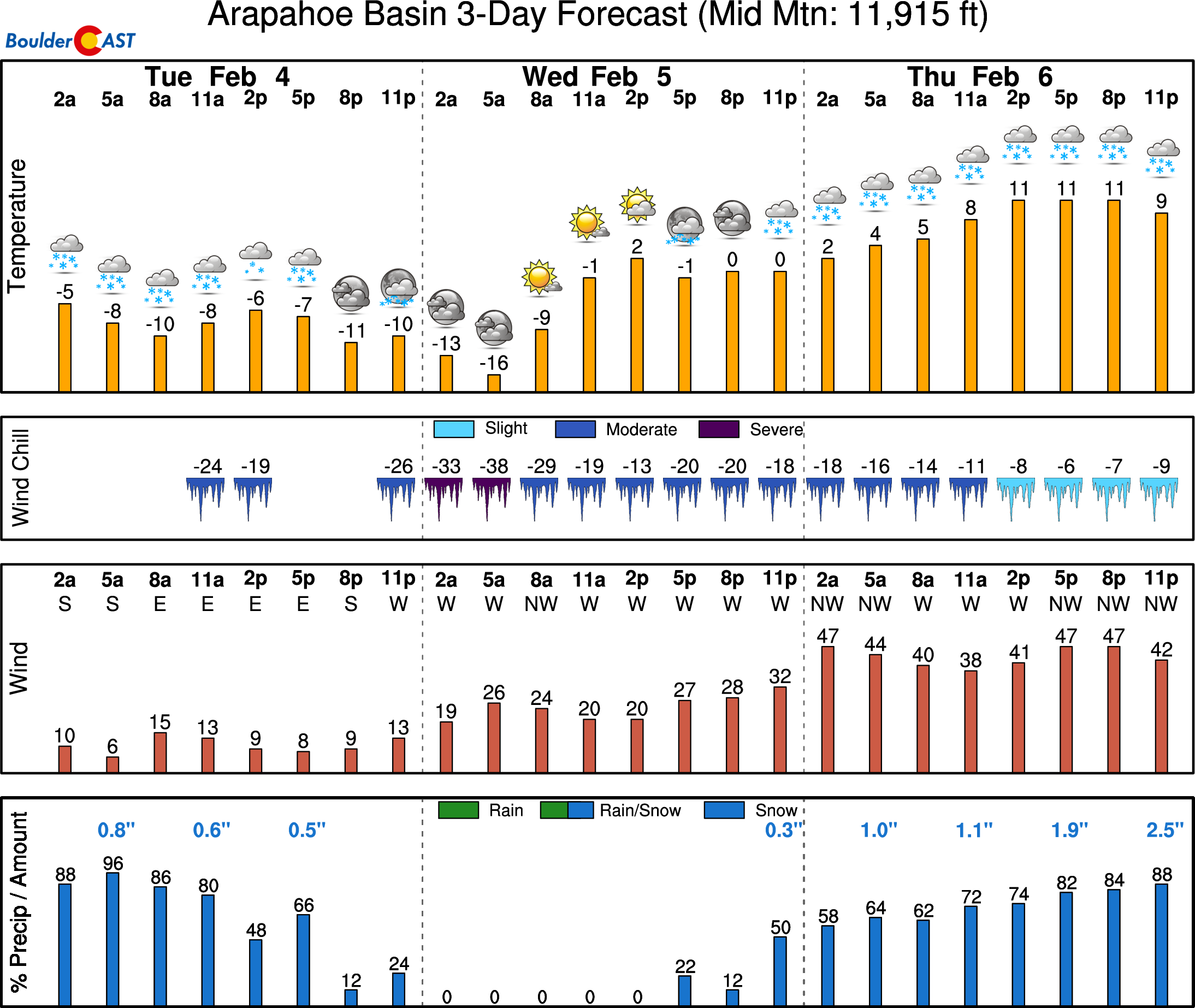
High Country: Very cold conditions will be present in the Mountains Tuesday into early Wednesday, but generally dry weather will prevail during this time outside of a few flurries. Late Wednesday the nose of a potent Pacific jet enters the state and will remain in place through Friday night. This will produce heavy mountain snow and blustery conditions across the Mountains and passes. 1-3 feet of snow may fall during this time, especially in northern Colorado. Check our PowderCAST page for always-updated weather forecasts for all of the Colorado ski resorts.
DISCLAIMER: This weekly outlook forecast is created Tuesday morning and covers the entire upcoming week. Accuracy will decrease as the week progresses as this post is NOT updated. To receive daily updated forecasts from our team, subscribe to BoulderCAST Premium.

.
Spread the word, share our forecast!


You must be logged in to post a comment.