We are now approaching the two month mark of a very active weather pattern across Colorado. However, this week looks to be quieter as the main storm track finally shifts to our north.
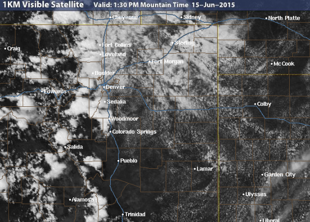
A cold front has crawled into Northeast Colorado overnight (see below), with weak, but moist, upslope flow producing some stratus over Boulder County today (see above visible satellite image). The clouds and upslope will keep temperatures in the low to mid 70s on the Plains for Monday, in addition to increasing the chance of scattered showers and thunderstorms this afternoon. Expect storms to begin developing in the Foothills around 3pm, moving eastward on the Plains thereafter. With weak west-northwesterly flow aloft and ample low level moisture, the storms that do form will be moving rather slowly and could produce an inch or more of rain in one hour.
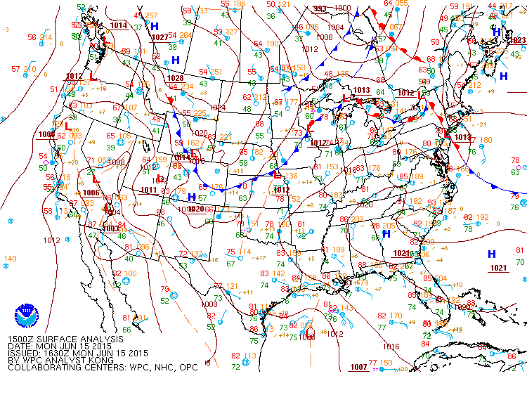
NCEP surface analysis, valid Monday at 10am MT, depicting the cold front that moved into Colorado overnight.
As the week progresses, the entire continental USA will be under nearly zonal flow (straight west to east; see below), with the jet stream and storm track pushed to our north, over Montana. There is very little synoptic forcing under these conditions, and temperatures are usually at or just slightly above seasonal values.
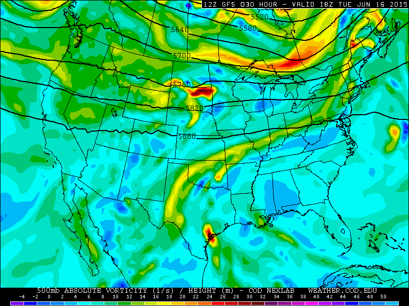
GFS 500mb vorticity map valid Tuesday afternoon. Notice the zonal flow pattern from California, across Colorado, to NYC.
For Tuesday, despite the zonal flow, some lingering low level moisture may fire off a few isolated storms in and near the Foothills, while temperatures rise into the 80s. On Wednesday, another weak, backdoor cold front is slated to push into Colorado. It will provide enough moisture and weak instability to support scattered afternoon storm development once again, with the potential threat for severe weather east of I-25.

GEFS plume forecast for precipitation in Boulder. Monday and Wednesday are shown to have the best chances for picking up some rain, but even then, not much.
A small ridge begins to build in the Western USA by Thursday and into Friday, bringing westerly flow to support much drier and warmer conditions for our region. Thursday and Friday will truly feel like Colorado summer, which is quite convenient considering the Summer Solstice is right around the corner on Sunday, June 21st. Friday will be the warmest day of 2015 so far, with temperatures on the Plains climbing well into the 90s.
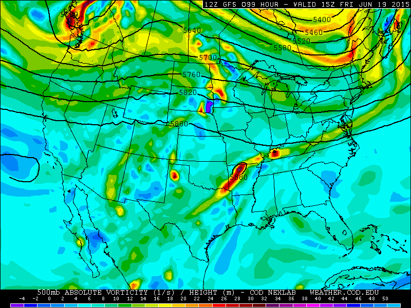
GFS 500mb vorticity map valid Friday morning. Notice the weak ridging present over Colorado.
Forecast Summary:
Monday: Mostly cloudy with scattered afternoon thunderstorms. Storms will be slow-moving an could produce more than 1″ of rain in one hour. Temperatures in the low 70s on the Plains, mid 60s in the Foothills.
Tuesday: Increasing clouds with a few isolated afternoon storms, particularly in and near the Foothills. Temperatures in the mid 80s on the Plains, upper 70s in the Foothills.
Wednesday: Weak cold front passing in the morning. Increasing clouds once again, with isolated to scattered afternoon storms, particularly in and near the Foothills. Highs will reach into the low 80s on the Plains, with mid 70s in the Foothills.
Thursday: Mostly sunny and drier, with temperatures near 90 on the Plains, with 80s in the Foothills.
Friday: The ridge continues to build. Sunny and hot, with highs topping out in the low to mid 90s. Likely to be the warmest day of 2015 so far!
Beyond: The weekend looks somewhat unsettled, as another weak trough and cold front may approach Colorado. However, several of the models are hinting at the development of a large ridge over the West next week, which would dry us out and warm things up significantly. Only time will tell.
—
Mountains (above 10,000ft): A chance of afternoon storms Monday through Thursday, but dry on Friday. Highs warming from 50s into the 70s by Friday. Snow levels remain even above the highest peaks, so dont expect any snow. With the lack of snow, Arapahoe Basin Ski Resort is now closed for the season!


