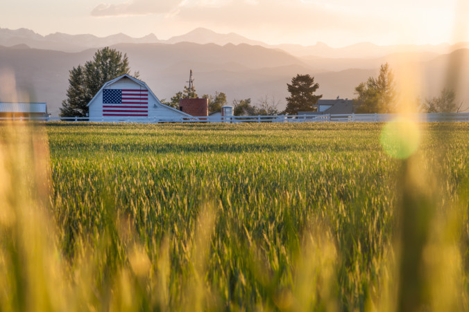
After two weeks of hot and relatively humid conditions across much of eastern Colorado, this week will be marked by a significant cool down that is sure to be welcomed by all. The monsoon is in full swing!
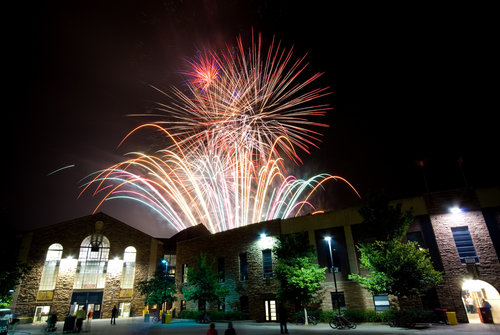
The holiday weekend turned out fairly nice, with hot conditions and just a few passing thunder showers on Saturday and Sunday. Despite early concerns that rain may postpone the fireworks at Folsom Field, it was actually strong westerly downslope winds that picked up around 9:00pm Saturday evening that ended up causing a nearly half-hour delay. Fortunately, officials deemed conditions safe to proceed with the celebration, despite winds gusting above 30mph, with the visual display of explosives commencing around 10:05pm! We at BoulderCAST hope you all had a safe and enjoyable 4th!
The week ahead will be cool and unsettled, to say the least, as an upper-level trough approaches Colorado from the west, helping to feed in monsoon moisture. As of 8am Monday morning, Boulder sits at a very comfortable 58 degrees, with low clouds, fog, and mist currently being observed, the result of a cold front which moved through yesterday evening. With stubborn stratus clouds, easterly flow, and scattered showers, Monday will see a high temperature 25 degrees cooler than Sunday, which topped out in the low to mid 90s across the Plains. Low and mid level moisture is abundant, and the models keep the easterly flow into the evening hours. Expect just a few breaks in the clouds this afternoon, with more sun further from the Foothills. Temperatures will only rise into the mid 60s across the Plains and Foothills.

700mb Relative Humidity map for midnight Monday evening. The presence of high RH banked up against the Foothills doesn’t bode well for much clearing before Tuesday AM.
On Tuesday, Colorado will be under weak westerly flow aloft ahead of an upper-level trough coming ashore in northern California (see below). There should be slightly more sunshine under these conditions, which will destabilize the atmosphere for some isolated afternoon thunderstorms, particularly in and near the mountains. For temperatures, look for most areas in the low to mid 70s.
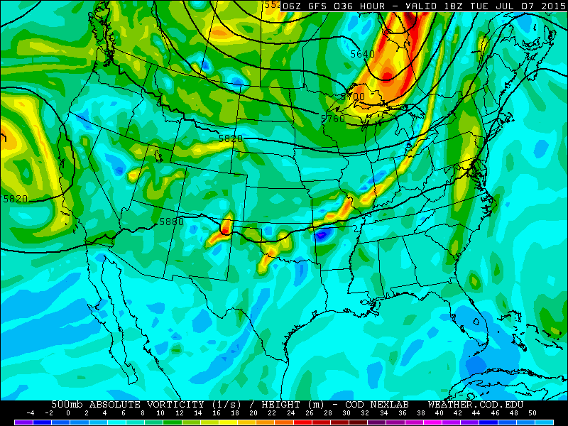
The 500mb vorticity map from the GFS, valid Tuesday afternoon.
Wednesday will see a weak ridge build across Colorado, with abundant moisture supplied by west-southwesterly flow aloft. Clouds will increase in the afternoon, with scattered to numerous storms forming across the region, first over the mountains. Temperatures will moderate even further, reaching to near 80 degrees.
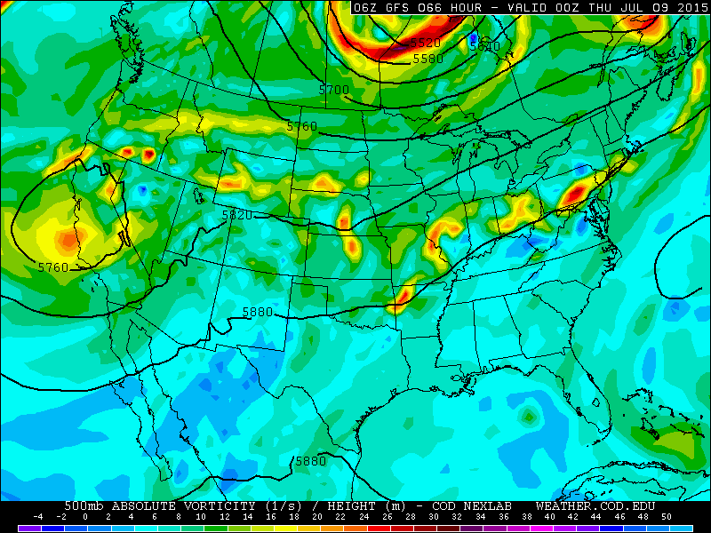
The 500mb vorticity map from the GFS, valid Wednesday evening, showing the approaching trough to our west.
Thursday and Friday will be very similar, as the trough gets pushed to our north. Moist south-westerly flow aloft will support afternoon showers and thunderstorms across much of Colorado, especially if any embedded shortwaves pass overhead. The air mass will warm slightly, into the low 80s both days.
Summary: The week will start off quite cool, but temperatures will moderate slightly each day. Rain can’t be ruled out at this time for any day, especially for the Mountains and Foothills. This should be old news for monsoon season! However, if we had to put our money on it, Tuesday and Friday appear to have the best chance of being drier across the Plains. Rain activity will be mostly hit or miss through the week, with generally less than 1.00″ in most places through the week.
The Forecast:
Monday: Mostly cloudy and cool, with morning mist and isolated afternoon showers. Some thunder is possible as well, particularly over the higher terrain. Temperatures will top out in the mid 60s, more than 20 degrees below normal for this time of year!
Tuesday: Mostly cloudy with afternoon storms forming, particularly across the mountains. Only isolated storms across the Plains. Temperatures in the mid 70s.
Wednesday: Increasing clouds and scattered to numerous afternoon thunderstorms, forming first across the Mountains and spreading onto the Plains in the afternoon. High temperature in the upper 70s.
Thursday: Increasing clouds and scattered afternoon thunderstorms, forming first across the Mountains and spreading onto the Plains in the afternoon. High temperatures in the low 80s.
Friday: Increasing clouds with isolated afternoon thunderstorms, mostly in the higher terrain. High temperatures climbing into the low to mid 80s.
Extended: There is slight model agreement that a large ridge will build across the region by the end of the weekend, shifting the monsoon moisture to our west (see below) and shooting our temperatures back into the 90s. Look for more discussion on this next week!
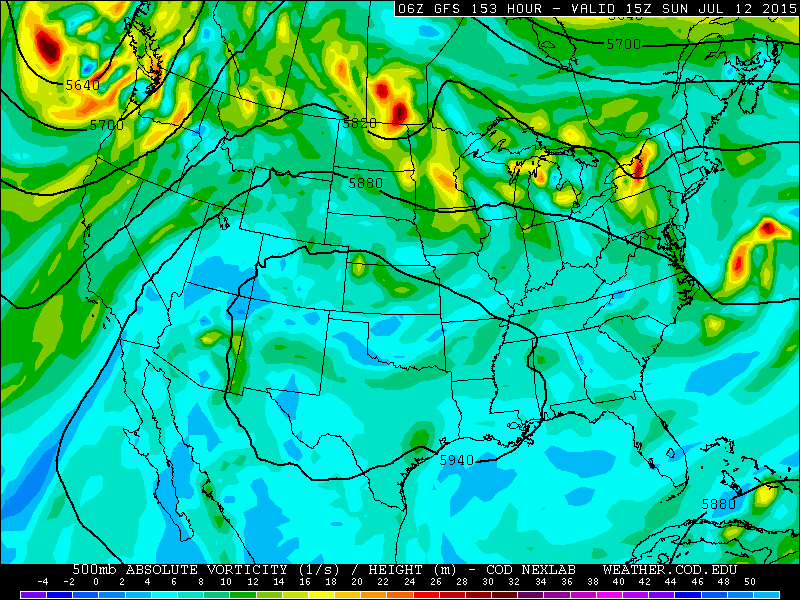
The 500mb vorticity map from the GFS, valid (next) Sunday.
We are going to try something new in these “Week Ahead” posts. To evaluate and demonstrate our forecasting skill for Boulder, we will provide the forecast values for high temperatures from other well-known weather resources. Then, in the following week’s post, we will go over who did the best, validating against the mean of the Boulder Airport, BoulderCAST weather station, and the NCAR Foothills Lab weather station! Precipitation will not be considered, as it is much harder to quantitatively gauge correctness. Here we go!
Source
Mon
Tue
Wed
Thu
Fri


BoulderCAST
65
77
80
81
83


NWS
69
75
76
81
83


The Weather Channel
66
74
72
79
81


AccuWeather
66
75
76
80
83
—
If you haven’t already done so, follow us on Twitter or Facebook for frequent weather updates and subscribe to the site to get these posts automatically delivered to your email box (enter your email in the sidebar widget to right)!


