A storm currently located over the Baja Peninsula in Mexico will swing northeast during the day Sunday. Though the system’s track doesn’t exactly favor the Denver Metro area, some wintry weather will be possible Sunday into Monday. Read on for how much snow to expect and when it will fall.
We have been watching this storm for many days now. The models have consistently kept its track well south of Denver, so we haven’t been too concerned. As mentioned, the storm is currently located over the Baja. It will swing up through New Mexico and into central Kansas by Monday morning.
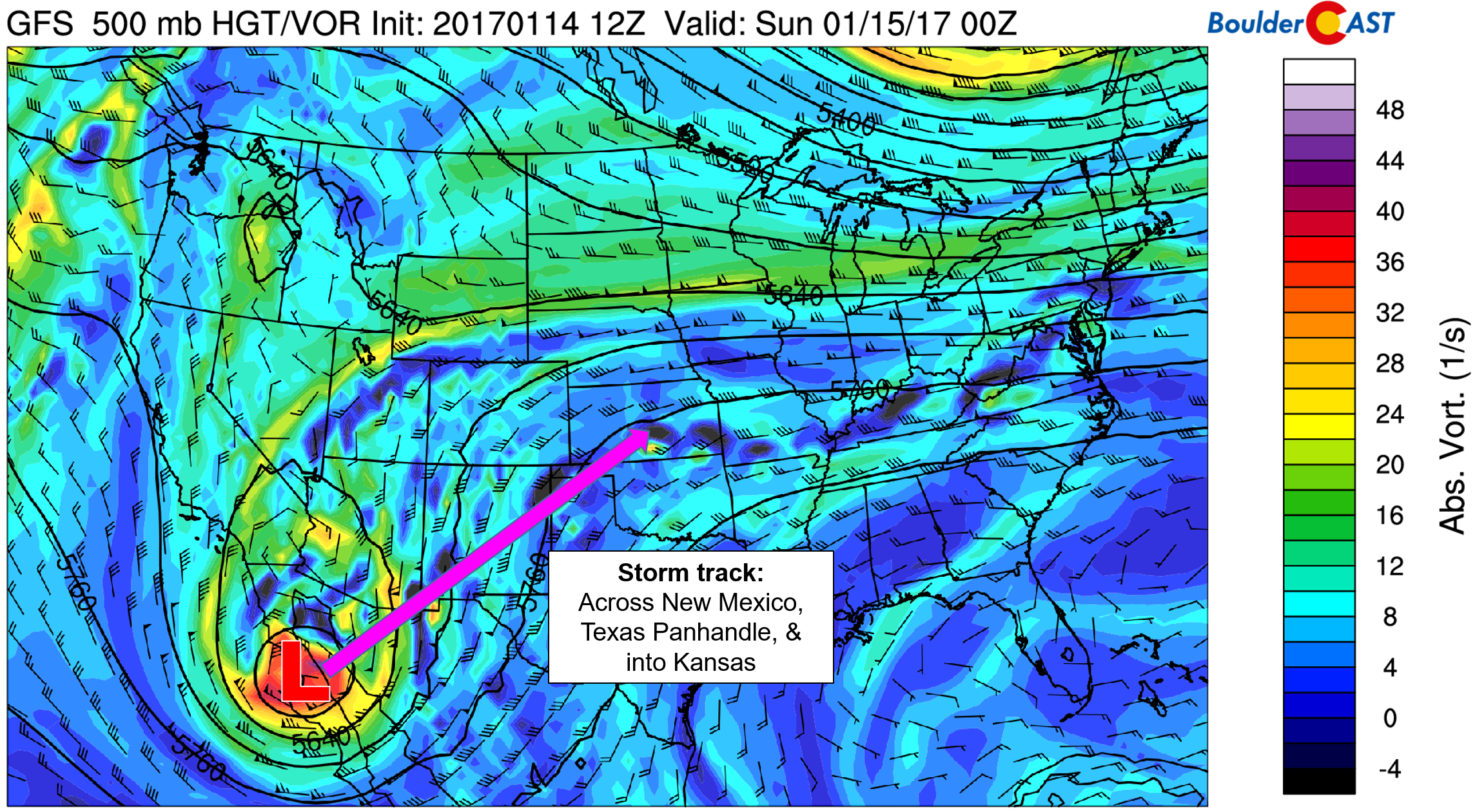
GFS 500 mb vorticity map for Saturday evening showing the current position of the storm and general expected track through Monday.
The southern approach of the storm will allow it gather warmth and moisture, which will follow right along with the system into Colorado. Notice the strong southerly flow streaming from New Mexico into Colorado in the map above. There is already a fair amount of moisture around (did you notice those plentiful high clouds on Saturday?), and even more arrives tomorrow. Moisture values Sunday night will be THREE to FIVE standard deviations above normal for mid-January (see below).
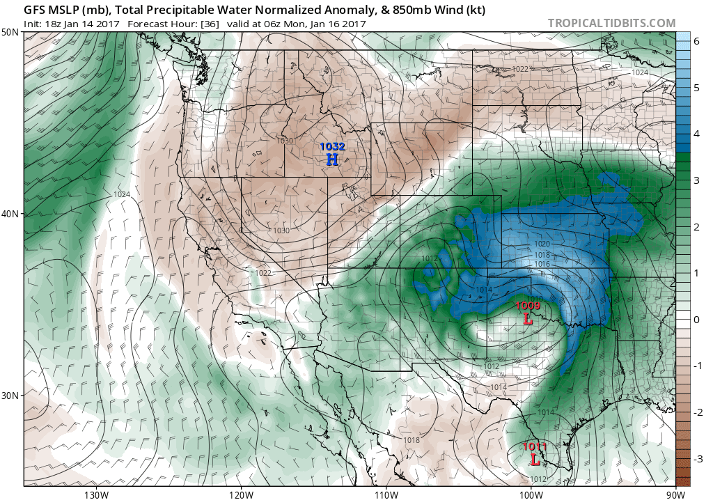
GFS precipitable water (moisture) anomaly and sea-level pressure for Sunday night
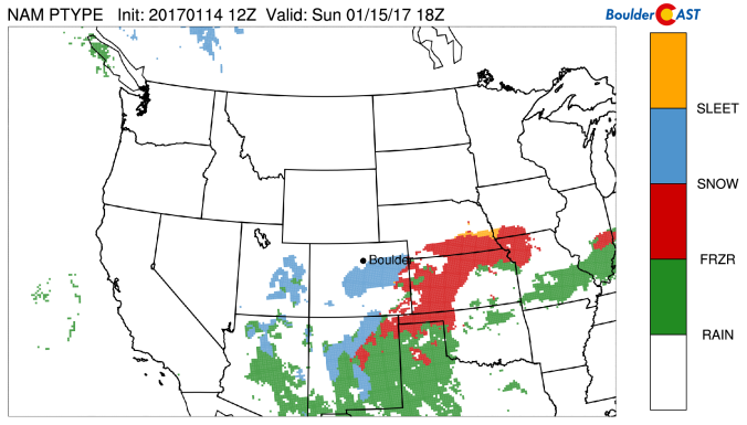
As that warm/moist air over-runs the cold airmass that is already in place across Colorado, a wintry mess of precipitation will fall across the eastern Plains on Sunday into Monday, particularly in southeast Colorado.
Our state in general will be getting off easy this time around. The map below shows the HUGE area of the country to be impacted by this storm, mostly in the form of significant accumulations of ice.
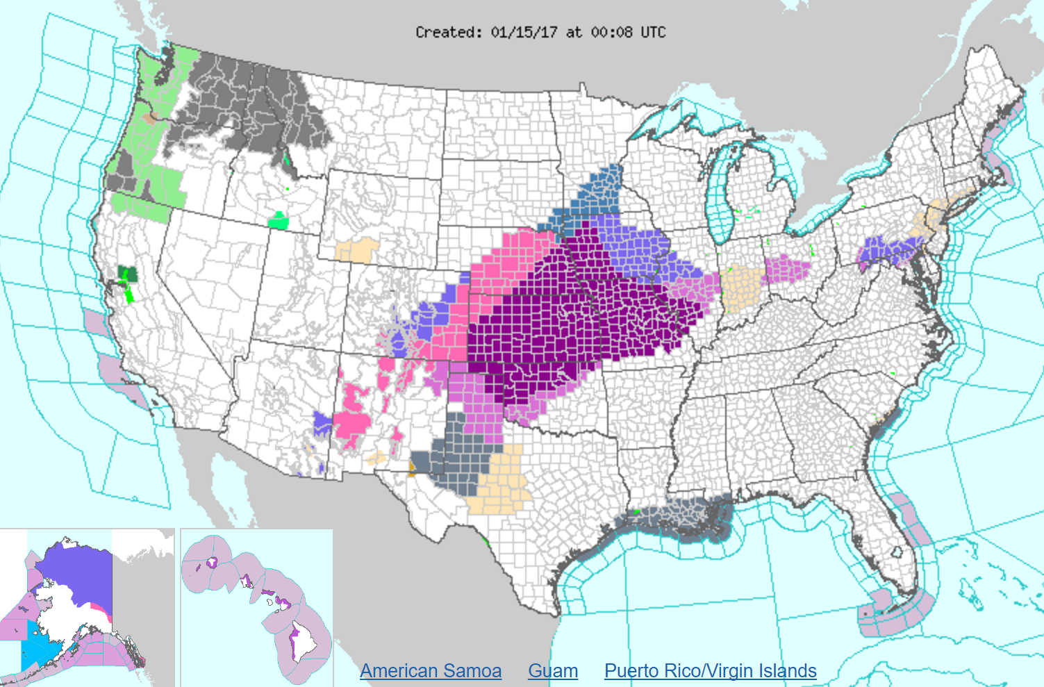
Current highlights from the National Weather Service as of 5pm MT Saturday… Colorful to say the least.
The entire state of Kansas is under a wintry warning of some type, with an 80%+ chance of exceeding 0.10″ of ice statewide (according to NCEP – see below).
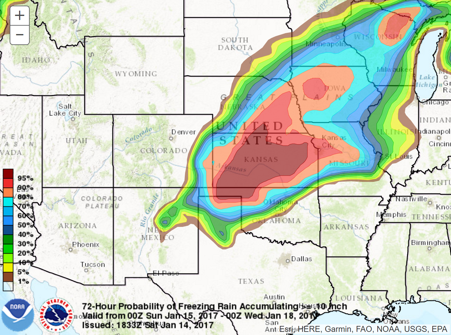
NCEP probability of freezing rain accumulations exceeding 0.10″
Denver and Boulder will be far enough north to keep any precipitation that does fall in the form of snow. However, that distance also means we’ll be right on the fringe of the precipitation shield entirely. In fact, with the surface low all the way in central Oklahoma, some places may see nothing at all, especially north and west of Denver.
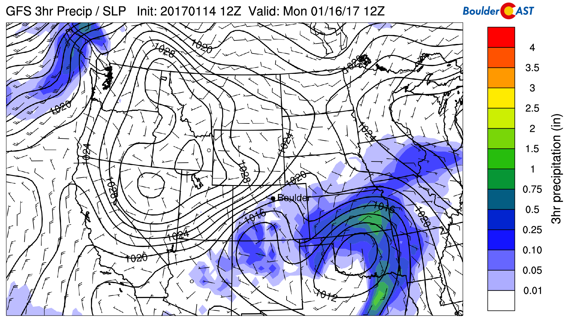
GFS pressure and precipitation map for Sunday night
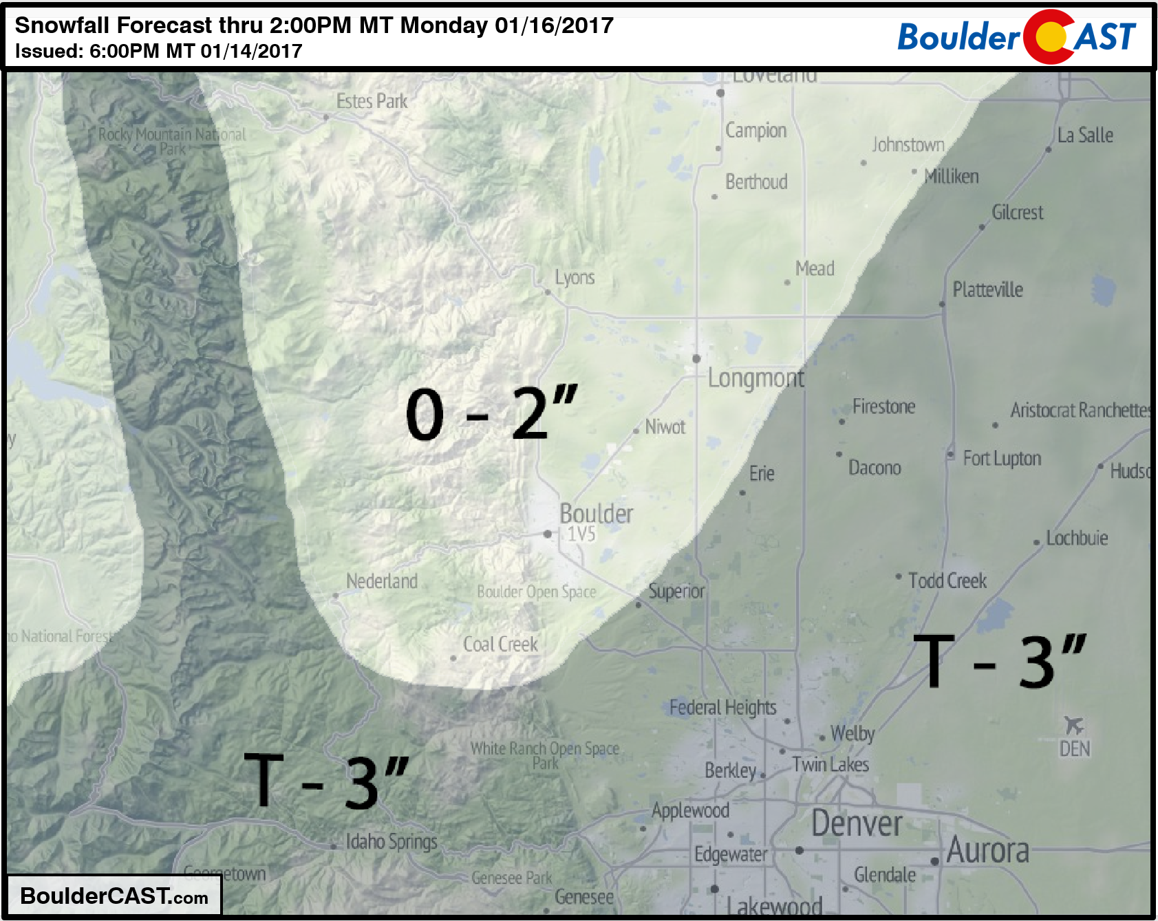
While light snow/flurries will be possible for the Front Range beginning Sunday early afternoon, the best chance of snow accumulating for the region will be Sunday evening and night. Even then, most areas should see 1″ or less, except possibly locations east and south of Denver, which could see several inches if things come together. The main forcing for Boulder will be upslope, but the low-level winds will be more north-northeasterly, favoring the Palmer Divide south of Denver for upslope. For this reason, we’re not expecting much in Boulder County.
At this juncture, the storm track is fairly consistent model-to-model and run-to-run. The NAM and Canadian have been trending further north and west with the precipitation shield; the GFS and Euro…not so much. Again, because we’re right on the fringe, we do expect some places to see a few inches, while others see nothing. Our snowfall forecast map for the event is shown below:
In summary:
- A southern-track storm will skirt to our south, bringing the threat of light snow the region Sunday afternoon into Monday morning.
- Snow accumulations will mostly occur Sunday night, with up to 3″ possible in areas south and east of Denver. Less is expected north and west towards Boulder. Some spots could even see none at all.
- Travel impacts should be minimal, but if your heading east on I-70 towards Kansas, or south on I-25 over the Palmer Divide, travel will be worse but likely not impossible.
- Ski Forecast: A couple of inches or less of powder will be possible Sunday night for the ski resorts. This is not a favorable Mountain snow set-up by any stretch of the imagination.
Post storm, a warming trend will continue into mid-week with temperatures quickly jumping back into the 50’s or low 60’s. More on this “heat wave” in our weekly outlook on Monday.
Have a good end to the weekend!


