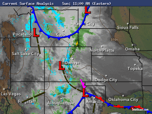
The storm is beginning to ramp up across our region, though it is now following a slightly more southern track. How will this impact the forecast?
Easterly flow has strengthened across the region, with widespread rain/drizzle engulfing most areas after midnight last night, with light snow accumulations above 9000 feet. A persistent, heavier band of showers and storms along a north-south oriented convergence line is sliding west and will be effecting Boulder County before noon.
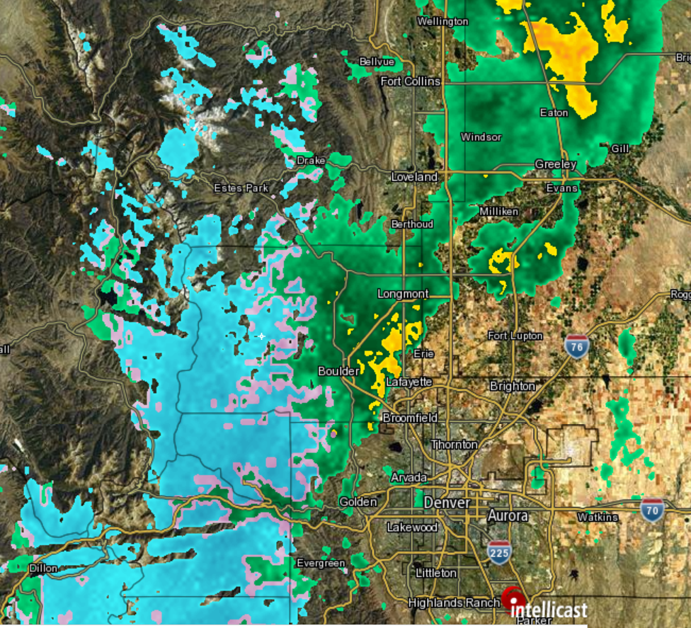
Current radar for the region as of 11am Sunday, with a band of moderate rain and mountain snow in Boulder County
As we warned, and as a few of the models were hinting, the storm will be taking a slightly more southern track, though only by ~100 miles. In the image below, shown on the left is the GFS’s model prediction of the closed-low from Friday, valid at 6pm Sunday. On the right, is this morning’s GFS run, valid for the same time. Notice how the model’s prediction of the low has shifted slightly south and east.
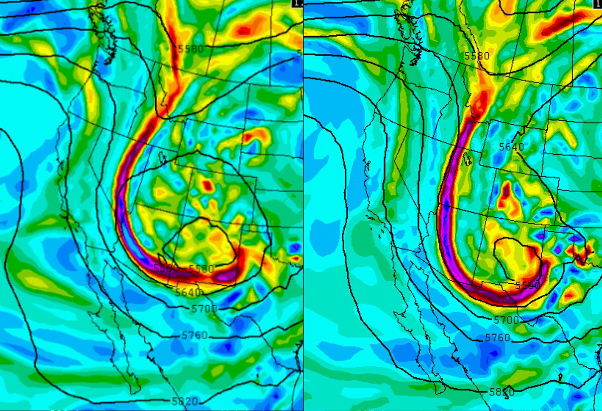
6pm Sunday 500mb GFS forecast from Friday (left) and from this morning (right). The forecasted location of the closed-low has shifted south and east.
This shift in track will have two main impacts on our region:
- It will move the stronger easterly upslope flow and synoptic forcing even further to our south. Overall, this will minimally reduce our precipitation totals. There is still plenty of moisture around and decent prolonged upslope into Monday morning. On Friday, the forecast was for 1.0 to 2.0″ of precipitation from Boulder west. Now, 0.5 to 1.5″ looks more reasonable.
- This track will draw southward marginally cooler air, lowering snow levels by 500 feet from original projections. Levels are currently around 9,000 feet and will be falling to ~7,000 feet overnight tonight.
The best period of upslope and available moisture is between now and about 3am Monday, after which precipitation should begin to lighten up as winds become more northerly and drier air moves into NE Colorado. As mentioned, snow levels will be falling through the day, especially after sunset this evening. However, the coldest air will not arrive in time to overlap with the best forcing for precipitation. Because of this, snow totals will not be as large as they could be in many areas of the Foothills.
The Forecast:
Plains: Things are still on track for a very soggy Sunday and showery Monday. Expect a prolonged period of light to moderate rain through midnight tonight, with temperatures hovering in the mid to upper 40’s, falling to near 40 overnight into Monday. Low clouds and drizzle will linger into Monday evening. With less precipitation coverage, Monday should bump up the thermometer a few degrees over Sunday.
High County: Areas above 9000 feet will be in store for a decent snow event! Snow is already falling and will continue, heavy at times, through this evening with temperatures near 30 degrees. Snowfall rates of 1 to 2″ per hour are not out of the question this afternoon. Snow levels will be dropping through the day. Locations of Boulder County above 9000 feet are under a Winter Storm Warning and can look forward to accumulations of 6 to 14″ by late morning tomorrow, with the greater amounts on east facing, higher elevation slopes. Areas between 7000 and 9000 feet should expect 3 to 8″ of heavy, wet spring snow. A rain/snow mix may make its way down to 6,000 feet overnight, but don’t expect any accumulation.
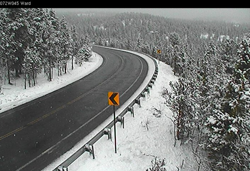
Current view of Peak to Peak Highway, near Ward, at 11am Sunday, where a couple inches of snow has already fallen.


