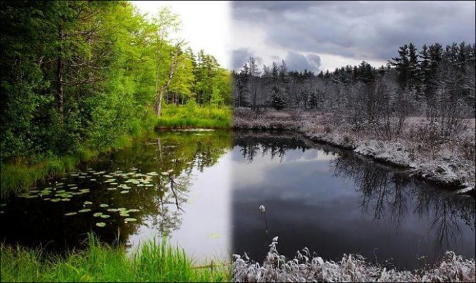
Whether you’re ready or not, bitter cold temperatures and snow are coming to the Front Range Wednesday night into Thursday! We discuss the forecast for the winter storm that will end the growing season, obliterate temperature records, and produce our first snowfall of the season.
PREMIUM STORM UPDATE (Thu October 10th 8:00 AM): Heavy snow arrives just on schedule! Click to read.
We discuss Boulder and Denver weather every single day on BoulderCAST Premium.
Sign up today to get access to our daily forecast discussions every morning, complete six-day skiing and hiking forecasts powered by machine learning, access to all our Front Range specific weather models, additional storm updates and much more!

I
n typical Colorado fashion, you’d hardly know that our first snow of the season is less than 36 hours away! Temperatures across the Denver Metro area this afternoon have soared to near 80 degrees. While not quite record-breaking, this is more than ten degrees above normal for this time of year and is what we in the weather-world like to call the “warm before the storm”.
We’ve been closely monitoring this winter storm for several days now. In fact, it has been rather consistent in most of the major weather models since last Friday when we brought the threat of snow to the attention of our Premium members. As of Tuesday afternoon, the storm has crossed the border into Washington state and will be dropping into Colorado by late Wednesday night. The GFS 500 mb height anomaly animation below shows the movement of the storm as it progresses across northern Colorado and Wyoming in the coming days.
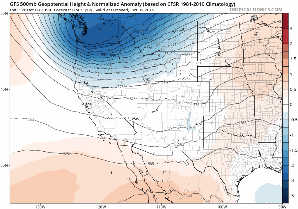
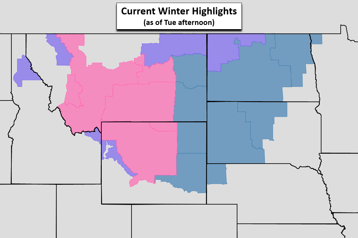
Admittedly, the incoming storm’s track is one that we would normally deem too far north. The bullseye for heavy snow is mainly over northern Wyoming, Montana, and the Dakotas. Winter Storm Watches and Warnings are already in effect for just about everywhere north of Cheyenne.
Despite the storm’s lousy track, there will be two favorable aspects in-play that allow us the ability to guarantee snowfall for everyone across the Front Range….
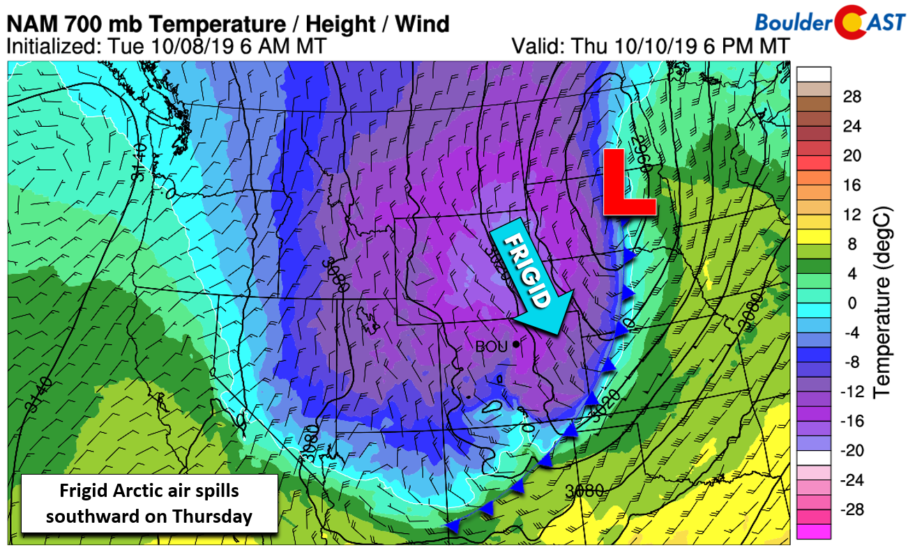
First, this system is packing extremely cold air for how early we are in the season. As the surface low intensifies across South Dakota Wednesday night into Thursday, very cold air will filter down on its backside into Colorado. While it’s a little too early for a true Arctic airmass to develop, this front will act very much like a winter-time Arctic boundary when it passes through Boulder and Denver Wednesday evening. We’re talking gusty north winds up to 30 MPH and temperatures plummeting from the 70’s into the 30’s in a matter of a few hours. If your garden has managed to hang on this long, we commend you. However, the fat lady is singing her grand finale; growing season will abruptly end Thursday for all of eastern Colorado. This comes with many areas having not even experienced their first frost yet!
Temperatures will fall into the 30’s Wednesday evening and eventually into the 20’s overnight. On Thursday, the Foothills likely will stay in the teens, while the Metro area struggles to get out of the 20’s. This is more than 40 degrees below normal, a bitter reminder that winter isn’t far away despite how deceivingly warm autumn tends to be in our area.
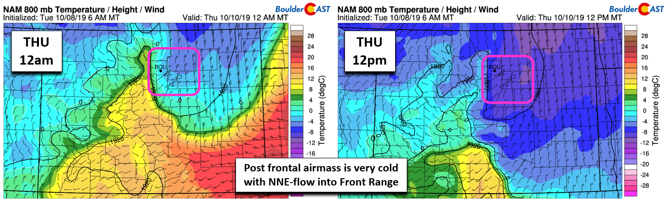
All of this cold air will help falling snow combat the very warm ground temperatures and encourage accumulation. It will also produce a surprisingly fluffy snow, especially in the Foothills west of town.
The second favorable aspect of the storm, which is actually the most important one, is the presence of a jet streak along the southern flank of the storm system. While the main portion of the winter storm will pass well north of our area (boo!), this jet is expected to move directly overhead during the morning hours on Thursday. Models have been and continue to show a favorable orientation to produce concentrated lift and bands of heavy snow across the Front Range during this time.
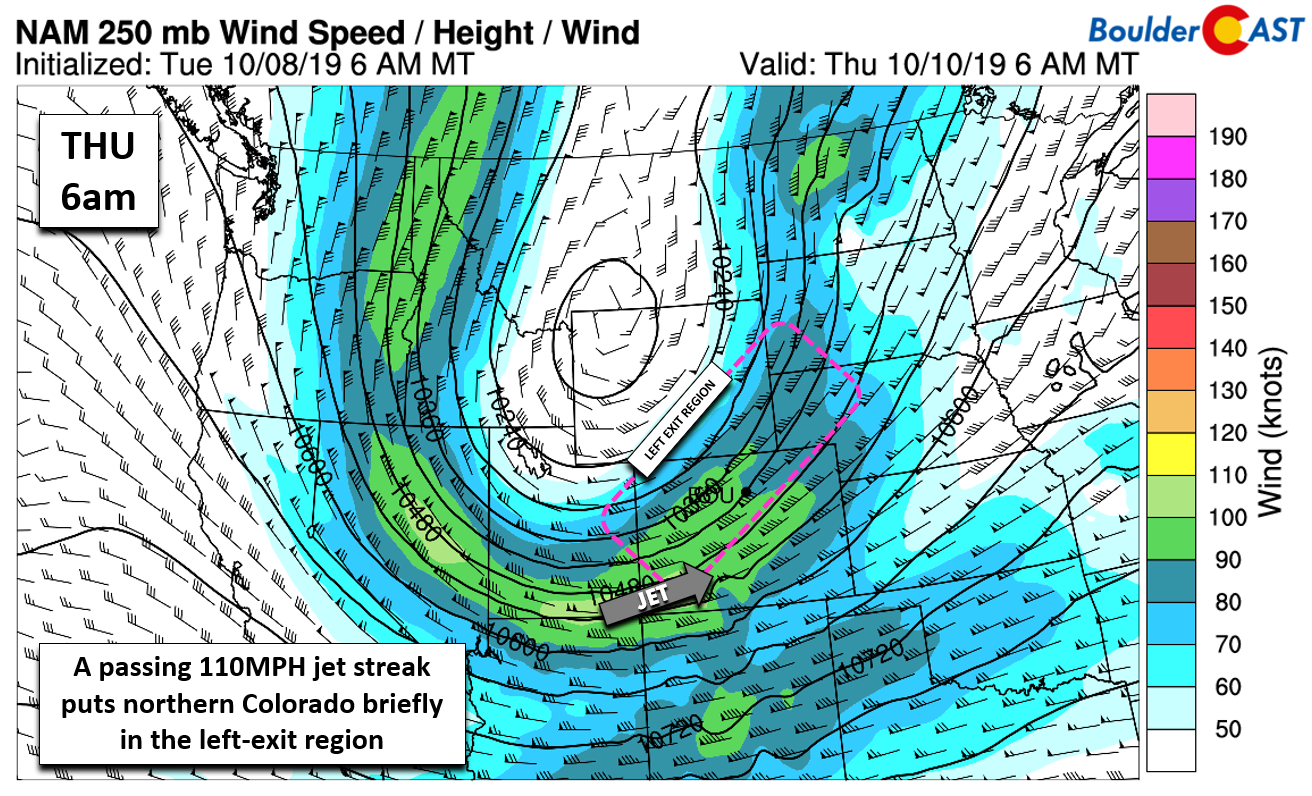
Ultimately it’s the jet and these bands that will produce the most snow for our region, which is both good and bad. Despite good model agreement, the exact location of these bands are difficult to predict this far in advance. The GFS has been targeting the Front Range for many days now, which is not typical. We’re seeing similar agreement as the higher-resolution models begin to come into focus as well. With this consistency, our confidence in the existence of the bands is high for about a six-hour window Thursday morning into the early afternoon.
Timeline
Enjoy the “warm before the storm” on Wednesday! Morning sun will give way to increasing clouds with temperatures reaching the mid to upper 70’s. The powerful cold front will move in around 6:00 PM, plus or minus an hour or two. Gusty winds and the smell of the feed lots will roll across the Front Range during this time with temperatures rapidly dropping into the 30’s.
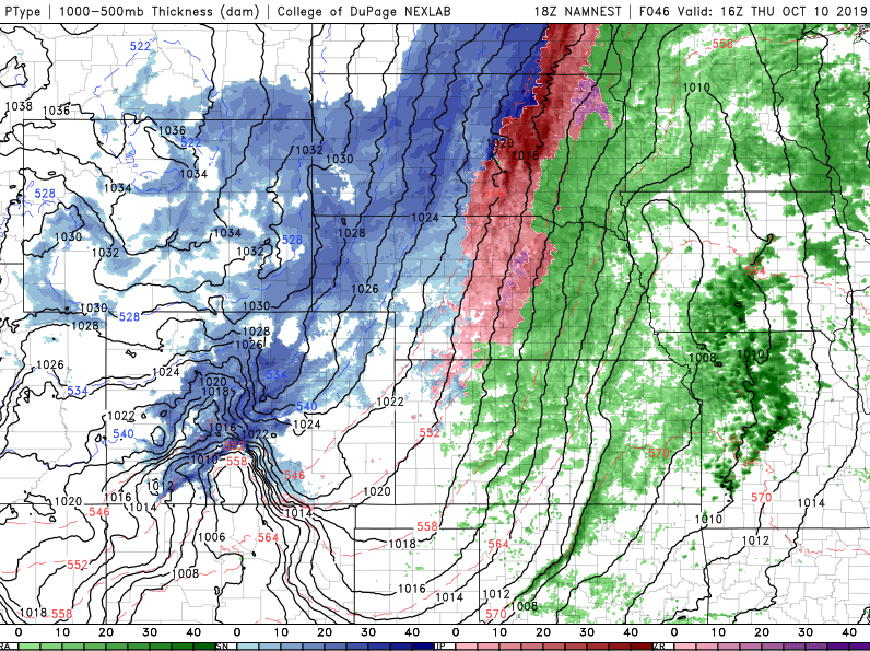
There could be a brief period of a light rain or drizzle, but a complete change-over to snow will be happen near or just after midnight as a deep and very cold airmass makes itself right at home. Freezing drizzle turning to light snow will be possible during the overnight hours as shallow upslope takes hold and temperatures fall into the 20’s. The main event, the “meat and potatoes” of the storm, will be the passage of the jet Thursday morning. Again, we stress that the exact timing and placement of the associated heavy snow bands are not set in stone, but they will likely be scattered across the Metro area most of Thursday morning. Snowfall rates of 1 to 2″ per hour in these bands may cause brief white-out conditions.
By afternoon, the jet forcing will have pushed into southeast Colorado, but a frigid and saturated airmass will linger over Boulder and Denver. Though north-northeasterly winds will be light and overall not a great direction for upslope, light snow could linger into the late afternoon or evening especially in the Foothills and the nearby suburbs (we’re looking at you Boulder).
Winds turn northwesterly rather quickly as the storm system pulls further north and east Thursday night. This will shutdown any lingering snow showers and eventually cause the skies to clear paving the way for bitter cold temperatures come Friday morning. At this point, there isn’t a single model forecast that doesn’t have the entire area obliterating existing record lows Friday morning. If we’re lucky, temperatures will only bottom out in the middle teens. However, some forecast guidance drops us into the single digits, something that has never happened this early in the season! The timing of the clearing skies may be just a tad too late which has our expectations trending a smidgen warmer than single digits, but still at least five degrees below existing records for the date in most cities.
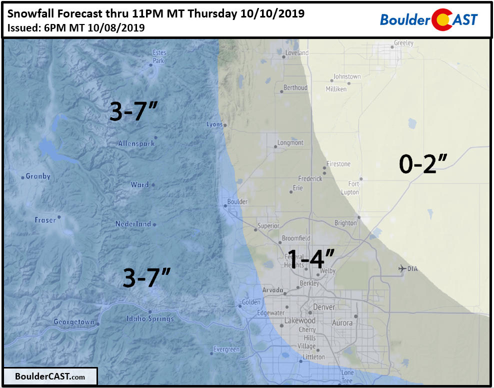
Snowfall Amounts
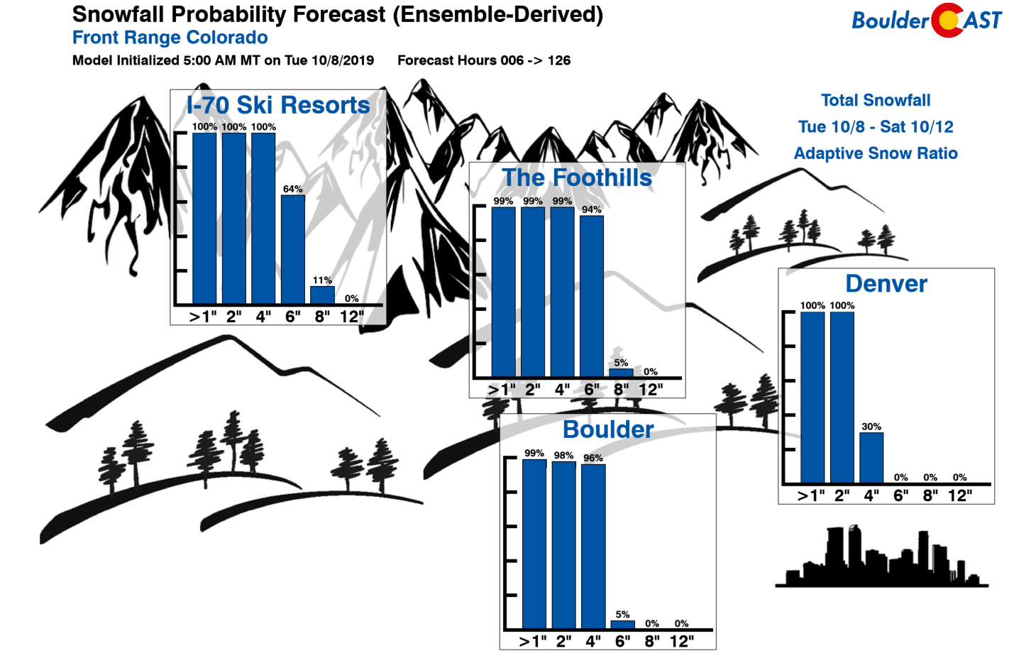
Given the influx of moisture, very cold temperatures, and shallow upslope in the forecast from Wednesday evening through Thursday afternoon, it’s conceivable that at least light snow will be falling in many areas for a good 12 to 18 hours. Adding in the expected heavy snow bands, most of us will see an inch or two of snow, with perhaps several inches more in localized areas. Our snowfall probability charts are right in-line with our current thinking (below).
Our official snowfall forecast map is shown below. Depending on how the model runs are looking tonight, we may issue an updated forecast on Wednesday.
Given this very early and extremely cold snow event, we have a few words of caution:
- Prepare your outdoor pipes, faucets, hoses, and irrigation systems for winter. Anything exposed will freeze solid by Friday morning. That is a certainty.
- Almost all of the trees across the Plains have extensive foliage. Even a few inches of snow could be troublesome. If amounts push towards or past the upper bounds of our forecast amounts, things could get ugly…
- Watch for icy roadways Thursday morning. Melting snow on the warm pavement could freeze quickly as temperatures tumble, especially on bridges and overpasses. Brief whiteout conditions could ensure within any heavy snow bands.
Be safe and try to make the best of our early taste of winter!
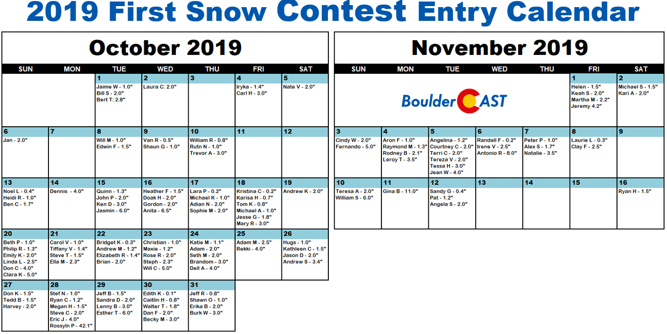
P.S. It looks like there is a clear front-runner in the 5th Annual BoulderCAST First Snow Contest….
We discuss Boulder and Denver weather every single day on BoulderCAST Premium.
Sign up today to get access to our daily forecast discussions every morning, complete six-day skiing and hiking forecasts powered by machine learning, access to all our Front Range specific weather models, additional storm updates and much more!
.
Spread the word, share the BoulderCAST snow forecast!


You must be logged in to post a comment.