From freezing drizzle, to fog and rain, to thundersnow and blizzard conditions, Friday’s storm system had it all across northeast Colorado! Or did it? As expected, its quick progression and lack of cold air ultimately left us with rather unimpressive snow totals. We take a quick look back at how Friday’s winter event played out across the Denver Metro area.
Despite our strong tone of confidence in our last forecast update issued for the event Thursday afternoon, we were admittedly a little uneasy as the system approached and models continued to advertise low-end chances for a more concerning scenario for the Front Range. Even as the rain/snow began Friday afternoon, global and high-resolution models were still confused on exactly where the low pressure would form and how much of the heavier wrap-around snow would impact our area. This isn’t surprising for a storm system that was tracking almost directly west to east across Denver on Friday. Any shift north in the storm’s track and we would be completely downsloped. Any shift south and the upslope could really enhance things. As the National Weather Service scrambled to add Winter Weather Advisories and even Blizzard Warnings Friday afternoon just east of our area, we decided not to make any forecast adjustments. The overly snowy scenario didn’t make much sense to us and was too of a long shot in our opinion.
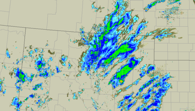
In the end, the storm evolved just as we expected Friday evening. As it came over the crest of the Rockies, a strong low pressure developed along I-70 in eastern Colorado, a little too far north and east for much upslope in our area. There were many factors that contributed to a period of intense precipitation across the Front Range, but ultimately it was the speed of the storm and the overwhelming swift shift to downslope that killed this storm’s potential in the Metro area.

While it lasted, rain and snow rates were impressive. With temperatures in the low to middle 30’s, moderate to heavy wet snow fell on much of area Friday evening. There were even a handful of thunderstorms east of Denver heading towards the Kansas border resulting in nearly 100 strikes of lightning.
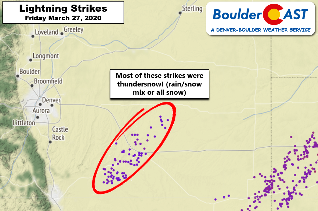
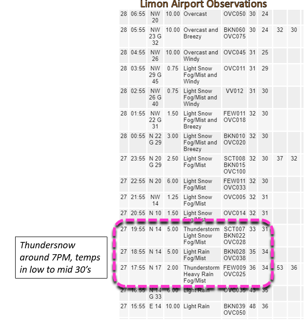
Several of the thunderstorms passed directly over Limon Friday night where heavy rain/snow along with thunder were reported for nearly two hours as temperatures sat in the low to middle 30’s.
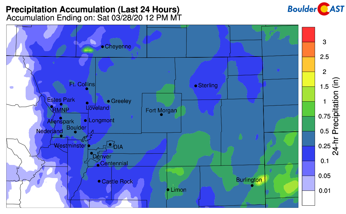
There’s not a lot of reliable snowfall observations from the eastern Plains of Colorado, but we were unable to find any reports greater than 4″ of snow between Denver and Kansas. Mostly reports were 2″ or less. The winds did get nasty overnight as the storm intensified (possibly making actual snow amounts hard to measure), but true blizzard conditions likely were not observed in the blizzard-warned counties where the National Weather Service was forecasting 4-10″ of snow and 55 MPH winds.
Shown below is our snowfall forecast map for the Front Range issued Thursday afternoon with actual storm totals overlaid in boxes. Green boxes indicate that our forecast verified to within one inch of the observed snowfall. Red did not. Overall, we had complete forecast verification with the only real slight disappointment coming from the Foothills of Jefferson County.
OFFICIAL TOTALS
Boulder: 2.1″ (Trace – 2″ forecast)
Denver: 1.0″ (Trace – 2″ forecast)
Largest Report: 7.2″ near Ward in Boulder County

This brings Boulder’s seasonal snowfall total to ~115″.
| Seasonal Snow Totals (Updated March 28 2020) |
|---|
| Boulder | Denver |
|---|---|
| 114.7" | 48.7" |
With no real chance of any additional frozen precipitation through Tuesday across the lower elevations, Boulder will end March with 16.3″ of snow for the month. This is about 1″ below normal.
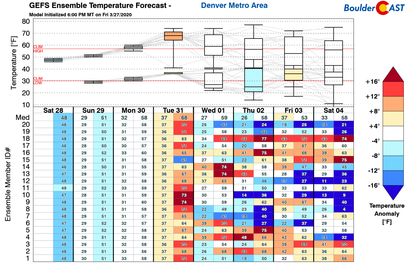
Temperatures will be warming up over the next several days transitioning back above seasonal normals by Tuesday. However, models start to diverge significantly by the middle of next week. Will we see a shift into the warmth of spring, or return to winter? Check back on Monday for our weekly outlook to find out!


You must be logged in to post a comment.