Winter has made quite the return across the Front Range this weekend! Snowfall totals from this weekend’s storm ranged from a couple of inches to a couple of feet. Continue reading as we provide a brief recap of what could potentially be our last snow event until Autumn.
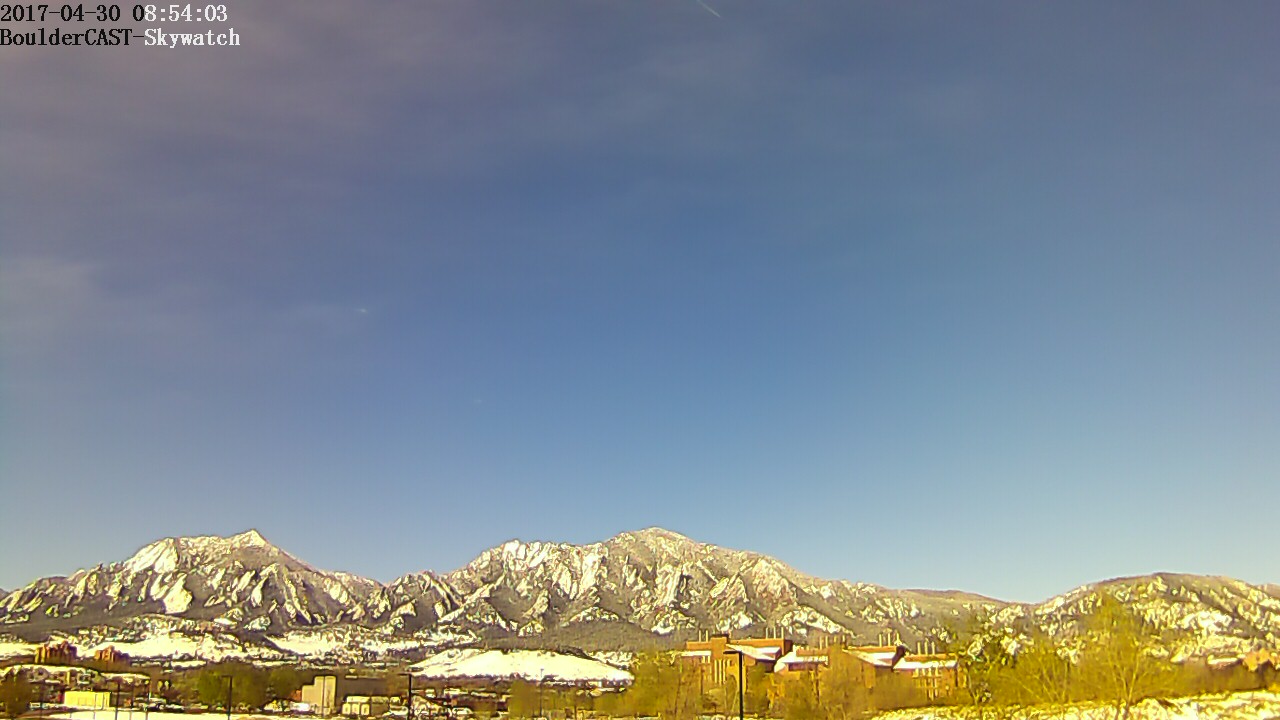
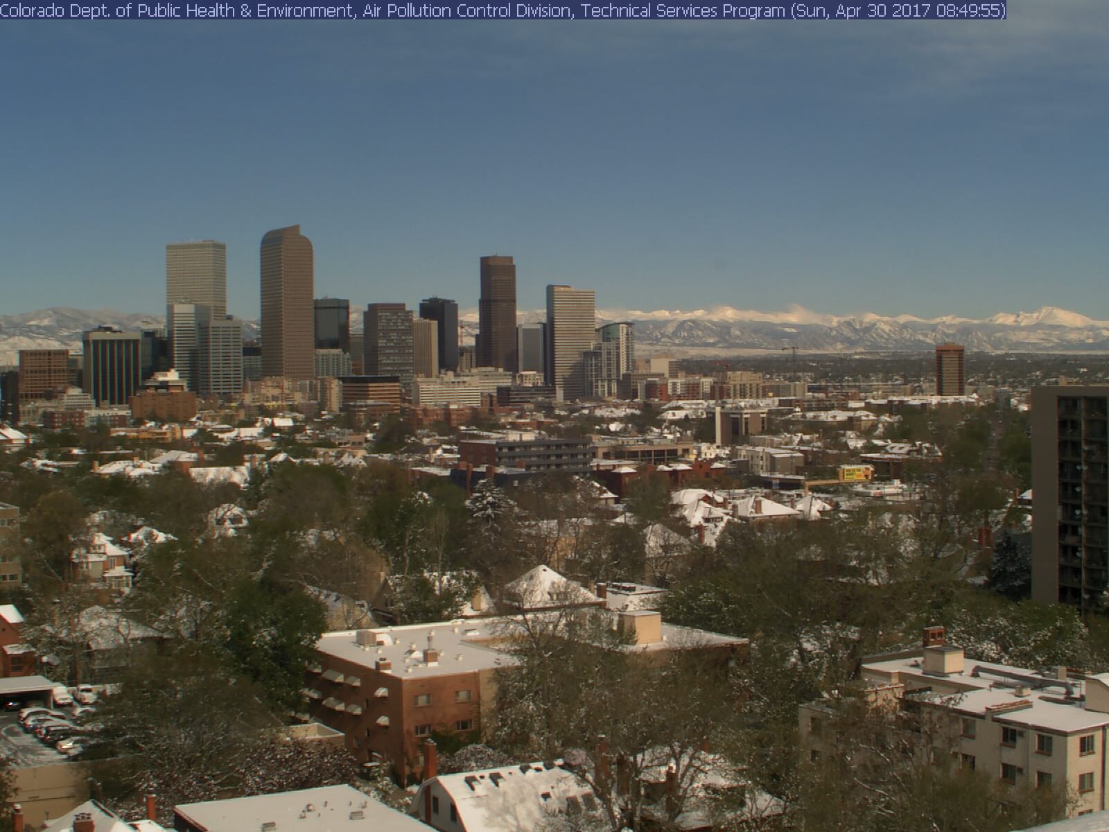
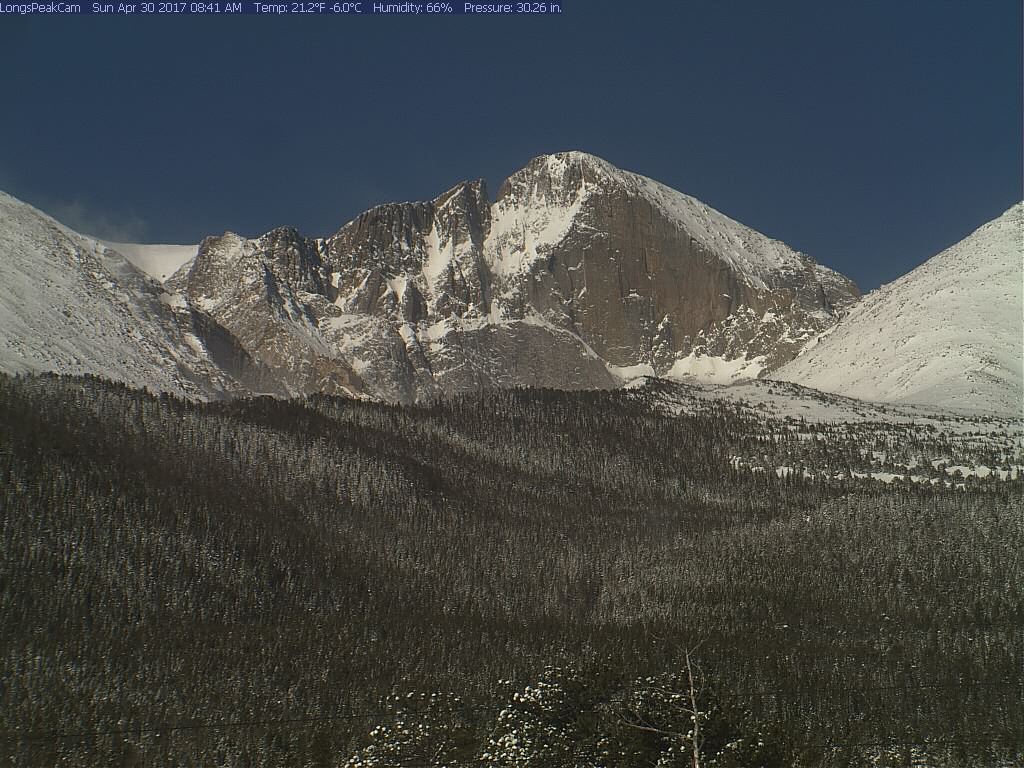
Let’s start with a visual representation of winter’s return! Here’s the wintry scene as of Sunday morning in Boulder…
Denver…
The Foothills…
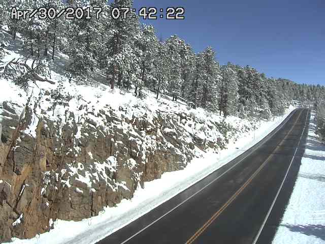
And on Longs Peak…
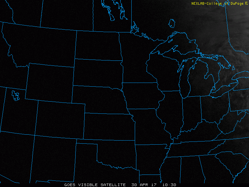
Cold air and abundant moisture teamed-up to produce widespread snow across the Denver Metro area Friday afternoon into Saturday night. The current animated visible satellite loop below shows the core of the storm has since moved eastward into Kansas. In its wake, sunny skies, melting snow, and vegetation that will hopefully make a recovery.
The storm largely played out as expected for our region. We did dodge somewhat of a bullet though as the storm system’s movement has since slowed from what models were projecting. This slowdown will have more of an impact on southeast Colorado and western Kansas snow totals. Though, areas of the Plains already cashed in on numerous hours of additional light snow Saturday afternoon and evening.
Shown below is a 72-hour snowfall analysis map for Colorado ending at 6AM Sunday.
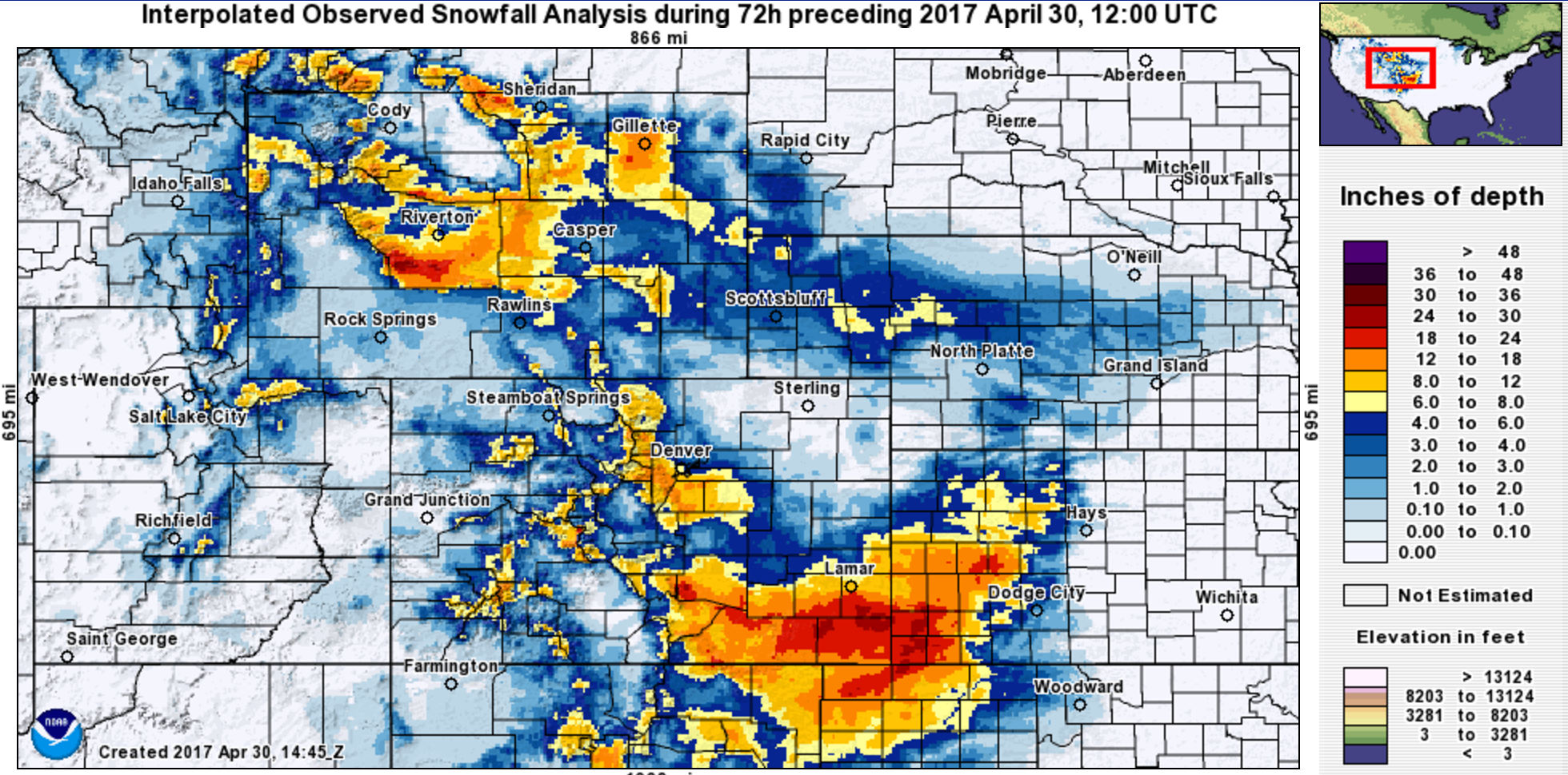
We see patches of heavy snow in Wyoming, a mass of extreme snowfall in southeast Colorado (more than two feet!), and significant accumulations encroaching on the southern and western portions of Denver where upslope had the biggest impacts. This should look quite familiar to a graphic in our original forecast:
Overall, the models did a great job with this storm for our region in particular (maybe not so good in other locales). The track was forecasted more-or-less correctly four or five days out. The finer details are always a challenge due to the local topography, but we think our interpretation was fairly good for this event. Unless you live in eastern Boulder County or near DIA and bought into the Winter Storm Warning issued by the National Weather Service, we’d say most folks ended up with about as much snow as expected. Melting and breezy conditions during the height of the snowstorm prevented major power outages, while travel impacts were minimal as roads largely remained just wet.
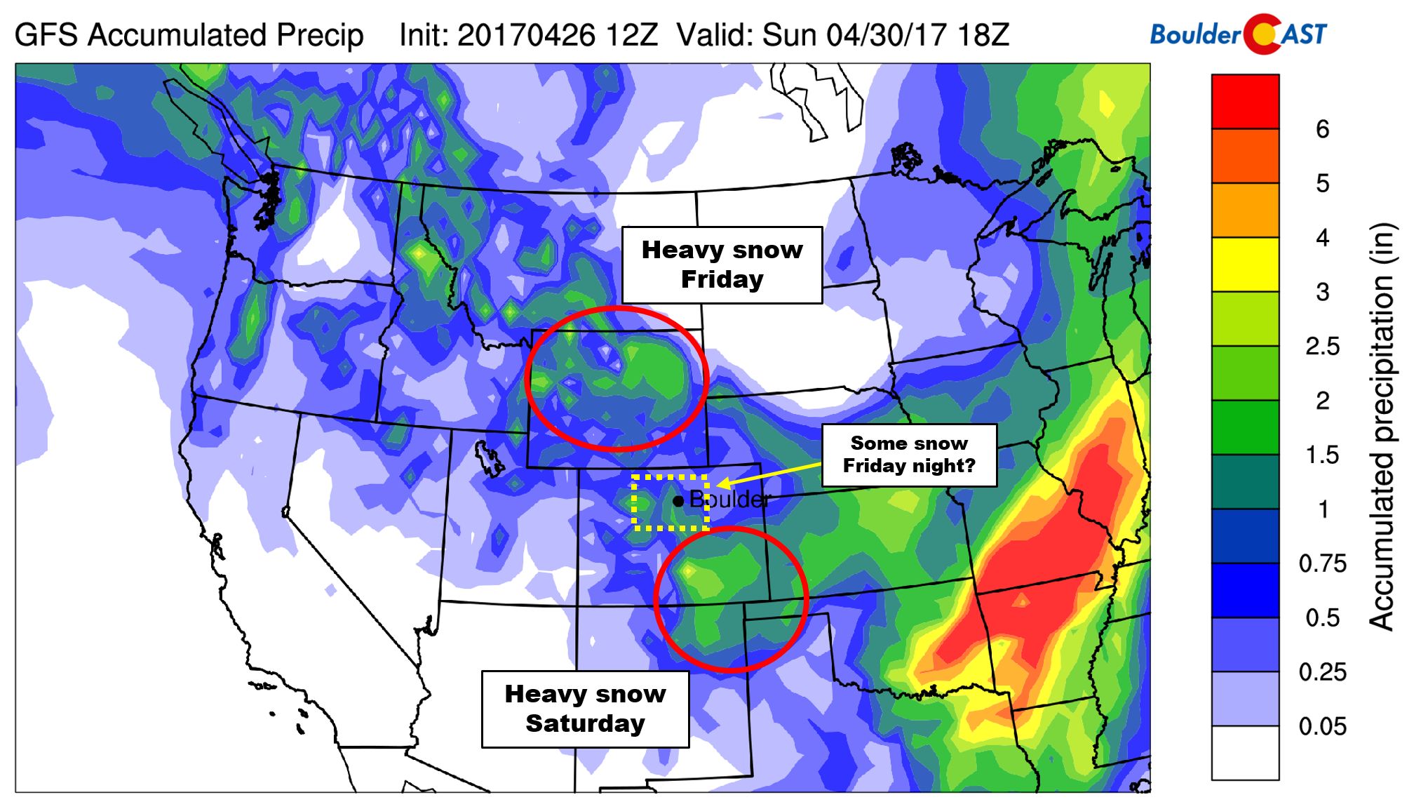
Shown below is our original forecast map created early Friday morning. The observed storm totals per location are contained in boxes. Green ones indicate that the observed snowfall was within one inch of the given forecast range, while red was outside the scope of our forecast.
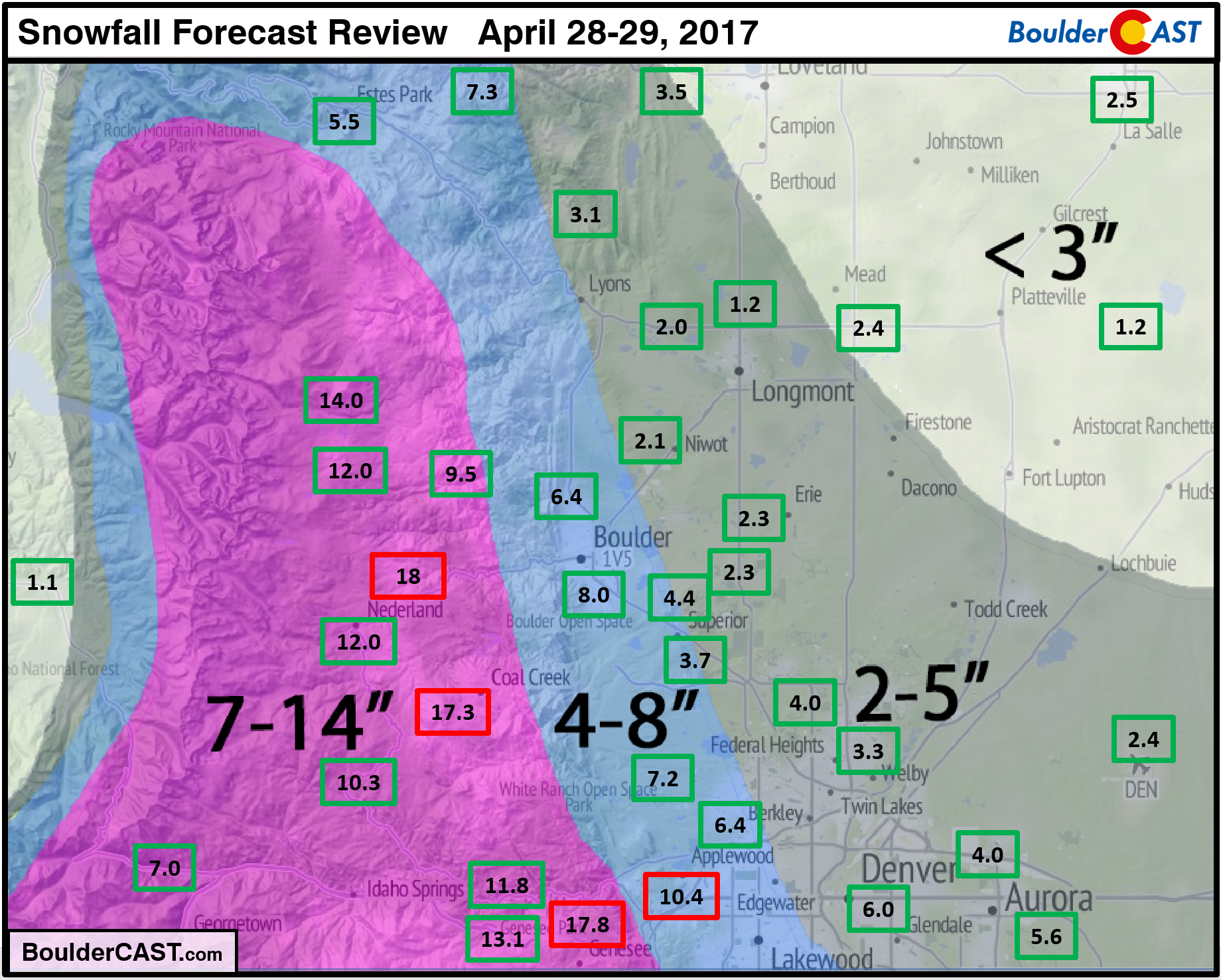
Predominantly green across the region. Trouble spots were mostly in the Foothills which exceeded 15″ in some cases. There were even a few reports suggesting two feet of snow may have fallen, though we are somewhat skeptical of these.
Boulder’s official total for the event was 7.8″, bringing our seasonal snowfall to 65.4″. This is approximately two feet below normal. Even worse, Denver only managed 2.4″ of snow from this storm officially at DIA. This brings Denver’s seasonal total to a dismal 21.8″, just barely enough to prevent this winter from being the least snowy on record (it’s now the second lowest). To put this into perspective, Boulder’s April 2017 snow total alone is almost 20″…
With April coming to a close, this could very well be the last flakes we see across the lower elevations this winter, but maybe not… May snowfall has been recorded 15 out of the last 18 years in Boulder, so don’t put those snow shovels away just yet! More on this in our May monthly outlook post, which should be published on Tuesday….
P.S. This weekend’s snowstorm eliminated nearly two-thirds of the participants in our Late Season Snow Contest….Mother Nature can be very cruel!