A few big changes in the models in the eleventh hour last night brought the threat of heavy snow westward into the Boulder area. How much more is going to fall? Read on to find out.
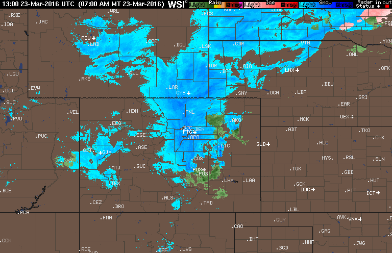
Up until the very last model run, Boulder was set to be mostly spared from this storm, shielded from the brunt of it by westerly downslope winds. As the onset approached, it became clear this was going to be a much more significant snow storm than originally advertised. In fact, Boulder was at the epicenter.

The storm was more intense and tracked further south, removing downslope from the equation, replacing it with strong upslope.
Rain developed last night around midnight, changing to snow by 2:30AM. We actually picked up about 0.5″ of rain before the change-over occurred. In the next six hours, heavy snow set up across most of the region. With temperatures near or slightly above freezing, roads have become a soupy mess. Just about everything across the Denver Metro is closed, with power outages speckled across the Front Range. We warned late last night that this storm seemed eerily similar to the “surprise” snow storm back in mid-December. If you recall, that storm dumped 11″, mostly between 3 and 9AM, shutting down Boulder in a similar fashion to today.
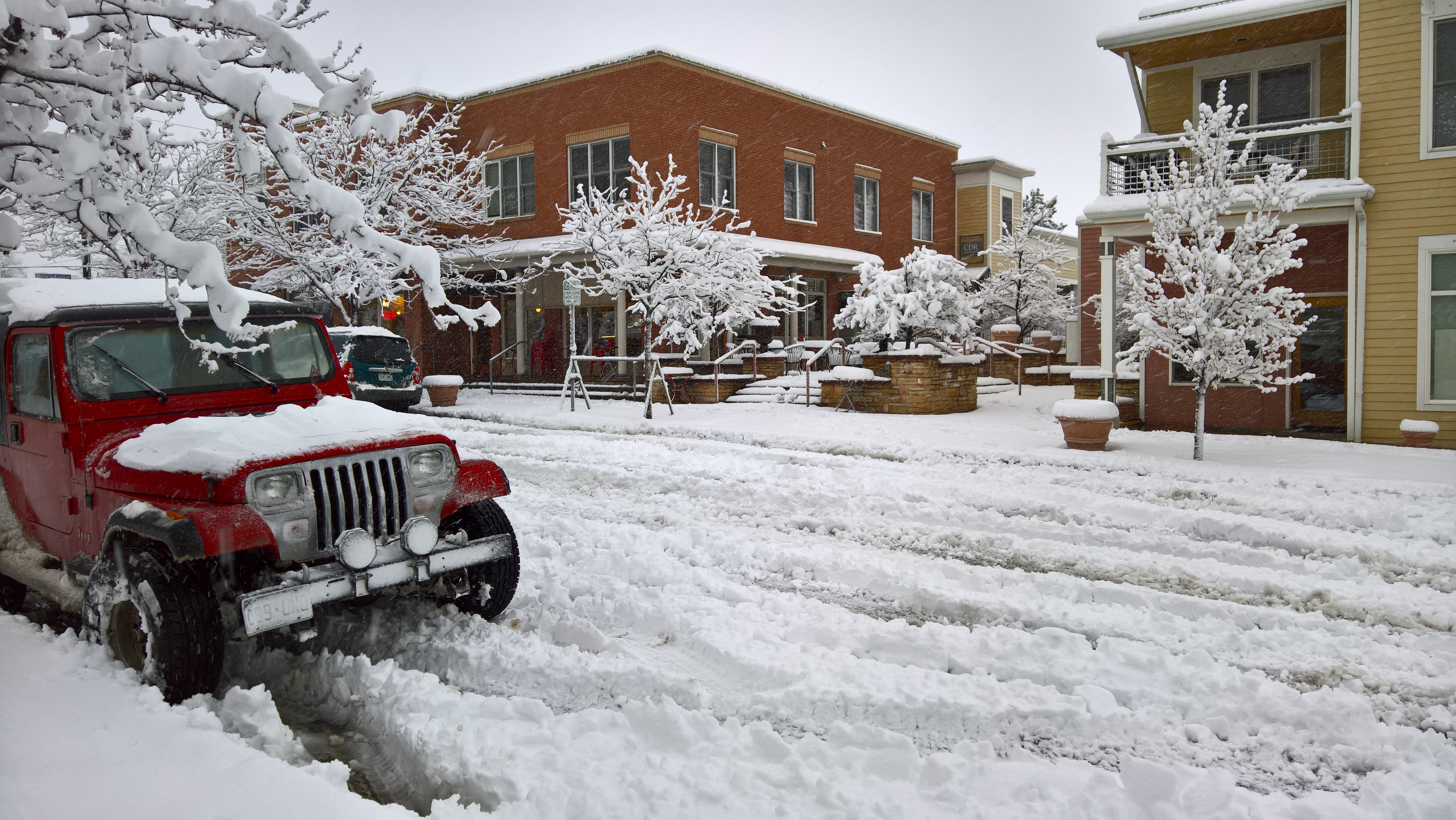
Roads out there are ugly | North Boulder
A look at early reports indicate about 6-10″ has fallen on the Plains of Boulder County through 9AM. In the Foothills, totals up to 20″ have been observed near Gold Hill. Remarkably, anywhere from 1.00 to 2.00″ of liquid equivalent has accumulated! Excluding the first 0.5″ of rain, the snow-to-liquid ratio for the event so far is a measly ~6:1. That is no doubt making shoveling today an utter chore.
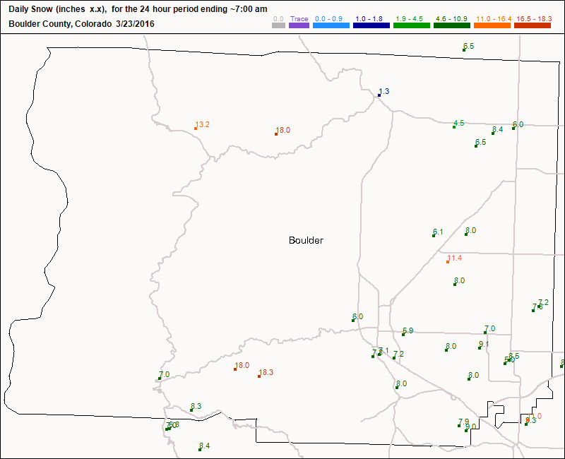
Boulder County snow reports through 9AM
West Denver has similar accumulation to Boulder thus far, with east Denver lagging behind by several inches (due to later onset).
When will it end?
HRRR and RAP models show moderate snow continuing into the afternoon for Boulder and Denver, finally tapering off by 6pm or so. We’re thinking 3-7″more for Boulder, 4-9″ for Denver. Despite snow continuing through the day, temperatures will be warming up and the sun angle increasing. As a result, there will be lots of melting and sludge. At lower elevations, the amount of snow on the ground won’t increase all that much. It will definitely be hard to judge how much more snow has really fallen, especially with the wind.
Temperatures will be in the low to mid 30’s for the Plains, with 20’s higher up.
In the Foothills. we could see some locations top 30″ before the storm pulls out, something that seemed damn near impossible less than 24 hours ago. Bravo, Colorado! You never cease to amaze us!


