The first of two spring storms that we detailed in our weekly outlook arrives today and lingers into Wednesday. We provide a brief update and discuss which areas will see snow and which stay mostly rain.
We’ll preface our forecast by saying that this storm system overall has a “look and feel” very, very similar to last week’s storm that brought rain/snow to the Denver Metro area.
The similarities include:
- Upper-level low tracking well to our south across New Mexico today and tonight.
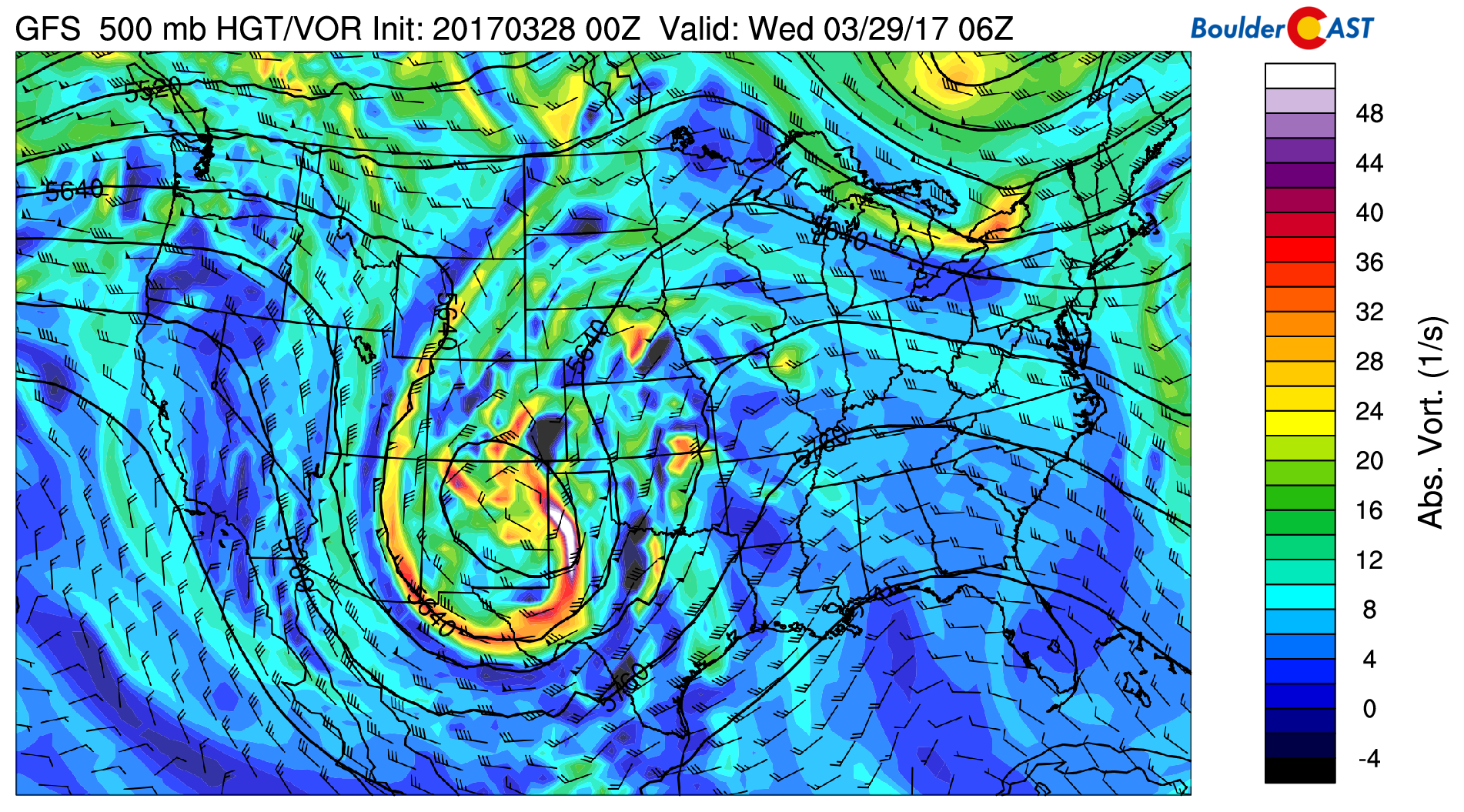
GFS 500 mb vorticity map for Tuesday night showing the upper-low tracking across New Mexico
- Due to this track, the best forcing with this system will remain in southern Colorado. Denver and Boulder will be on the northern fringe of the system once again.
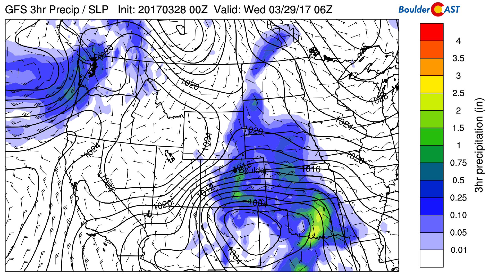
GFS precipitation and sea-level pressure for Tuesday night, showing the position of the surface low in the Texas Panhandle. Upslope-driven precipitation is widespread across Colorado
- Snow levels will initially be high, but fall through the evening hours and overnight tonight. Expect the snow level to remain around 8,000 feet through much of today, but fall towards 6,000 feet by midnight tonight. After midnight, further cooling could bring snow levels down to include parts of the Plains. The cooling will be more widespread this time, mainly a result of prolonged precipitation and falling temperatures after sunset. There is no true cold front associated with this system. We imagine a scenario where higher spots in your neighborhood could see a little accumulation, whereas the lower spots don’t.
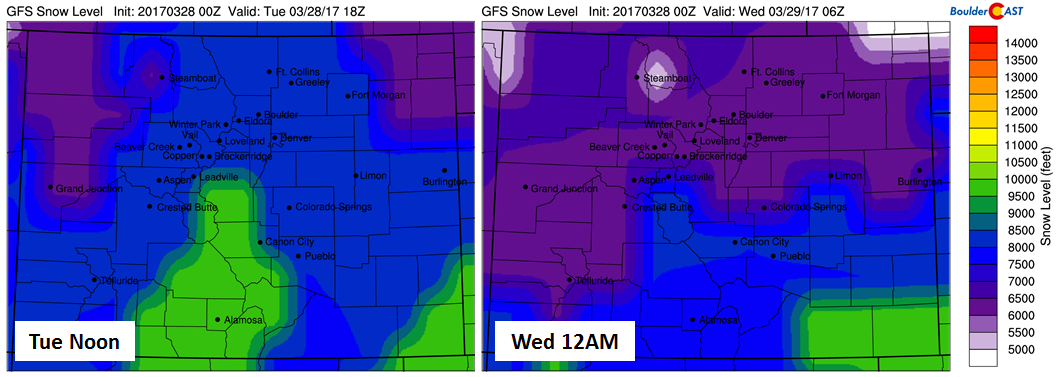
GFS-derived snow level forecast for Tuesday afternoon (left) and Tuesday night (right). This shows the drop in snow levels expected this evening from 8,000 to 6,000 feet.
- Model variation is large once again. For one reason or another, weather models have not be able to get a hold of these storm systems of late. There is quite a discrepancy again between the various models and even consecutive runs of the same model. This is never good and always makes us a little nervous.
.
The GFS was the most bullish model last night with 1-2″ of precipitation for the Metro Area, but has backed off this morning. The NAM continues to show smaller totals of 0.3-0.7″ for the region, keeping the heaviest precipitation WAY too far east in Kansas.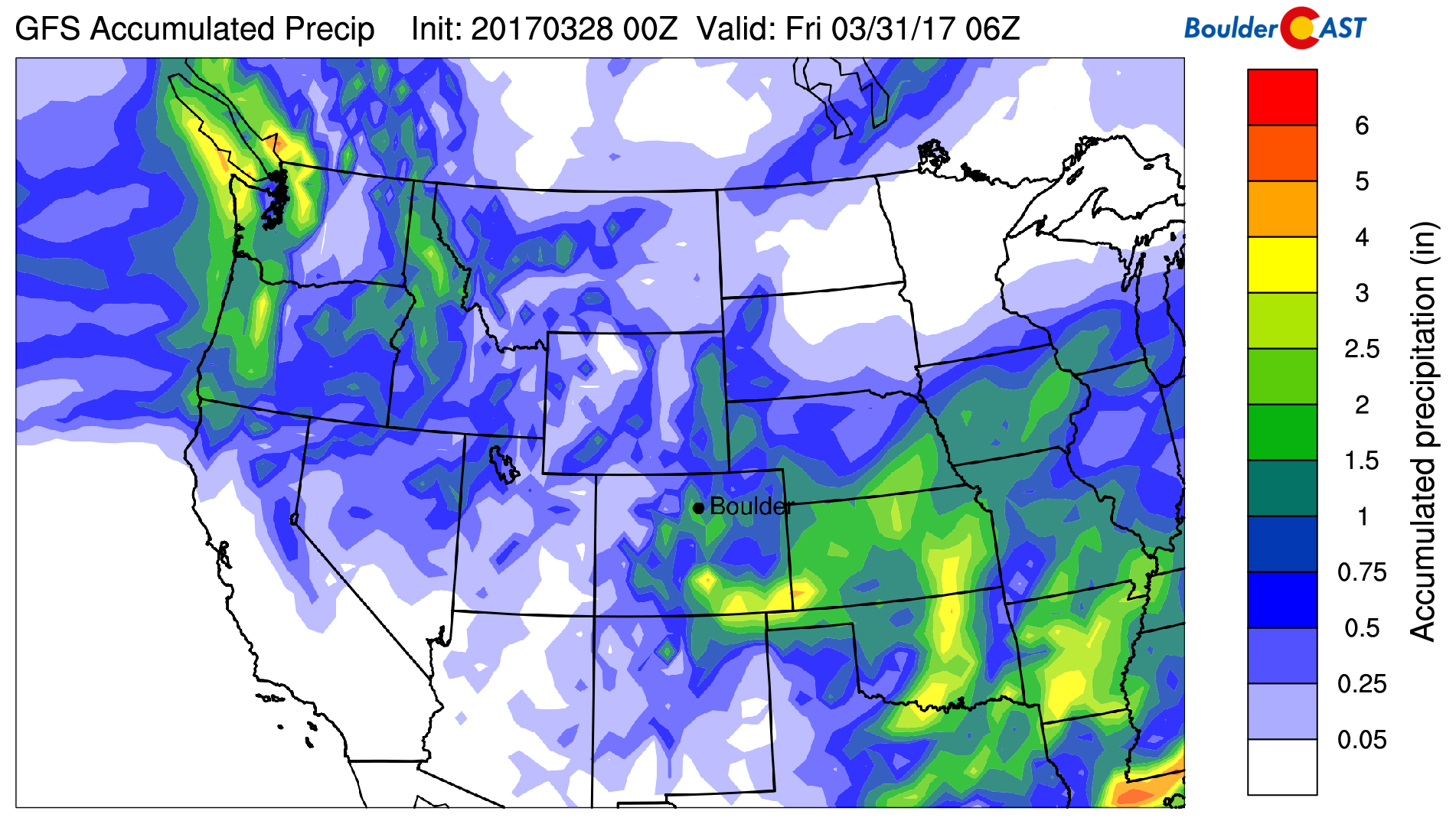
GFS total accumulated precipitation forecast for the event. Beneficial precipitation is expected for almost all of eastern Colorado
- Another concern is how long will the precipitation stick around after midnight? Some models suggest precipitation decreasing sharply from north to south by 3AM. Others keep the action going into mid-morning Wednesday.It’s a difficult forecast based on this uncertainty alone. When you factor in marginal temperatures for snow, the bust potential is again quite high for the event.
With all the said, here is how we expect this storm to play out over the next 24 to 36 hours….
Precipitation will slowly ramp up in coverage across the region through the day, become more widespread by afternoon and early evening. Accumulating snow during the day will remain at or above about 8,000 feet. 1-4″ are possible by sunset in these areas. It will be rain everywhere else until later tonight. We’ll be lucky to hit 50 degrees this afternoon for a high.
Snow levels should begin dropping near sunset down to around 6,000 feet by midnight. After midnight, snow could mix in or change over in some parts of the Plains with temperatures falling into the low to middle 30’s by sunrise.
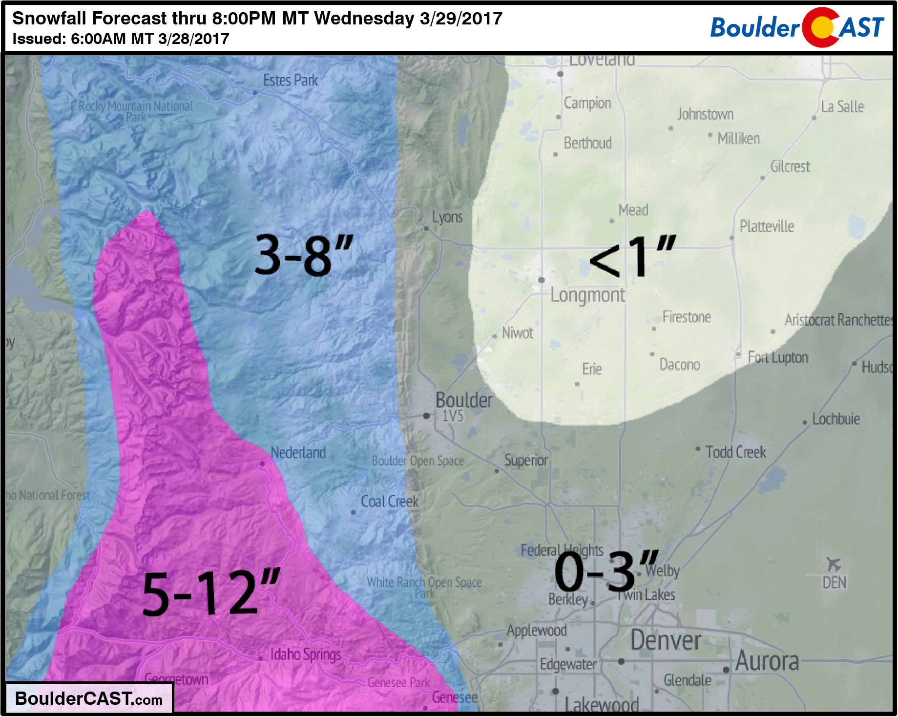
Storm snow totals should be 3-8″ in the Foothills above 6,500 feet and 5-12″ for areas above 8,500 feet. A couple inches of slush could accumulate on the Plains where cooling is most prominent or the elevation is slightly higher. Likely areas for this would be in Boulder west of Broadway, Superior, and Aurora. Most areas in the Metro Area will see little wintry impact from this event (mostly rain or non-accumulating snow). Cool and mostly cloudy conditions will linger through the day Wednesday with a high in the 50’s.
Our snowfall map is below. Enjoy the dreary day! A book and a fire sound excellent right about now…