
Several waves of light snow and a dash of freezing drizzle impacted the Denver Metro area over the last 36 hours resulting from a slow-moving storm system to the southwest. We take a look at snow totals, the beautiful weekend ahead, and the strong possibility of another cold air outbreak headed our way early next week.
UPDATE (Friday Nov 22 at 12PM): Added discussion of official snow totals and map.
T
he “Las Vegas Low” which brought flooding rains and heavy mountain snow to portions of the Four Corners region has weakened and transitioned most of its energy to a new low pressure developing in southeast Colorado. The GOES-East water vapor animation below shows the passing of the torch, so to speak, which largely occurred during the overnight hours last night.
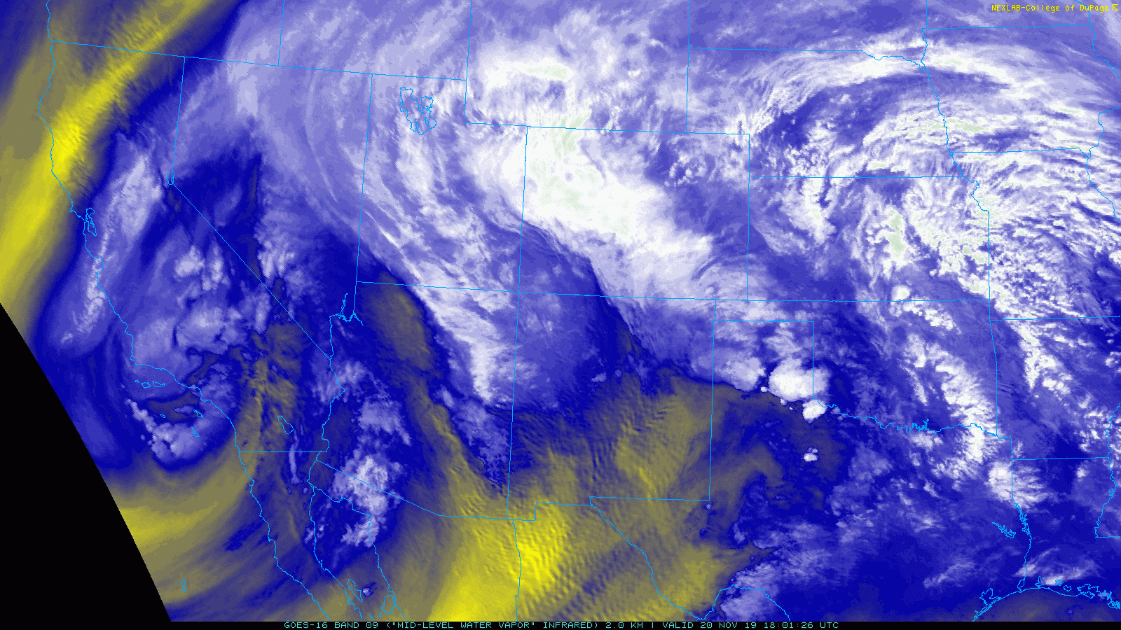
Mid-level water vapor satellite animation from GOES-East for Thursday into Friday morning. Watch the huge low near Las Vegas dissipates as a secondary, smaller low forms in southeast Colorado
Friday morning’s GFS 500 mb vorticity map below helps to pinpoint the position of the newfangled low and where it will be headed this afternoon (Hello Kansas!).
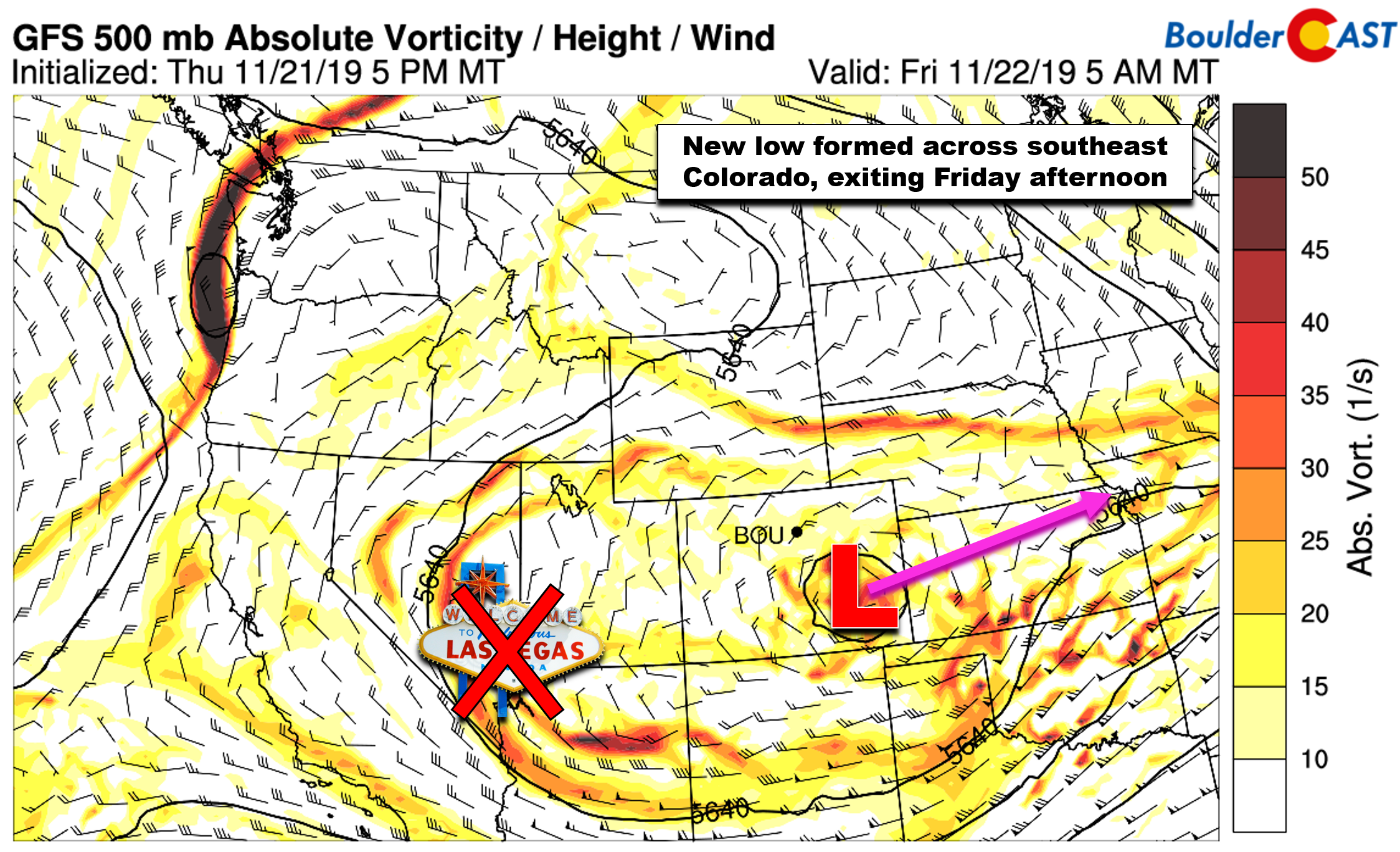
GFS 500 mb vorticity map for Friday morning showing the newly formed low in southeast Colorado and the dissipated “Las Vegas Low” further west
As the low formed overnight, stronger lift and deeper upslope developed across the Denver Metro area leading to a resurgence of snowfall, the second wave of white stuff we’ve been discussing for several days now. There should have been NO surprises are you woke up to snow this morning. Colder air aloft and deeper upslope have also allowed us to tap into the dendritic growth zone aloft producing more voluminous snowflakes overnight which are good for accumulation. If you noticed, snow that fell Wednesday night and Thursday was the opposite: tiny crystals or snow-balls that really didn’t add up to much.
Snow reports are starting to come in this morning with a clear trend in storm totals: 1-4″ across the lower elevations and 4-8″ in the Foothills. Boulder will finish somewhere around 3″.

CU snow table shows 3″ as of 7:00 AM Friday
Shown below is our snowfall forecast map issued on Tuesday with actual storm totals overlaid in boxes. Green boxes indicate that our forecast verified to within one inch of the observed snowfall. Red did not (there are no red). We always like to see a perfect forecast!

| Seasonal Snow Totals (Updated Nov 22 2019) |
|---|
| Boulder | Denver |
|---|---|
| 32.7" | 15.7" |
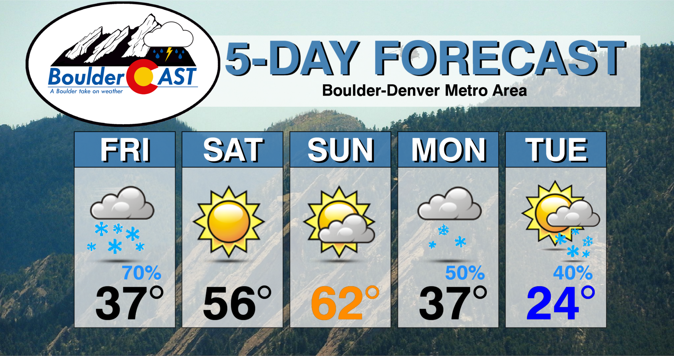
As the closed-low pulls away, snow will taper off from north to south through the morning Friday, likely ending for everyone by the lunch hour. Some models are more optimistic than others regarding how quickly skies clear this afternoon and whether or not the sun will make an appearance. In general, though, expect overcast skies trending towards partly cloudy conditions by sunset. Highs stay cool in the mid to upper 30’s.
As we look ahead to the weekend, Colorado will remain in-between storm systems with dry northwest flow dominating. Expect quiet weather, plenty of sunshine, and highs in the middle 50’s to lower 60’s.
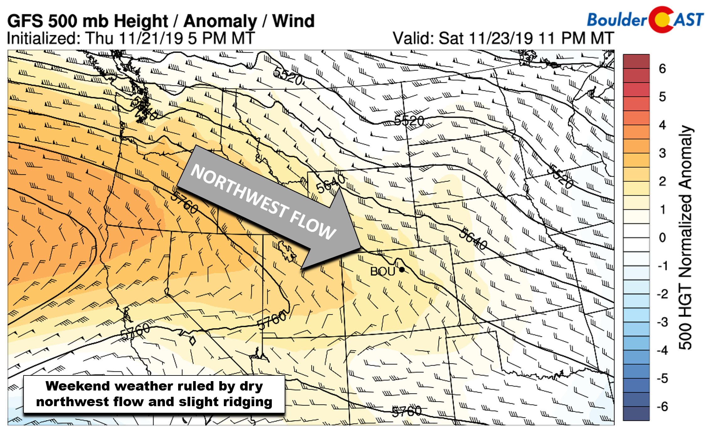
GFS 500mb height anomaly forecast for Saturday evening. Northwest flow and cross-ridging are evident over Colorado
Enjoy the mild weekend as the holiday week ahead is shaping-up to take a very cold and snowy turn! Of course there is still some wiggle room, but nearly all models are showing a deep and slow-moving trough developing across the western United States by Monday or Tuesday and lingering for much of the week. The GFS ensemble animation below shows an extremely anomalous dip in 500 mb heights: this will be very cold air.

GFS ensemble 500 mb height anomaly animation covering Friday through next Wednesday (Nov 27)
At this point, the fulcrum of the coldest air (and possibly most of the snow) could be off to our west. Though still a ways out, PowderCAST is indicating some BIG powder totals in the San Juans just in time for the Thanksgiving holiday.
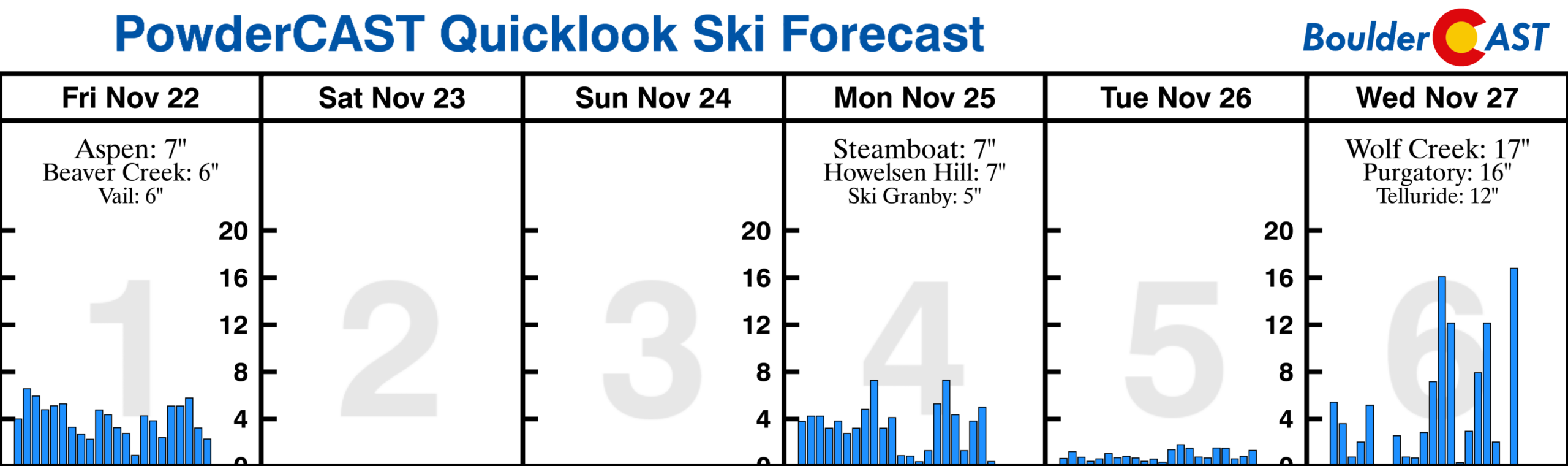
We’re already tracking our next chance(s) for snow beginning late in the day Monday into Monday night (and maybe additional chances over the following days). The unseasonably cold air and meandering jet stream next week are just the ingredients we want to see for a dumping of snow across the Inter-Mountain West, including the Front Range. The latest run of the GFS is predicting more than a foot of snow in our area by the morning of Thanksgiving! This is indeed something to watch.
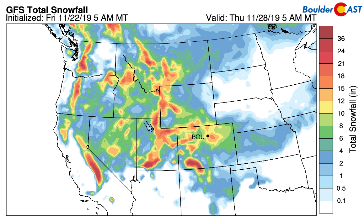
In any case, temperatures will for sure take a tumble in the Denver-Boulder area beginning Monday with the potential to remain below freezing for a few consecutive days.

Stay tuned for more on the cold and snow in the coming days. Have a good weekend!
.
Subscribe to BoulderCAST for instant email notifications for all of our storm updates, forecasts, and posts:
We respect your privacy. You can unsubscribe at any time.
.
We discuss Boulder and Denver weather every single day on BoulderCAST Premium. Sign up today to get access to our daily forecast discussions every morning, complete six-day skiing and hiking forecasts powered by machine learning, access to all our Front Range specific weather models, additional storm updates and much more!

.
Spread the word, share Colorado weather:


You must be logged in to post a comment.