We’ve been monitoring a weak storm system lingering off the California coastline for the last few days. Latest model guidance indicates a track that is significantly further north than what has been advertised the last few days. While there is still some uncertainty, especially in regards to temperatures and the potential for rain versus snow in our area, the chances have increased for precipitation during the day Thursday. Read our updated forecast discussion including our thoughts on snow amounts.
A cut-off low pressure system currently located across California this evening will eject eastward into western Colorado by early Thursday morning and weaken into an open wave. The storm’s track is actually a bit peculiar: it moves from its present position near Los Angeles northward into central Utah tonight and then dives southeast into the Texas Panhandle by Thursday evening. The wobbly movement definitely gives us cause for concern in regards to pin-pointing the exact forecast for the Front Range on Thursday. However, given that there is fairly decent model agreement on this odd track, we’ll go with it.

NAM 500 mb vorticity animation covering Wednesday evening into Thursday night
We expect scattered snow showers to begin across the Mountains late Wednesday night. Large-scale lift from the passing wave and surface upslope flow developing behind the associated “cool” front will help spread precipitation eastward into the Foothills and the Denver Metro area Thursday morning. Initially temperatures will be too warm for snow in Boulder and Denver (quite shocking for December!), but snow levels will be dropping through the day as falling precipitation cools the airmass. Cold air advection with the front is minimal at best. Certainly precipitation will commence as rain, but eventually it will change to wet snow. There is a large spread in change-over timing between the various weather models: the GFS being the earliest (morning), the HRRR the most sluggish (late-afternoon) and the NAM somewhere in the void between (early afternoon).
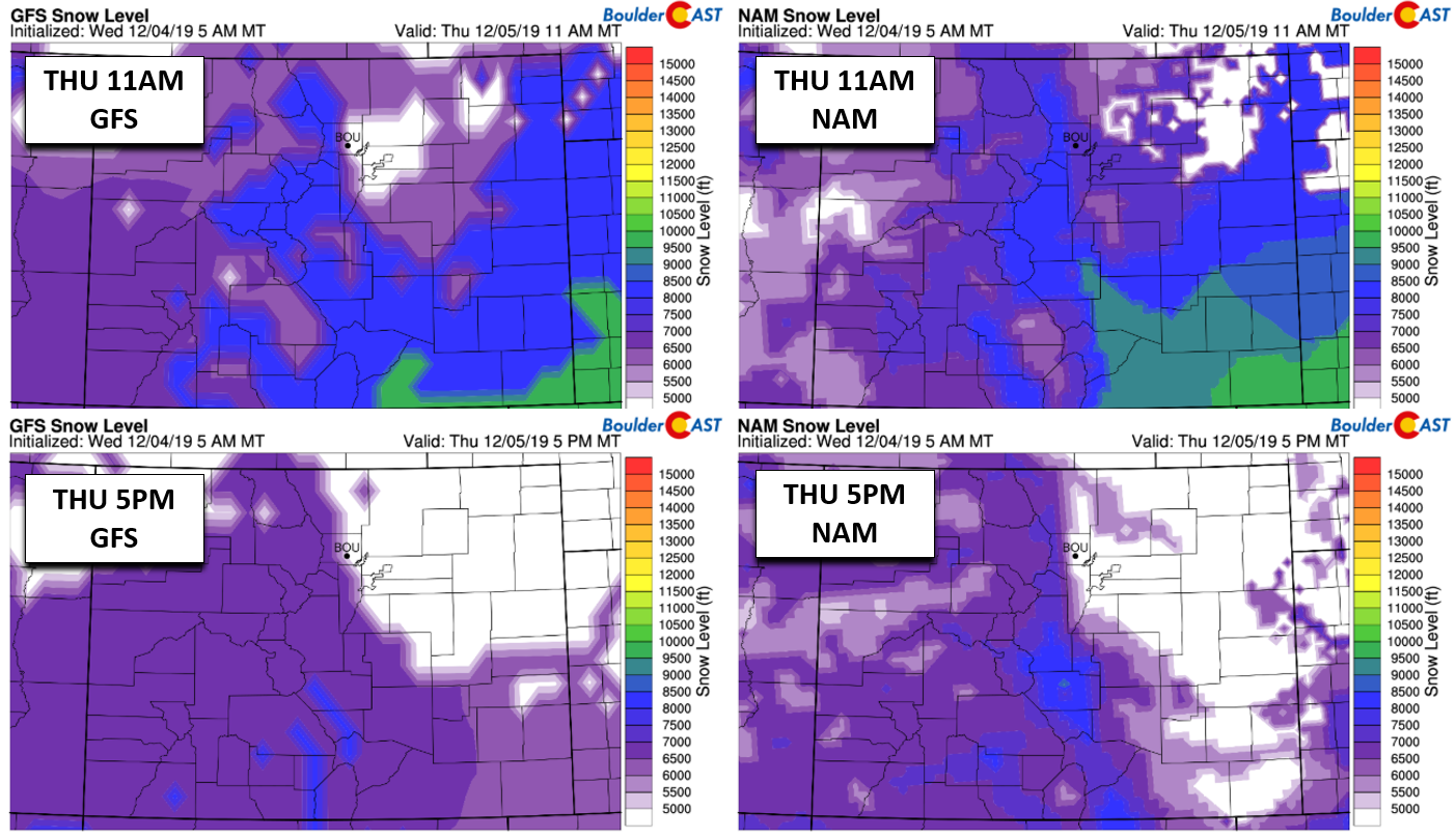
GFS (left) and NAM (right) model-derived snow level forecasts for Thursday midday (top) and evening (bottom)
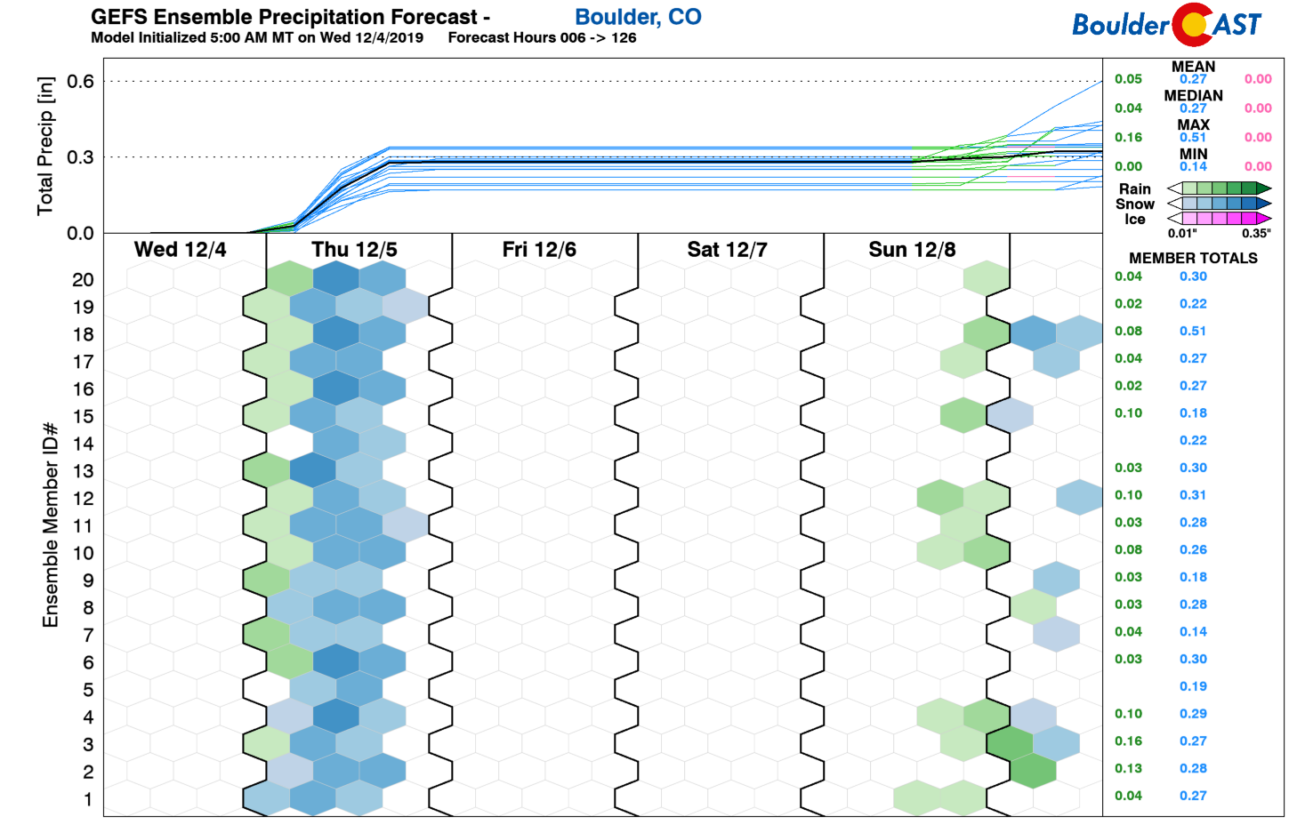
Precipitation amounts look to range from 0.1″ east of Interstate 25 to upwards of 0.2 – 0.4″ in and near the Foothills, including Boulder. Even in the unlikely event that the rain does change to snow quickly in the morning, temperatures are probably going to remain several degrees above freezing throughout the day which would limit the overall snow accumulations possible anyway. This is especially true given the mid-day and afternoon timing of the more widespread precipitation.
Light snow will wrap-up around sunset in the Metro area, ending from north to south as the trough axis passes and large-scale sinking motion quickly takes hold. Given the recent hammering of snow in our area, we suspect you won’t lose sleep over the swift cessation of the snow on Thursday.
Our snowfall forecast map for the event is shown below followed by our latest Snowfall Probabilities…far from a big winter storm that’s for sure!
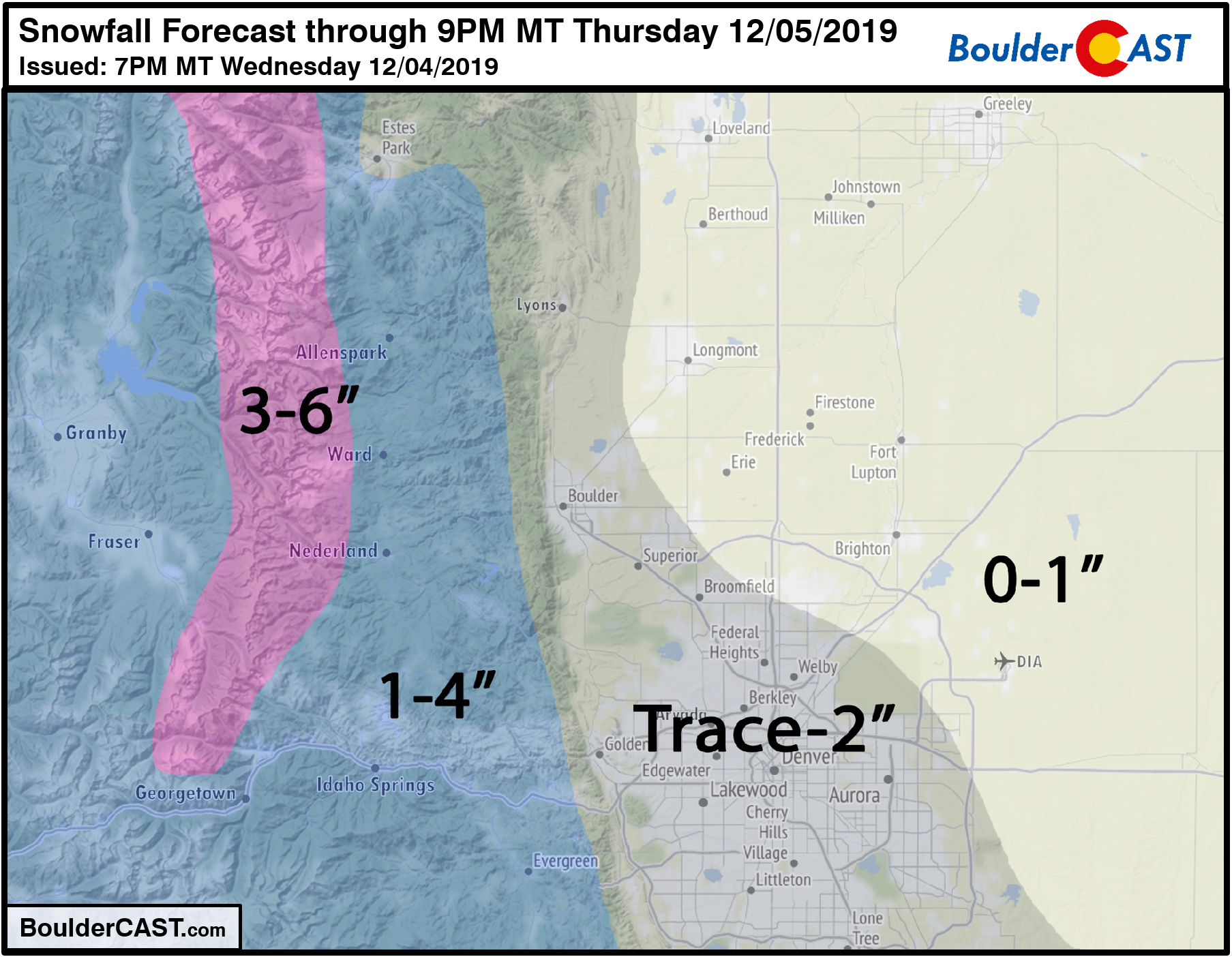

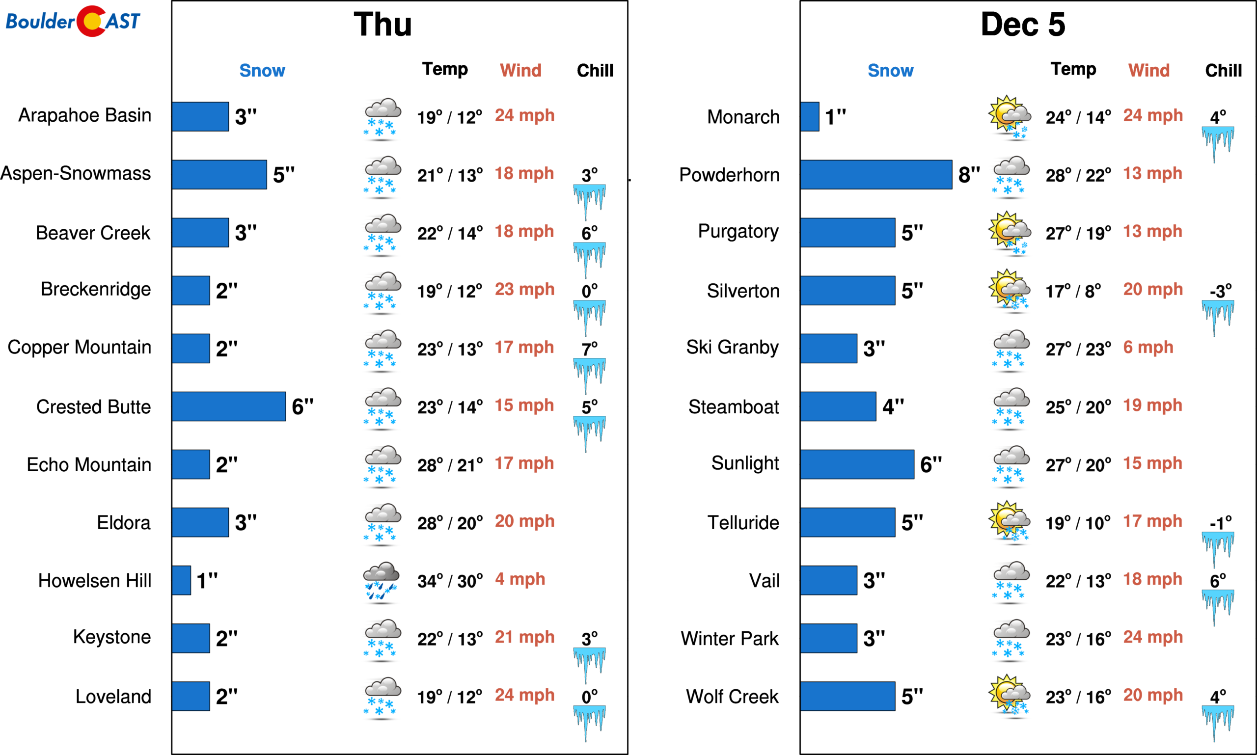
Pick your favorite adjective: Thursday will be [soggy/dreary/snowy/gloomy], but any wintry impacts will be relatively minor given the above-freezing road surface and air temperatures. Accumulation will primarily remain confined to already snow-covered and elevated surfaces. Expect any snow that sticks to be wet and slushy. Skiers can look forward to a few inches of fresh snow with this storm statewide, but that’s about it.
Have a good rest of the your Wednesday evening!
.
Spread the word, share the BoulderCAST forecast:
.


You must be logged in to post a comment.