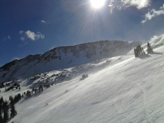
There are only a few ski resorts still open on this late April day, and on what will be Winter Park’s last ski weekend, Mother Nature will not disappoint with powder likely Sunday.
Ski resorts still open include Arapahoe Basin, Loveland Ski area, and Winter Park. Here are the current snow base levels:
- Arapahoe Basin: 53″ snow base, 5″ in last 3 days. Conditions: Packed powder; Pending, but open until June
- Loveland Ski: 67″ snow base, 2″ in last 2 days. Conditions: Packed Powder; Open a few more weeks
- Winter Park: 68″ snow base, 0″ in last 3 days. Conditions: Spring conditions; Closes after Sunday
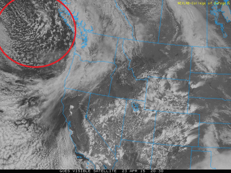
The visible satellite image below shows the current conditions as of this afternoon across the western United States. The system that will impact Colorado and the ski resorts is the area highlighted in red. still out over the NE Pacific Ocean, south of Alaska. This system will move onshore tonight and tomorrow into the state of Washington and will produce a large trough through much of the West. While the main storm will stay to the north of Colorado, a secondary system will develop over the Four Corners region Saturday night into Sunday.
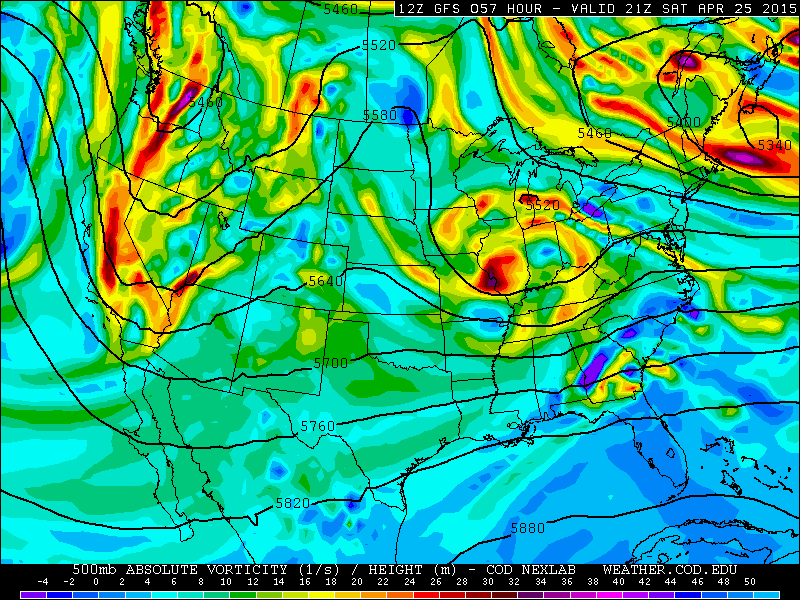
Below is the 500 mb pressure level map for Saturday afternoon from the GFS model, showing absolute vorticity and geopotential height contours. The main system that is shown in the satellite image above has already moved over Washington. However, a large trough of lower geopotential heights is present, extending from Washington down to California. The trough axis will strengthen and produce another low pressure system to impact Colorado Sunday.
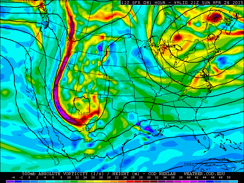
Below shows the 500 mb map once again, but for Sunday afternoon. A small cut off low pressure system has developed and is centered over New Mexico. There are still some uncertainties regarding the track of this low pressure system, with a few of the computer models developing this system over northern New Mexico, while others place it further south. The exact location will be crucial to how much snow the resorts get.
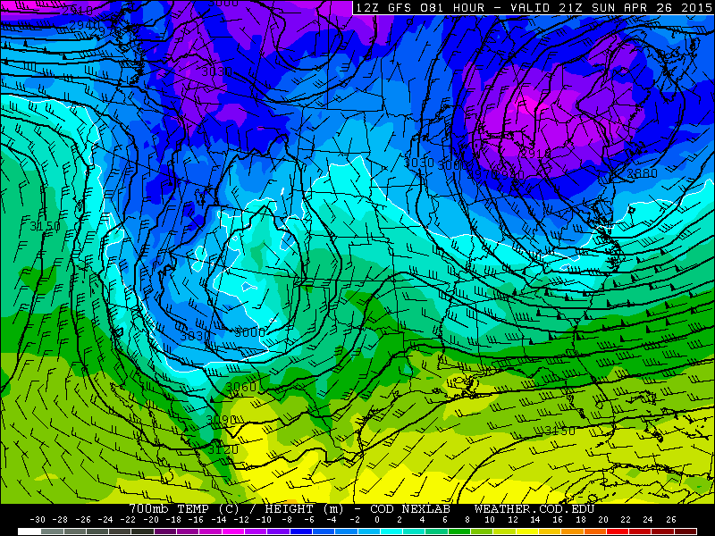
The 700 mb pressure level map for Sunday afternoon shows upslope flow across eastern Colorado with temperatures cold enough for mountain snow (map below). The flow across the mountains is from the northeast and southeast. This will lead to upslope conditions along areas east of the Continental Divide, as well as convergence for lift in areas west of the Divide. Again, the exact location of the system Sunday will be key to the forecast.
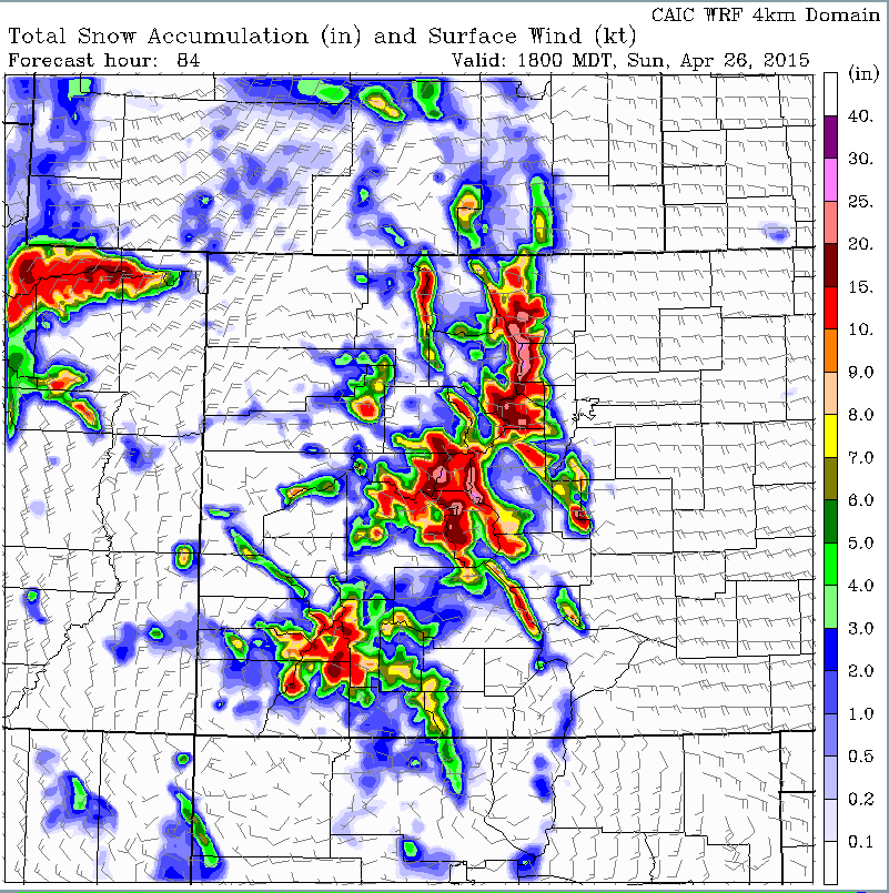
The snow totals for the event show a wide range in amounts. The high-resolution Weather Research and Forecasting (WRF) model shows by midday Sunday (below map), over a foot of snow is possible in areas east of the Divide, which would favor Loveland and Winter Park. Large amounts are also possible west of the Divide. However, we will focus mainly on the 3 ski resorts discussed earlier for the forecast.
General synopsis:
There will likely be a few rain/snow showers around Friday afternoon/evening and Saturday, but these will likely be more spotty and scattered in nature. The prime time for the event will be Sunday afternoon and evening into Monday. So the best day for fresh powder will be Sunday, so if you like skiing in the snow, Sunday is your day. The snow base for all three resorts is already great, as shown above, so if you like sunshine while you ski, Saturday is your day! Saturday will feature scattered rain/snow showers but expect lots of sunshine, too. If you’re skiing Sunday, roads will likely be icy in the evening, so be sure to give yourself extra time for your commute.
Forecast for ski resorts:
Winter Park: Scattered rain/snow showers on Friday and Saturday. On Sunday, it may start off sunny, but clouds will increase with snow developing in the afternoon and becoming heavy by early evening. Snow totals by Sunday late afternoon may be 3-4″. Total snow by Monday morning of 6-12″ possible. These amounts could be lower or higher given the exact track of the storm. Sunday is a powder day for the season’s end!
Loveland Ski area: Scattered snow showers on Friday and Saturday, with a few inches possible each day, but remember, scattered and not widespread. On Sunday, snow developing by midday and picking up in intensity late in the day and evening. Snow totals of 1-2″ in the afternoon, with 6-8″ possible by Monday morning. These could be higher or lower depending on the system track. Sunday is a late powder day, while Monday is a full powder day!
Arapahoe Basin: Scattered snow showers Friday and Saturday, with an inch or two possible each day. On Sunday, clouds will increase after sunny skies in the morning. Because Arapahoe Basin is a little further west of Loveland, the snow amounts will be somewhat lower. Snow developing mid to late afternoon, with 1-2″ by late in the day, with 4-8″ by Monday afternoon/evening. Sunday is not a powder day, but Monday likely will be!
Enjoy!


