As a sizable upper-level low approaches from the west, the ingredients are coming together to summon the return of severe weather to the region Saturday afternoon. Large hail and damaging winds will be possible, with a few tornadoes not out of the question as well. We detail when and where we believe the greatest threat exists, and give our forecast for Mother’s Day.
It’s been a while since we have had to consider the threat of widespread severe storms in the Denver Metro area. But alas, it is that time once again. With an average of 12 twisters per year, May is the second most active month for tornadoes in Colorado!
Saturday’s weather set-up:
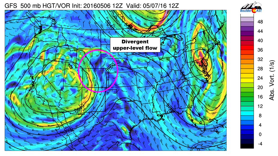
GFS 500 mb vorticity map for Saturday afternoon
Large upper-low approaching from the west (shown above), with enhanced synoptic lift across Colorado, as well as diffluent flow (as winds come northward from New Mexico, they spread out over Colorado, with some going northwest into WY, as well as northeast into NE). The “omega” ridge that brought unseasonably warm weather the last few days has pushed eastward.
Mid-level jet oriented north-south across the region, with northeast Colorado in the left exit region, providing bonus low-level lift!
Moist low-level easterly flow will push dew points near 50 degrees for much of the region. This moisture will decrease stability. The easterly flow is upslope and will enhance storm coverage.
Speed and directional wind shear in the lower atmosphere, capable of facilitating rotating supercells
Surface low develops across NE Colorado, along with a frontal boundary north of Denver.
Unstable vertical atmospheric profile, with CAPE values of 1200 to 2400 J/kg from Denver northward Saturday afternoon
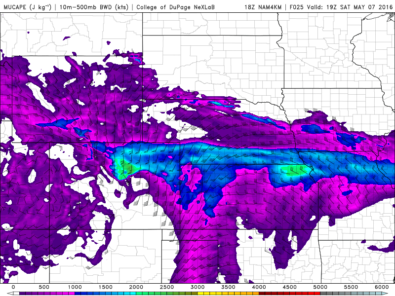
CAPE for Saturday early afternoon.
Overall, these ingredients will make for an active afternoon across northeast Colorado. With the jet moving northward, we expect storms to initiate early, maybe as soon as noontime over the Denver area, then quickly push north. The high-resolution NAM shows the storms strengthening and consolidating into a line northeast of Denver by early evening (shown below).
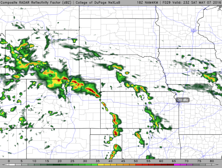
4KM NAM simulated reflectivity for Saturday at 5pm.
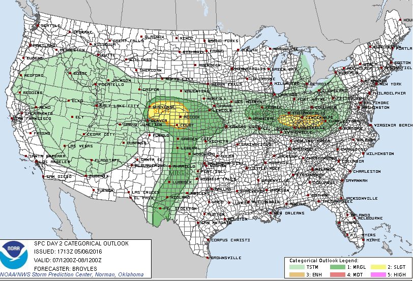
The threat of supercells forming in the Denver Metro is lower than it is further north and east, but we won’t rule out one or two clipping the region. Boulder has even lower odds, but again, there is still a chance, especially early in the afternoon. The Storm Prediction Center has both Boulder and Denver at “Marginal” risk.
Whether the severe threat materializes across the Metro area or not, we expect plenty of clouds and scattered thunderstorm coverage during the afternoon hours, with temperatures much cooler than Friday, only in the upper 50’s.
Bring your umbrella to Sunday brunch
We’ll see the cooler and stormy weather continue into Sunday. Look for isolated to scattered afternoon storms with a high in the low 60’s. Thankfully, the severe threat shifts east into Kansas and Nebraska on Sunday. Not all doom and gloom for Boulder and Denver by any means, but do expect hit and miss afternoon showers with a few rumbles of thunder. At least it isn’t snowing for Mom’s Day again this year…
With the current track of the upper-low, the heaviest precipitation this weekend will likely remain from Ft. Collins north. In fact, Flood Watches are already in place for southeast Wyoming.
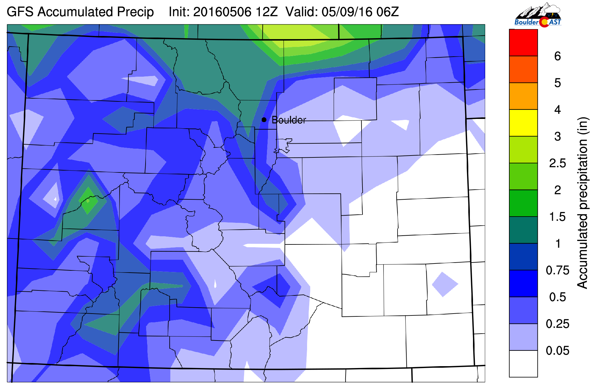
GFS total accumulated precipitation through Sunday
Keep an eye to the sky tomorrow and happy Mother’s Day to all the Moms out there! Stay safe!


