Heavy snow fell overnight across the Front Range, much more in some places than others. We review the storm totals, discuss how our forecast played out, and let you know when all of it will melt.
Snow began early Wednesday morning and persisted almost continuously into Thursday afternoon for parts of the Metro area. The heaviest snow fell during the early morning hours Thursday. It was during this time that all of the ingredients came together at once: the moisture, the lift from the jet and shortwave trough, and low-level upslope. These ideal conditions were really only present for about an 8-hour period overnight. Outside of this, snow was generally light across the region.
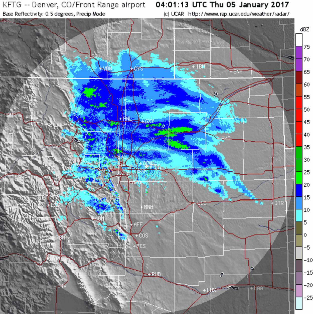
Click image if animated radar loop doesn’t load properly.
Forecast did alright
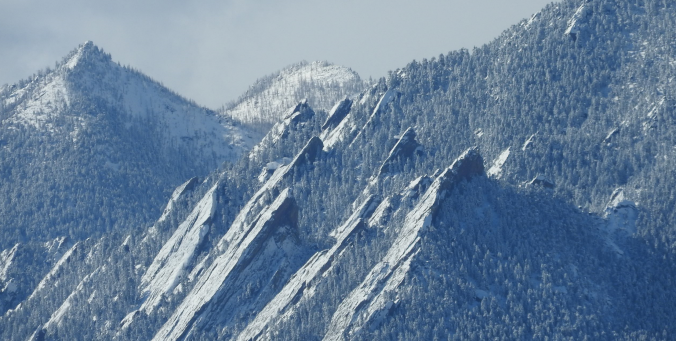
Boulder officially recorded 13.8″ of snow. At BoulderCAST Station in North Boulder, we measured 13.5″. To the east, Denver scratched a much smaller number into the books, with a storm total of only 4.1″ at Denver International Airport. It’s times like these that shine a bright spotlight on the influence of Boulder’s topography for snow and demonstrate why Boulder’s annual snowfall is nearly twice that of Denver!
Shown below is our original forecast snow map (issued Wednesday morning), with the observed storm totals per location contained in boxes. Green ones indicate that the observed snowfall was within one inch of the given forecast range, while red was outside the scope of our forecast.
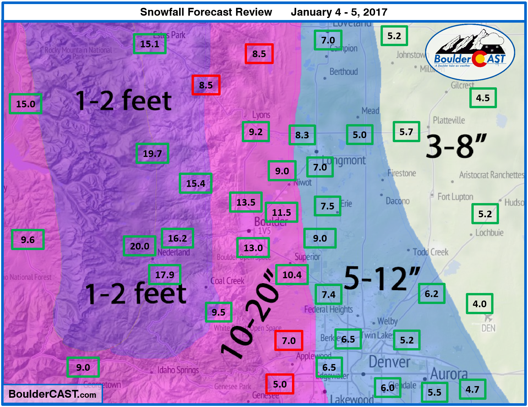
The storm didn’t quite play out exactly as expected, but opposing factors allowed most areas to end up within our predicted ranges, albeit towards the lower end in many cases. It was a tough forecast, with relatively short notice (i.e. this wasn’t a storm we were explicitly tracking well beforehand). Not that we want to make excuses, but storms that have an eye on the Front Range many days in advance are easier to get a grasp for, forecast-wise. All-in-all, though, we’re happy with our forecast!
What went awry?
The weather models in general nailed the liquid precipitation forecast for the region. Boulder got its projected ~0.75″, Denver got its ~0.4″, and the Foothills were near or just above 1″. No problems there….
Instead, the issue we see is with how the snow fell….
- Models were not projecting the extended duration of light snow that fell in Boulder and surrounding areas Wednesday during the day. A lot of this came from an extremely shallow stratus cloud deck (a top at 500 meters above ground) which most of the models missed. By the evening rush hour, 3 to 4″ were already on the ground, with even 1 to 2″ in parts of Denver. This helped to ultimately boost our totals (and probably saved the forecast!) by providing several hours of “bonus” snow at the onset.
- Working in the opposite direction, the ingredients didn’t really come together all that well. Heavy banded snowfall was not as widespread or intense as we expected. Considering how much moisture was available to this storm, it really didn’t take full advantage of it. The “heavy” snow bands were fairly isolated and rarely contained snowfall rates greater than 1″ per hour. You can see from the radar loop earlier in the post, there were very few dark green bands on radar (which would have snowfall rates 2+” per hour). There was even a point around 8PM or so when precipitation almost entirely ceased. The National Weather Service commented that it was a brief surge of “drier” air. Yes, it was slightly drier, but still fairly moist considering it is early January. This just demonstrates how close the storm was to the tipping point of being a much bigger bust!
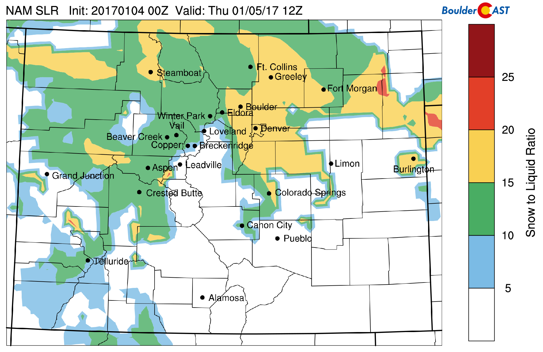
- One last comment regarding the snow-to-liquid ratios, or SLR’s for the storm. Using NAM model data, our algorithms pointed to SLR’s of 15 to 20 for the Front Range throughout the storm (see below). This range is fairly typical in Colorado for mid-winter systems with jet interaction. However, looking at Boulder, 12.6″ of snow fell containing 0.83″ of liquid. This equates to an SLR of 15.2. In Denver, one representative station near downtown had 5.7″ containing 0.41″ of liquid, giving an SLR of 13.9. So on the Plains at least, SLR’s were down from expectations. Our reasoning for this mostly ties into the two bullets above, so we won’t divulge anymore.
These mishaps may seem extensive, but that isn’t the case. Remember, our forecast did verify for about 90% of the region. Weather forecasters are notoriously looking for ways to justify less-than-ideal outcomes. There’s always something subtle with each storm, something that seems so blatantly obvious afterwards, which just can’t be reliably forecasted beforehand.
Boulder now sits at 31″ of snowfall for the winter, which is slightly above normal through January 5th. See our updated 2016-2017 Winter Storm Summary page for more details.
Looking ahead to warmer times
Current temperatures from around Metro area are shown below (as of Noon Thursday)…single digits for the Plains, and single digits on the opposite side of zero in the Foothills. They will hardly budge through the day today with light snow and clouds lingering.
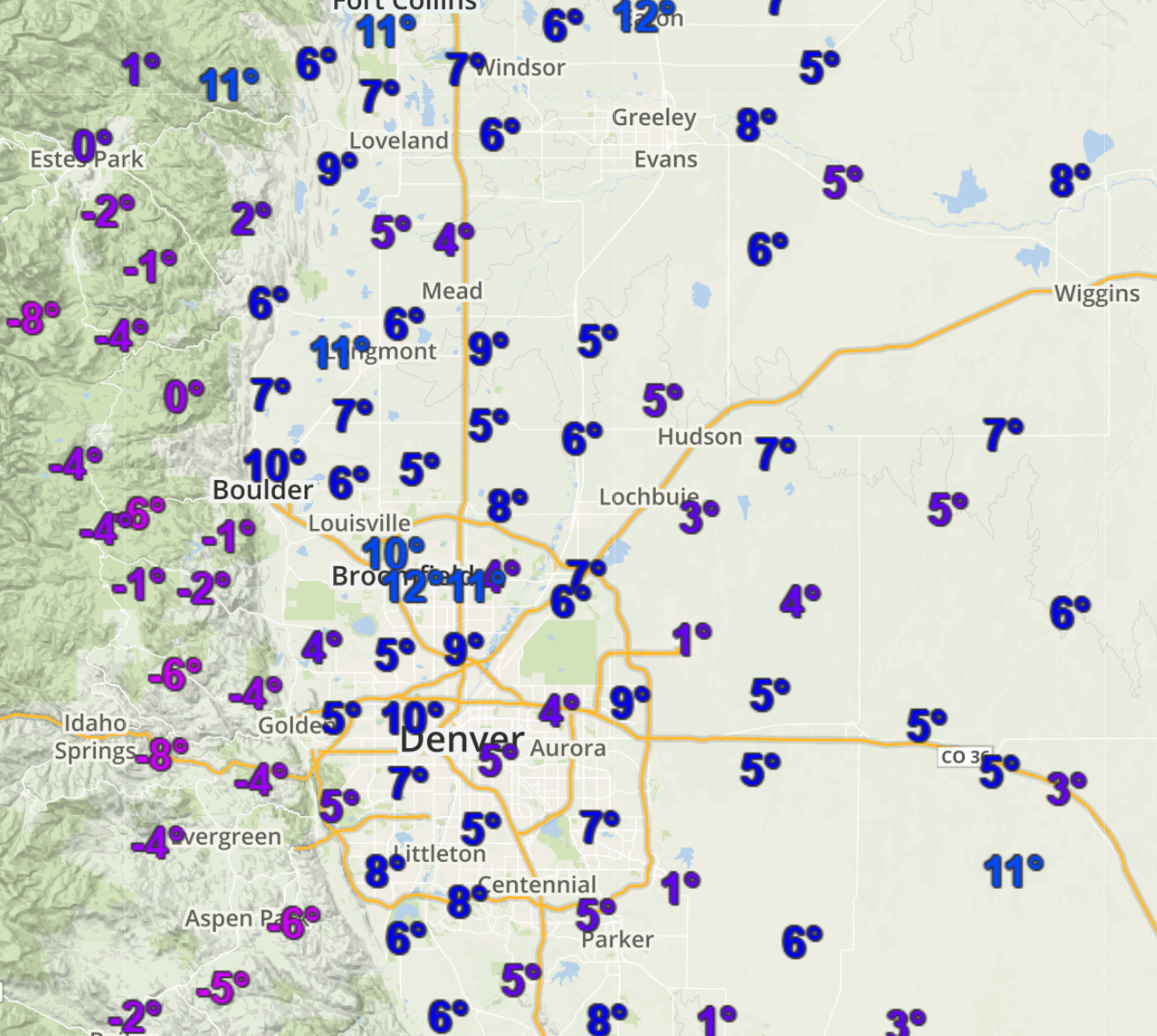
It will take a few days to chisel away the Arctic airmass that has made its home over northeast Colorado, but we promise, it is coming! We just need a little bit of downslope to whisk it away to Kansas. Tomorrow should reach into the 20’s, with 30’s by Saturday, and potentially near 60 degrees by Monday.
Thanks for reading! Keep it frosty!
.


You must be logged in to post a comment.