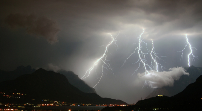
This afternoon’s thundershowers were a welcomed reminder of what July in Colorado could and should be like, weather which we have been hoping for over the last few weeks. Thankfully, Mother Nature has a few promising changes in-store for the near-future, beginning early next week with the resurgence of monsoon moisture to the region.
The recent stretch of dry weather has left its charred mark on our Foothills, to say the least.
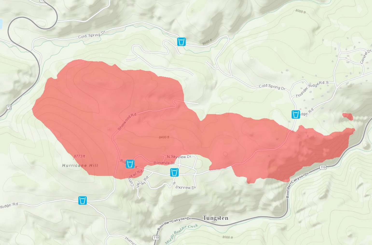
Cold Springs Fire burn scar northeast of Nederland. The fire is now 100% contained.
Much of Boulder County now lies in the “Abnormally Dry” yellow blob denoted by the USDA’s Drought Monitor.
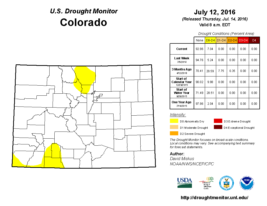
In fact, the city of Boulder’s last measurable rainfall occurred mere moments before the fireworks display at Folsom Field, eleven days ago. With just 0.18″ of rain falling so far this month, which is now at the half-way point by the way, we’re running well-below normal in the precipitation department.
This changes Monday…
After a month of enduring a stagnant, moisture-starved airmass across much of the western United States, monsoon moisture is set to make its return to the Front Range on Monday!
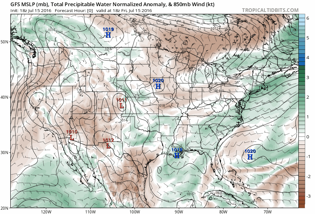
Shown below is the precipitable water map for today (Friday). You can see a broad area of low moisture across the southwest United States (browns!), a set-up that hasn’t changed much over the course of the last two weeks. The monsoon moisture has been pushed South of the Border by persistent westerly flow across our region.
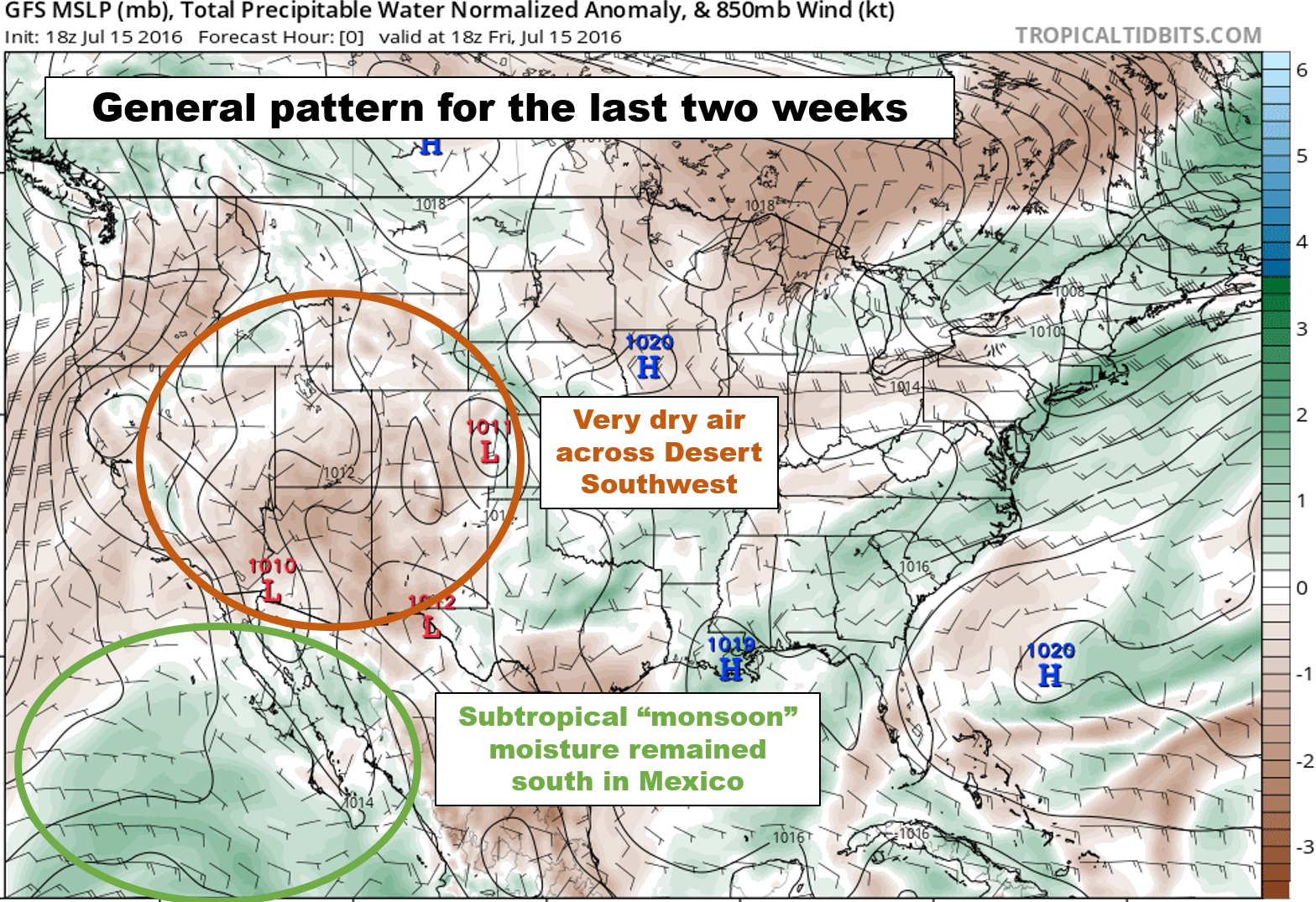
This pattern was largely the result of an atypical trough across the Pacific Northwest (seen below), which was responsible for sub-freezing temperatures in parts of Washington and Idaho, as well as accumulating July snow in the higher elevations!
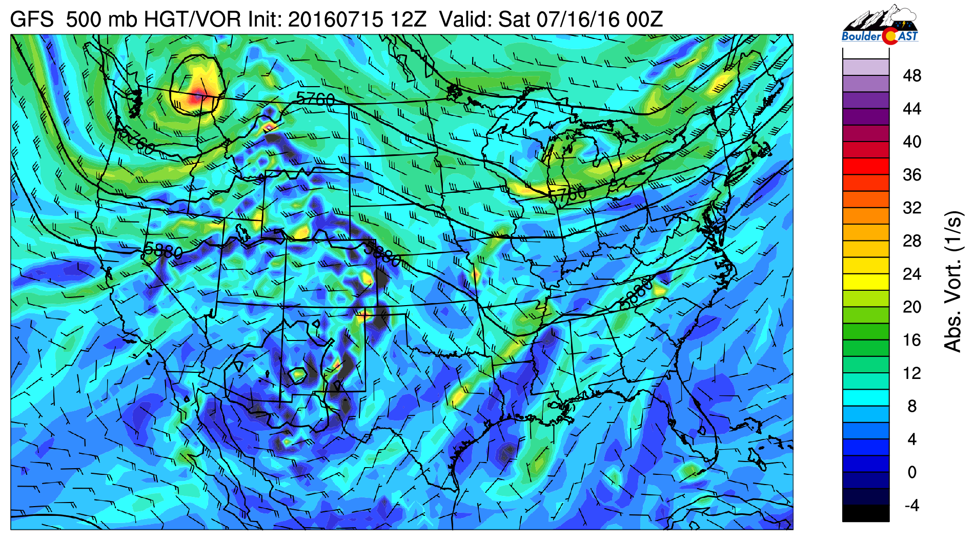
GFS 500 mb vorticity map for this evening (Friday), showing the nuisance trough that has lingered across the Pacific Northwest.
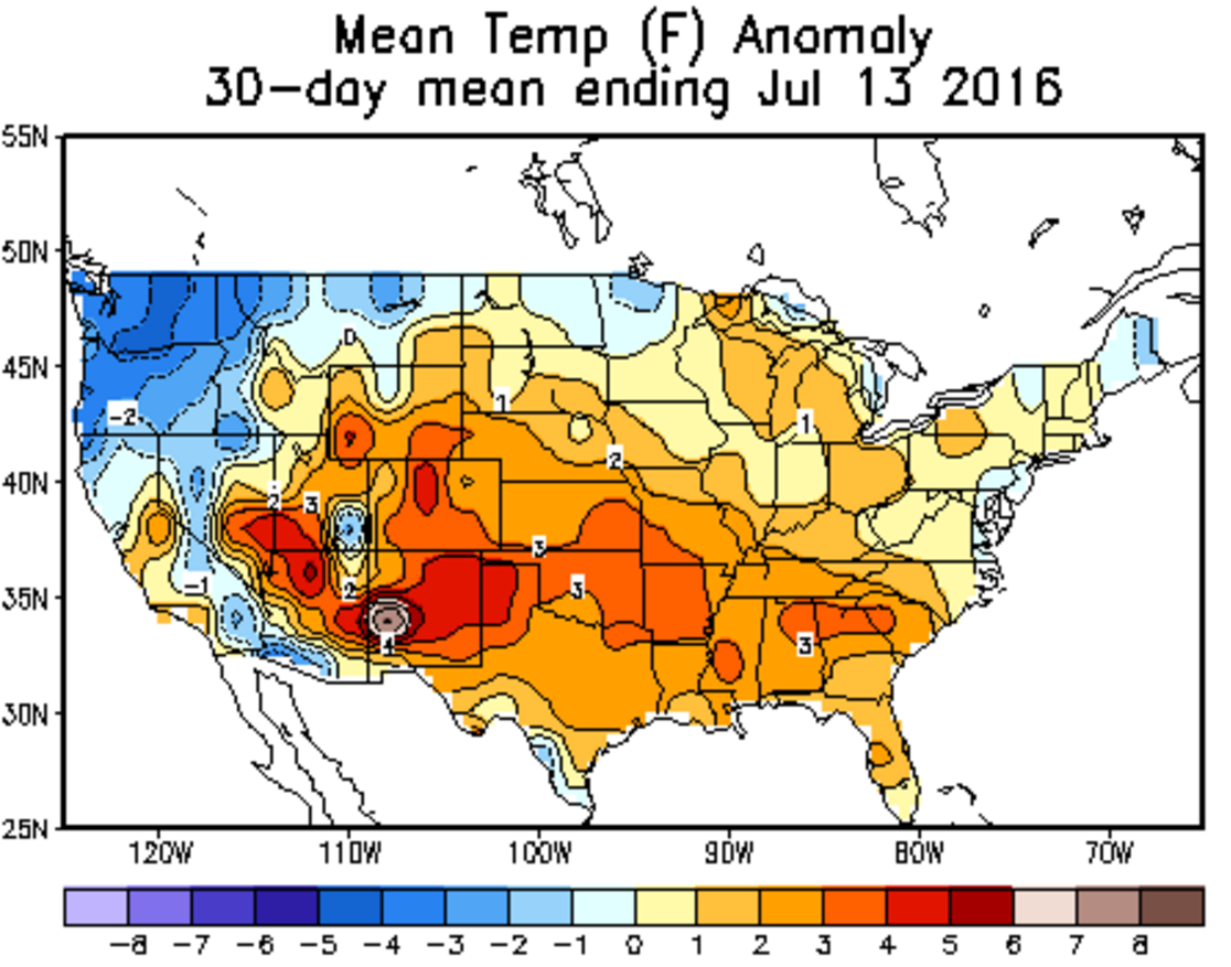
While this trough has kept things cool across the Northwest, here in the Front Range, we have experienced above normal temperatures, with many, many days in the 90’s (and even a few 100-degree days in spots).
We are finally seeing agreement in the models that this pattern will shift as early as Sunday night and Monday. While that trough doesn’t want to budge much until mid-week, the tropical eastern Pacific is becoming very interesting. There are currently three tropical systems active just southwest of Baja California (remnants of Hurricane Cecilia, Hurricane Darby, and soon-to-be Tropical Storm Estelle).
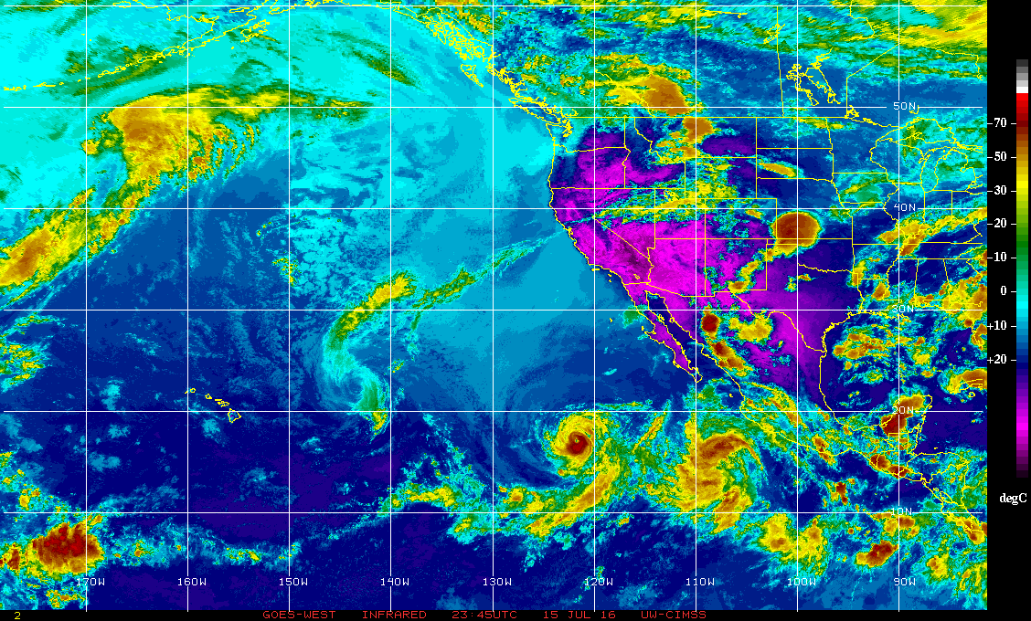
Current enhanced infrared satellite image over the eastern Pacific Ocean. Can you find Hurricane Darby?
Hurricanes are enormous and can have wide-reaching effects, which in this case, has Darby providing the extra “oomph” to ignite monsoon season for Colorado. Despite the eye of Hurricane Darby remaining more than 1,000 miles from Colorado, its impact will be felt in the form of subtropical moisture advecting northward on it’s eastern flank.
The monsoon ingredients are finally coming together
A combination of added moisture/southerly winds from Darby, a strong high-pressure center across the southeastern United States, and the thermal (“monsoon”) low over southwest Arizona will funnel a plume of moisture northward into Colorado.
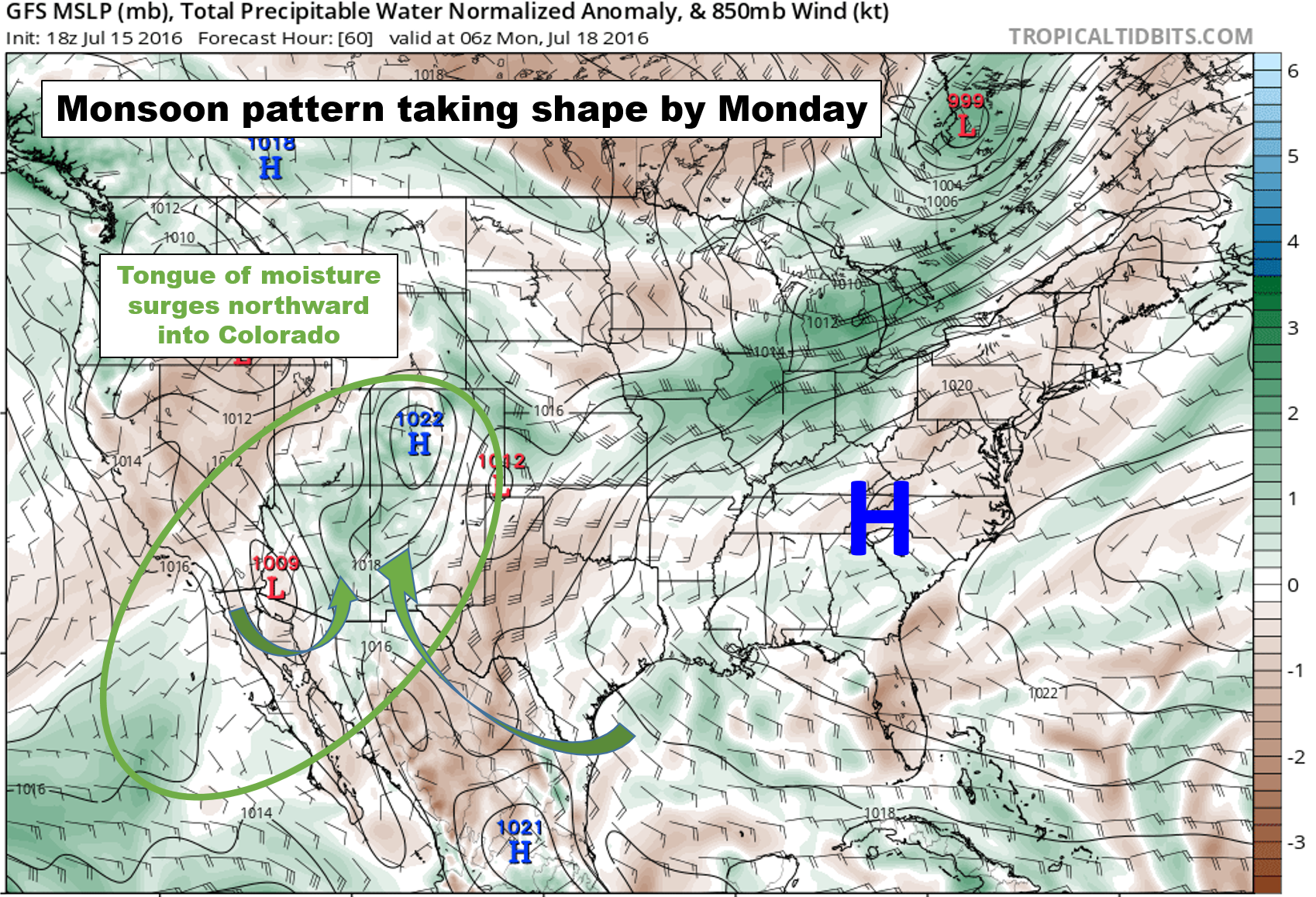
Medium-range ensemble model guidance suggests that this plume won’t be a one-off, showing good agreement that it will likely persist longer-term. The animation below shows this plume’s evolution from now through all of next week. An observant eye can also pick out the offending tropical cyclones in the bottom left corner.
Hopefully the fire-hose of moisture can stay with us into at least part of August. We sure could use it. For now, it looks like a fair chance of afternoon rain each day next week, beginning Monday. Expect specifics on this in our weekly outlook on Monday morning.
Have a great weekend!


