Snow that fell Sunday night into Monday continues to melt as warmer temperatures have taken hold the last few days across the Front Range. We review the totals from the event earlier in the week, check in on our Mountain snowpack, and detail what’s on-tap for Thursday night as another chance of snow arrives.
Monday’s snow totals
A rather potent system tracked across New Mexico Sunday into Monday this week. Its core was very far from Denver, but there was TONS of moisture available and plenty of cold air to facilitate some light snow for our region. A majority of model forecasts were to keep most, but not all, of the snow south and east of Denver. Despite this, we expected up to 3″ of snow for the Metro area.
Shown below is our original forecast map created Saturday evening (24+ hours before the snow started). The observed storm totals per location are contained in boxes. Green ones indicate that the observed snowfall was within one inch of the given forecast range, while red was outside the scope of our forecast.
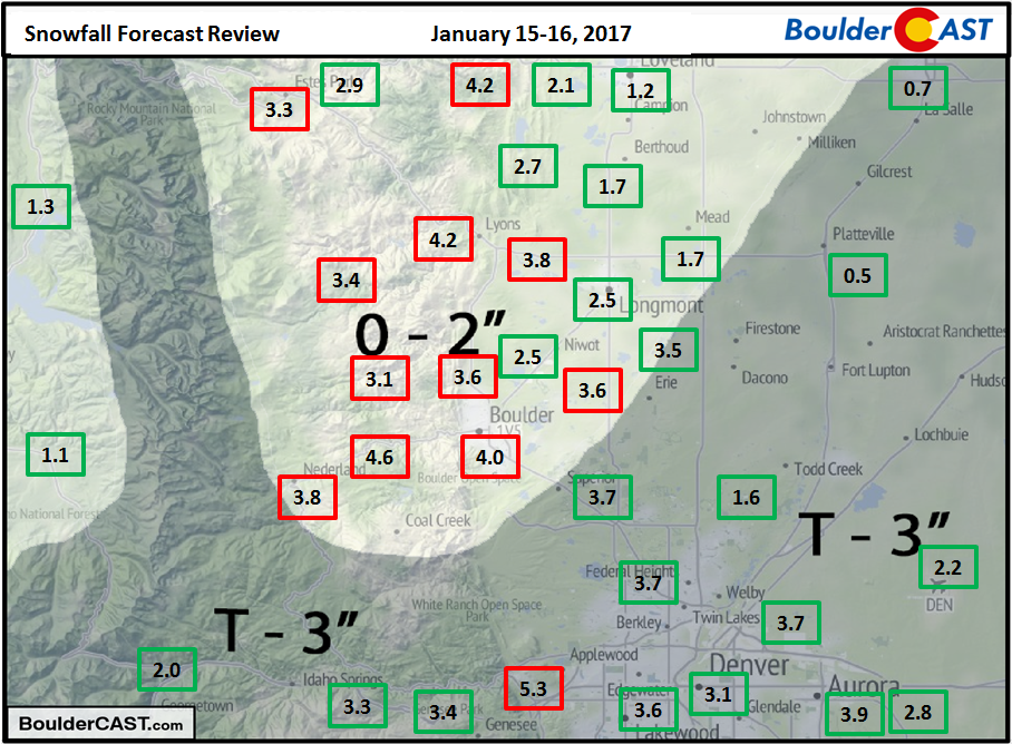
Models adjusted the precipitation shield slightly more north and west in the last few runs before the snow started. We however declined to make any changes to our forecast as only minor bumps in amounts would have been warranted (likely pushing everyone into 1-3″ range). We expected lower totals in Boulder compared to Denver, but that really didn’t happen. In fact, nearly the entire forecast area landed between 1 and 4″. This southern track system was much warmer than prior storms, creating a “soupier” snowfall with snow to liquid ratios close to 10:1.
Boulder’s official number was 4.0″, bringing our January total to a hefty 18.6″. Denver recorded 2.2″ from the storm, and now sits at just 6.3″ for the month. As always, here’s our updated 2016-2017 Winter Storm Summary page.
Snowpack looking super!
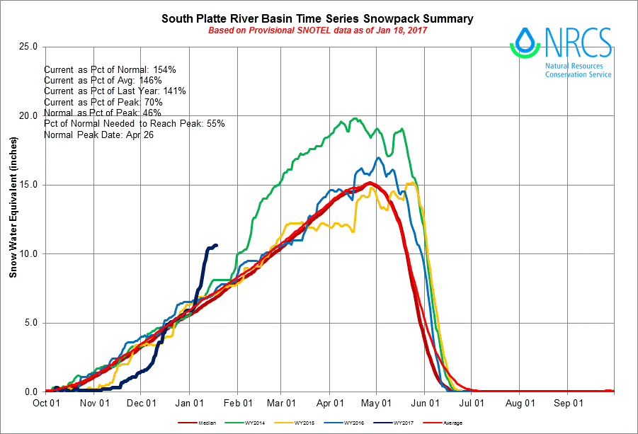
While this most recent storm was not a big “powder producer” for the Mountains, the first two weeks of 2017 have been more than generous across the Front Range. The snowpack time series for the South Platte River Basin shows the rapid accumulation of snow in January. We’re now sitting at 154% of median snowfall for January 18th!
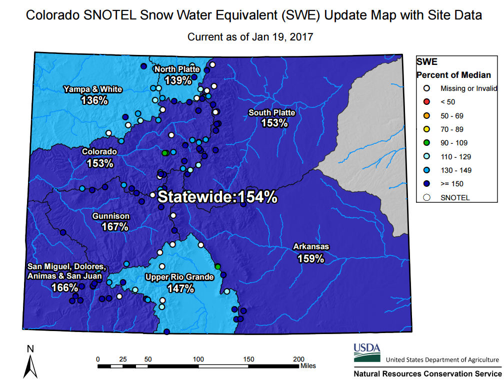
This good fortune has not just been confined to our region…all of Colorado is “in the blue”… Colorado snowpack hasn’t been this healthy in January since 2011, which was also a weak La Niña winter.
More snow tonight
Another weak system is coming ashore in California today. It will slide across southern Colorado tonight and tomorrow, bringing snow to the Mountains and a slight chance of snow to the Plains overnight tonight and tomorrow morning. The 500 mb vorticity map below shows the weak wave over Colorado tomorrow morning.
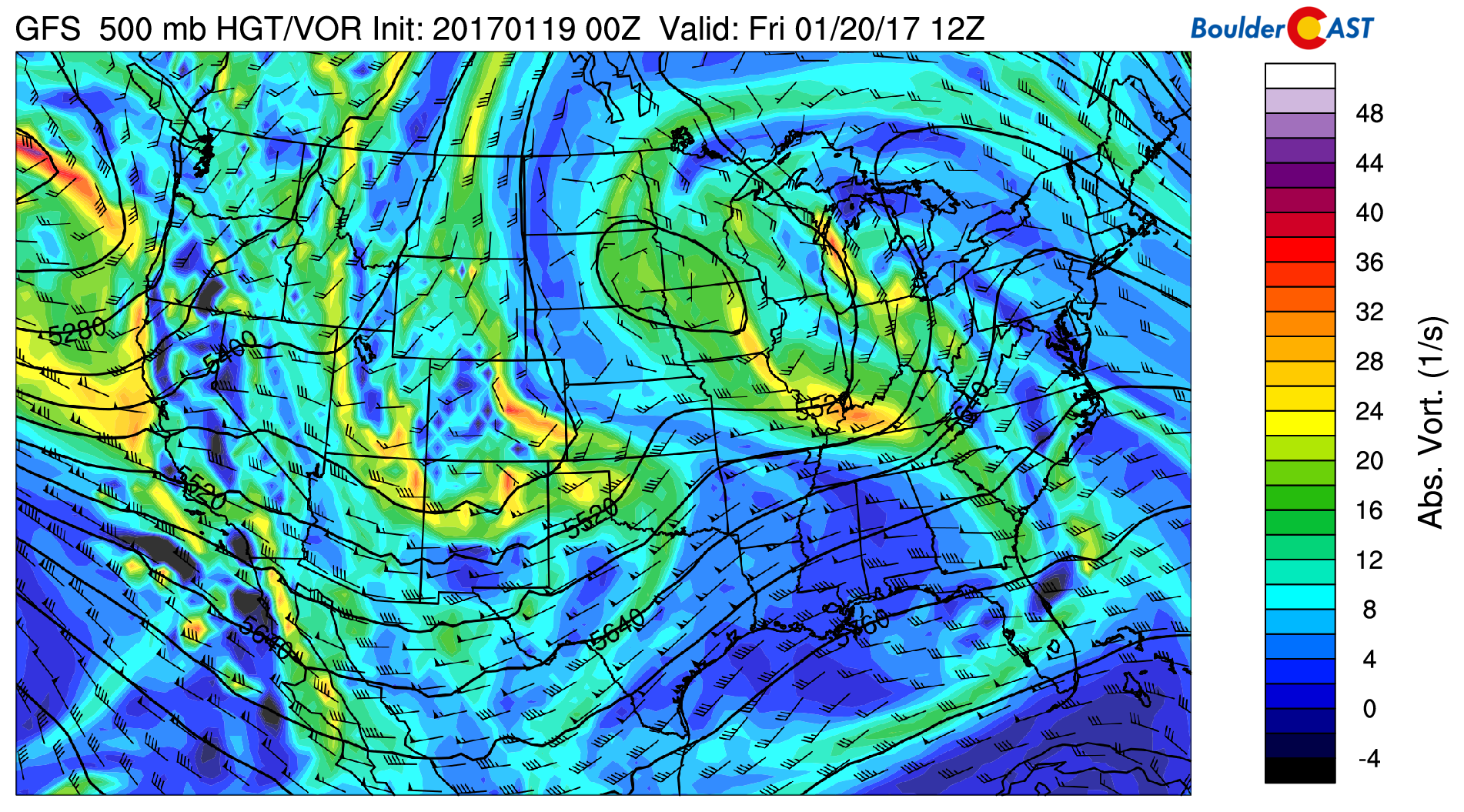
GFS 500 mb vorticity map showing the shortwave moving across Colorado Friday morning
The Mountains should easily see 1-4″ of snow tonight. Some ski resorts will do better than others. Winter Storm Warnings are posted, but those include snow that will come with a second, more potent system Saturday into Sunday. We’re talking another 5-16″ for the Mountains, with the higher amounts in southwest Colorado.
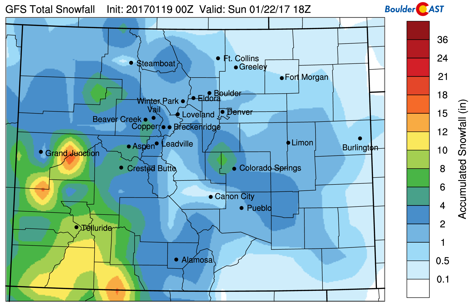
GFS total snowfall forecast through Sunday afternoon. Heavy mountain snow is inbound, with light accumulations possible in Denver/Boulder.
The feature tonight is very subtle, and we’re not entirely convinced it will produce much precipitation for the lower elevations. The main lift will be provided by a short period of upper-level forcing from the trough. There is no upslope, and limited moisture in the lower and upper levels of the atmosphere. Despite this, most models show at least something happening tonight between midnight tonight and tomorrow’s lunch hour. After the warm day today, and with temperatures tonight likely remaining in the low to mid 30’s, little impact will be had on the morning rush hour. There could be some light accumulation, generally a dusting or less, on grassy surfaces tonight into Friday morning, with possibly a couple of inches in the higher Foothills.
Temperatures remain cool to seasonal through the weekend, with continued snow in the Mountains and isolated chances of light snow on the Plains…nothing too concerning. That’s all for now.


