Are you beginning to anticipate those hot, sunny, and at times, stormy summer afternoons? You’re definitely not alone. Winter in Colorado can be long, with snow possible (and dare I say, common) nine months out of the year, even on the Plains. Following our biggest single-storm snow event in nearly three years, we check in on our snow totals and mountain snowpack thus far for the 2015-16 winter season.
We’ve got an encouraging announcement for you! Today is officially the “hump day” of winter! We are exactly halfway towards spring. Even better, if we consider meteorological winter, which runs from December 1 – February 29, we are nearly three-fourths the way done with the coldest season!
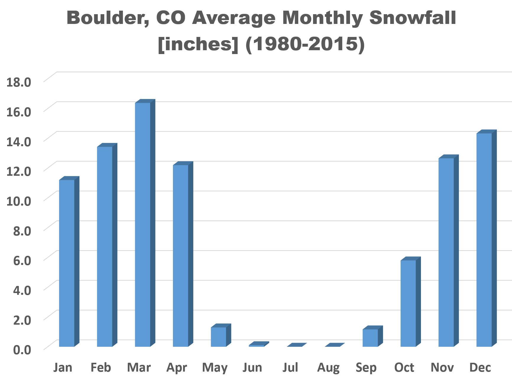
As of today, 57% of our average snowfall is behind us. However, there is a bit of bad news. We still have our snowiest month on tap, March. Though, Boulder’s 86.4″of annual snowfall is very well distributed, with each month from November through April averaging more than 10″ of snow.
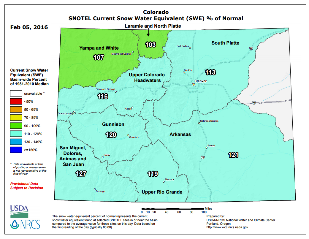
Through February 5th, Boulder has officially recorded 49.8″, just trailing BoulderCAST station’s 51.3″. Denver officially sits at 38.5″ (DIA). If you recall, we were running significantly below normal in the snow department. The recent wintry weather has actually brought nearly all of the Denver Metro Area back to normal or slightly above for the season.
The tale is similar in the mountains, with above normal snowpack across the entire state.
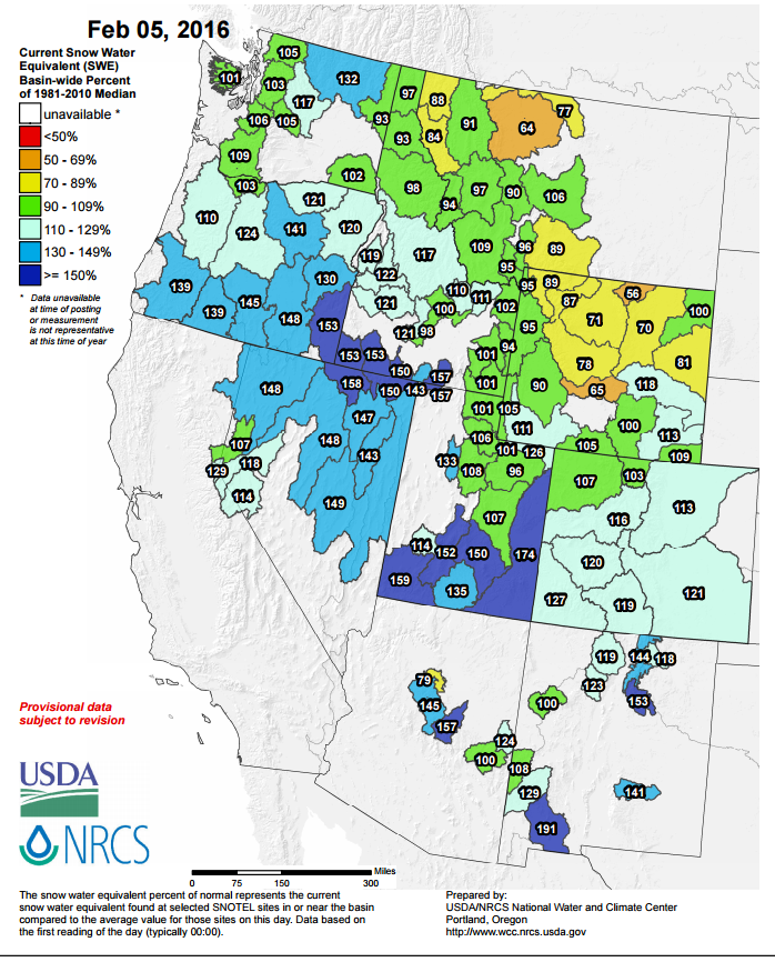
Checking big picture, for once we get to say that this trend extends to much of the western U.S. as well.
We have definitely seen the reversal of some of the extreme drought, most notably in Washington and Oregon. Check out the reduced area and intensity in the maps below.
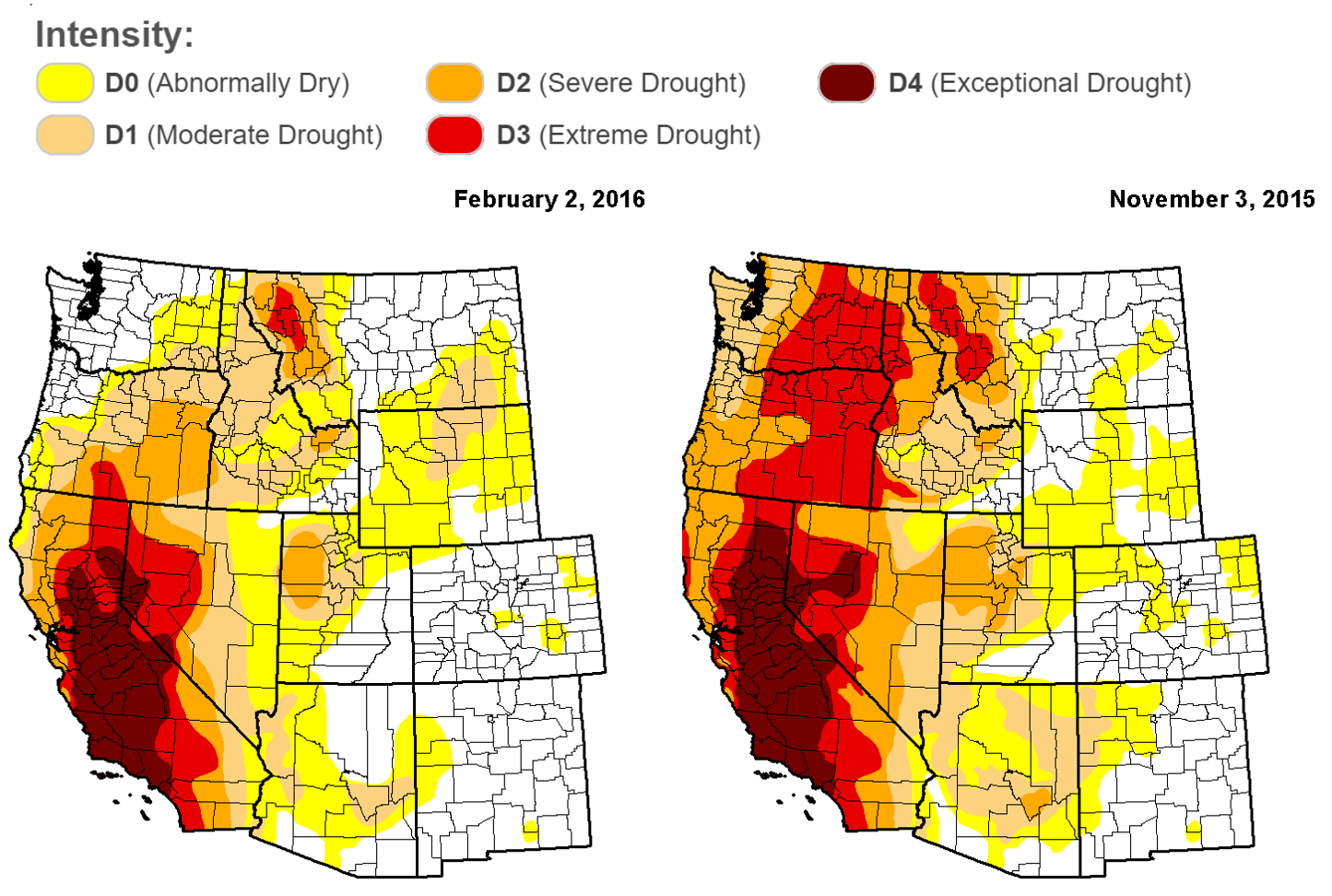
Change in western USA drought between today (left) and three months ago (right). Notice the substantial reduction in Washington and Oregon
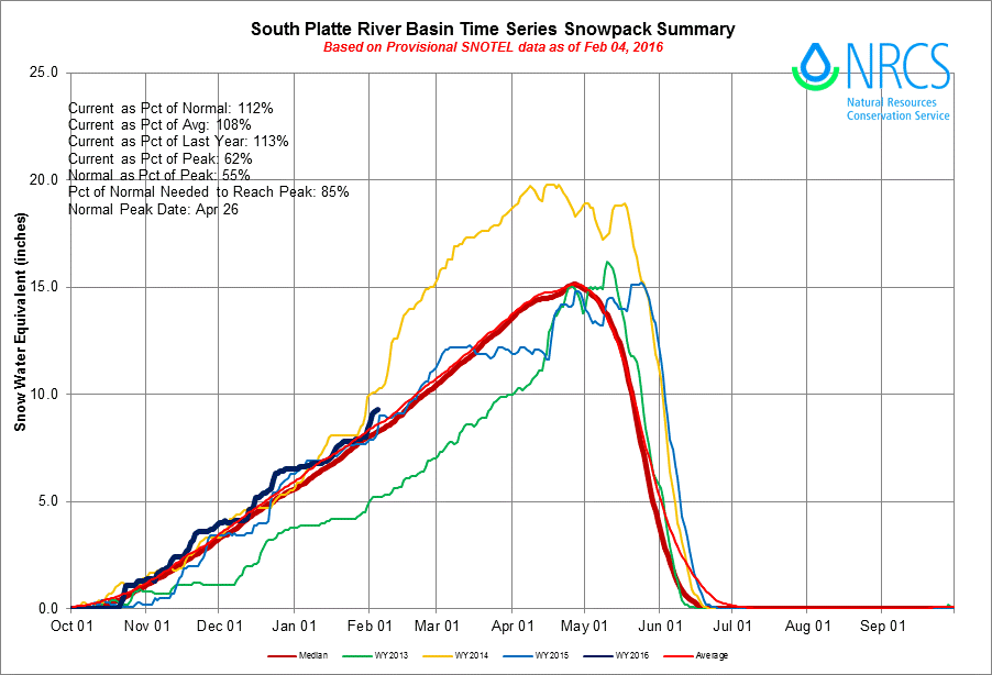
The South Platte Basin has been at or above normal through the entire water year, increasing the chances of a green spring and early summer for the area.
A Changing Pattern?
Be sure to get out there and enjoy the powder while you can. A potential pattern shift looks to be in progress as we speak. Ensemble guidance and long-range forecasts indicate the West Coast, including Colorado, may be in store for an extended period of dry and above normal temperatures as an unseasonably strong upper-level ridge builds across the region. The 10-day European ensemble forecast below shows this nicely…

This ridge would deflect incoming storms northward, into Washington state and Western Canada. There is fairly good agreement that Colorado will be high and dry through the end of next week, possibly longer.
Stay tuned. More on this Monday in our “Week Ahead” post.


