We recap last week’s two snow events, examine where March 2016 fits into Boulder’s history, and look forward to what’s shaping up for April.
A little winter to end the month
Light snow was in the forecast for the final two days of March.
On Wednesday, a powerful spring snowstorm was moving across Wyoming, dumping 6-14″ in Cheyenne. Further south, across our area, we were forecasting significantly less as the trailing cold front moved south through the Denver area.
In the wake of that big storm, northwest flow brought a quick-moving, weak system into the region for Thursday. A six to twelve hour period of upslope was expected to produce light accumulations, mostly in the Foothills and nearby Plains.
Both of our forecast snow maps are shown below. The observed storm totals per location are contained in boxes. Green ones indicate that the observed snowfall was within one inch of the given forecast range, while red was outside the scope of our forecast.
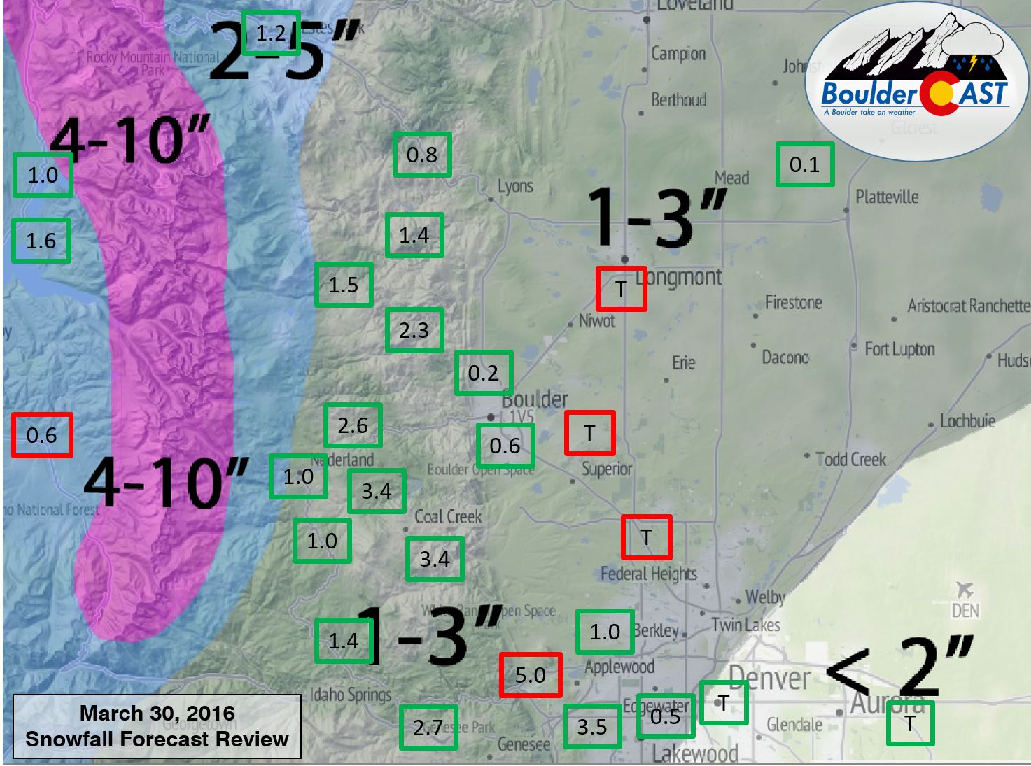

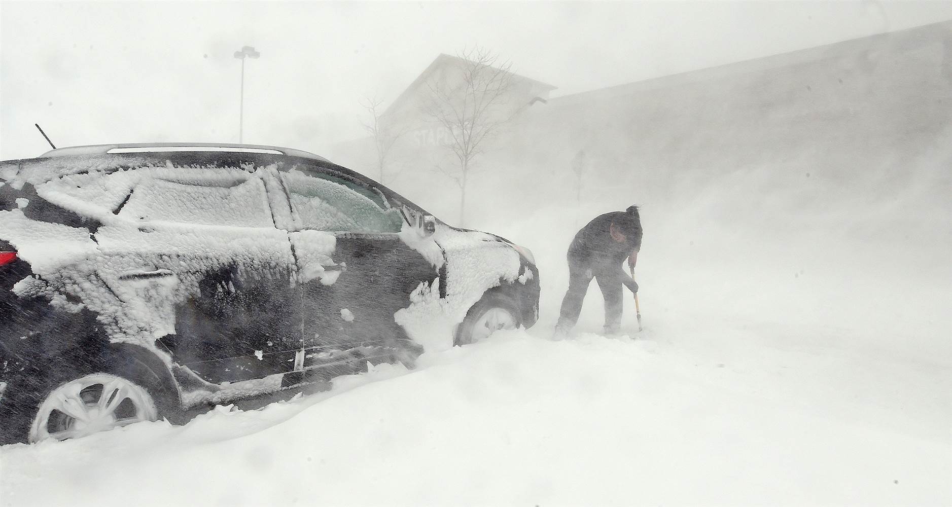
Despite a few heavy snow squalls on Wednesday (first event), temperatures were above freezing. The 0.6″ of snow that was officially measured for Boulder melted rapidly. Thursday’s snow largely impacted the Foothills and the Plains of Jefferson County (as we would expect with the NNE upslope, hence higher forecast amounts there).
Overall, a decent forecast for both days. Snow totals were generally towards the low end of our expectations. This was mostly the result of warm air/ground temperatures limiting accumulation, but also the fact that things just never fully came together for the Plains of Boulder County.
Another El Niño March delivers!
We were hopeful that those two snow events would allow Boulder to squeeze out a few more inches for the month. However, Boulder’s 32.5″ of snow during March was still good enough for 5th place in the record books! That’s pretty amazing considering our first measurable snowfall didn’t occur until March 17. Nearly all of that snow was contained in just two storms: the 15-incher on March 17-18 and the 16-incher on March 23. Boulder’s seasonal snow total has skyrocketed to 90.9″, which is nearly two feet above normal through the end of March. Denver sits at 57.2″, about 10″ above normal. This fits right in with our outlook posted two months ago for the second half of winter, in which we expected a very snowy month of March.
For precipitation, March ended with 3.84″ (rain and melted snow), which is more than 1.5″ above normal.
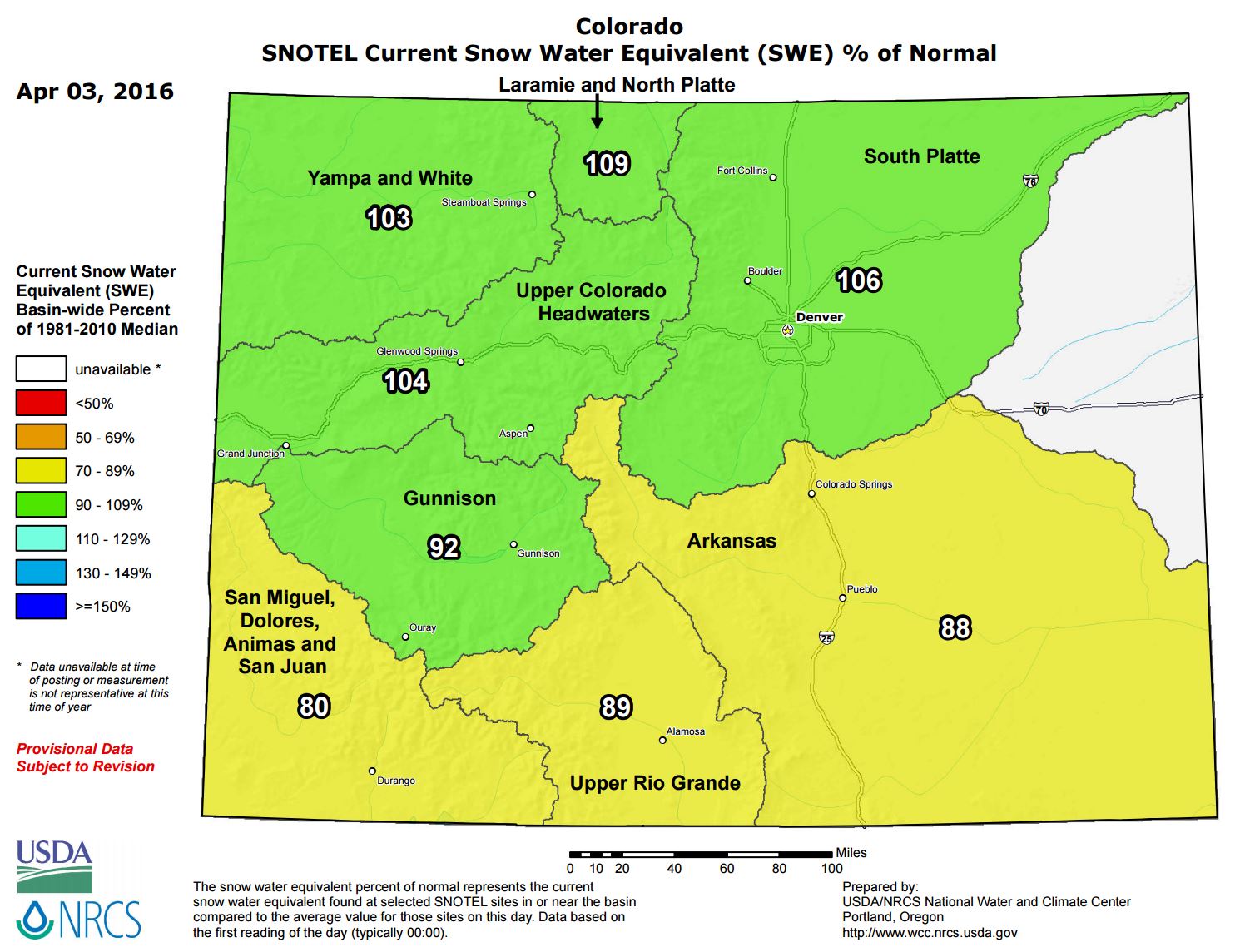
In the Mountains, the snow has really been piling up! Great for the skiers out there. Looking statewide, the north has been doing better than the south (which is a reversal of conditions two months ago). Needless to say, the situation isn’t dire anywhere just yet. The South Platte is currently at 106% of normal snowpack.
Will April showers bring May flowers?
Our outlook posted back in February called for near normal temperatures and above normal precipitation during the month of April. Based on the long-range models and ensemble guidance, this projection still looks good. We may have to wait until the second half of April for the action to pick back up, though. The CFSv2 mid-range model shows an increasing likelihood of precipitation by mid-April:
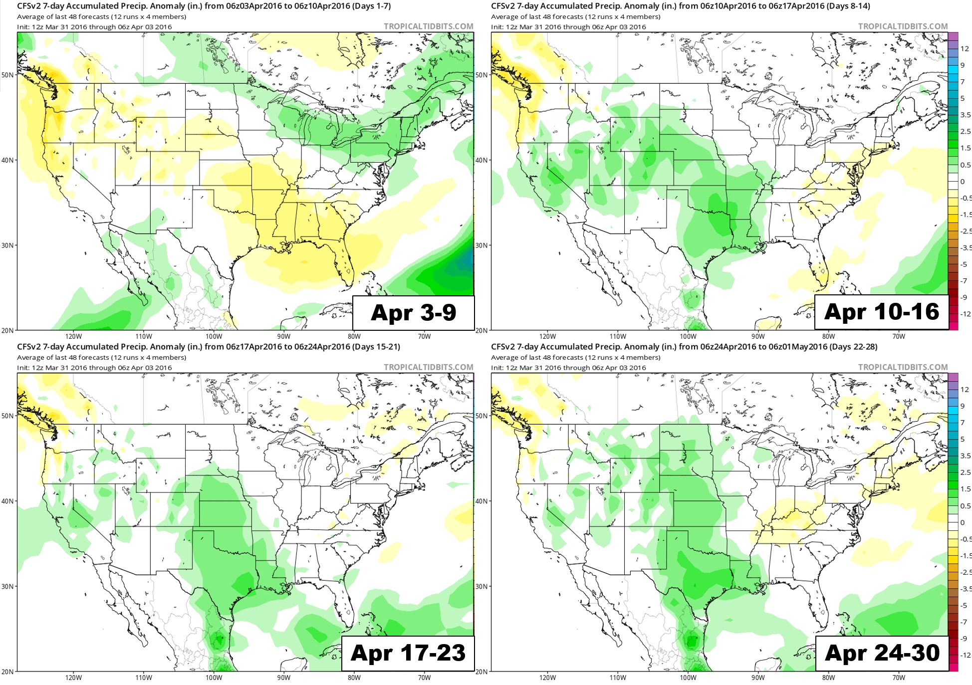
CFSv2 model outlook for April precipitation by week. Dry at the start, with increasingly more precipitation through the month.
By then, it will be warmer and hard to get much accumulating snow on the Plains.
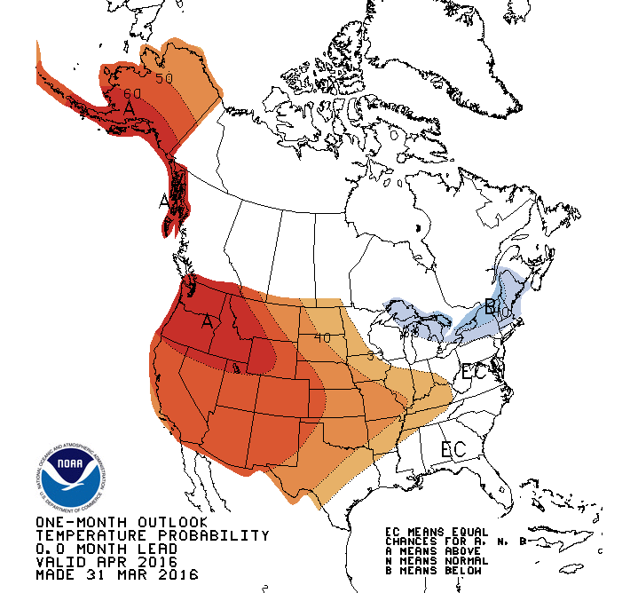
Temperature probability outlook for April from the CPC. They are forecasting above normal temperatures across the West.
Combining the timid beginning to the month with the Climate Prediction Center’s above normal temperature forecast, we believe a bulk of this month’s precipitation will fall in the form of rain for the lower elevations. If April does produce any snow, it’s going to be the sloppy, night-time variety.
The higher Foothills and Mountains should have no problem continuing to accumulate the white stuff, though. We can all breath a temporary sigh of relief as the Front Range is right on track for another below normal fire season.


