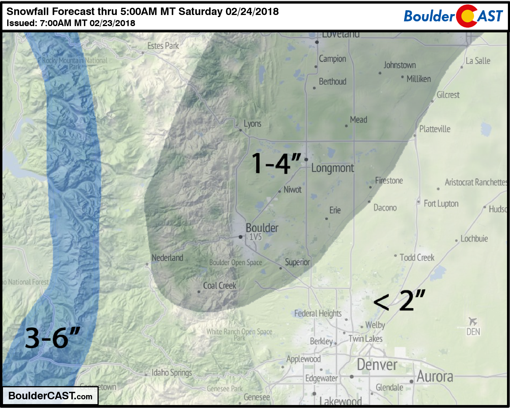
Don’t let the sunny skies Friday morning fool you. Similar to the snowfall event on President’s Day, atmospheric components will briefly align this evening for banded snowfall to once again form across the Front Range. The Northwest Metro area appears to be favored again by the models, including Boulder, Louisville, Longmont, and Broomfield.
Today will in all likelihood be our 5th consecutive day below freezing, quite the feat for late February! Our afternoon highs this week have been 14 degrees (Mon), 14 degrees (Tue), 23 degrees (Wed), and 24 degrees (Thu). Temperatures will top out in the upper 20’s today, with morning sun giving way to overcast skies by early afternoon.
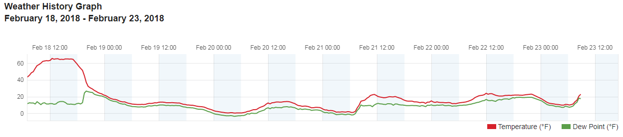
Last 5 days of temperature observations (red line) from BoulderCAST Station.
Things will do downhill this afternoon. Shown below is the jet streak that will be impacting the Metro area. The entrance region is narrow and elongated, but it will deliver the upper-level forcing to produce a few isolated to scattered snow bands this evening.
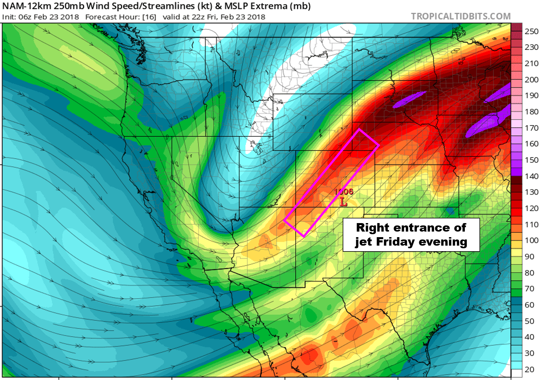
NAM 250 mb wind forecast for this evening showing the jet streak impacting the region.
The high-resolution HRRR model, which did so great in Monday’s forecast, shows the banding beginning to develop around 2:00 PM, continuing until about midnight. The heaviest bands set-up along a line from Boulder, through Longmont, to Greeley. After the banding dies down, light snow showers or flurries may linger into the wee-morning hours on Saturday.
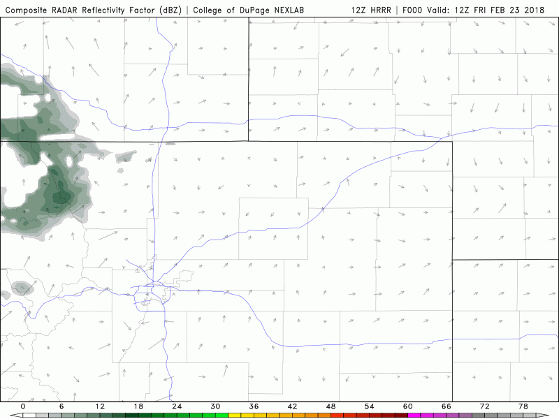
HRRR simulated reflectivity forecast for Friday afternoon and evening showing the developing snow bands.
Of course we wouldn’t trust the HRRR model alone. We’re also seeing good agreement in the banding location from the GFS and NAM models as well, favoring a near identical location to the HRRR.
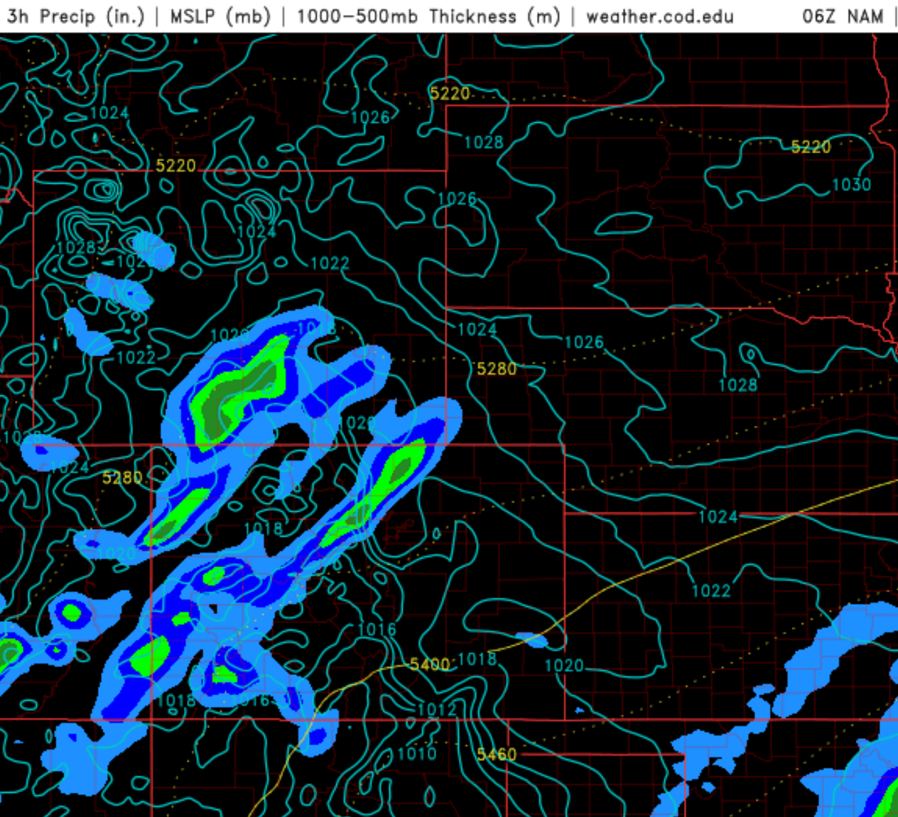
NAM precipitation forecast for Friday evening. Southwest to northeast banding structure is indicated across northwest Metro area.
We’re not expecting quite the snowfall intensity we saw earlier in the week, but rates could exceed 1″ per hour in the core of some bands this evening. The commute home will be impacted in spots as a result. We expect 0-2″ for most of the Denver Metro, with 1-4″ in areas we believe are most likely to see a longer period of banded snow. Our snowfall forecast map is shown below.
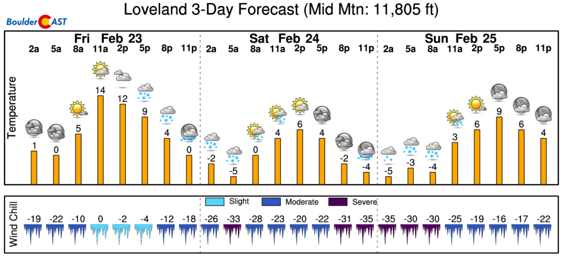
The Mountains will see light snows this weekend as well. While western Colorado will get the brunt of it, the I-70 ski resorts are looking at 2-5″ Friday night, and 1-2″ Saturday night. The wind chills will be brutal, however…
More ski forecast details can be found over at PowderCAST.
Another aspect of this storm is a trough axis that will be moving across Colorado Saturday morning. Earlier in the week, this was something we were watching to potentially bring widespread accumulating snow to our region. Energy ultimately consolidated slightly too far south and east, and therefore will have little to no direct impact on the Front Range.
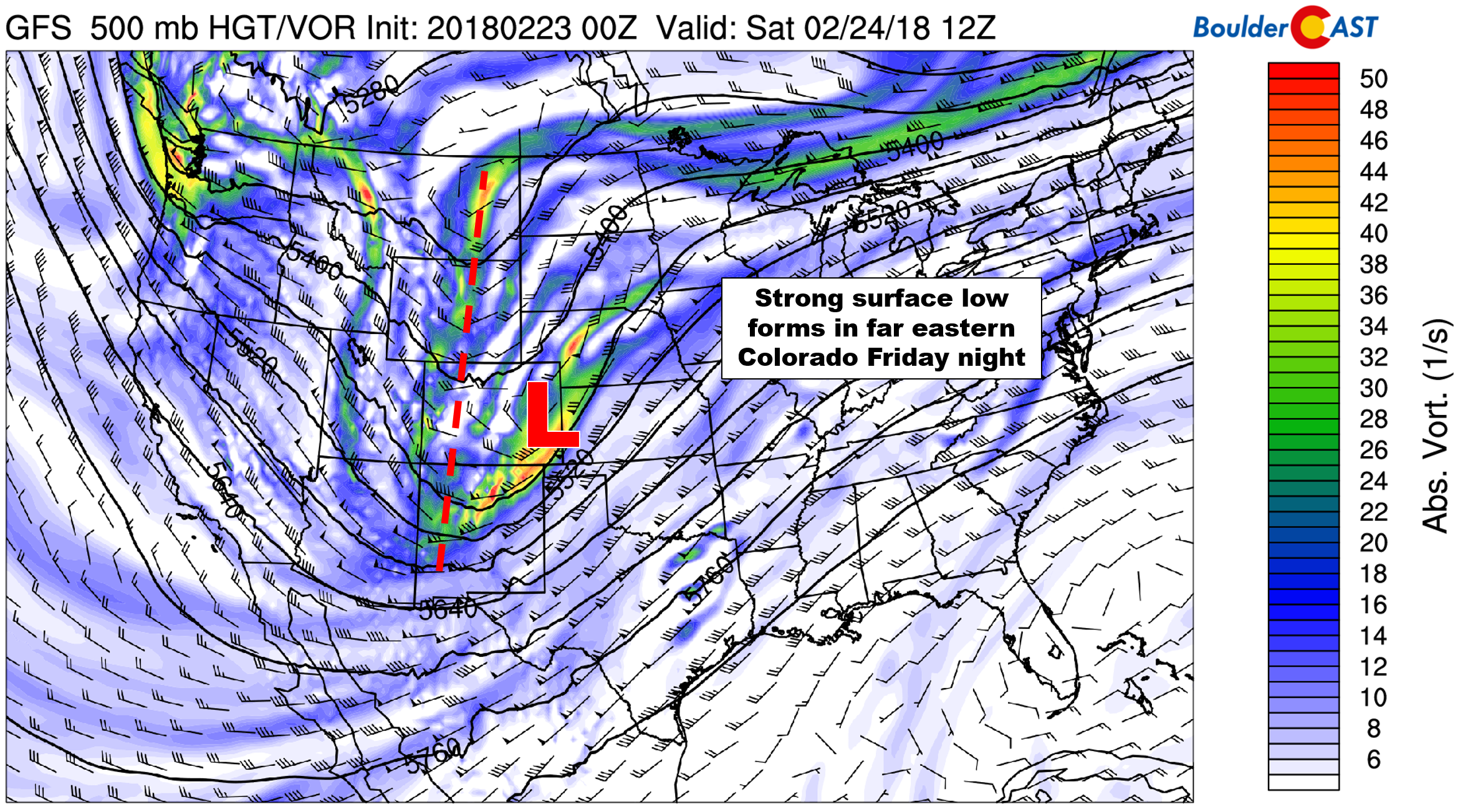
GFS 500 mb forecast for Friday night showing the position of a developing surface low.
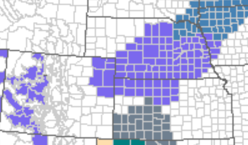
Winter Weather Advisories are posted for the northeast corner of Colorado. 2 to 5″ are expected there associated with the surface low.
That’s all for today…it is Friday after all! Warmer temperatures are on the way…potentially reaching into the 40’s Sunday and Monday, about where we should be for this time of year. Have a good weekend!
P.S. If you’re a Premium member, please take this poll.
Share this forecast:
.


