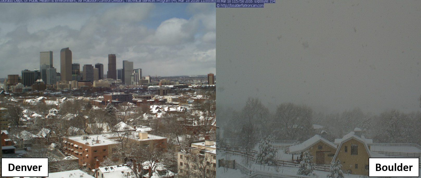
Though much of the country associates mid-March with springtime, the Front Range cannot. We are smack in the middle of what is normally our snowiest month of the year. Today is a prime example. As of 8:00am, Boulder is approaching a foot of snow. When will it come to an end and how much more snow can we expect today? Continue to find out.
Spot on forecast, but maybe too low
The storm upon us is tracking right in-line with the upper bounds of our forecast. Despite some late afternoon tweeting by us to convince the National Weather Service to upgrade the region to a Winter Storm Warning, they decided to wait until 1:00am, at which point we already had 8″ on the ground. Our guess is many (most?) folks in the Denver Metro weren’t expecting as much snow as they got. Unless of course they follow BoulderCAST!
We have measured 12.6″ of snow so far at our location in North Boulder, which is now at a brisk 20 degrees. So far, with a meager amount of reports already coming in, it looks like 8-12″ in Boulder/Ned, 5-8″ in Longmont, 6-10″ in Louisville/Broomfield, 4-7″ in most of Denver. We think once the reports come in from the Foothills west and north of Boulder, we’re going to see some big totals, maybe 14-18″. Here is our forecast map as a reminder.

Below is a nice look at one of the jet-induced heavy snow bands we were worried about….10 miles wide, 150 miles long, with 2″ per hour snowfall rates at it’s core! This particular band formed just north of Boulder around 7pm and sagged slowly south to the position seen in the image below (at midnight).
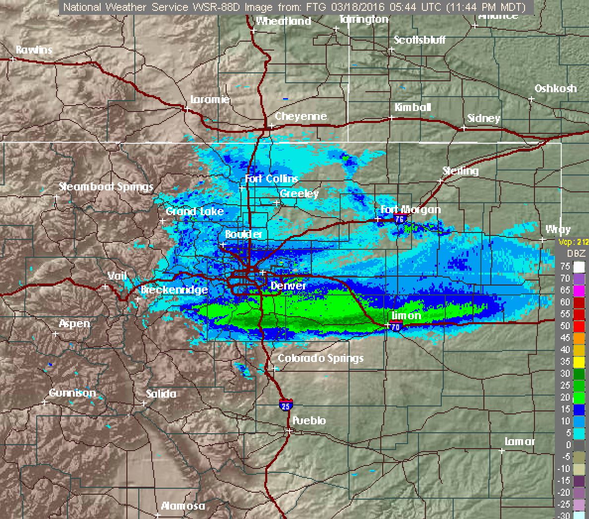
Composite radar image of Denver area at midnight last night. A heavy band of snow associated with the jet stream can be seen south of Denver.
Wrapping up the storm
Despite the deceiving northern edge of snow approaching Boulder on radar, light snow will continue into the afternoon/early evening in and right along the Foothills as upslope is still very much alive.

HRRR simulated reflectivity begnning at 6am today. Snow persists into the afternoon, especially along the Foothills
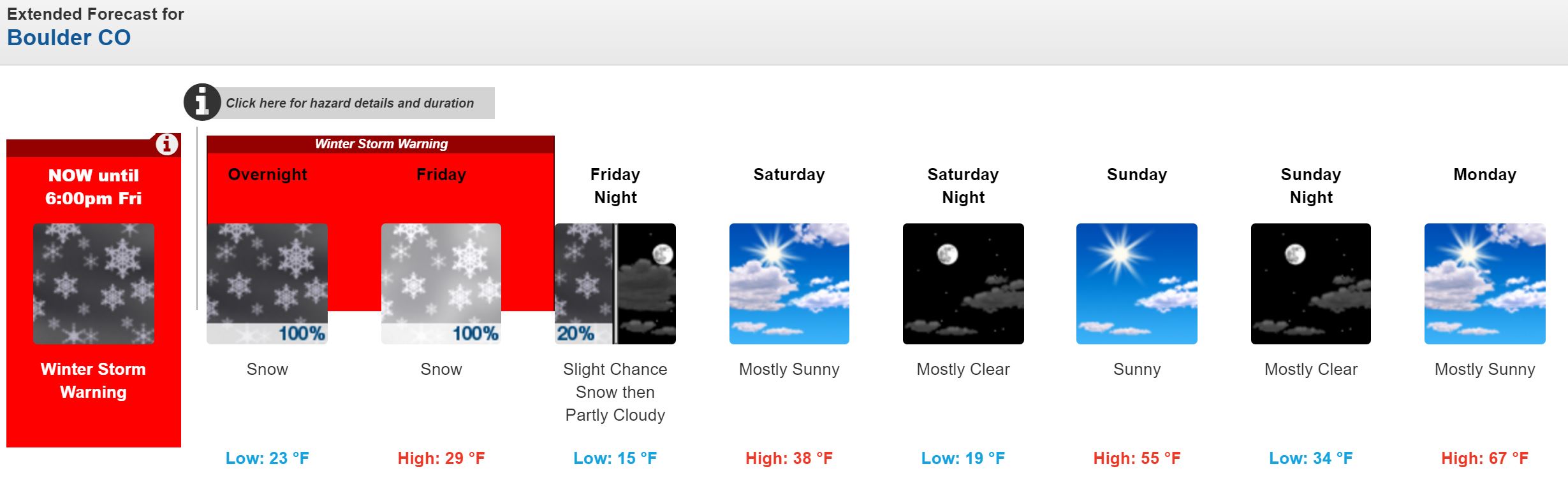
Denver will be clearing out a bit sooner. Expect an additional 1-4″ of snow to fall through the day in Boulder area, with less than 2″ in Denver.
Look for our recap post once storm totals are in tonight or tomorrow. Not sure about your thoughts, but we sure can’t wait for Monday!