To most people, Labor Day marks summer’s last hurrah; one last chance to go camping, boating, backpacking, or to throw a killer BBQ. It’s also the last weekend many outdoor facilities, like your friendly neighborhood pool, are open. To help you set your expectations, we provide a brief weather forecast for the upcoming holiday weekend.
We are going to keep this one short and sweet, as we have our own travel and camping trips to plan and pack for as well. A large trough currently sits over the Pacific Northwest (see below). This will be the main weather player through the weekend. Ahead of the trough, southwesterly flow will continue to advect moisture into Colorado. As it approaches, it will help produce enough instability to fire off some storms, mostly over the mountains, and western Colorado.
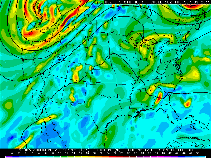
GFS 500mb vorticity map, valid at Noon Thursday
Friday: A slight chance of afternoon showers and storms over the Mountains. Otherwise, partly cloudy skies. Temperatures across the Plains will be in the mid 80s, with 70s in the Foothills. Overnight lows on the Plains near 60.
West of the Divide is another story, with areas like Grand Junction and Montrose picking up significant rainfall Friday into early Saturday morning (shown below).
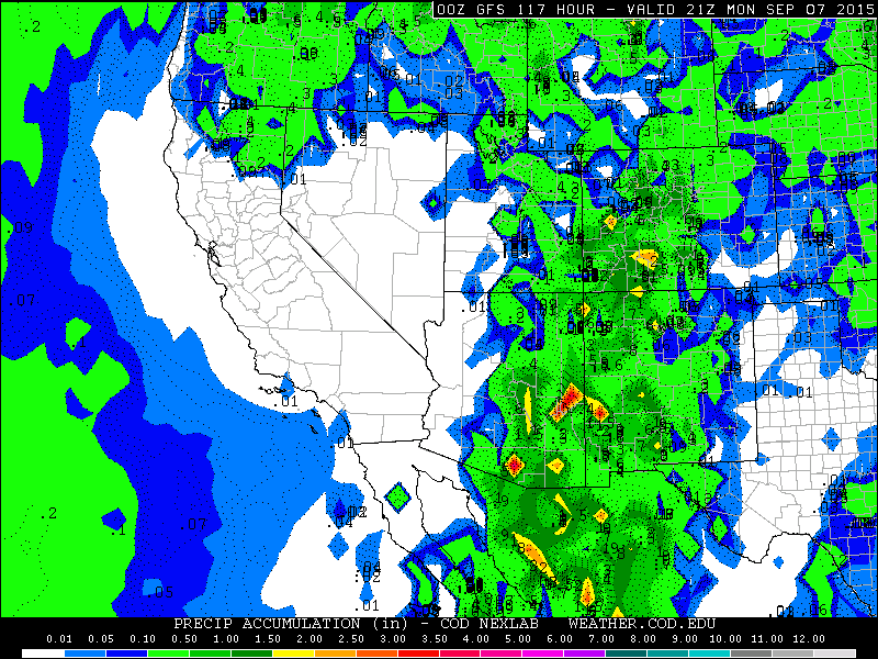
Total precipitation from the GFS model, through Monday evening
Saturday: Mostly cloudy with some isolated morning showers around. Widely scattered storms possible in the afternoon, mostly west of the Divide and over the Front Range Mountains. Isolated afternoon activity on the Plains. Temperatures in the mid 80s on the Plains; 70s in the Foothills. Overnight lows on the Plains near 60.
Sunday: Clouds early, then mostly sunny as the trough pulls away to our north and east. A weak cold front looks to push through sometime in the afternoon, with only a slight cool down and limited moisture to work with. Isolated storms over the Mountains. High temperatures in the low 80s on the Plains, 70s in the Foothills. Overnight lows on the Plains in the mid 50s.
Monday: Partly sunny and seasonal. Drier, west-southwesterly downslope flow will ensue, which could be gusty at times, particularly higher up. Cooler, with highs only reaching into the upper 70s on the Plains, with low 70s in the Foothills.
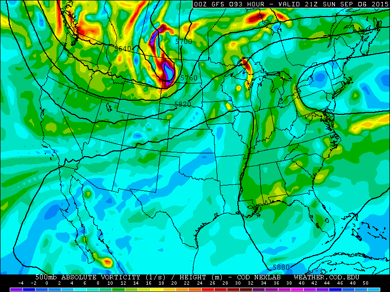
GFS 500mb vorticity map, valid at 3pm Sunday, with downslope and drier air over the state.
Overall, the weekend will be fairly nice in the immediate area to Boulder. The further west you go, things will be wetter, especially Friday into Saturday. However, both Sunday and Monday look exceptional across all of Colorado. Enjoy!


