Happy Friday! Our colder, more-likely-to-produce-snow storm has arrived. We provide a small update to our forecast from yesterday with final details on how this evening and tonight will play out across the region.
SET-UP:
Our deep storm system is currently located over the Four Corners region (see below). General model consensus is for the upper-level low pressure to track southeast into New Mexico by Saturday morning and weaken considerably. This track will be further south than the prior storms, but this system is stronger and has more moisture to work with overall, so we’re not overly concerned.
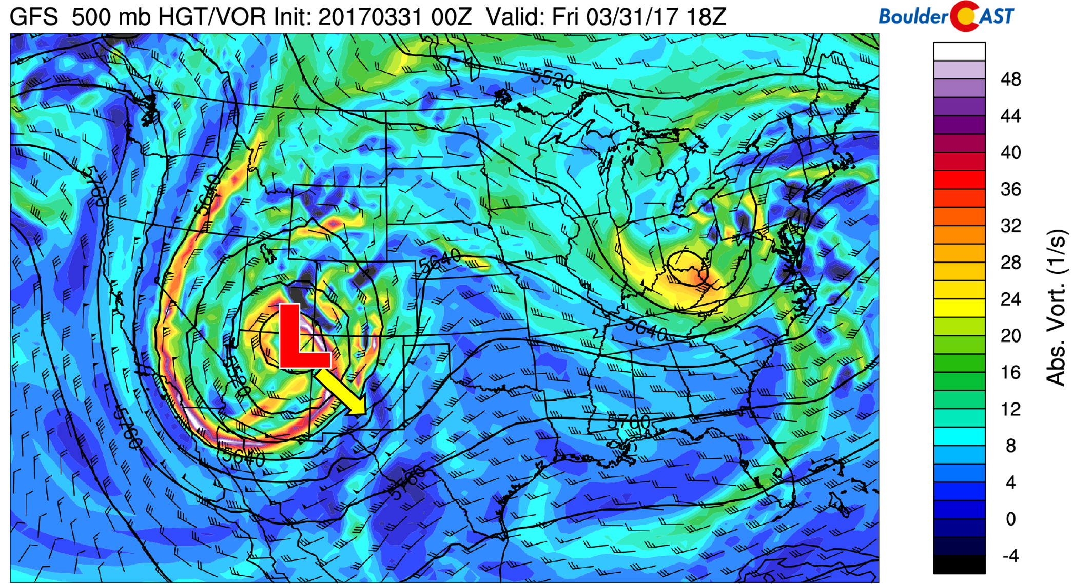
GFS 500mb vorticity map for Friday morning. The storm is currently located over northeast Arizona.
We had hoped it would make a more direct approach towards Colorado and also maintain it’s strength a little longer. This would have made this a much more impactful event. Instead, most of the action will be to our south in central and southern Colorado. Nonetheless, we still have a potent spring storm to deal with over the next 36 hours…
The position of the storm on Saturday afternoon is shown below.
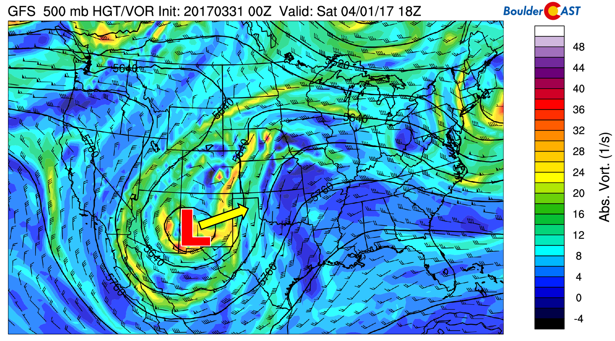
GFS 500 mb vorticity map for Saturday showing the low tracking well to our south.
TIMING:
On and off rain showers have occurred overnight with light snow above 9,000 feet. Our storm is moving in now and moist upslope flow will set-up this afternoon and evening, spreading more widespread and heavier precipitation. As slightly colder air filters in, snow levels will be falling down to include the entire Denver Metro Area between sunset and midnight. Some areas will make the change-over earlier than others. Light snow will linger into Saturday morning before coming to an end. Expect a chilly day with a high near 40 for Saturday.
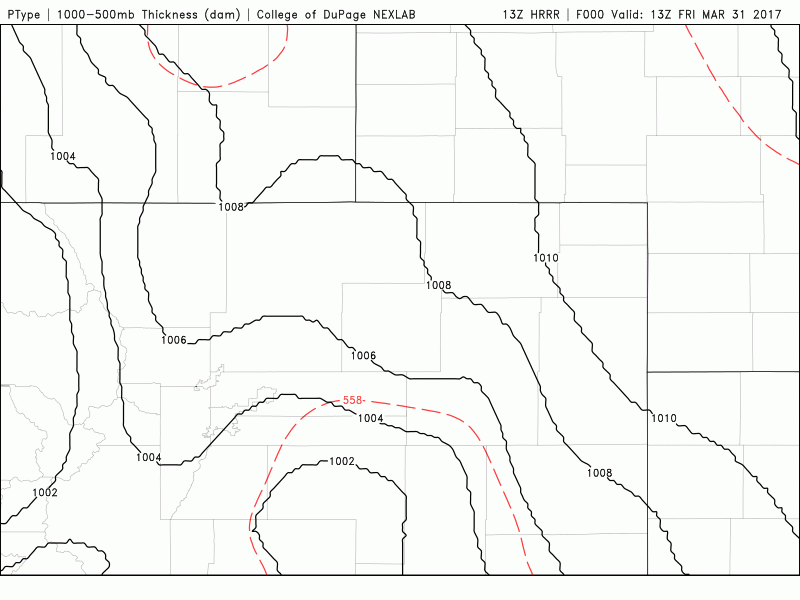
Latest HRRR simulated precipitation forecast type and intensity through this evening. Rain changing to snow across the Front Range (College of DuPage)
SNOW AMOUNTS:
We hate to say it, but this system bears a lot of similarities to the previous two storms, at least as far as track and general model consensus in the days leading up to the storm. The GFS forecast model is still the most hopeful for heavier precipitation across the Front Range, but most other models come in lower. Our blended projection is for 0.5 to 1.0″ of liquid to fall across the region.
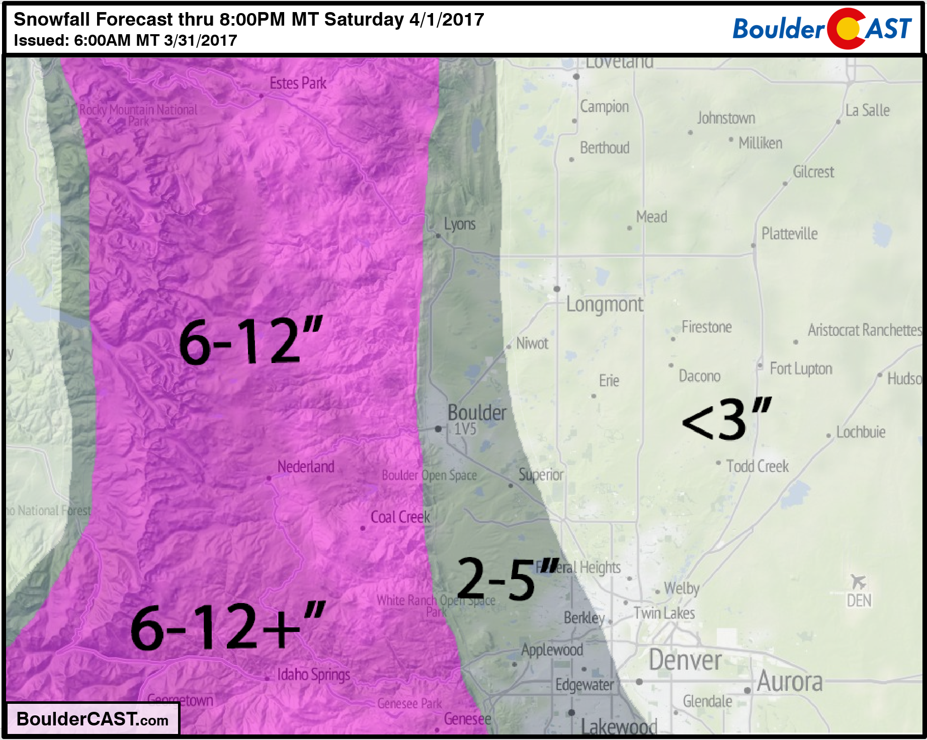
Temperatures are COLDER than the last two storms, but still not all that COLD. The main question remains is how long will favorable upslope conditions overlap with the colder air tonight. The best forcing for precipitation looks to be between 4PM and 4AM this evening and night. We need cooler air to be in place for at least a chunk of this time frame. Sure the Foothills should easily get 6-12″ of snow (if not more!), but the Plains are far less certain given the temperatures and change-over timing for snow. The overnight timing of the precipitation is definitely a positive for snow.
Our snowfall map for the event is given below. If we start seeing some flakes mix in around rush hour, thumbs up for the high-end of these snow totals. If it’s raining after midnight, we’ll be lucky to get into the low-end of these ranges. With the amount of melting expected and temperatures barely, if at all, below freezing, travel impacts and power outage potential should be minimal.
Even with this tricky forecast right ahead, we’ve already got one eye turned to our next system set to arrive Monday evening. It looks even colder (yes!) and has the potential to again produce snow for the Front Range Foothills and Metro area. Let’s get past tonight’s hurdle first, though…
Don’t be selfish…share our forecast with your friends!
.


