
We hope you had a cozy, joyous. and relaxing holiday with your family and friends. Mother Nature delivered the best gift of all, a White Christmas, our second in as many years. We quickly recap storm totals across the region.
We issued out final forecast for snowfall on then evening of December 23rd (Christmas Eve Eve?), projecting that a light snow event for the Plains was imminent, arriving late in the afternoon on Christmas. This was roughly 48 hours before the first flakes started flying. We expected a general 1-3″ for the Plains, with 2-5″ in the Foothills. I think we were a little more aggressive with our forecast than other weather outlets, which paid off in the end. After we posted our forecast, models trended downward on snow amounts. The Boulder NWS was only forecasting a trace up to two inches of snow in most areas. We debated updating our forecast, but ultimately decided to stick with it, as our alterations would have only reduced the Plains to 1-2″ and Foothills to 2-4″. Not a significant change by any means. We were not convinced our Christmas snow would be a complete flop (as the NWS suggested).
Snow arrived remarkably on cue, beginning in areas south of Denver by 11am, finally materializing over Boulder around 5pm. Light to moderate snow continued to fall into the night, ending around sunrise Saturday morning. A few heavier bands of snow did set up, mainly east of Boulder. Consequentially, those areas had the whitest Christmases around the Metro Area! Surface temperatures were in the low 20’s throughout the snow event, quite cold, leading to high snow to liquid ratios in the 15:1 to 18:1 range for Boulder. Everything that fell immediately began sticking on roads and sidewalks, making for tricky holiday travel. Road care was marginal at best in my NoBo neighborhood, but hey, we shouldn’t expect much on Christmas Day.
Shown below is our original forecast snow total map, with the observed storm totals at each location contained in boxes. Green boxes indicate that the observed snowfall was within one inch of the given forecast range, while red ones were outside the scope of our forecast.
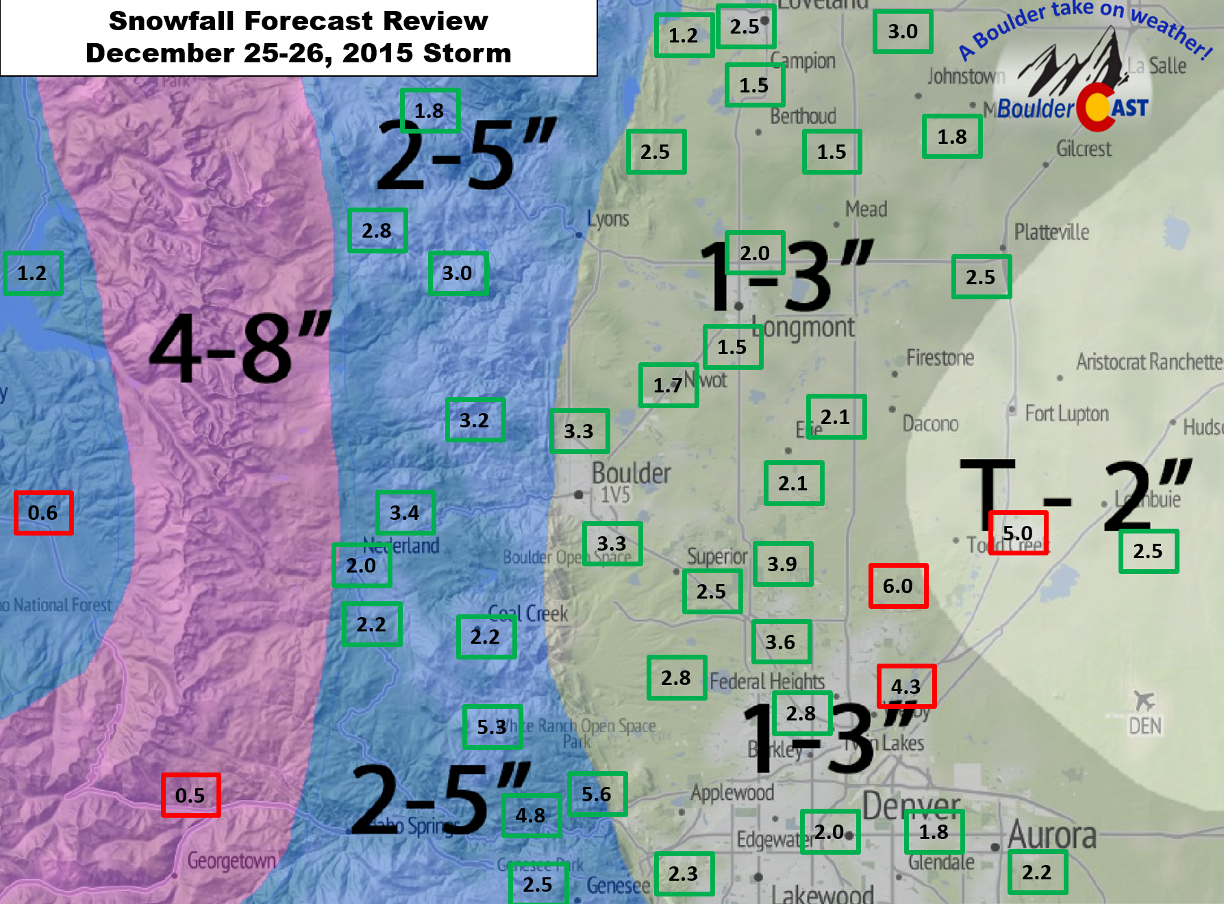
Not a bad forecast by any means, but not entirely perfect either. Most locations trended towards the high end of the forecast, which was definitely a nice treat for the holiday. We nailed the Foothills, and nearly all of the Plains. At the BoulderCAST location, we measured 3.3″, with Boulder officially picking up 2.6″.
The two bad-apples of our forecast:
- Right along a line extending northeast from downtown Denver, which accumulated up to 6.0″. This area was hit hardest by the heavier, banded snowfall. It was fairly localize right along the north-south oriented bands.
- In the Mountains… We knew upslope would be weak, but even the banded precipitation stayed east of the highest terrain. We were expecting 4-8″ above 9,500 feet. However, we are hard-pressed to find a single Mountain location that got more than 2″ (which is what Eldora reported). We didn’t bust as big here as the NWS. They had 6-12+” over roughly the same locales.
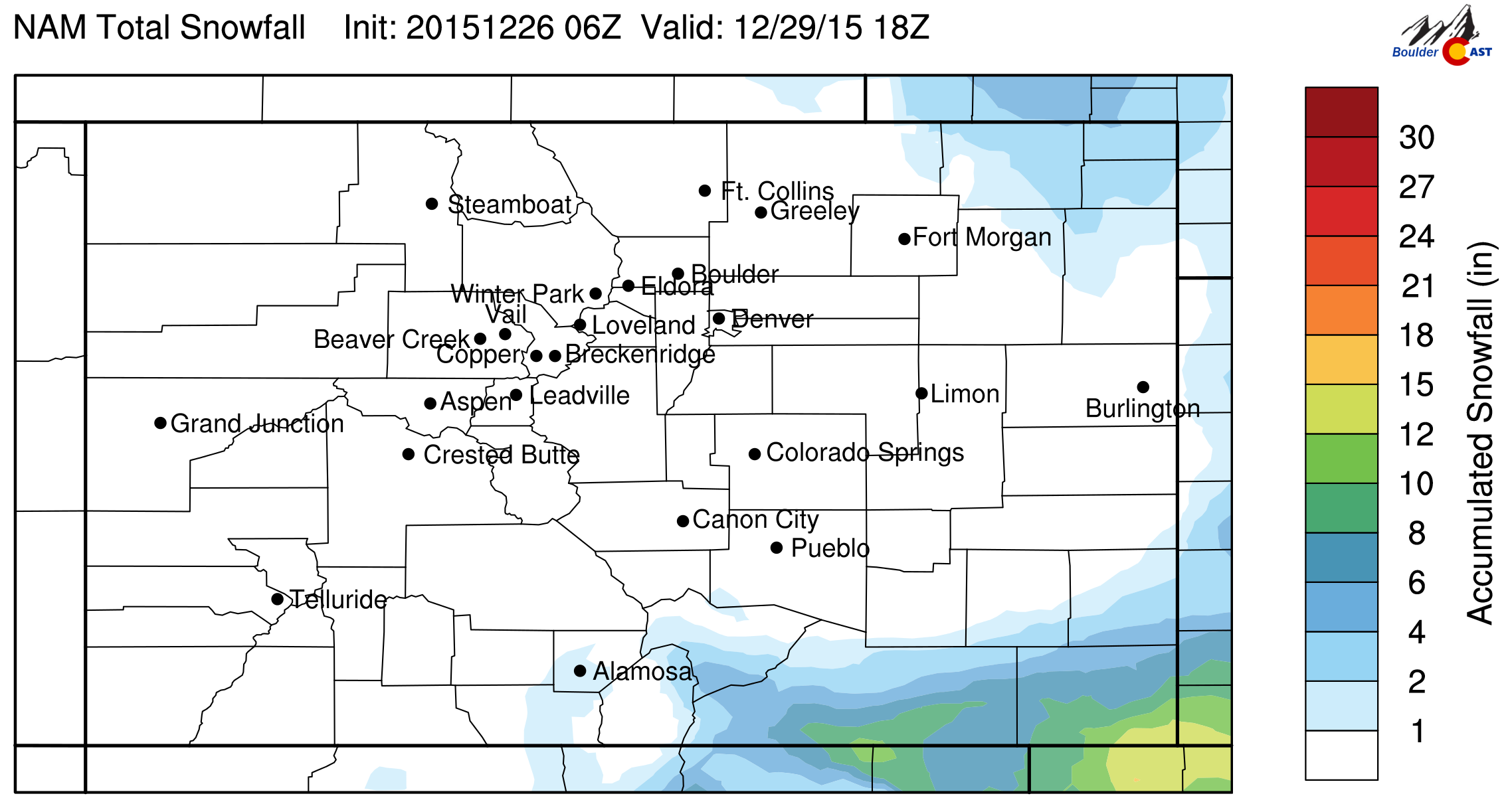
On a related note, the southern piece of the same storm system is now dumping (and we really mean dumping!) snow on extreme southeast Colorado, New Mexico, and west Texas, with one to two feet of snow forecast across a large area. The snow forecast from the NAM shows the impact the storm will have over the next few days.
The current radar shows the circulating low bringing heavy snow to desert locations that rarely see snow in this quantity.
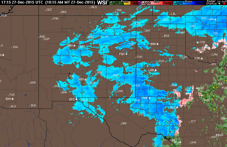
Current radar loop showing the blizzard underway to our south | Intellicast
A plume of Gulf of Mexico moisture is feeding the system, with slow storm progression and high winds compounding the impact. New Mexico has issued a Civil Emergency message, reminding it’s residents of proper blizzard travel etiquette. Though, with four to ten foot snow drifts, is travel even a thing?
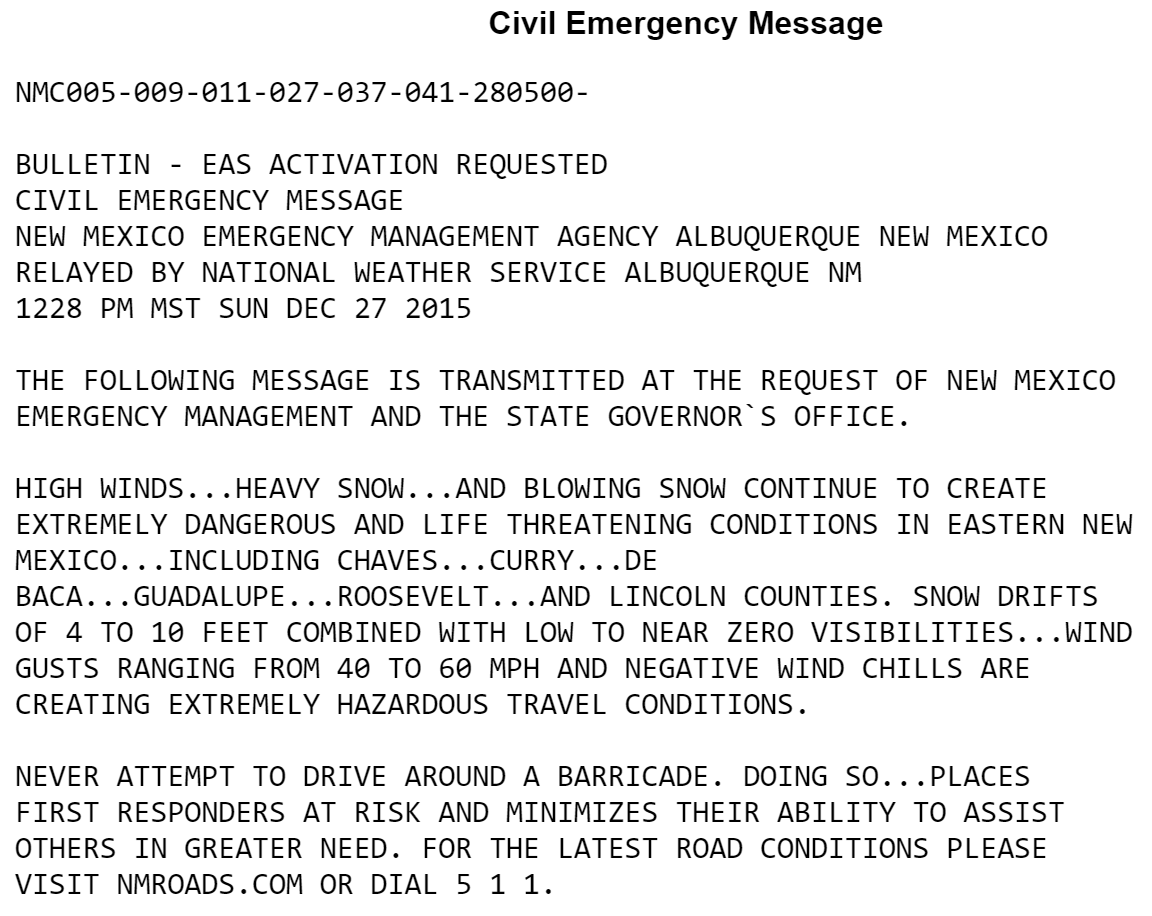
Nearly every major road in eastern New Mexico is shut down at this point…
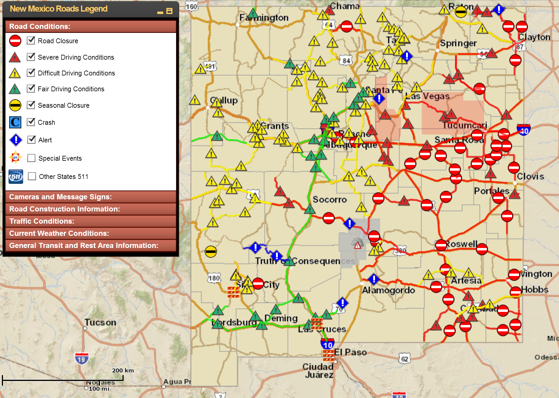
Travel conditions across New Mexico right now are treacherous at worst, bleak at best.
While disappointing that this monster storm won’t hit northeast Colorado, we know our turn may very well be right around the corner!
Be sure to subscribe to BoulderCAST and follow us on Facebook and Twitter! Stay tuned!


