A brief review of our first “major” snowstorm in more than a month.
Snow began falling Thursday morning and persisted right into Friday afternoon. Some upper-level forcing caused a few heavier bands of snow to form across the Metro Area during the day Thursday. These bands were more widespread than any of global forecast models indicated. In our final forecast issued early Thursday morning, we mentioned that there was a big discrepancy between the high-resolution models and the global models, mostly due to the high-resolution models indicating the potential for that banded snow Thursday during the day.
The large variation in the models didn’t instill much confidence…For this reason, we turned to one of our less frequently used snowfall forecast ranges, 1-4″. We really don’t like to use such an ambiguous range. As forecasters, we should be able to differentiate whether the storm will be a 1-2″ event or one dropping up around 4″. Unfortunately, this time we could not.
All along, we expected a bulk of the snow to fall from late Thursday afternoon into Friday as a reinforcing shot of upslope arrived. In the time series below from BoulderCAST Station, the sharp dip in temperature between 2:00 and 3:00PM was this front arriving on Thursday.
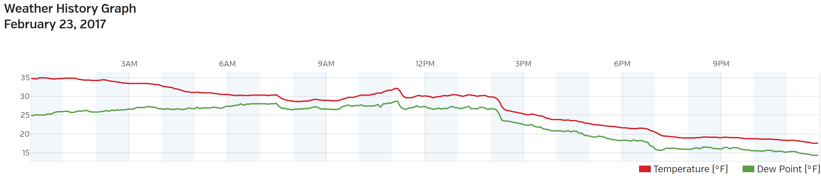
Temperature and dew point time series from BoulderCAST Station on Thursday, February 23rd.
After this point, light snow fell near continuously through Friday afternoon with weak/shallow upslope in place. This facet of the forecast was well-respresented by the large-scale models many days in advance. The clouds producing the snow Friday were so shallow, there was almost no radar signature from the snow falling in Boulder much of the day Friday! The radar beams coming from east Denver were above the clouds!
Shown below is our original forecast map created early Thursday morning. The observed storm totals per location are contained in boxes. Green ones indicate that the observed snowfall was within one inch of the given forecast range, while red was outside the scope of our forecast.
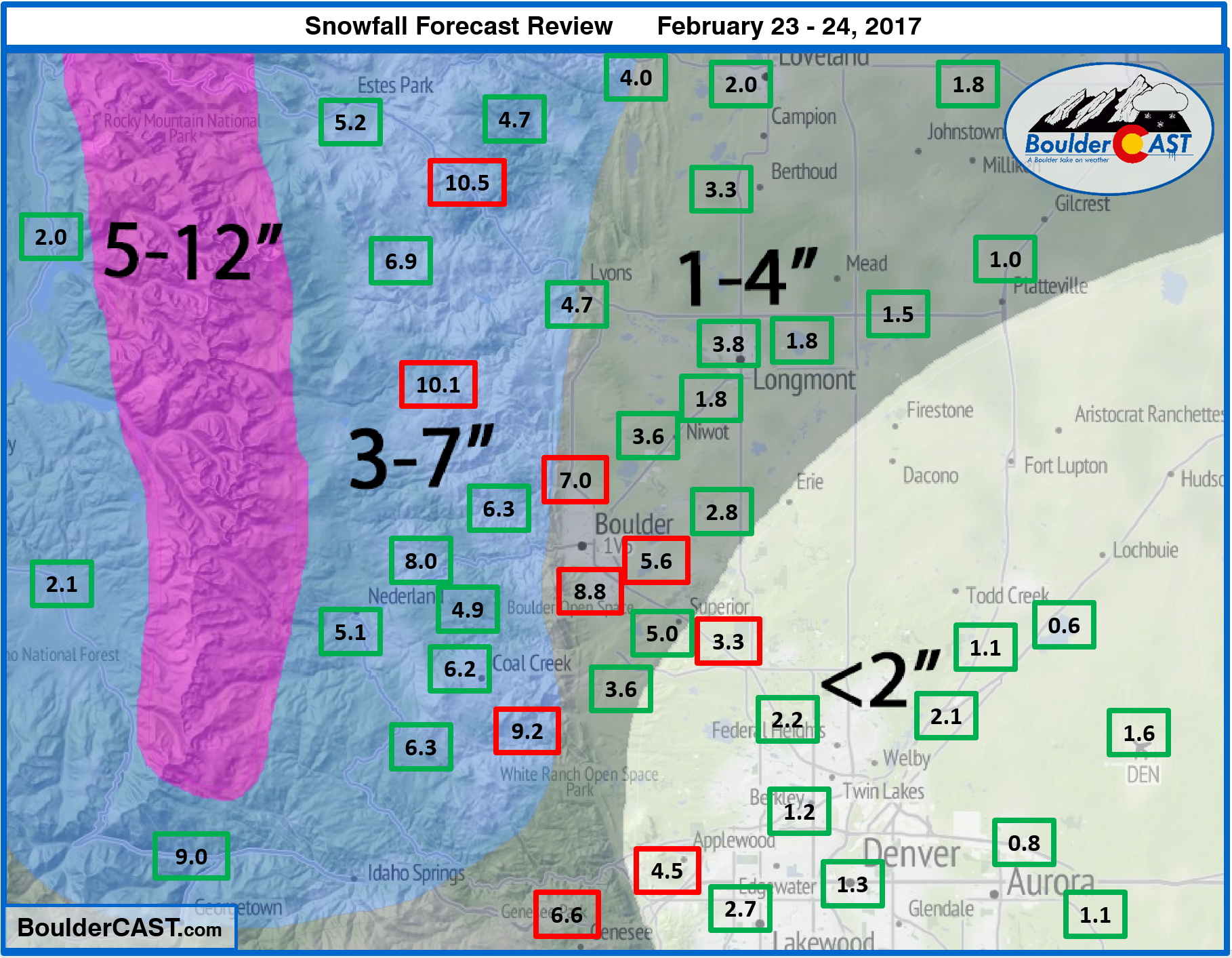
In general, what we expected was observed…more snow north and west, with much of Denver only seeing two inches or less. Our only real “busted” forecast fell in areas right along the base of the Foothills, like the city of Boulder and Golden. It is hard to believe because there was a lot of melting on Thursday, but Boulder’s official total was 8.8″ form this storm! Denver only recorded 1.6″.
Boulder’s seasonal total now rests at 46″, with just 19″ in Denver. Find a updated storm-by-storm breakdown of our 2016-2017 Winter Season here.
Wildfire concerns were just starting to creep back into consideration last week. Let’s hope the snow continues.


