Mostly sunny with widely scattered afternoon showers and thunderstorms. Highs soaring into the mid 90’s before capping/dropping with late afternoon cloud cover. Continue reading for today’s full forecast.
A massive ridge is currently in place across the center of the country, with heat and subtropical moisture pumping northward into Colorado and the northern Plains.
The 500 mb map below for this afternoon shows this ridge centered across Kansas.
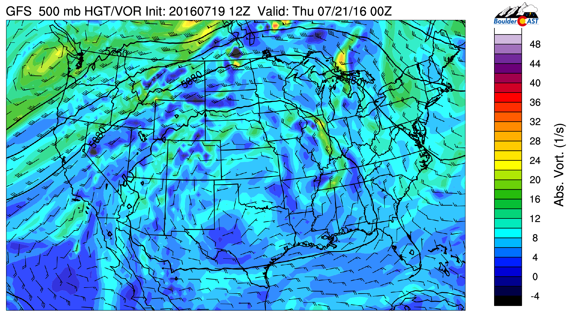
GFS 500 mb vorticity map for this afternoon showing a ginormous ridge across the center of the United States
Across Colorado, a solid plume of monsoon moisture still resides over the state. With this, we’ll be in store for another round of potent afternoon thunderstorms today, just like the past two afternoons. The narrow plume of moisture, tracing back to the Gulf of California, is seen in the precipitable water anomaly map below.
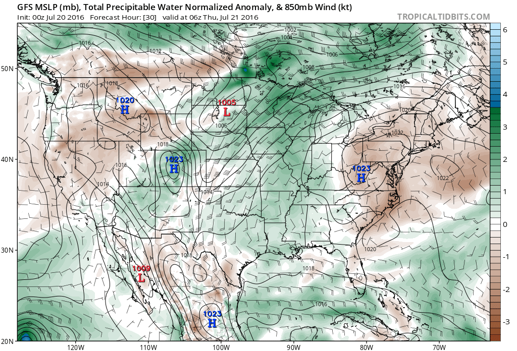
GFS model forecast moisture anomaly for today showing the monsoon plume sprawled across Colorado
Expect highs to soar into the mid 90’s by mid-afternoon before clouds and storms build in. Storm coverage will be similar, if not slightly reduced from yesterday. We’re still looking at about a 30% chance for everyone across the region.
Enjoy the rains…. they look to continue (though slightly less widespread) right through the upcoming weekend!
—
 Remember, DayCAST’s are Premium content. Periodically, we open this forecast up to all of our readers. Today is one of those days!
Sign up to become a Premium member today to get the best BoulderCAST experience, including daily forecasts, periodic video content, custom forecasts, an extended LiveCAST, early access to select content and much more! For a limited time, sign up and use the offer code BOULDER to get an additional $3 off an annual subscription!


