It will be a dreary day here in the Front Range. Read on for our complete forecast for today and tonight.
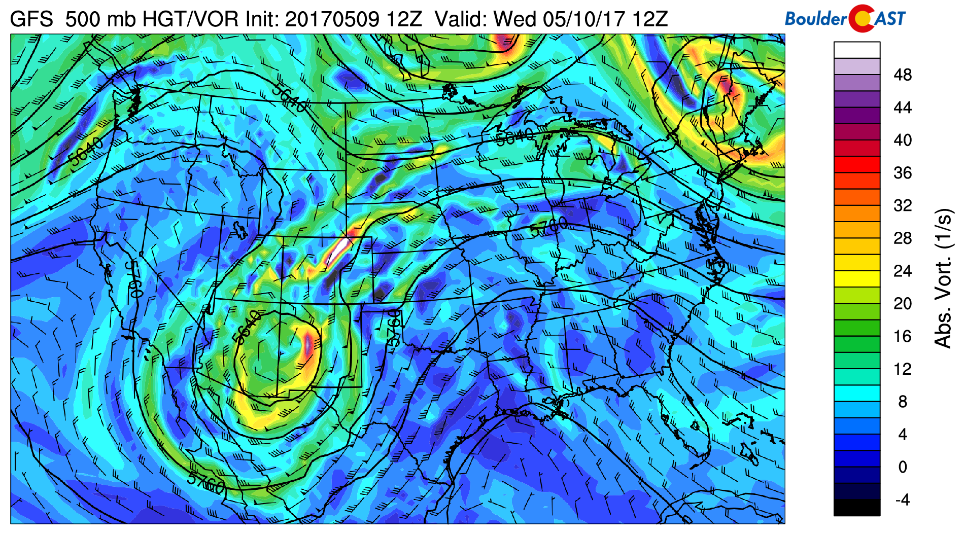
The cut-off low pressure system that has been pumping sub-tropical moisture into Colorado since Sunday will be trekking across New Mexico today and tonight. The system looks quite impressive on the 500 mb map below….notice the strong southerly flow across eastern Colorado.
At the surface, a cold front will provide upslope across the region today which will keep our temperatures only in the 50’s. With all the moisture around, scattered light rain showers will ensue much of the day and linger into the overnight hours. Just as we see for many of our snow storms, models are disagreeing on the track and intensity of the system, and ultimately how much rain falls today and tonight. We think around 0.3 to 0.7″ should cover most areas, but localized spots could potentially exceed 1″, especially right along the Foothills.
Snow won’t be much cause for concern for the event as cold air is very limited. Notice how weak the northerly flow coming into Colorado from Wyoming is in the above map…. Snow levels this morning are around 11,000 feet, but they will be falling as cooler air works in behind the front this afternoon and evening. By tomorrow morning, snow levels will bottom out around 9,000 or 8,500 feet…enough for the higher Foothills east of the Divide to see a few, minimally impactful flakes.
 A warming and drying trend will take us into the weekend…so there’s that at least!
—
Remember, DayCAST’s are Premium content. Periodically, we open this forecast up to all of our readers. Today is one of those days!
Sign up to become a Premium member today to get the best BoulderCAST experience, including these daily forecasts, extended and enhanced graphical forecasts, chat room and forum access, early viewing of select content and much more! Hiking forecasts are the next product coming to BoulderCAST Premium. We’re expecting to launch them in the next few weeks.


