Overcast early, then partly cloudy. Near 60 degrees. Rain and snow on tap for this evening into Wednesday. Continue reading for today’s full forecast.

DayCAST’s are Premium content. From now until Friday April 1, 2016, all BoulderCAST readers will have access to these daily forecasts. Subscribe to BoulderCAST Premium before April 1st and get 75% off your first month using the promo code SPRING or 17% off your first year with the promo code WEATHER.
——
Today will be a transition day for northeast Colorado. A formidable-looking closed-low to our west will be driving more southerly flow to the region.
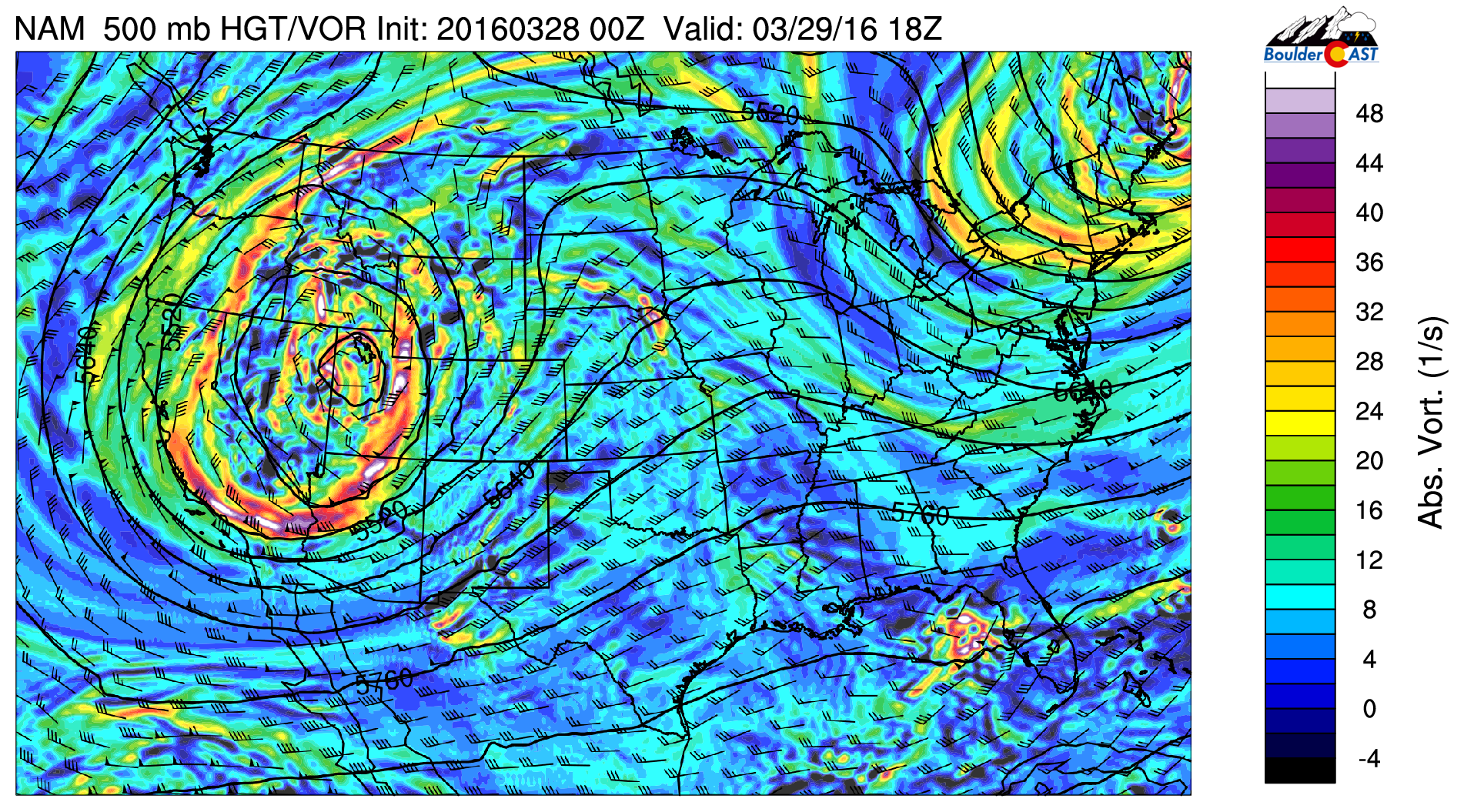
NAM 500 mb vorticity map for Tuesday afternoon
This will continue to keep us relatively warm. Yesterday’s high was 60 degrees. We’ll be right in that ballpark once again today. High clouds this morning will clear up a little bit this afternoon for a tad of sunshine.
The big story this week is the progression of that trough pictured above. We’re tracking the system closely, but it still hasn’t wavered too much from it’s original path. This will be mostly a Wyoming snowstorm. We’re still optimistic that it may come a little further south, though!
As of now, precipitation chances increase Tuesday evening through the day on Wednesday, with intermittent rain/snow across the Front Range. We’re not expect major impacts at this time, but the potential for a couple inches of snow is there for the northern Denver Metro area.

NAM forecast total precipitation through Thursday AM. SE Wyoming is finally set for a snowstorm!
In the High County, snow will be on the increase this afternoon ahead of the trough, with heavy snow likely by evening. We’re expecting 5-12″ up there by Wednesday afternoon. The NWS has already posted Winter Weather Advisories. Get out there and ski if you can!
Depending how the models look later today, we may need to post a snowfall forecast tonight or tomorrow morning. Stay tuned.


