Dreary with low clouds and light precipitation lingering through the day. Additional light snow accumulations possible above 9,000 feet. Highs across the Plains in the low 40’s. Continue reading for today’s full forecast.
 DayCAST’s are Premium content. Periodically, we open this forecast up to all of our readers. Today is one of those days!
Sign up to become a Premium member today to get the best BoulderCAST experience, including daily forecasts, periodic video content, custom forecasts, an extended LiveCAST, exclusive content and much more! For a limited time, sign up and use the offer code BOULDER to get an additional $3 off an annual subscription!
——
Good morning! As of 6am today, BoulderCAST station has recorded 0.65″ of rain from the storm (well spread over the last 24 hours).
The upper-level system that has made for a soggy last several days across the Front Range continues to die a slow death to our west. It is currently located near Las Vegas.
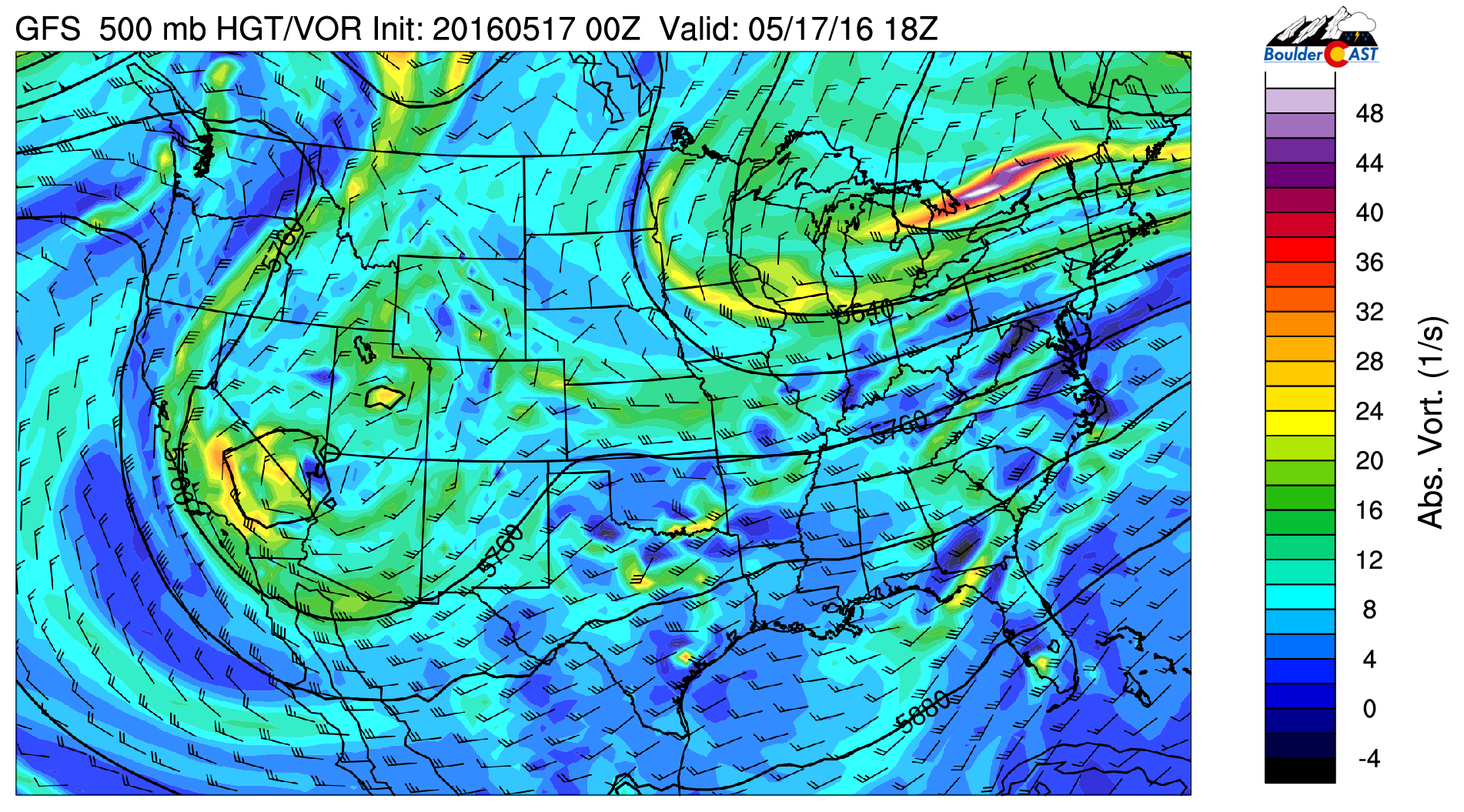
GFS 500 mb vorticity map for this afternoon
This position will keep NE Colorado in an area of weak uplift through tonight, and with plenty of moisture in place, light precipitation will continue through much of the day, especially in and near the Foothills where upslope will help focus that lift. Highs will only be in the low to mid 40’s.
Locations above 7,000 feet will have snow mixing in at times, especially early this morning, but additional snow accumulation will be light (less than 2″) and only above 9,000 feet for the most part (the mid-May sun is wicked!). Our forecast snow TOTAL map from Sunday night still looks good.

Clouds will stay socked in through tomorrow, but we should finally start to kick this ugly weather out on Thursday as the upper-level system moves east and Mother Nature finally realizes this isn’t Seattle.
Hang in there!


