Mostly cloudy and cool, with a slight chance of drizzle/showers. High in the upper 40’s. Continue reading for today’s full forecast.
 DayCAST’s are Premium content. Periodically, we open this forecast up to all of our readers. Today is one of those days!
Sign up to become a Premium member today to get the best BoulderCAST experience, including daily forecasts, video content, custom forecasts, exclusive content and much, much more! As a special promotion, the first 50 readers to sign up can use the offer code BOULDER to get an additional $3 off an annual subscription!
——
The upper-low that was responsible for the snowstorm over the weekend is now nothing more than a nuisance to us. It has barely moved over the last 24 hours, and is now situated right above Denver.
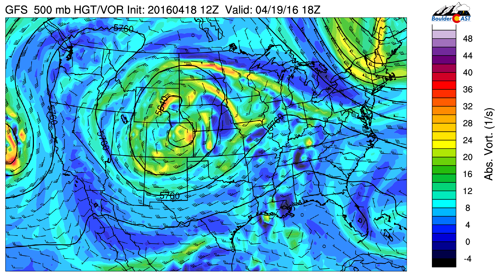
GFS 500 mb vorticity map for this afternoon, showing the upper-low still over northern Colorado…
It will continue to spin and keep the cool and unsettled weather across the region today.

Water vapor satellite image for this morning showing the spinning low across the area
Beneath the low is a lot of residual moisture, seen below in the 700 mb relative humidity forecast for this afternoon. High values over our region indicate skies will remain mostly cloudy.

GFS 700 mb relative humidity map, showing the large expanse of clouds on tap for the region today.
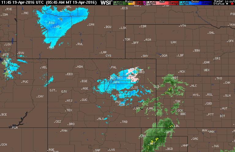
There will even be a chance of isolated flurries/rain showers through the day. Most of us will stay dry, though. Expect highs in the upper 40’s. You can see the rotation centered on Denver in the current radar loop, with light snow and rain just to our east.
Drier weather takes hold by tomorrow, with a ridge building in for the second half of the week. We’ll look for gradual warming, back into the 70’s by Friday!
—————————–
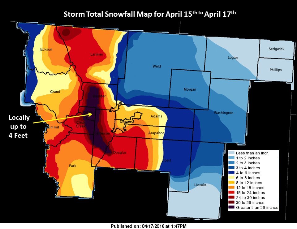
P.S. Boulder’s official total from the snow storm was 18.3″, while Denver recorded 12.1″. Here is a snow total map from event, compliments of the NWS. Northeast Boulder County got spared the most.