Mostly sunny and warm. Continue reading for today’s full forecast.
 DayCAST’s are Premium content. This is the last day that all BoulderCAST readers will have access to these daily forecasts. Subscribe to BoulderCAST Premium TODAY and get 75% off your first month using the promo code SPRING or 17% off your first year with the promo code WEATHER. Promotion ends today!
——
The ridge has made minimal eastward progress over the last 24 hours. The axis is currently located in western Colorado.
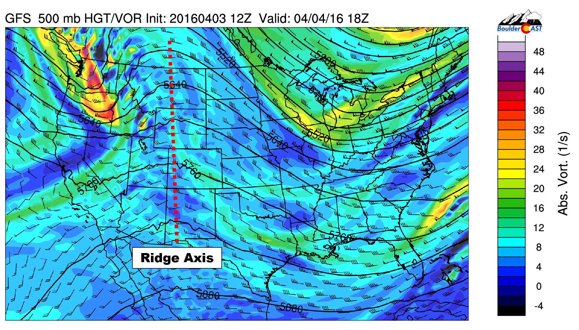
GFS 500 mb vorticity map valid this afternoon. The ridge axis is centered over western Colorado
The slow movement will produce one more gorgeous day before a weak trough pushes in. The trough is visible above, located over Oregon today. With the same airmass in place and not much changing from yesterday to today, we’ll see temperatures creep up a degree or two, into the low 70’s across the Plains with mostly sunny skies.
That trough reaches eastern Colorado tomorrow. It will bring a brief cool down, light mountain snow, a slight chance of rain and windy conditions to the Plains Tuesday evening.


