Low clouds early to give way to sunny skies in the afternoon with the threat of scattered storms by evening hours, with some potentially severe. Highs will be slightly cooler than yesterday with highs near the low 80’s. Read on for today’s full forecast.
—
 Remember, DayCAST’s are Premium content. Periodically, we open this forecast up to all of our readers. Today is one of those days!
Sign up to become a Premium member today to get the best BoulderCAST experience, including daily forecasts, periodic video content, custom forecasts, an extended LiveCAST, early access to select content and much more! For a limited time, sign up and use the offer code BOULDER to get an additional $3 off an annual subscription!
—
After a warm start to the week, we have ended the week on a cool note. The ridge is slightly to our west and a weak dip in the jet stream has ensued to bring in a cold front southward from Wyoming. Below shows the 250 mb upper-level flow. It has a weak trough sagging southeast from the north, which was the result of bringing down a cold front yesterday and overnight last night. This is our main feature for today and the reason for the cooler air.
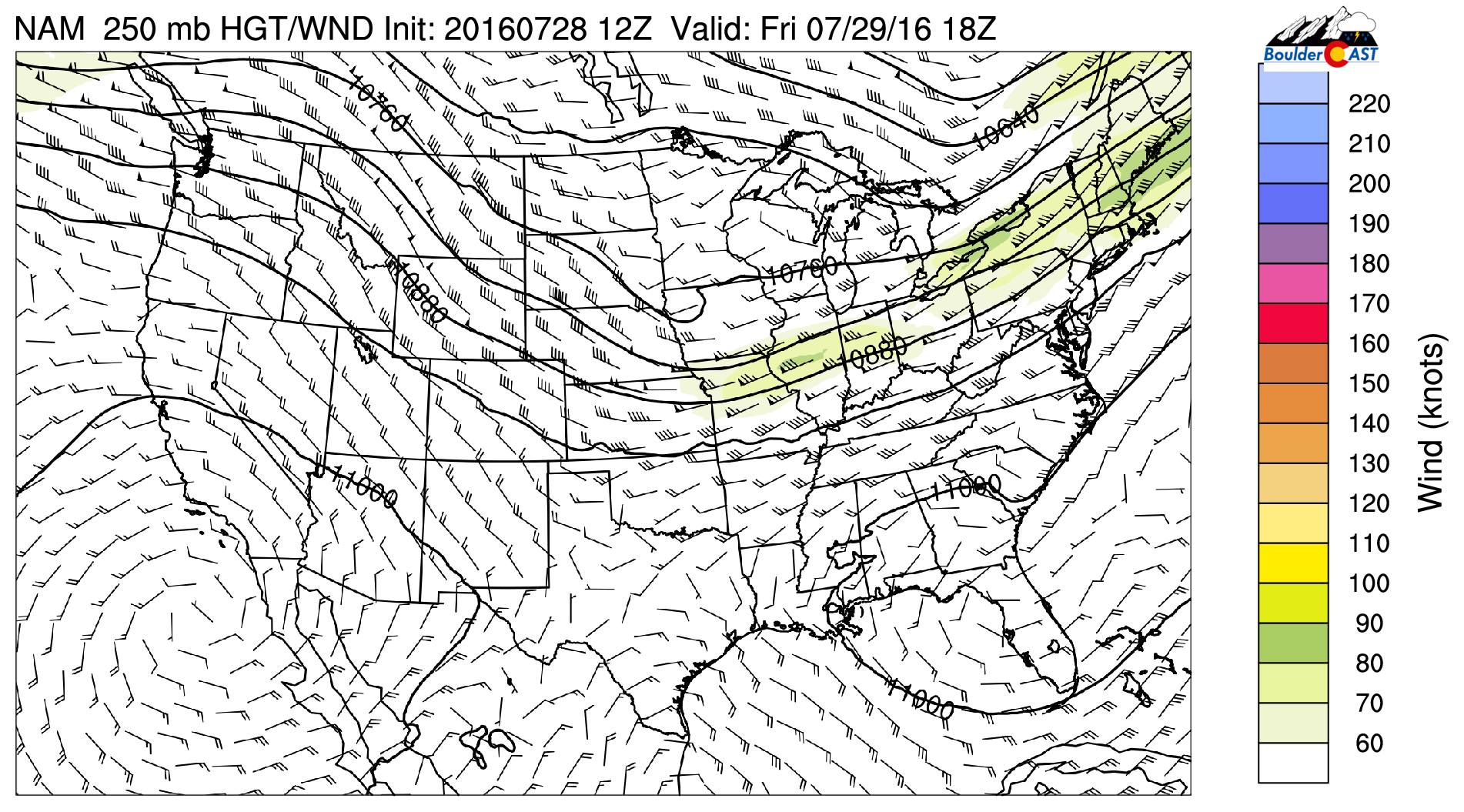
NAM 250 mb heights and winds for this afternoon
At the mid and low-levels of the atmosphere, the cold front is quite evident. The bottom figures indicate both a cooling and moistening of the lower levels with the ensuing east-northeasterly flow for Friday. Thus, it can be expected that there will be some low clouds around in the morning; partly sunny skies will ensue though as the morning moves to afternoon. A great day to take your bike to work! Highs in the low 80’s in Boulder with middle 80’s in metro Denver. Over the Foothills, beautiful weather near 70!
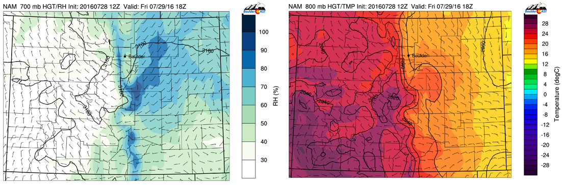
NAM 700 mb relative humidity (left) and 800 mb temperature (right) for this afternoon
Last of note is the chance of storm activity today. Both global and regional models are suggesting of the increased threat for isolated to scattered storm activity from the High Country to the Foothills and even some over the Plains. We had some last night in the approach of the cold front. Low level upslope flow will aid in surface lift. The upper-level flow is from the northwest, indicating a strong sheared environment. There is also potential for instability. All these things combined are what the models are seeing to increase our storm chances. The GFS (bottom left) is more bullish than the NAM on thunderstorm activity. This difference is likely due to the uncertainty in the forecast. Since highs will be cooler, along with potential low clouds, we may not reach the threshold for storms to pop up. More to it, the GFS develops storms later in the evening, whereas the NAM starts earlier around 6pm. Long story short, we do expect an increased chance of storms compared to earlier in the week. But storms will be isolated in nature, but where they occur, will have potential to be severe with heavy rain, lightning, and gusty winds. Happy Friday!
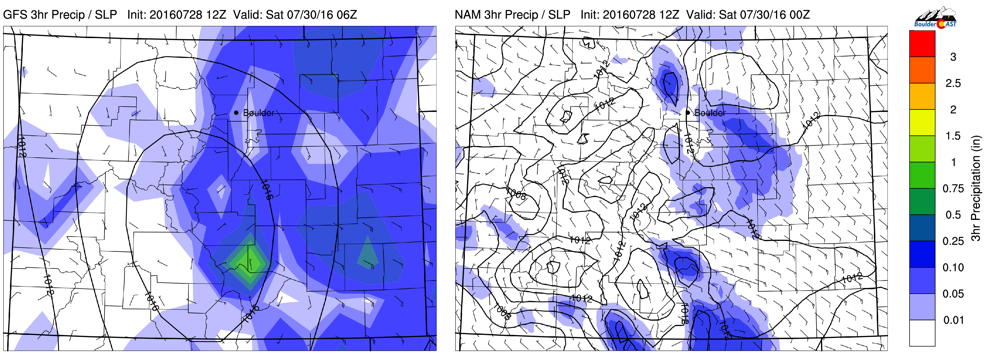
GFS (left) and NAM (right) model forecasted 3-hr precipitation for this evening and tonight


