Another mostly sunny day to end the work week with highs again well into the 80’s. Time to water those outdoor plants! Read on for a detailed forecast for today and a look into the weekend.
 DayCAST’s are Premium content. Periodically, we open this forecast up to all of our readers. Today is one of those days!
Sign up to become a Premium member today to get the best BoulderCAST experience, including daily forecasts, periodic video content, custom forecasts, an extended LiveCAST, exclusive content and much more! For a limited time, sign up and use the offer code BOULDER to get an additional $3 off an annual subscription!
——
The upper-level ridge that was first mentioned in our week-ahead post Monday finally set up shop over Colorado on yesterday. Today, it will continue to be in place with yet another warm day anticipated.
Below shows the 500 mb absolute vorticity for this afternoon. One factor is the aforementioned ridge of high pressure situated over the desert southwest. A second feature is a cut-off low over eastern Texas, and a third feature is a weak trough of low pressure over North Dakota and Minnesota.
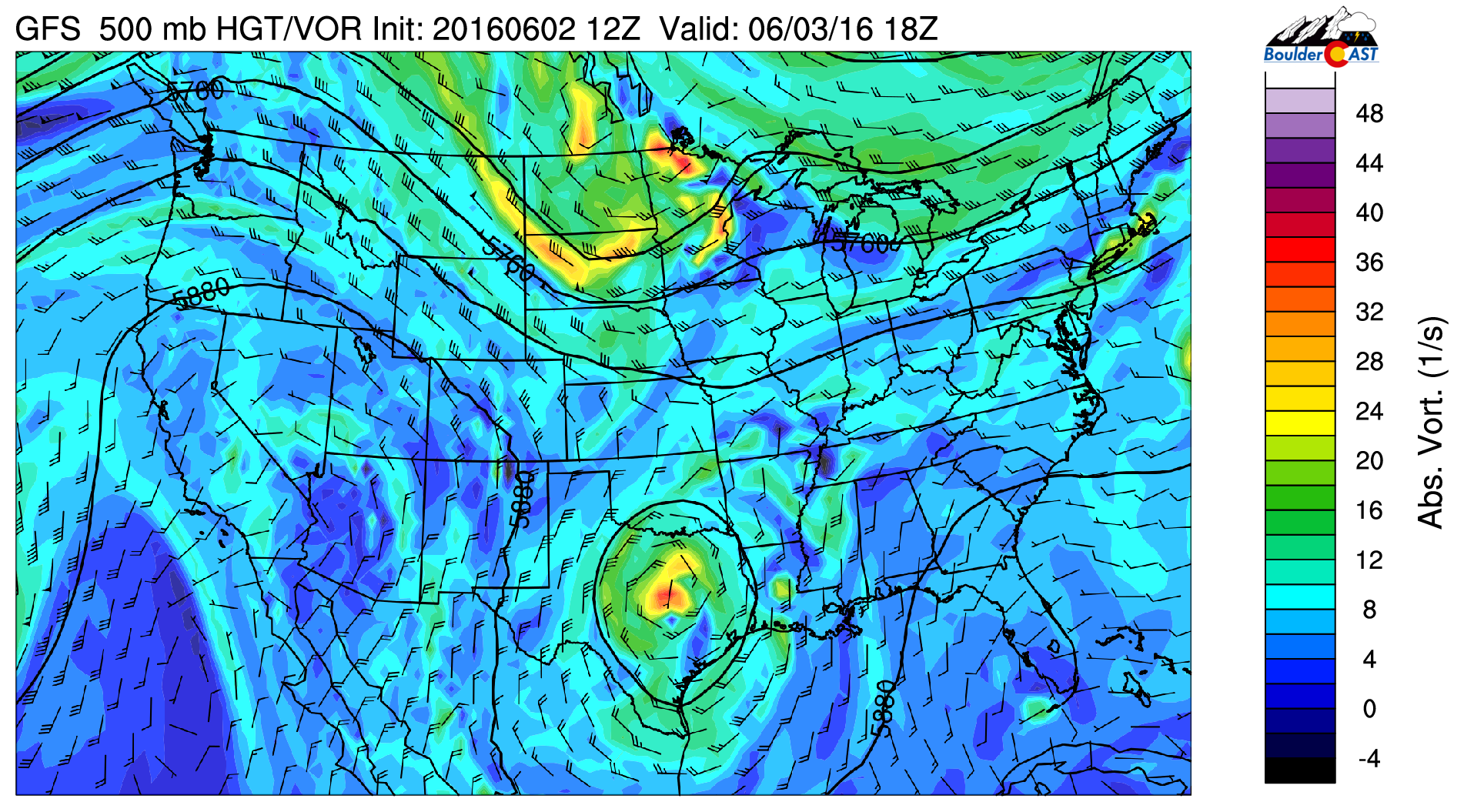
GFS 500 mb vorticity for today
This trough in the upper Midwest brought in a very weak trough this morning, turning winds from a north-northeasterly direction. This won’t have any influence, so highs again top out around the middle 80’s on the Plains this afternoon. But the trough will bring a cold front through for slightly cooler highs Saturday. Yesterday we officially hit 84 degrees and there is no reason to see why we won’t at least reach that again today. There will be some afternoon clouds drifting southeastward from the High Country, and we certainly can’t rule out a very isolated thunderstorm over the Foothills, but nearly everywhere will be dry.
Weekend outlook
The weekend forecast continues to look warm under the ridge of high pressure that drifts eastward. A weak cold front pushes in for Saturday so we are expected to be slightly cooler, with highs in upper 70’s Saturday and lower 80’s Sunday. While we should stay dry for the most part, we will have to keep an eye out for storm activity to develop late in the weekend and early next week, mostly for the High Country. Below shows the GFS mid-level forecast for Sunday night. It shows a cut-off low over California. This system will help to bring in some Pacific moisture back into Colorado.
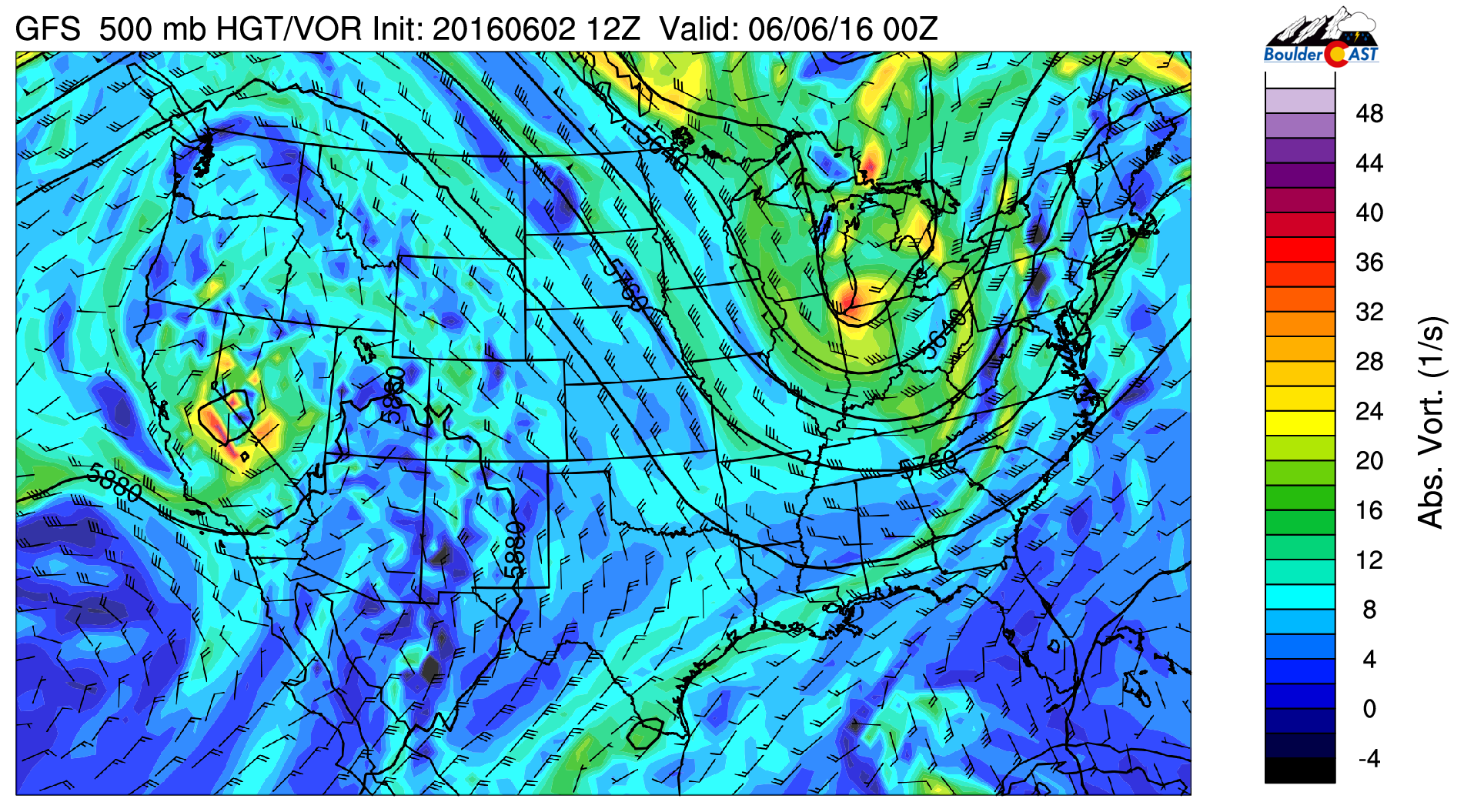
GFS 500 mb vorticity for Sunday night
With added Pacific moisture from the California low pressure system and increasing instability over the High Country this weekend, shower and thunderstorm activity should increase as we go through the weekend across the mountains. So if you are hiking this weekend, be alert for developing afternoon storms. The NAM forecast for Sunday (below) shows precipitation increasing in coverage over the High Country with some isolated storms in Boulder County. The best chance of storms on the Plains looks to be south of Denver. We can’t rule an isolated storm late Sunday as a result. Enjoy your weekend!
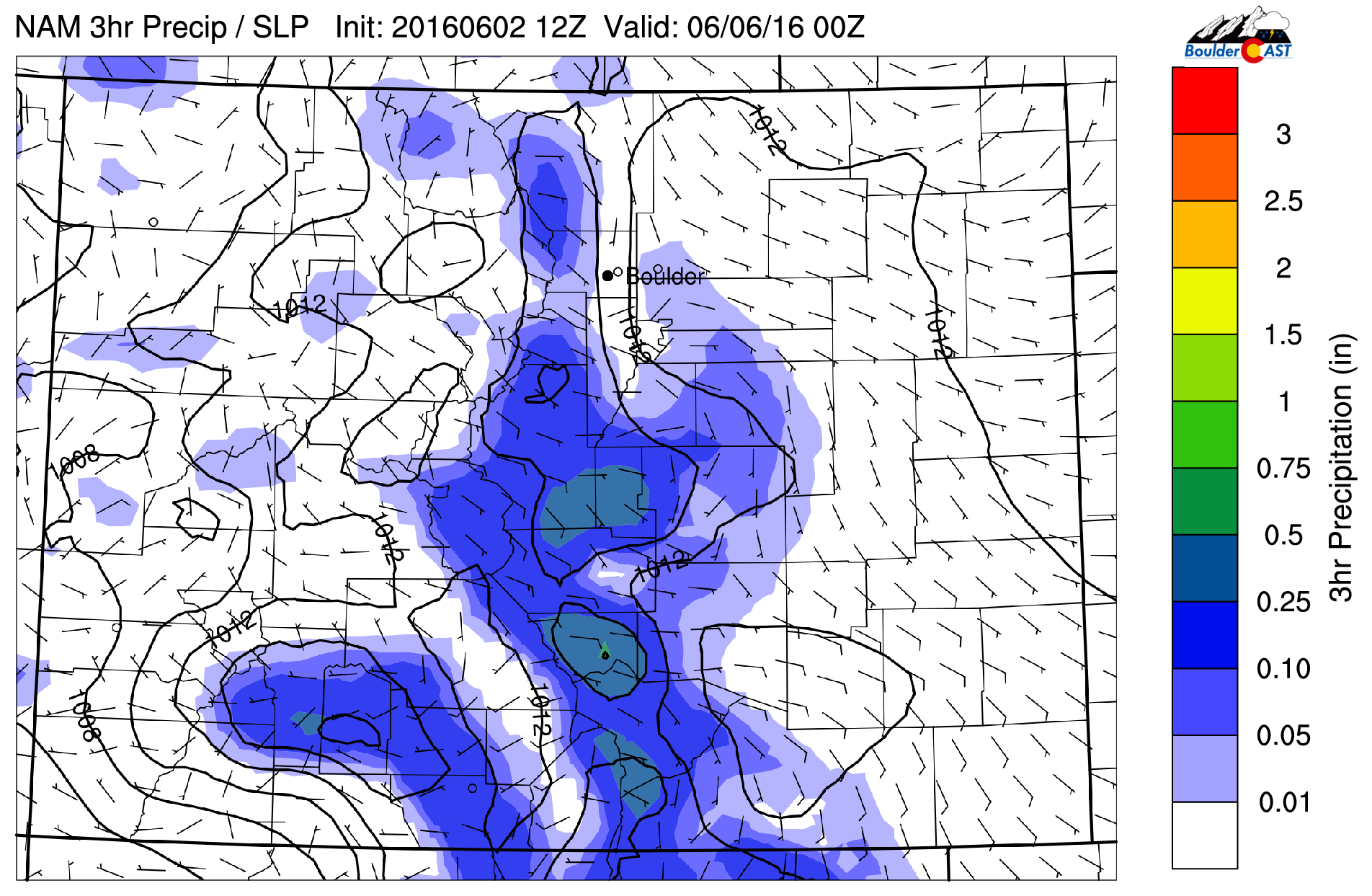
NAM precipitation forecast for Sunday


